


Redefine Your Industrial Operations with DJI Matrice Series Drones
Engineered for the toughest missions—unmatched endurance, adaptability, and intelligence for industrial, commercial, and public safety operations.
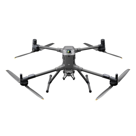
The DJI Matrice Series sets the standard for industrial and commercial drone applications, offering precision, reliability, and unparalleled versatility. Whether you need an advanced solution for mapping, inspections, or emergency response, the Matrice Series provides the tools to tackle any mission with confidence. Let's explore the distinct capabilities of the Matrice 300 RTK, Matrice 350 RTK, Matrice 30 Series, and Matrice 200 Series to help you choose the ideal solution for your needs.
Matrice 400 Series: Next-Generation Industrial Drone Platform
The Matrice 400 Series represents DJI's newest flagship industrial drone platform, combining upgraded payload capacity, advanced AI features, and improved endurance for enterprise operations.
See how the Matrice 400 Series performs in real-world operations.
- Extended Flight Endurance: Increased battery efficiency delivers longer missions without frequent swaps.
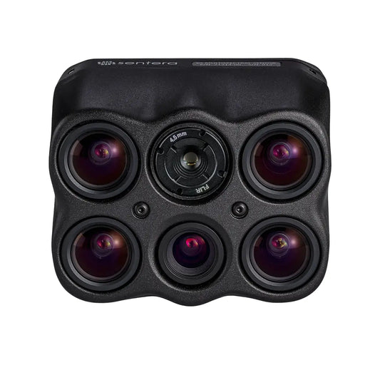
- Heavy Payload Support: Designed to carry larger, more advanced sensors, including next-gen LiDAR, high-zoom optical cameras, and dual-imaging payloads.
- Advanced Autonomy: Enhanced waypoint planning, AI-assisted inspections, and improved obstacle detection for more accurate, hands-off missions.
- Enterprise Connectivity: Seamless integration with DJI FlightHub 2 for fleet management, remote monitoring, and mission analytics.
- Built for Harsh Environments: IP-rated weather resistance and improved wind tolerance allow operations in extreme climates.
The Matrice 400 Series is ideal for operators needing a future-proof, high-capacity platform for critical infrastructure inspections, emergency response, and advanced surveying.
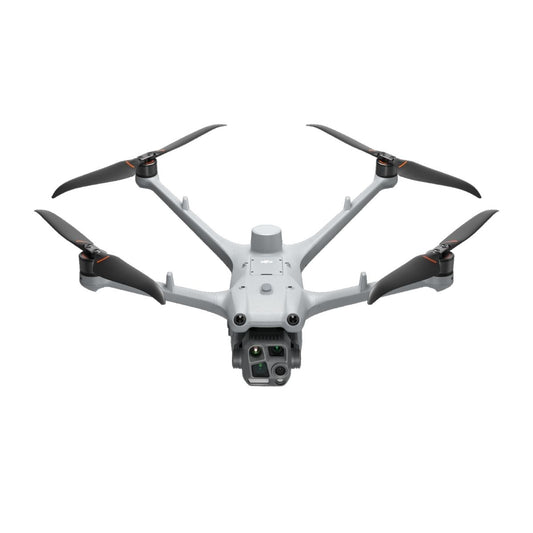
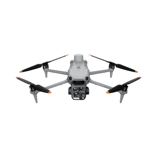
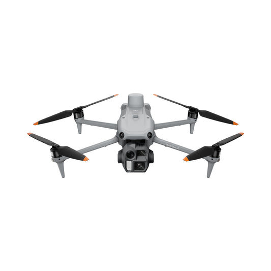
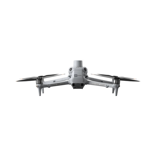
DJI Matrice 4 Series – Future-Ready Platform for Mapping and Inspection.
The DJI Matrice 4 Series is a next-gen enterprise drone built for precision, speed, and adaptability. It combines advanced imaging, improved AI, and seamless FlightHub 2 integration for efficient, real-time field operations.
Watch the Matrice 4 Series in action:
- Upgraded Flight Controller: Enhanced flight algorithms improve responsiveness, precision, and stability during complex missions.
- Extended Range and Uptime: O3 Enterprise transmission enables stable connectivity up to 20 km, supporting longer, safer operations.
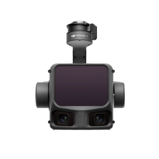
- Dual Payload Flexibility: Supports both visual and thermal imaging payloads, including Zenmuse H30 and Zenmuse P1, for multi-sensor data capture.
- Integrated RTK Positioning: Built-in RTK ensures centimeter-level accuracy for mapping, surveying, and infrastructure inspections.
- Rugged Design: IP55-rated weather protection allows deployment in rain, wind, and dust without performance loss.
- Fleet Integration: Fully compatible with DJI FlightHub 2 for cloud-based management and collaborative mission planning.
Ideal for public safety teams, construction monitoring, infrastructure inspections, wide-area mapping, and environmental surveying where a dependable, all-weather platform is required.
Learn more about what the DJI Matrice 4 series can do for your enterprise drone operations.
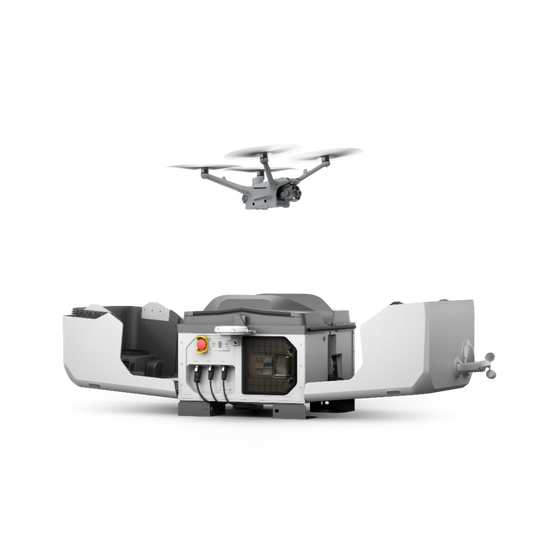
DJI Matrice 4TD Dock System – Autonomous Operations, 24/7 Readiness
The DJI Matrice 4TD Dock System pairs the Matrice 4T with DJI Dock 3 for fully autonomous, pilot-free operations. It delivers reliable readiness with automated charging, remote mission scheduling, and real-time data access. This setup gives enterprise teams a steady tool for wide-area surveillance, perimeter patrols, and critical infrastructure monitoring.
See how autonomous dock operations transform field missions.
- Autonomous Dock Operation: Automates takeoff, landing, and battery charging for true remote mission control.
- Instant Deployment: Launch missions on demand or on schedule, even in extreme conditions, via DJI FlightHub 2.
- All-Weather Design: IP55-rated Matrice 4TD and IP54-rated Dock 3 enclosure ensure consistent operation in harsh environments.
- Integrated Care Enterprise Plus: Includes DJI’s enterprise warranty plan with unlimited replacements and zero repair fees for maximum uptime.
- Real-Time Data Access: Automatically uploads photos, videos, and telemetry to the cloud for instant review and dispatch coordination.
- Secure Connectivity: Encrypted transmission and remote fleet management for compliance-critical operations.
- Low Maintenance: Self-monitoring system diagnostics and simplified service design reduce on-site technician visits.
Designed for 24/7 security patrols, critical infrastructure inspections, disaster response, and smart city monitoring where teams need automated oversight with minimal human intervention.
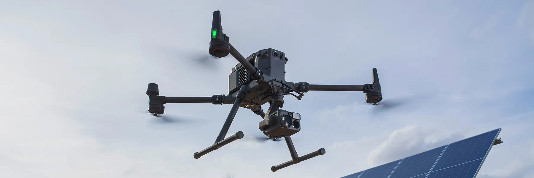
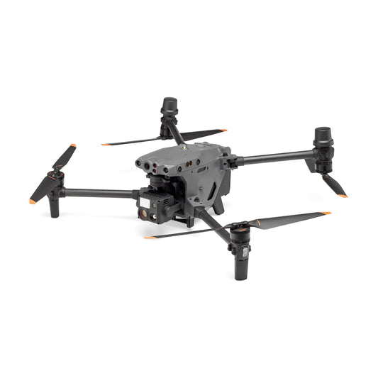
Matrice 350 RTK: Versatility Meets Durability
The Matrice 350 RTK is designed for demanding professional operations, excelling in environments that require adaptability and precision. This drone supports multiple payload configurations, enabling industries to customize its functionality.
- Advanced Payload Capabilities: With support for up to three payloads, including single or dual downward gimbals and a single upward gimbal, this drone accommodates a wide variety of cameras, sensors, and tools to meet the needs of complex missions.
- Operational Resilience: Featuring an IP55 rating, the drone resists water and dust, performing flawlessly in temperatures ranging from -4°F to 122°F and wind speeds up to 27 mph.
- Enhanced Control: The RC Plus controller with its 7-inch display offers intuitive controls, customizable buttons, and dual-operator functionality, making it perfect for intricate aerial tasks.
- Safety You Can Trust: With six-directional obstacle sensing, night vision FPV, and multilayered redundancy systems, the Matrice 350 RTK ensures secure operations in all conditions.
Ideal for utility inspections, search and rescue, infrastructure mapping, and night operations where reliability and sensor flexibility are essential.
Watch the Matrice 350 RTK in action:
Matrice 30 Series: A Compact Powerhouse for Critical Missions
The Matrice 30 Series combines portability and advanced features, making it the ideal choice for first responders and industrial applications requiring rapid deployment.
- Optimized for First Responders: Its durable, foldable design is perfect for search and rescue missions, fire suppression, and disaster response. The drone operates in extreme conditions, from -4°F to 122°F, ensuring reliability in challenging environments.
- Safety Features That Shine: Equipped with a laser rangefinder, ADS-B receiver, and obstacle avoidance sensors, the Matrice 30 prioritizes operational safety even in shared airspace.
- Efficient Night Operations: A night-vision FPV camera and long-range OcuSync 3 Enterprise transmission system enable precise navigation and monitoring during low-light missions.
A top choice for search and rescue, fire response, disaster assessment, and urban inspection where mobility and speed matter as much as sensor capability.
See how the Matrice 30 compares to the Matrice 4 in real missions.
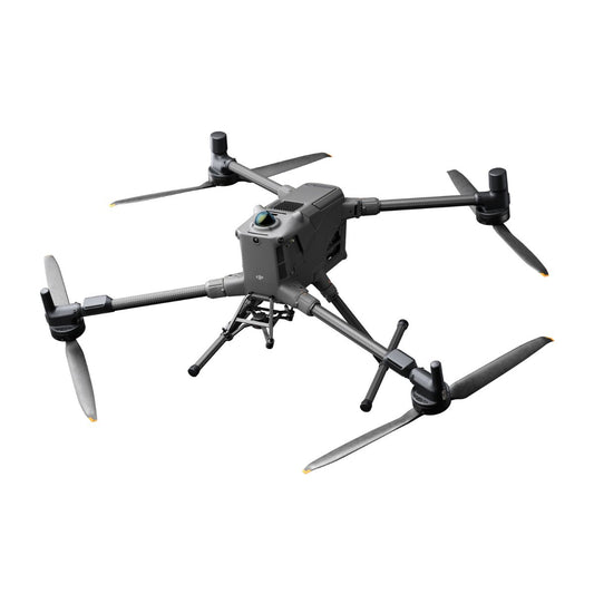
Matrice 300 RTK: The Industry's Most Adaptable Drone
The Matrice 300 RTK is a workhorse for industrial applications, boasting exceptional flight time, advanced AI capabilities, and rugged durability.
- Rugged Design: Built for extreme conditions, this drone features an IP45 rating and operates effectively in wet, dusty, or windy environments.
- Intelligent Flight Capabilities: The Matrice 300 RTK leverages AI-powered inspections, six-directional sensing, and an advanced UAV health management system for peak performance.
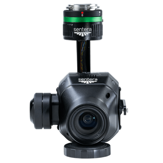
- Customizable Payload Options: This drone supports a range of payloads, including thermal cameras, LiDAR, and multispectral sensors, making it indispensable for industries like construction, agriculture, and energy.
Ideal for infrastructure inspections, topographic mapping, energy sector surveys, and public safety missions where durability and heavy payload support are essential.
See why the M300 RTK is still a frontline favorite:
DJI Matrice 3D Series: Precision Mapping and Automated Inspection
The DJI Matrice 3D Series is engineered for teams that need accurate, repeatable data without the bulk of larger platforms. It delivers dependable performance for mapping, modeling, and automated inspections. And when paired with DJI Dock 2, it supports true autonomous workflows for survey, utility, and commercial operations.
- Purpose-Built for Mapping: Optimized for photogrammetry, 3D modeling, and automated inspection routes.
- Survey-Grade Accuracy: High-precision RTK positioning ensures consistent, reliable data capture.
- Dock-Ready Automation: Fully integrates with DJI Dock 2 for scheduled, pilot-free missions.
- Compact and Rugged: Durable airframe built for frequent deployments in demanding environments.
- Intelligent Flight Planning: Repeatable route accuracy with seamless data management through DJI FlightHub 2.
The Matrice 3TD is ideal for precision mapping, 3D modeling, utility inspection, site monitoring, and automated data capture where consistent, repeatable accuracy is required.
Applications Across Industries
The DJI Matrice Series shines in a variety of fields, showcasing its versatility and advanced capabilities:
- Energy and Utilities: Inspect power lines, wind turbines, and solar farms with high-resolution imaging and precision mapping tools.
- Public Safety and Emergency Response: Perform search and rescue missions, assess disaster areas, and provide critical support during emergencies with drones equipped for thermal and visual imaging.
- Construction and Infrastructure: Monitor progress, conduct detailed surveys, and ensure safety on construction sites with drones tailored for accurate 3D mapping.
- Agriculture: Utilize multispectral sensors to analyze crop health, optimize irrigation, and maximize yields.
- Environmental Conservation: Monitor wildlife, track deforestation, and support ecological studies with drones designed for minimal environmental impact.
Choosing the Right Matrice Platform for Your Mission
Each Matrice model is built for a different level of mission complexity, flight duration, and sensor load. Understanding what each platform offers helps teams match the right tool to the job—whether it’s autonomous patrols, corridor mapping, or survey-grade imaging.
Key Differences at a Glance
| Model | Key Strength | Best For |
|---|---|---|
| Matrice 400 | Longest flight time, most advanced payloads | LiDAR surveys, large-scale inspections |
| Matrice 4 Series | Balanced performance and AI navigation | Public safety, infrastructure monitoring |
| Matrice 4TD | Fully autonomous with Dock 3 support | Perimeter security, BVLOS operations |
| Matrice 350 RTK | Rugged daily-use platform with hot-swap batteries | Utility work, SAR, night ops |
| Matrice 30 | Compact and fast to deploy | Fire response, rapid inspections, urban ops |
| Matrice 300 RTK | Trusted multi-payload workhorse | Infrastructure, thermal, photogrammetry, LiDAR |
| Matrice 3D Series | Compact, RTK-enabled automation | Precision mapping, automated inspections |
Need LiDAR?
Go with the Matrice 400, 350 RTK, or 300 RTK. These platforms support the Zenmuse L2 and offer the endurance needed for complete LiDAR workflows.
Need Speed and Portability?
Choose the Matrice 30. It folds down fast and deploys quickly—ideal for fast-moving field teams.
Need Autonomy?
The Matrice 4TD with Dock 3 and the Matrice 3D with Dock 2 are built for scheduled, hands-free operations. No manual launch or landing needed.
Why Choose DJI Matrice Series?
The Matrice Series represents the pinnacle of drone technology, offering unmatched reliability, safety, and performance. With their modular designs, these drones are highly adaptable to specific mission requirements, making them invaluable assets across industries.
Explore the full range of DJI Matrice drones and customize your fleet with accessories and payloads tailored to your needs. Contact us to discover how DJI Matrice can elevate your industrial and commercial operations.
Frequently Asked Questions
Which Matrice model has the longest flight time?
The Matrice 400 Series offers up to 59 minutes of flight time with a Zenmuse H30T payload under optimal conditions, making it the longest-endurance model in the series. The Matrice 300 RTK and Matrice 350 RTK follow closely with up to 55 minutes.
Is the Matrice 400 Series backward-compatible with older payloads?
Yes, many payloads from the Matrice 300/350 RTK are compatible, though some require adapter mounts or firmware updates.
Can DJI Matrice drones carry LiDAR payloads?
Yes. The Matrice 400, 350 RTK, and 300 RTK support the Zenmuse L2 LiDAR sensor and are frequently used for survey-grade mapping and terrain modeling.
Which models are best for thermal imaging?
The Matrice 30T, Matrice 350 RTK with Zenmuse H20T/H20N, and Matrice 400 Series with thermal payload options excel in thermal operations.
Do any Matrice models support fully autonomous flights?
Yes. The Matrice 4TD (Dock 3) and Matrice 3D (Dock 2) are built for autonomous deployment, automated recharging, and scheduled missions with minimal human input.
Can these drones operate in rain or snow?
Yes, most models in the series are IP-rated for dust and water resistance, allowing safe operation in light rain and challenging weather.
Do I need special licensing to operate these drones commercially?
Yes, in most regions, you'll need a Part 107 license in the U.S. or equivalent commercial drone certification in your country.
Talk to a DSLRPros Expert
Request a quote or schedule a consultation to configure the right Matrice system for your mission requirements. DSLRPros provides full integration, mission-ready setup, and ongoing U.S.-based support for every enterprise deployment. Our team helps you select the correct payloads, optimize your workflow, and keep your fleet operational with reliable after-sales assistance.
Contact DSLRPros to build a Matrice solution tailored to your field operations.
