
AgEagle Aerial Systems Inc.
FAA-approved and Blue UAS-listed, AgEagle drones and sensors deliver proven performance for mapping, surveying, and precision agriculture.
-
Authorized AgEagle Enterprise Dealer
-
U.S. Warranty & Service
-
Enterprise Training & Support

When your project demands accuracy, endurance, and compliance, AgEagle drones and sensors deliver.
These fixed-wing platforms offer long flight times, RTK precision, and field-ready reliability. Whether you're mapping remote terrain or analyzing crop health, AgEagle enterprise drones and accessories are built to meet the mission.
Shop AgEagle Enterprise Solutions
-
MicaSense Altum-PT
Request a Quote- Multispectral + Thermal + Panchromatic Sensor
- Triple-sensor system captures multispectral, RGB, and thermal data in one pass
- 1.2 cm pan-sharpened GSD at 60 m for ultra-high spatial resolution
- Thermal GSD down to 33.5 cm at 120 m for irrigation and stress analysis
- Global shutter and CFexpress storage for distortion-free, high-speed image capture
- Compatible with DJI SkyPort for quick, secure drone integration
-
MicaSense RedEdge-P
Request a Quote- Multispectral + Panchromatic Sensor
- Captures pan-sharpened imagery at ~2 cm/pixel from 60 m—twice the clarity of earlier RedEdge models.
- Synchronizes 5 spectral bands with a panchromatic band for rich data in one flight.
- Stores up to 3 captures/sec on CFexpress with quick card swaps for fast turnaround.
- Rugged, global shutter design integrates easily for precision agriculture and vegetation analysis.
-
MicaSense RedEdge-P Dual Multispectral Kit
Request a Quote- 10-Band Multispectral Payload for Advanced Agriculture
- Captures 10 synchronized spectral bands, including coastal blue and panchromatic, for precise plant diagnostics.
- Delivers ~1.6 MP per band, pan-sharpened to ~2 cm GSD at 60 m for fine detail.
- Includes CRP2 reflectance panel and DLS2 light sensor for scientific consistency.
- Global shutter provides distortion-free imaging at up to 3 fps for fast aerial surveys.
-
MicaSense RedEdge-P Blue Kit
Request a Quote- High-Res Multispectral + Coastal-Blue Payload
- Captures 2 cm/pixel imagery from 60 m for fine detail.
- Records six spectral bands—blue, green, red, red-edge, NIR, and coastal blue—for vegetation and water analysis.
- Coastal blue band aids in chlorophyll, sediment, and algal bloom detection.
- Rugged global shutter delivers distortion-free images during fast flights.
-
Micasensense RedEdge-P with DJI SkyPort
Request a Quote- Plug-and-go integration with Matrice drones—no adapters needed
- Same pan-sharpened multispectral output in a streamlined setup
- Ideal for rapid deployment and enterprise use
-
RedEdge-P PPK Activation License
Request a Quote- Upgrades your RedEdge-P with PPK for survey-grade geolocation—no GCPs needed
- Delivers centimeter-level precision to support mapping, research, and compliance
- Seamlessly integrates into your existing drone ecosystem—no hardware changes
Still unsure which payload fits your workflow?
Proven Accuracy. Government-Grade Compliance.
AgEagle drones and sensors are engineered for professionals who need more than just flight—they need accurate data, long-range coverage, and full FAA and military compliance.
-
FAA-Approved & Blue UAS Listed
Compliant with Remote ID and approved for federal and tactical use.
-
RTK/PPK Mapping Precision
Achieve down-to-centimeter georeferencing accuracy for surveying, GIS, and compliance reporting.
-
Field-Tested Durability
Rugged design supports tough environments—from wide-open farmland to contested tactical zones.
-
BVLOS & Tactical Flight Options
Fly beyond visual line of sight (BVLOS) with confidence. eBee TAC supports GPS-denied and offline missions.
Key Benefits
-
FAA Remote ID Compliant
-
Blue UAS Approved
-
Long-Endurance Fixed Wing
-
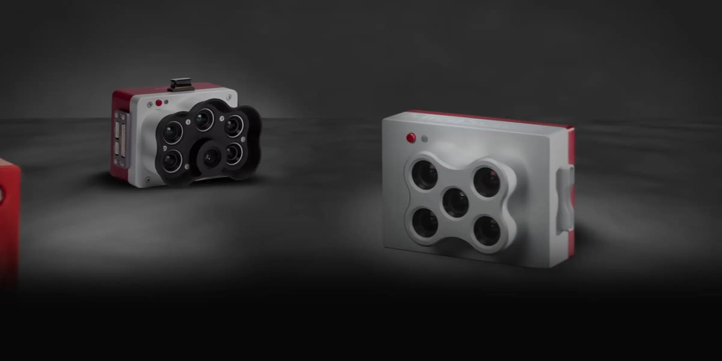
Multispectral + RGB + Thermal Payloads
Where AgEagle Drones Excel
Built for large-area missions and high-accuracy data capture, AgEagle drones and sensors are trusted across key industries. Their high-resolution imaging, advanced mapping tools, and long-range coverage make them ideal for both commercial and government applications.
-
Agriculture
Explore AgEagle for AgriculturePlan, plant, and harvest smarter. AgEagle drones support NDVI analysis, field mapping, and crop health monitoring with multispectral imaging and centimeter-level accuracy.
-
Land & Resource Management
Read how drones support Land ManagementCapture accurate terrain models, analyze land boundaries, and monitor environmental changes—all in one flight. AgEagle delivers the geospatial data teams need for effective land use planning.
-
Utilities & Infrastructure
Discover AgEagle solutions for InfrastructureFly long distances with fewer takeoffs. AgEagle drones cover pipelines, roads, and gridlines with reliable RTK imaging—reducing crew risk and improving documentation.
-
Defense & Tactical Surveying
See how AgEagle supports Tactical OperationseBee TAC supports tactical mapping in GPS-denied environments with fully NDAA-compliant design. Fast deployment and real-time situational awareness make it mission-ready.
Want to see how AgEagle fits into the bigger picture?
Explore these expert insights and comparisons to understand how AgEagle drones stack up—and where they shine in mapping, compliance, and survey work.
Parrot Bluegrass Fields vs eBee X
Compare top fixed-wing drones for mapping.
Top American-Made Drones for 2025
Explore NDAA and Blue UAS options, including AgEagle.
Smart Mapping & Land Management
See how drones support survey and GIS teams.
Flight Path Planning Guide
Learn how pros plan efficient drone missions.

Your Trusted AgEagle Dealer
DSLRPros is an authorized AgEagle reseller, providing certified products straight from the source with U.S.-based support, expert consultation, and fast logistics. Our team offers pre-sale guidance, post-sale technical help, and on-site training for professional teams. We also handle warranty claims locally for faster turnaround.
Frequently Asked Questions
Are AgEagle drones FAA-approved?
Yes. AgEagle drones meet FAA Remote ID standards and are approved for commercial operations.
Can AgEagle drones carry multispectral or thermal payloads?
Yes. AgEagle’s drone lineup supports a variety of payloads including RGB, multispectral, and thermal sensors. Models like the eBee Ag and eBee X can integrate sensors such as the MicaSense RedEdge-MX and Duet T, making them suitable for vegetation analysis, thermal detection, and crop monitoring.
Can AgEagle sensors capture thermal and multispectral data simultaneously?
Yes. The Altum‑PT supports synchronized capture of thermal and multispectral bands, enabling one-pass missions that reduce flight time and streamline post-processing.
Do AgEagle’s MicaSense sensors support RTK/PPK workflows?
Absolutely. Both the RedEdge-P and Altum-PT support RTK/PPK integrations for high-accuracy geotagging. When used with compatible drones like the eBee X, users can achieve survey-grade results without GCPs.
How accurate is data collected by AgEagle drones?
AgEagle drones are capable of achieving sub-inch horizontal and vertical accuracy with RTK/PPK workflows. This makes them suitable for high-precision mapping, cadastral surveys, and engineering-grade deliverables.
What vegetation indices can be generated with MicaSense sensors?
MicaSense cameras support NDVI, NDRE, GNDVI, SAVI, and more—allowing users to analyze crop vigor, nutrient levels, and species differentiation across fields.
Does DSLRPros offer support and training for AgEagle drones?
Absolutely. As an authorized dealer, DSLRPros provides U.S.-based technical support, warranty services, and custom training programs. Our team helps ensure you’re ready to fly with confidence from day one. Contact us to learn more.

Ready to Equip Your Team with AgEagle Drones and Sensors?
We’re here to help you choose the right fixed-wing platform for your mission. Whether you’re optimizing yield, mapping terrain, or gathering secure field intelligence—DSLRPros has the insight and gear to support your goals.