


Autel EVO Max Series: Multi-Sensor Enterprise Drones Built for GPS-Denied and High-Stakes Missions
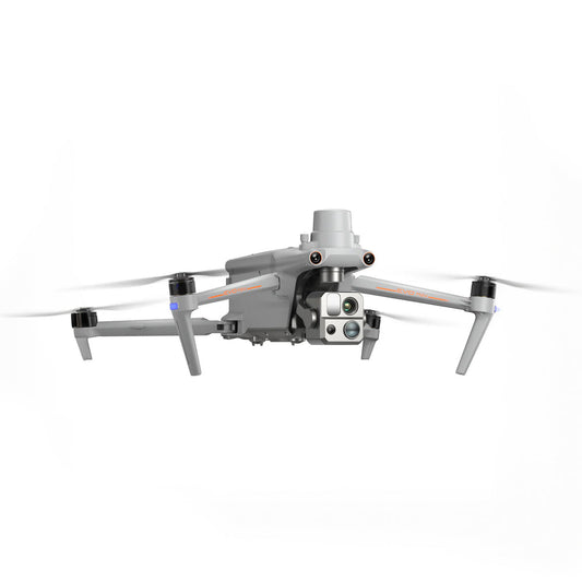
The Autel EVO Max Series is a family of professional multirotor aircraft engineered for demanding enterprise and public safety operations. Built around Autel's Autonomy Engine and SkyLink 3.0 transmission platform, the EVO Max family combines autonomous navigation, 720° obstacle avoidance, and swappable multi-sensor payloads in a compact, foldable airframe rated IP43 for all-weather deployment.
The three models in the family — EVO Max 4T, EVO Max 4N, and EVO Max 4T XE — share a common platform while offering distinct imaging configurations for thermal inspection, low-light surveillance, and multi-mission field work.
These aircraft are deployed by public safety agencies, utility inspection teams, search and rescue units, and survey professionals who require reliable autonomous operation across complex terrain, urban environments, and areas where GPS signals are obstructed or unavailable.
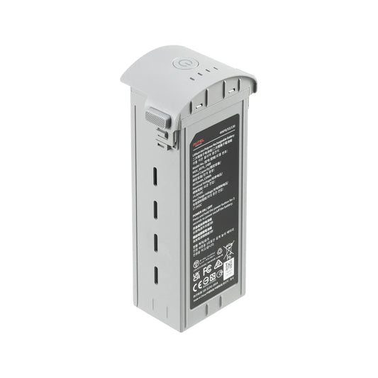
With a 42-minute max flight time, hot-swappable batteries, and A-Mesh 1.0 mesh networking, the EVO Max Series is built to sustain continuous operations in the field without returning to a ground station.
How the EVO Max Series Is Engineered for Autonomous Field Operation
The EVO Max family is built around Autel's Autonomy Engine, a proprietary onboard processing system that combines binocular fisheye vision with dual-frequency millimeter-wave radar at 60 GHz and 24 GHz. This sensor fusion approach gives every model in the series true 720° situational awareness, with object detection resolving down to 0.5 inches.
Unlike systems that rely on a single sensing modality, the EVO Max platform maintains obstacle avoidance capability in low-light conditions, rain, and environments where visual contrast is insufficient for camera-only systems.
The airframe itself is purpose-built for operational reliability. Each model folds to 257 × 145 × 131 mm and weighs under 3.7 lbs with battery and payload attached. The flight control modules include anti-interference algorithms that allow the aircraft to operate reliably near high-voltage power lines, communication towers, and dense urban infrastructure — environments that cause positional drift or signal loss in less hardened systems.
For operations where GPS is unavailable, the onboard visual inertial odometry system enables stable, precise flight inside structures, underground, and in signal-denied airspace.
EVO Max 4T, 4N, and 4T XE: Matching Payload Configuration to Mission Requirements
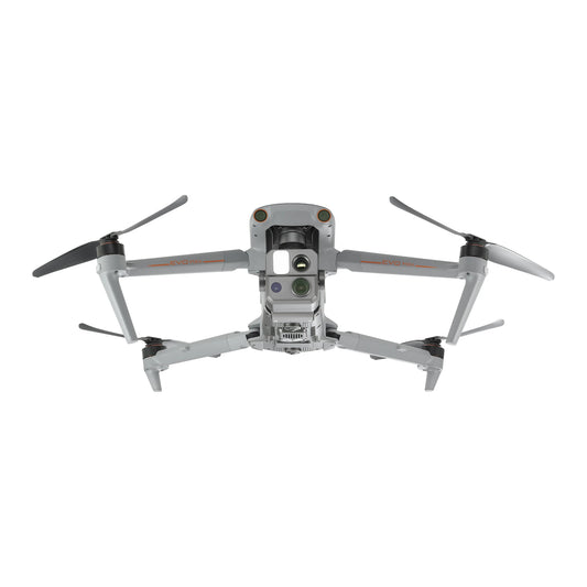
- EVO Max 4T: Built around thermal and optical zoom imaging for inspection and public safety. Payload includes a 50 MP wide camera (f/1.9), a 48 MP zoom camera with 10x optical and 160x hybrid zoom, a 640×512 thermal imager (9–1,022°F range, ±3°C accuracy), and a laser rangefinder accurate to ±(1 m + D×0.15%) from 16.4–3,737 ft.
- EVO Max 4N: Configured for low-light and nighttime operations. Replaces the zoom camera with a 2.3 MP starlight camera capable of 0.0001 LUX sensitivity and ISO 450,000, retaining the 50 MP wide camera, 640×512 thermal imager, and laser rangefinder.
- EVO Max 4T XE: An enterprise variant optimized for inspection and law enforcement applications. Features a 1/1.2" CMOS 48 MP zoom camera with 10x optical zoom, a 48 MP wide-angle camera (f/2.8, DFOV 83.4°), a 640×512 thermal imager with ±2°C accuracy, and a laser rangefinder. Maximum control range of 15 km under FCC compliance.
Payloads, Accessories, and Supported Configurations
- EVO Max 4T payload: 50 MP wide camera, 48 MP 10x optical zoom camera (160x hybrid), 640×512 thermal imager, laser rangefinder
- EVO Max 4N payload: 50 MP wide camera, 2.3 MP starlight camera (0.0001 LUX), 640×512 thermal imager, laser rangefinder
- EVO Max 4T XE payload: 48 MP zoom camera (10x optical / 160x hybrid), 48 MP wide-angle camera, 640×512 thermal imager, laser rangefinder
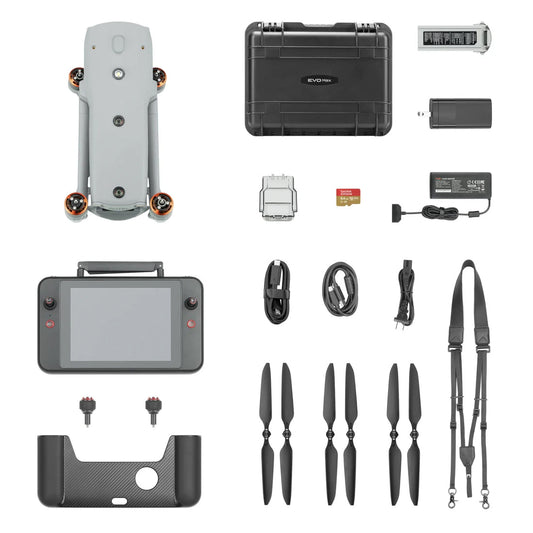
- Autel Smart Controller V3: 7.9-inch daylight-readable display at 2,000 nits; 128 GB internal storage; SuperDownload at 20 MB/s; HDMI output; 4.5-hour battery life; 2-hour fast charge
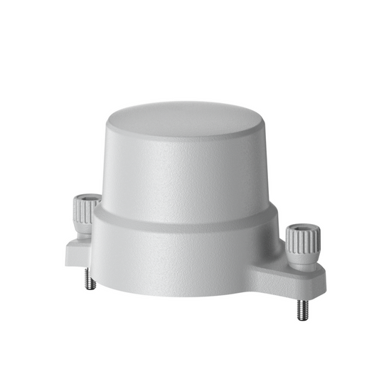
- RTK Module (optional): centimeter-level positioning accuracy for mapping and survey missions; reduces electromagnetic interference near critical structures
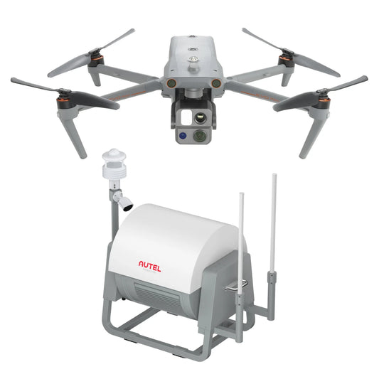
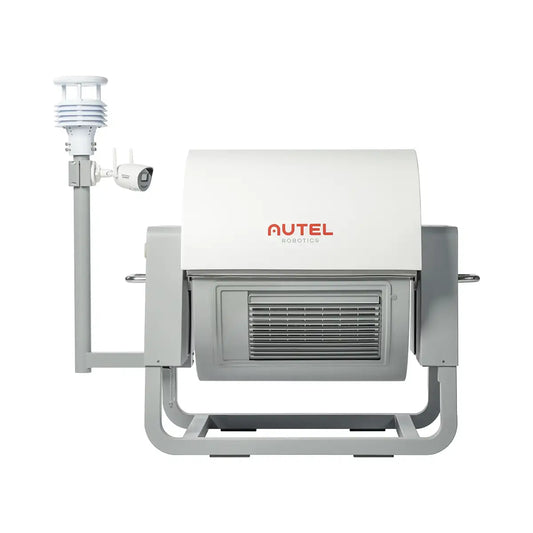
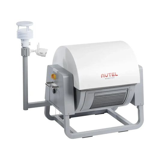
- EVO Nest (optional): automated docking station for remote takeoff, landing, charging, and mission scheduling; IP55-rated; charges EVO Max from 10% to 90% in 25 minutes
Core Capabilities Across the EVO Max Family
- 720° obstacle avoidance: binocular fisheye vision combined with 60 GHz and 24 GHz millimeter-wave radar eliminates sensing blind spots in all directions
- GPS-denied navigation: SLAM-based visual inertial odometry enables stable flight inside structures, underground, and in signal-obstructed environments
- Anti-interference flight control: advanced algorithms maintain positional accuracy near power lines, communication towers, and electromagnetically complex infrastructure
- A-Mesh 1.0 networking: drone-to-drone mesh network enabling multi-aircraft autonomous coordination, relay-based BVLOS operations, and self-healing communication topology
- SkyLink 3.0 transmission: 6-antenna, 4-band (900 MHz / 2.4 GHz / 5.2 GHz / 5.8 GHz) system with AES-256 encryption, optional 4G integration, and <150 ms latency
- Max transmission range: 12.4 miles / 20 km (FCC) for 4T and 4N; 15 km (FCC) for 4T XE
- Hot-swappable batteries: field battery exchange without powering down between sorties
- 42-minute max flight time: sustained endurance for extended overwatch, inspection routes, and wide-area survey coverage
- Max horizontal speed: 23 m/s across all three models
- Hovering accuracy (RTK): ±0.1 m vertical, ±0.1 m horizontal
- IP43 weather rating: dust and rain resistance for all-weather field deployment
- Operating temperature range: -4°F to 122°F (-20°C to 50°C)
- AES-256 data encryption: flight logs, media, and positional data protected at rest and in transit
Where the EVO Max Series Gets Deployed
- Power line and electric tower inspection: zoom and thermal payloads enable close-range defect identification on energized infrastructure without line shutdowns
- Public safety overwatch: AI-based object identification and locking supports aerial surveillance, crowd monitoring, and incident management for law enforcement
- Search and rescue: starlight camera (4N) and thermal imager enable target detection in darkness, smoke, and dense vegetation
- Firefighting support: thermal imaging maps fire perimeters, identifies hot spots, and supports incident command situational awareness in zero-visibility conditions
- Industrial facility inspection: 3D scene reconstruction and autonomous path planning allow systematic inspection of substations, refineries, and solar installations
- Bridge and structural inspection: millimeter-wave radar allows precise proximity flight near steel and concrete structures without GPS assistance
- Mapping and land survey: RTK module integration delivers centimeter-level positioning accuracy for photogrammetric workflows and topographic data collection
Autel Enterprise App, SDK Integration, and Mission Workflow
The Autel Enterprise App provides the mission planning and execution layer for all EVO Max Series aircraft. Operators can execute waypoint missions with flexible, non-structured routing; rectangular area missions generated in a single tap; or polygon missions for irregular survey boundaries.
Automatic mission generation via KML import is available, as are quick missions that can be layered onto active flights for dynamic tasking. Mission Reproduction records camera angles and flight parameters to allow precise re-flight of previously completed routes — a critical feature for recurring inspection workflows.
Live view supports simultaneous multi-channel output combining RGB, infrared, and map overlays on a single display. ADS-B integration enables real-time aircraft position overlay for airspace situational awareness. The Autel SDK exposes both mobile and UX-layer APIs for iOS and Android, allowing integration into third-party ground control and data management platforms. All flight and sensor data can be encrypted at the aircraft level before transmission or download.
Matching the Right EVO Max Model to Your Mission Profile
- Choose the EVO Max 4T if your primary missions involve daytime inspection, thermal anomaly detection, or high-magnification target identification at standoff distance
- Choose the EVO Max 4N if your operations include nighttime surveillance, low-light search and rescue, or scenarios where starlight sensitivity is more operationally critical than optical zoom reach
- Choose the EVO Max 4T XE if your deployment environment involves complex signal environments, urban law enforcement operations, or missions requiring SLAM-based navigation and enterprise-grade integration
- Add the RTK Module when your mission requires centimeter-level positional accuracy for mapping outputs, orthomosaic generation, or survey-grade deliverables
- Add the EVO Nest when your operation requires unmanned autonomous sorties from a fixed or semi-permanent installation, or when rapid battery turnaround between flights is operationally essential
- Consider A-Mesh deployments when your mission involves multi-aircraft coordination, BVLOS relay operations, or coverage of areas where single-aircraft line-of-sight is insufficient
The EVO Max Series represents one of the most capable enterprise drone platforms available in a foldable, deployable form factor — combining sensor fusion obstacle avoidance, payload flexibility, and autonomous navigation into an aircraft that field teams can carry in a single case and deploy in minutes.
DSLRPros provides the full EVO Max Series ecosystem, including all payload configurations, the Autel Smart Controller V3, RTK Module, and EVO Nest docking station. Contact our team to configure the right EVO Max package for your mission requirements, or order direct from DSLRPros.
