Fields with their horizon stretching out, farmers toiling from dawn to dusk to deliver the crops that feed the nation….they are the backbone of civilization as we know it. However, the farmers are faced with challenges ranging from predictable weather and weakening soils to the constant threat of pests, as they continue with the day-to-day struggle to maximize yields while minimizing environmental impact.
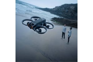
Agriculture drones have quickly become a popular feature in this industry, with more farmers turning to the UAVs to optimize their operations, from crop monitoring to spraying and spreading tasks. These drones usually come as part of a system, where integrated software solutions are used to increase their scope of operations – and one of the current market leaders is DJI SmartFarm. Here is what it brings to the fields:
9 Ways DJI SmartFarm Transforms Your Farm Operations
1. Data Handling Made Easier
With its user-friendly interface, the app presents an all-round solution for monitoring and managing agricultural tasks, from spraying and spreading to team collaborations and even detailed job reports.
At the heart of its offerings, the SmartFarm app presents its data in an easily digestible format. You can effortlessly track flight trajectories and mission parameters on interactive maps, with the aerial view enhancing decision-making and operational efficiency. And by integrating features such as field sharing, tutorials, and measurement tools, the app goes beyond mere data management to become a partner for you while you’re out in the field.
The data toolset of the app is designed to cater to the daily and periodic needs of its users. Whether it's accessing up-to-date device status or reviewing comprehensive job reports, every piece of information is just a few taps away.
2. Device Management – Keep Tabs On Your UAVs
This app supports end-to-end service for various activities, including spraying and spreading operations, making it easier for users to control and manage their Agras drones with efficiency. It consolidates all device statuses in one place, allowing users to stay updated with their operation status at any time and access frequently asked questions (FAQs) for troubleshooting and support.
Also Read: Farmer’s Toolkit: The Top 4 Drones For Crop Monitoring in 2024
3. Efficient Team Coordination
You get to create and manage teams, share device control, and ensure everyone is aligned with real-time access to operation data. The goal here is to make teamwork as smooth as possible, enhancing communication and task management among your crew.
With features that allow for comprehensive field management directly from a map and the ability to select and share field data with team members remotely, it cranks up coordination within your team.

This ensures that everyone is informed about the progress and status of tasks, and working towards the same goals. With features that allow for comprehensive field management directly from a map and the ability to select and share field data with team members remotely, it cranks up coordination within your team. This ensures that everyone is informed about the progress and status of tasks, and working towards the same goals.
4. Field Management
The DJI SmartFarm app enhances field management in several key ways. You can view and manage fields directly on a map, with a clear visual representation of their agricultural areas. It also supports the management of various crop types like rice, wheat, and corn, for more convenient and efficient operations, reducing costs while improving crop quality and increasing yield rates. The same level of support is extended to commercial crops like cotton, citrus trees, apple trees, and tea plants.
Of note is that DJI SmartFarm app is part of a broader ecosystem of DJI Agriculture solutions that include powerful equipment like the Mavic 3 Multispectral, for smooth integration with each other to save time and increase workflow efficiency. This comprehensive support system benefits a wide range of agricultural stakeholders, from farmers and growers to agricultural cooperation and service agencies.
5. High-Definition Imagery
DJI SmartFarm Web can generate high-definition images of farmlands and orchards, allowing for clear analysis of crop growth. This feature aids in the better management of digitalized agricultural information and supports the automatic operations of various agricultural machinery. The ability to monitor crop diseases, pests, and growth differences promptly allows for targeted interventions, improving overall farm productivity.
6. Intelligent Field Scouting and Analysis
The scouting images captured by drones are analyzed using AI algorithms, also through the SmartFarm Web platform. This AI-driven analysis can identify and evaluate various crop conditions, detect abnormalities, and monitor crop health and growth stages throughout the plant lifecycle. This integration enables automated monitoring of farmland and crops.
The insights gained from this hels you make informed decisions regarding crop management, pest control, irrigation, and other critical aspects of agriculture. The precise data provided by the app supports targeted actions, reducing waste and improving yield efficiency.
As a welcome bonus, it makes the monitoring process much more scalable and efficient compared to traditional manual methods. A single operator can manage extensive areas of land, improving productivity and reducing labor costs.
7. Variable-Rate Operations Guidance
Through SmartFarm Web, you can detect growth differences and generate prescription maps, which are then synchronized to agricultural drones for implementing variable-rate operations. This helps in saving pesticides and fertilizers by applying them only where needed.
It does this by using data from multispectral and RGB imaging systems, the platform can detect variations in crop health and growth. This is achieved through the analysis of images captured by drones equipped with multispectral cameras that record data across different wavelengths of light, including near-infrared, red edge, and visible spectra.
Once the variations are detected, the app generates NDVI (Normalized Difference Vegetation Index) maps. NDVI is a key indicator of plant health, allowing farmers to identify areas that require more or less input based on the crop's condition. The app then creates prescription maps that guide agricultural drones in applying inputs like fertilizers and pesticides at variable rates across the field. This approach ensures that each part of the field receives the exact amount of input it needs, optimizing resource use and potentially reducing waste.
The integration of DJI drones with the SmartFarm app, especially models equipped with multispectral imaging like the Mavic 3M, further enhances the effectiveness of variable-rate operations. These drones are capable of performing high-precision aerial surveying without the need for ground control points, thanks to their advanced imaging systems and RTK modules for centimeter-level positioning.
8. 3D Route Generation
For farms and hillside orchards with complex terrains, you can generate 3D maps and plan routes with height information. This feature is crucial for agricultural drones, such as the DJI Agras series, enabling them to fly optimal routes that improve the efficiency and safety of operations in challenging environments
9. Integration with DJI Terra
Data captured by the Mavic 3 Multispectral can be seamlessly integrated with DJI Terra for creating detailed maps and models. This feature is particularly beneficial for users who require detailed geographic information for their agricultural practices.
DJI Terra is a 3D model reconstruction software that excels in photogrammetry, offering accurate and efficient 2D and 3D reconstruction capabilities. It is particularly useful for creating georeferenced maps and models with enhanced accuracy, supporting a wide range of major coordinate systems. DJI Terra allows users to perform targeted image reconstruction to save processing time and improve efficiency. Additionally, it provides intuitive and effortless mission planning capabilities, enabling users to automate complex missions for capturing imagery that can be processed into various maps and models for analysis and decision-making.
For instance, you can integrate DJI SmartFarm, DJI Terra and use them with the Mavic 3M drone for feature-packed combo. Data captured by Mavic 3M can be seamlessly used within DJI Terra to efficiently create maps and models, while you use the SmartFarm app to streamline workflows, combining intuitive mission planning, fleet overview, field management, data assessment, and collaboration tools
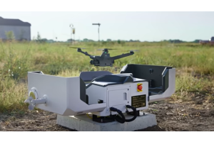
Compatible Drones
The SmartFarm app is fully compatible with the Mavic 3 Multispectral and other DJI Agras drones, including the T20P and T40, enhancing its utility for agriculture professionals.
The app is available on Apple App Store & Google Play store.
DJI SmartFarm Web is accessible online.
The Age Of The Smart Farmer
Scale up your operations with our range of agricultural drone solutions at DSLRPros. We’ve got you covered with UAV solutions for precision farming, crop health monitoring, irrigation management, and more. Whether managing vast fields or livestock, our drones ensure efficiency and productivity. Got questions or need help? Let's talk through (877) 299-1075 / (213) 262-9436 or sales@DSLRPros.com.