


DJI Matrice 4 Series Drones for Public Safety, Inspection, Mapping, and Survey
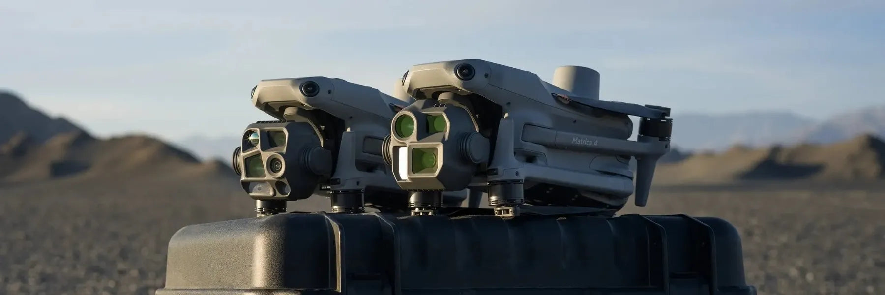
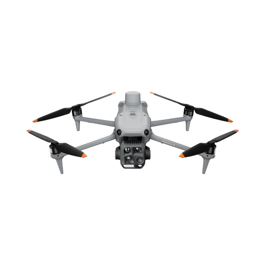
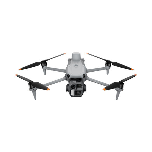
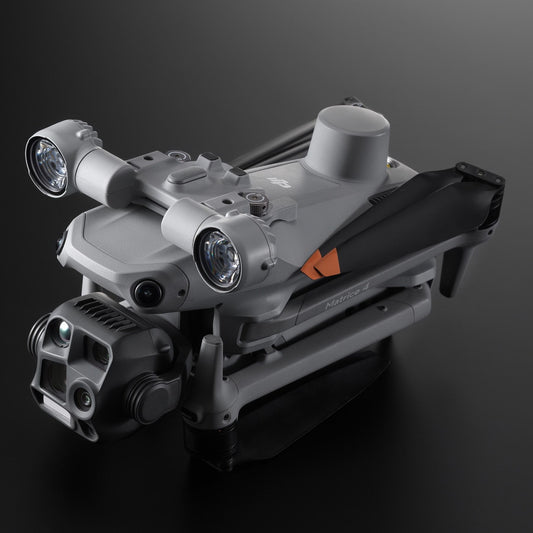
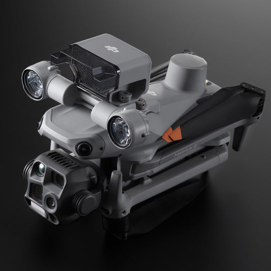
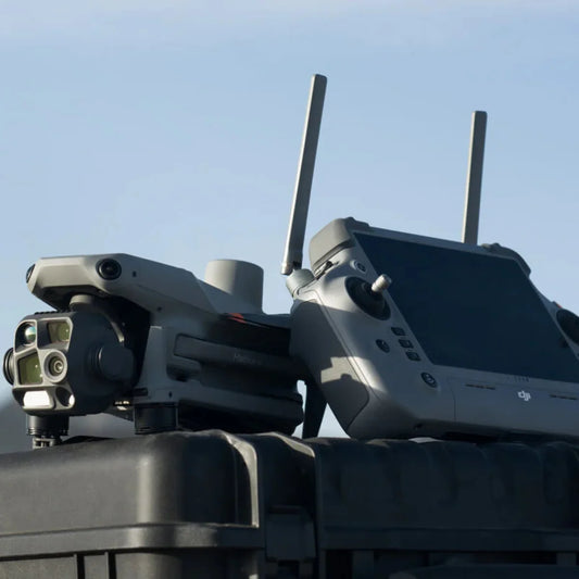
The DJI Matrice 4 Series is a compact enterprise drone platform built around fixed multi-sensor camera systems and AI-assisted flight — no payload swapping, no external sensor integration required. Released in January 2025, the series includes two models: the Matrice 4T, configured for thermal inspection, public safety, and search and rescue operations, and the Matrice 4E, configured for photogrammetry, mapping, and survey.
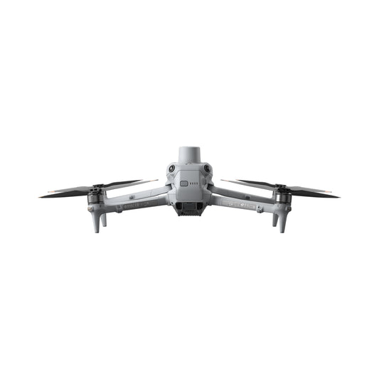
Both aircraft weigh under 1,230 g (2.71 lbs) with propellers and battery, fold to 260.6 x 113.7 x 138.4 mm (10.3 x 4.5 x 5.5 inches) for transport, and deliver up to 49 minutes of flight time on a single 99.5 Wh intelligent battery. They share the same airframe, O4 Enterprise video transmission system, omnidirectional binocular vision sensing, and DJI RC Plus 2 Enterprise remote controller.
At DSLRPros, the Matrice 4 Series is available as individual aircraft units alongside the full ecosystem of DJI-official accessories and third-party field tools — spotlight, speaker, obstacle sensing module, Manifold 3 onboard computing, air drop system, and a range of battery and charging hardware.
DSLRPros carries both models in stock and provides the pre-sale configuration support operators need to choose the right aircraft and accessories for their specific mission requirements.
Matrice 4T and Matrice 4E: How the Two Models Differ
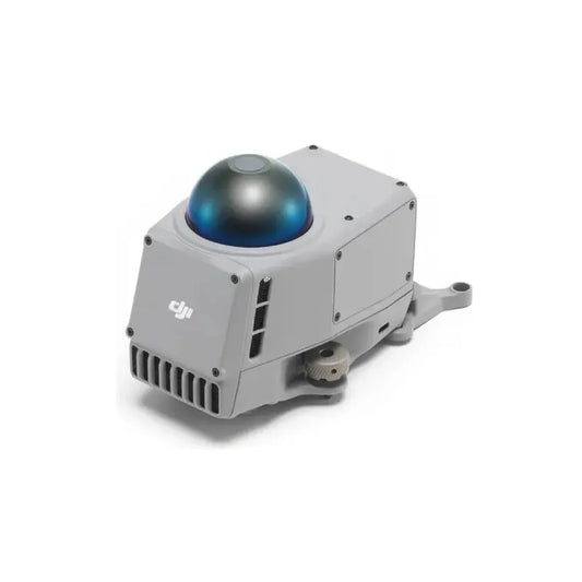
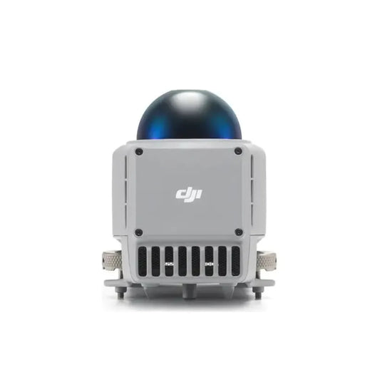
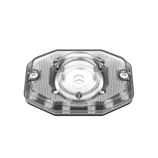
- Matrice 4T: four-sensor integrated camera system—wide, medium tele, and telephoto cameras (all 48 MP) plus a 640 x 512 radiometric thermal camera, NIR auxiliary light, and laser range finder—designed for thermal inspection, public safety, and search and rescue
- Matrice 4E: three-sensor integrated camera system—4/3-inch 20 MP wide camera with mechanical shutter plus medium tele and telephoto cameras (both 48 MP) plus a laser range finder—designed for photogrammetry, precision mapping, and survey with integrated RTK
The full model-by-model comparison table is below.
| Specification | Thermal / Public Safety Matrice 4T | Mapping / Survey Matrice 4E |
|---|---|---|
| Takeoff weight | 1,219 g (2.69 lbs) standard propellers | 1,219 g (2.69 lbs) standard propellers |
| Max flight time | 49 min (standard props, no payload) | 49 min (standard props, no payload) |
| Max speed | 21 m/s (46.9 mph) | 21 m/s (46.9 mph) |
| Wide camera | 1/1.3-inch CMOS, 48 MP, f/1.7, 82° FOV, 24 mm EFL | 4/3-inch CMOS, 20 MP, f/2.8–f/11, 84° FOV, 24 mm EFL |
| Wide shutter | Electronic 2–1/8000 s | Mechanical 2–1/2000 s + Electronic 2–1/8000 s |
| Wide photo format | JPEG | JPEG / DNG (RAW) |
| Min photo interval | 0.7 s | 0.5 s |
| Medium tele camera | 1/1.3-inch CMOS, 48 MP, f/2.8, 35° FOV, 70 mm EFL | 1/1.3-inch CMOS, 48 MP, f/2.8, 35° FOV, 70 mm EFL |
| Telephoto camera | 1/1.5-inch CMOS, 48 MP, f/2.8, 15° FOV, 168 mm EFL | 1/1.5-inch CMOS, 48 MP, f/2.8, 15° FOV, 168 mm EFL |
| Hybrid zoom | 112x (16x digital via telephoto) | 56x (16x digital via telephoto) |
| Thermal camera | 640×512 VOx, 12 µm, 30 Hz, f/1.0, 45° DFOV, 53 mm EFL | Not available |
| Thermal super-res | 1,280×1,024 (UHR mode) | Not available |
| Thermal temp range | -20°C to 150°C (high gain); 0°C to 550°C (low gain) | Not available |
| NIR auxiliary light | Yes — 5.7° FOV, effective to 100 m | Not available |
| Laser range finder | 1,800 m range, 1 m blind zone | 1,800 m range, 1 m blind zone |
| Integrated RTK | Yes | Yes |
| Mechanical shutter | No | Yes (wide camera only) |
| Smart 3D Capture | No | Yes |
| Night scene ISO (tele) | ISO 100 to ISO 819200 | ISO 100 to ISO 409600 |
| Gimbal tilt (mech.) | -140° to +113° | -140° to +50° |
| Primary use | Thermal inspection, SAR, public safety, firefighting | Photogrammetry, survey, construction, mapping |
Scroll horizontally to view all specifications.
Shared Platform Design: What Both Aircraft Deliver
Both Matrice 4 Series aircraft are built on an identical airframe: the same folding quad frame, the same propulsion system, the same battery, the same sensing architecture, and the same O4 Enterprise video transmission system. An operator trained on one is fully qualified on the other.
The integrated RTK module provides 1 cm + 1 ppm horizontal and 1.5 cm + 1 ppm vertical positioning accuracy across both aircraft, supported by GPS, Galileo, BeiDou, and GLONASS. The omnidirectional binocular vision system reaches 22.5 m in the forward and backward directions and 200 m at maximum range, with lateral sensing to 32 m and infrared downward sensing to 18.8 m, enabling obstacle avoidance at the full forward airspeed of 21 m/s (46.9 mph).
The O4 Enterprise transmission system delivers 1080p/30fps live view at up to 25 km (FCC) with 130 ms latency in clean conditions, and the DJI RC Plus 2 Enterprise provides a 7.02-inch 1,400-nit touchscreen, 3.8 hours of internal battery life, Android 11, HDMI 1.4 output, and optional 4G link via the DJI Cellular Dongle 2.
Maximum flight time is 49 minutes (standard propellers) or 46 minutes (low-noise propellers) at sea level without accessories. The 200 g (7.1 oz) accessory capacity supports the AL1 spotlight, AS1 speaker, DJI Obstacle Sensing Module, and DJI Manifold 3 within the aircraft's certified weight limits.
Matrice 4T and 4E Integrated Camera Systems, Field-Attachable Accessories, and Ground Hardware
Matrice 4T integrated camera system:
- Wide camera: 1/1.3-inch CMOS, 48 MP, f/1.7 aperture, 82° FOV, 24 mm equivalent focal length, electronic shutter 2–1/8000 s
- Medium tele camera: 1/1.3-inch CMOS, 48 MP, f/2.8, 35° FOV, 70 mm equivalent focal length
- Telephoto camera: 1/1.5-inch CMOS, 48 MP, f/2.8, 15° FOV, 168 mm equivalent focal length; 112x hybrid zoom
- Thermal camera: 640 x 512 VOx uncooled microbolometer, 12 µm pixel pitch, f/1.0, 45° DFOV, 53 mm EFL; UHR mode outputs 1,280 x 1,024; temperature range -20°C to 550°C across gain modes; ±2°C or ±2% accuracy (high gain)
- NIR auxiliary light: 5.7° FOV infrared illumination effective to 100 m for near-total-darkness operations
- Laser range finder: 1,800 m maximum range at 20% reflectivity, real-time GPS coordinate output for targets
Matrice 4E integrated camera system:
- Wide camera: 4/3-inch CMOS, 20 MP, f/2.8–f/11 aperture, 84° FOV, 24 mm equivalent focal length; mechanical shutter 2–1/2000 s eliminates rolling shutter distortion during forward flight; DNG (RAW) output supported; 0.5 s minimum interval
- Medium tele camera: 1/1.3-inch CMOS, 48 MP, f/2.8, 35° FOV, 70 mm equivalent focal length
- Telephoto camera: 1/1.5-inch CMOS, 48 MP, f/2.8, 15° FOV, 168 mm equivalent focal length; 56x hybrid zoom
- Laser range finder: 1,800 m maximum range at 20% reflectivity, real-time GPS coordinate output for targets
- Smart 3D Capture: remote controller generates rough point cloud on-site; aircraft autonomously plans close-range precise 3D modeling routes
- Ortho and oblique capture: 3-Directional Ortho and 5-Directional Oblique modes; single flight covers up to 2.8 km²
Field-attachable accessories (both models):
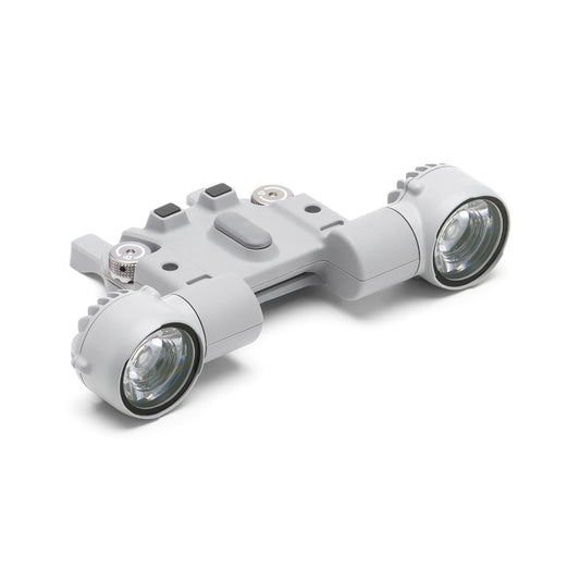
- DJI AL1 Spotlight: 32W, 4.3 lux at 100 m (17 lux at 50 m), 23° effective illumination angle, tilt-controlled and gimbal-linked, strobe and always-on modes, 99 g with bracket
- DJI AS1 Speaker: 15W, 114 dB at 1 m, 300 m effective broadcast range, real-time voice, recorded audio, text-to-speech (English and Chinese), 92.5 g with bracket
- DJI Obstacle Sensing Module: adds detection capability for thin hazards including power lines and branches
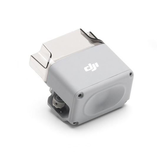
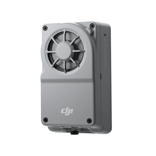
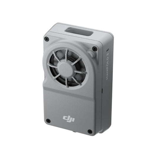
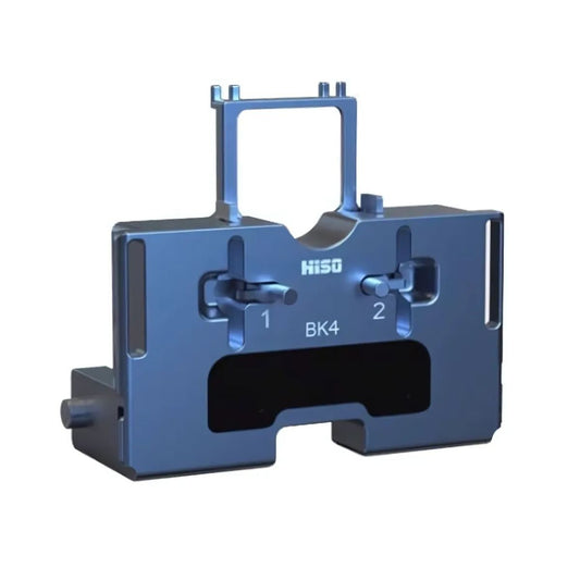
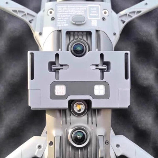
- DJI Manifold 3: onboard computing module for custom AI model deployment and automated data processing directly on the aircraft
- DJI Matrice 4 Series Propeller Guard: 360° blade protection for confined-space, proximity, and indoor operations
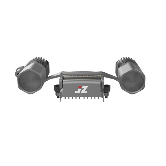
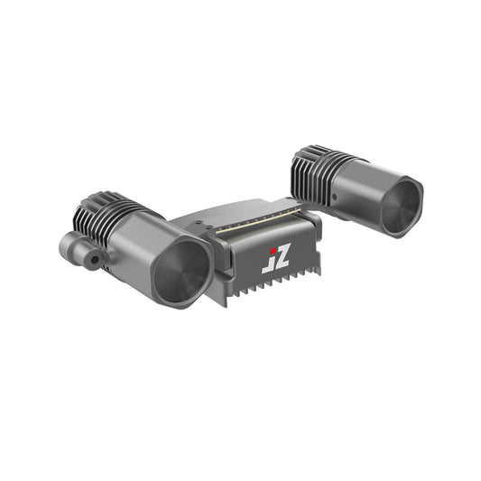
- JZ Drones AF1 Audio and Flashing Alarm: combined audio alert and strobe light for crowd management and public safety operations
- JZ Drones T30 V2 Matrix Lamp: high-output lighting for nighttime operations
- DSLRPros Air Drop System: payload delivery system for emergency response and SAR supply drops
Ground support and control hardware:
- DJI RC Plus 2 Enterprise: 7.02-inch 1,400-nit display, 3.8-hour internal battery, Android 11, HDMI 1.4, 128 GB ROM, 25 km FCC transmission range
- DJI RC Plus 2 Enterprise Enhanced: available as a standalone upgrade option at DSLRPros
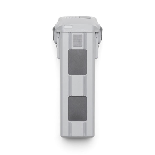
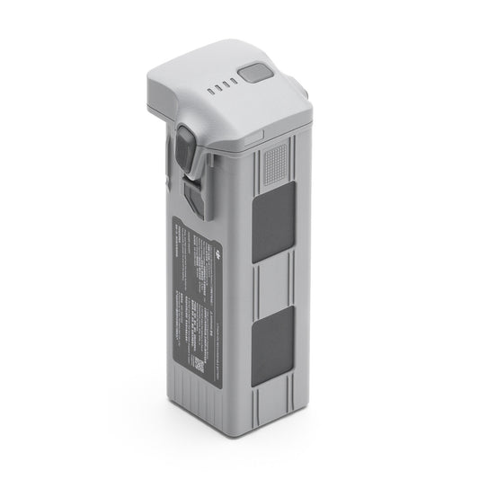
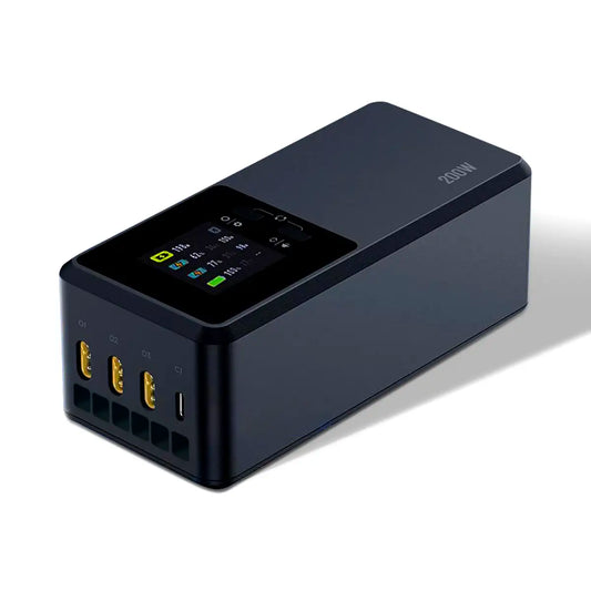
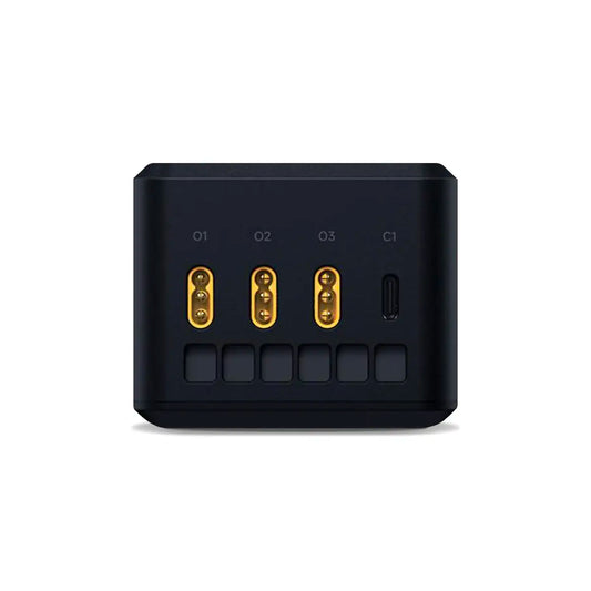
- DJI Matrice 4 Series Battery: 99.5 Wh, 6,741 mAh, 14.76V Li-ion 4S, 401 g, 200-cycle rated
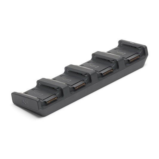
- DJI Matrice 4 Series Charging Hub (100W): 4-battery sequential charging; Standard Mode (100% SOC) and Standby Mode (90% SOC)
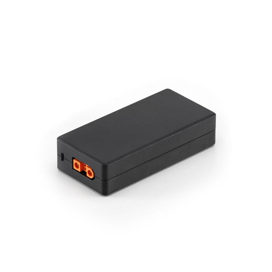
- DJI Matrice 4 Series Three-Way Multicharger: simultaneous three-battery charging
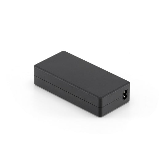
- DJI 240W Power Adapter: high-output charger compatible with Matrice 4 and 4D Series
- Colorado Drone Chargers DJI Matrice 4 Series PRCS: rapid field charging system
- DJI Matrice 4 Series Low-Noise Propellers (1154F): reduces acoustic signature by 3.5 dB; 46-minute flight time
What the Matrice 4 Series Delivers Across Both Models
- Flight endurance: 49-minute maximum flight time on a single 99.5 Wh intelligent battery at sea level
- Omnidirectional sensing: binocular vision arrays cover all six directions; obstacle avoidance functions at full 21 m/s airspeed
- Integrated RTK: 1 cm + 1 ppm horizontal positioning accuracy standard on both models; no external module required
- Laser range finder: real-time distance, altitude, and GPS coordinates for targets up to 1,800 m away on both models
- O4 Enterprise transmission: 25 km FCC range, 1080p/30fps live view, 130 ms latency, 8-antenna 2T4R system
- Compact deployment: folds to 260.6 x 113.7 x 138.4 mm; ready for flight in under 15 seconds from a vehicle trunk
- Multi-sensor imaging: wide, medium tele, and telephoto cameras integrated on both models for simultaneous multi-perspective capture
- 4K video: H.264/H.265, 3840 x 2160 at 30fps, 60 Mbps H.264 bitrate across all visible cameras
- AI intelligent flight: Smart Track, Cruise, POI orbit, AI Spot-Check, and AI-assisted object detection built into DJI Pilot 2
- Night operations: extended ISO range across all cameras; 4T adds NIR illumination and thermal detection for total-darkness missions
- Accessory expansion: 200 g payload capacity covers spotlight, speaker, obstacle sensing module, and Manifold 3 within certified limits
- DJI Pilot 2 and FlightHub 2: full mission planning, fleet management, and real-time annotation sharing across teams
Where the Matrice 4 Series Gets Deployed
- Search and rescue: Matrice 4T thermal camera and NIR light locate personnel in darkness, smoke, and obscured terrain while 112x hybrid zoom confirms subject identity at safe standoff
- Firefighting: Matrice 4T thermal imaging tracks fire spread and structure hotspots while visible cameras guide ground crew positioning in real time
- Public safety and law enforcement: 112x hybrid zoom and foreground stabilization on the 4T enable covert surveillance and suspect tracking from operationally safe altitudes
- Infrastructure inspection: laser range finder provides real-time target GPS coordinates; optical zoom cameras document conductor hardware, joints, and structural surfaces from standoff distance
- Photogrammetry and topographic survey: Matrice 4E mechanical shutter wide camera with 0.5 s minimum interval and DNG output supports mapping workflows without ground control points
- Construction progress tracking: Matrice 4E Smart 3D Capture and oblique collection modes produce detailed 3D site models from a single flight over areas up to 2.8 km²
- Solar and energy inspection: Matrice 4T thermal camera identifies underperforming panels and electrical hotspots across large arrays in a single mapping pass
- Nighttime operations: Matrice 4T ISO 819200 telephoto capability and NIR auxiliary light maintain operational capability across low-light and zero-illumination environments
DJI Pilot 2, FlightHub 2, and Matrice 4 Series Workflow Integration
Both Matrice 4 Series aircraft run DJI Pilot 2 as the primary flight and camera application, accessible through the DJI RC Plus 2 Enterprise controller. DJI Pilot 2 handles mission planning across six route types—Waypoint, Area (Ortho and Oblique Collection), Linear, Slope, Geometric, and Smart 3D Capture—with terrain follow using real-time vision-based detection or imported DSM files.
The Matrice 4E's area route modes support 3-Directional Ortho and 5-Directional Oblique capture with Smart Oblique enabled for single-pass multi-direction data collection. RTK supports Custom Network RTK and D-RTK base station connection, and positioning status (Fixed, Float, Single) is visible in real time during the mission.
DJI FlightHub 2 integrates with DJI Pilot 2 for cloud-based fleet management, mission synchronization, real-time PinPoint annotation sharing, and team coordination across multiple aircraft. DJI Terra processes captured imagery into orthomosaics, point clouds, and 3D models.
DJI Assistant 2 (Enterprise Series) handles firmware updates. Developers can access onboard computing capability through DJI's Mobile SDK, Cloud API, Payload SDK, and PSDK, and the Manifold 3 accessory extends this to custom AI model deployment directly on the aircraft. 4G enhanced transmission via the DJI Cellular Dongle 2 supplements O4 Enterprise link in signal-degraded or long-range environments.
Choosing Between the Matrice 4T and Matrice 4E
- Thermal detection required: the Matrice 4T is the only option—the 4E has no thermal sensor; for any mission where heat signature detection is a primary requirement, the 4T is the correct aircraft
- Low-light and nighttime operations: the 4T's NIR auxiliary light and ISO 819200 telephoto extend operation into environments the 4E cannot effectively cover
- Survey and mapping as the primary deliverable: the 4E's 4/3-inch mechanical shutter wide camera, DNG output, 0.5 s minimum interval, and mapping-without-GCP support make it the correct choice; the 4T can map, but its 1/1.3-inch electronic shutter wide camera produces different geometric results during forward flight
- 3D modeling of complex structures: Smart 3D Capture is a 4E-exclusive feature that allows on-site route generation from a point cloud model; the 4T does not support it
- Public safety and incident response: the 4T's four-sensor system covers the full operational range from visible to thermal to long-range zoom in a single aircraft; agencies running mixed response missions should prioritize the 4T
- Accessory requirements: both models share the same accessory ecosystem: spotlight, speaker, obstacle sensing module, and Manifold 3 all work on both aircraft without modification
- Operating both: teams that need thermal response and precision survey should consider operating one of each; because the airframe, controller, battery, and charging hardware are identical, shared logistics and maintenance costs apply across the fleet
DSLRPros Care Extended Warranty for the Matrice 4 Series
Both the DJI Matrice 4T and Matrice 4E are eligible for the DSLRPros Care Extended Warranty — an exclusive protection program available only to buyers who purchase directly from DSLRPros. Coverage runs for 13 months from the date your aircraft ships and includes accidental damage from pilot error, collisions, drops, water exposure, signal interference, and internal malfunctions.
Up to one replacement is covered during the term, with the replacement unit being new or refurbished at DSLRPros's discretion. The policy must be purchased before your product ships and applies to the original purchaser only. To file a claim, contact support@dslrpros.com within 7 days of an incident. Full terms, conditions, and the complete eligible product list are available on the DSLRPros Care Extended Warranty page.
Configure and Shop the DJI Matrice 4 Series at DSLRPros
The Matrice 4 Series gives field operators a compact, deployment-ready platform that removes the friction of payload configuration from the pre-mission checklist. Both models arrive ready to fly with their integrated camera systems, built-in RTK, and omnidirectional sensing active — the mission choice is selecting which aircraft serves the task, not which components to assemble.
DSLRPros is an authorized DJI Enterprise Gold Partner dealer for the Matrice 4 Series, stocking both the Matrice 4T and Matrice 4E alongside the full accessory and charging ecosystem. Our pre-sale team can help you configure the right aircraft, accessories, and charging setup for your operation.
Shop the DJI Matrice 4 Series at DSLRPros today or contact us to request a quote.
FAQs
What is the difference between the Matrice 4T and Matrice 4E?
The Matrice 4T is configured for thermal inspection, public safety, and search and rescue, featuring a four-sensor integrated camera system: wide (48 MP, f/1.7), medium tele (48 MP), telephoto (48 MP, 112x hybrid zoom), and a 640 x 512 radiometric thermal camera with NIR auxiliary light. The Matrice 4E is configured for photogrammetry, survey, and mapping, featuring a three-sensor system: a 4/3-inch 20 MP wide camera with mechanical shutter and DNG output, medium tele (48 MP), and telephoto (48 MP, 56x hybrid zoom). The 4E has no thermal sensor; the 4T has no mechanical shutter on its wide camera.
Does the DJI Matrice 4 Series have a built-in RTK module?
Yes. Both the Matrice 4T and Matrice 4E include an integrated RTK module that provides 1 cm + 1 ppm horizontal and 1.5 cm + 1 ppm vertical positioning accuracy. The RTK module is not removable. The system supports Custom Network RTK connection and D-RTK base station pairing, with real-time positioning status visible in DJI Pilot 2 during flight. The Matrice 4E's wide camera supports mapping without ground control points using the integrated RTK.
What accessories are compatible with the DJI Matrice 4 Series?
Both models support the same field-attachable accessory ecosystem within the aircraft's 200 g accessory capacity. Accessories available at DSLRPros include the DJI AL1 Spotlight (32W, effective to 100 m), DJI AS1 Speaker (114 dB, 300 m broadcast range), DJI Obstacle Sensing Module (detects thin hazards such as power lines and branches), DJI Manifold 3 (onboard AI computing), DJI Cellular Dongle 2 (4G enhanced transmission), and the DJI Matrice 4 Series Propeller Guard. Third-party accessories including the JZ Drones AF1 alarm, JZ Drones T30 V2 Matrix Lamp, and DSLRPros Air Drop System are also stocked.
What is the maximum transmission range and live view quality of the Matrice 4 Series?
Both models use the O4 Enterprise video transmission system, which delivers a maximum range of 25 km (FCC) in unobstructed environments free of interference — 12 km under CE, SRRC, and MIC standards. Live view quality is 1080p at 30fps with 130 ms latency in near-field interference-free conditions. The system uses 8 antennas in a 2T4R configuration and supports 4G enhanced transmission via the DJI Cellular Dongle 2 for supplemental connectivity in signal-degraded environments.
What mapping capabilities does the Matrice 4E offer compared to the Matrice 4T?
The Matrice 4E is the mapping-optimized aircraft. Its 4/3-inch 20 MP wide camera with mechanical shutter eliminates rolling shutter distortion during forward flight, supports 0.5 s minimum capture interval, and outputs DNG (RAW) files directly compatible with photogrammetry pipelines. It supports 3-Directional Ortho and 5-Directional Oblique collection modes, Smart Oblique single-pass multi-direction capture, and Smart 3D Capture — which generates a rough point cloud model on the RC Plus 2 and uses it to plan autonomous close-range 3D modeling routes. A single flight can cover up to 2.8 km². The 4T can fly mapping routes but lacks the mechanical shutter, 0.5 s interval, and Smart 3D Capture.
How long does the Matrice 4 Series battery last and how do I charge multiple batteries in the field?
The intelligent flight battery delivers up to 49 minutes of flight time with standard propellers (46 minutes with low-noise propellers) at sea level without accessories. Each battery is rated at 99.5 Wh, 6,741 mAh, and 200 charge cycles. For field charging, the DJI Matrice 4 Series Charging Hub (100W) charges up to four batteries sequentially and supports Standby Mode at 90% SOC for rapid turnaround. The Three-Way Multicharger charges three batteries simultaneously. The DJI 240W Power Adapter and Colorado Drone Chargers PRCS rapid charger are also available at DSLRPros for high-tempo field operations.
