


DJI D-RTK 3 Multifunctional Station + Survey Pole and Tripod Kit
DJI D-RTK 3 Multifunctional Station + Survey Pole and Tripod Kit
SKU:B-DJI-DRTK3-CB


- Description
- Specifications
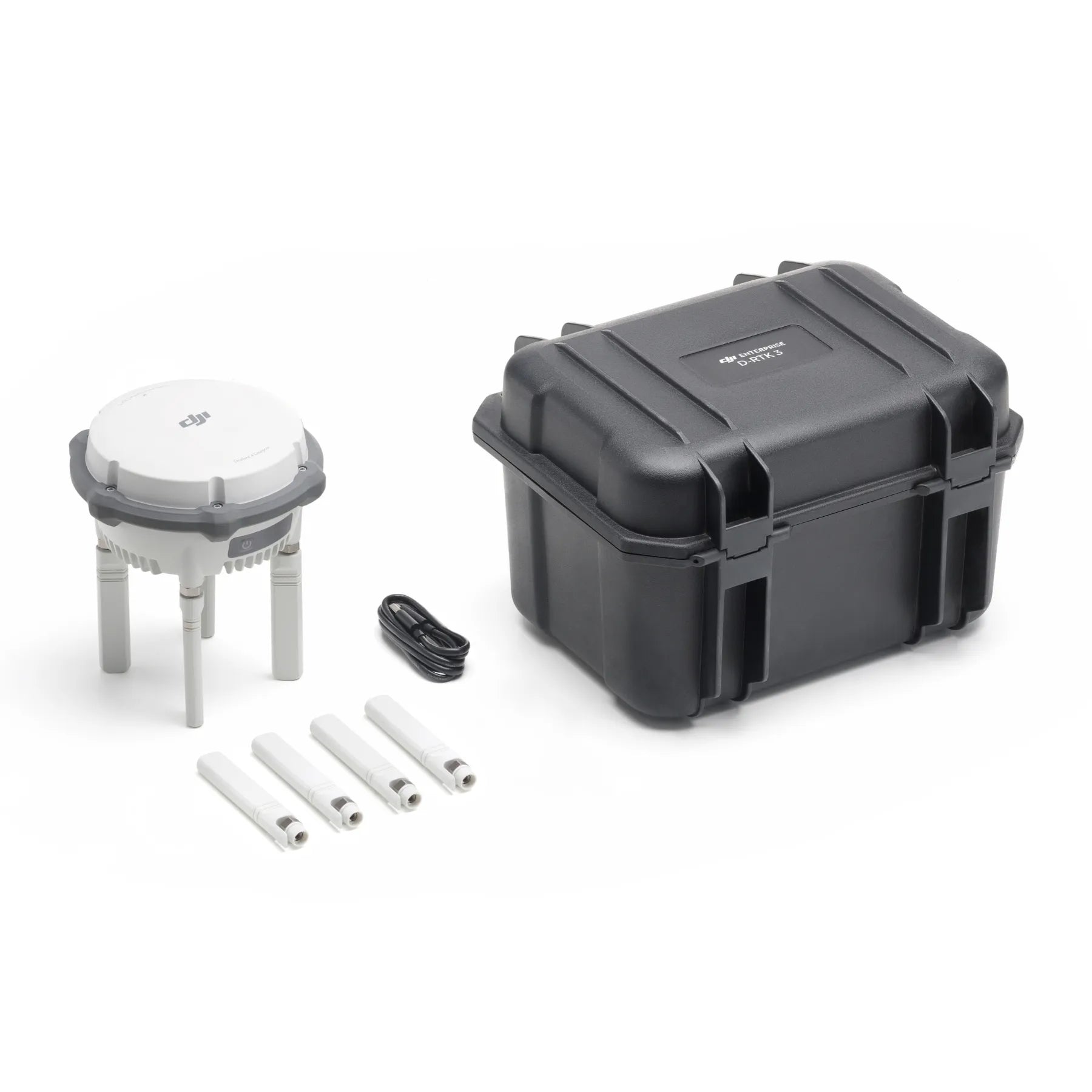
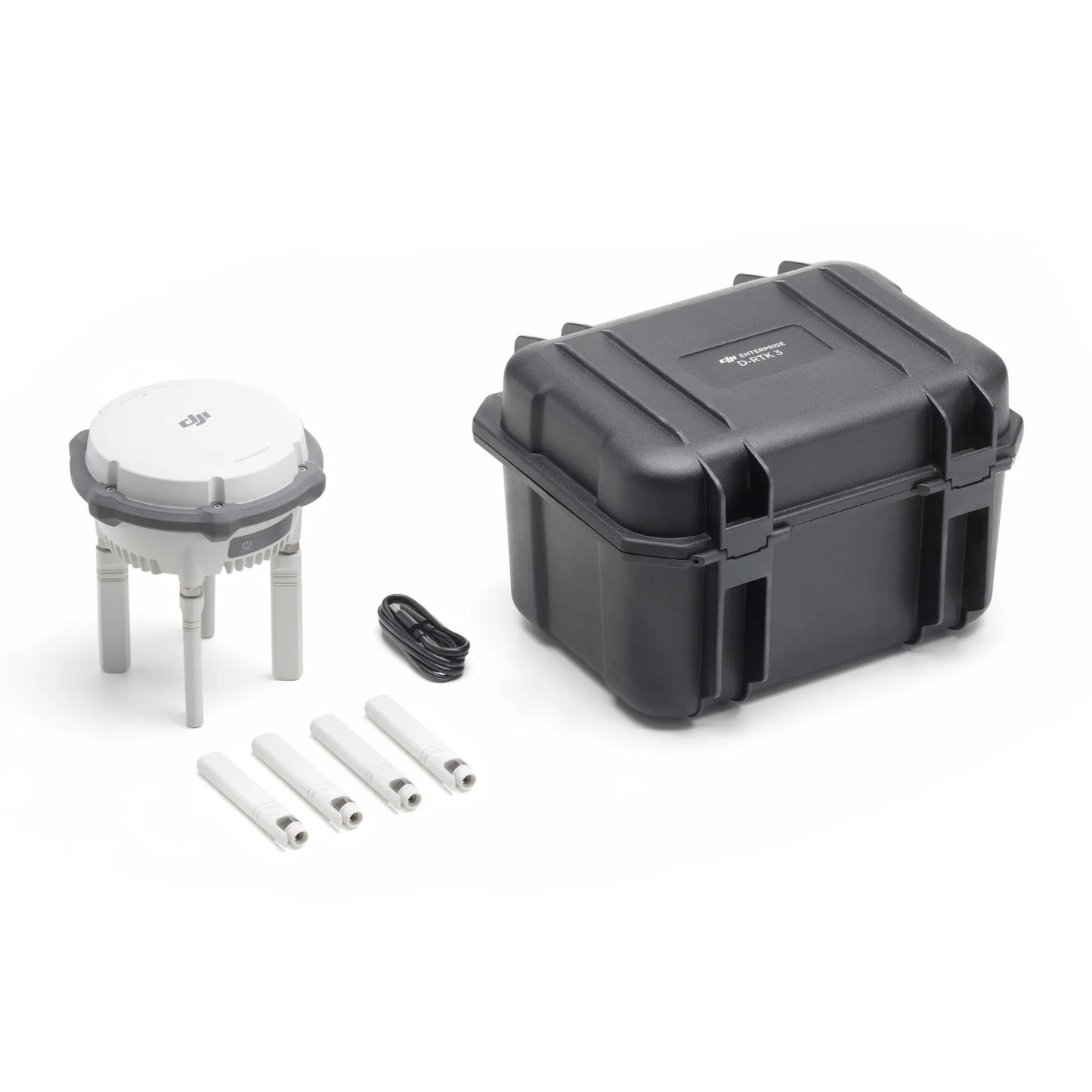
- In the Box
- FAQ
DJI D-RTK 3 Multifunctional Station Bundle for Surveying and Mapping
The DJI D-RTK 3 Multifunctional Station + Survey Pole and Tripod Kit delivers a complete, field-ready RTK positioning solution for enterprise drone operations.
This bundle pairs DJI’s multi-mode D-RTK 3 station with a survey pole and tripod kit for stable ground deployment. Supporting base, relay, and rover workflows, the system enables precise positioning, improved connectivity, and rapid deployment across varied environments.
It is designed for organizations that require accuracy, operational continuity, and reduced downtime during critical surveying, inspection, and infrastructure missions.
D-RTK 3 Multifunctional Station + Pole/Kit bundle features
- Multi-mode operation: Supports base station, relay station, and rover station workflows.
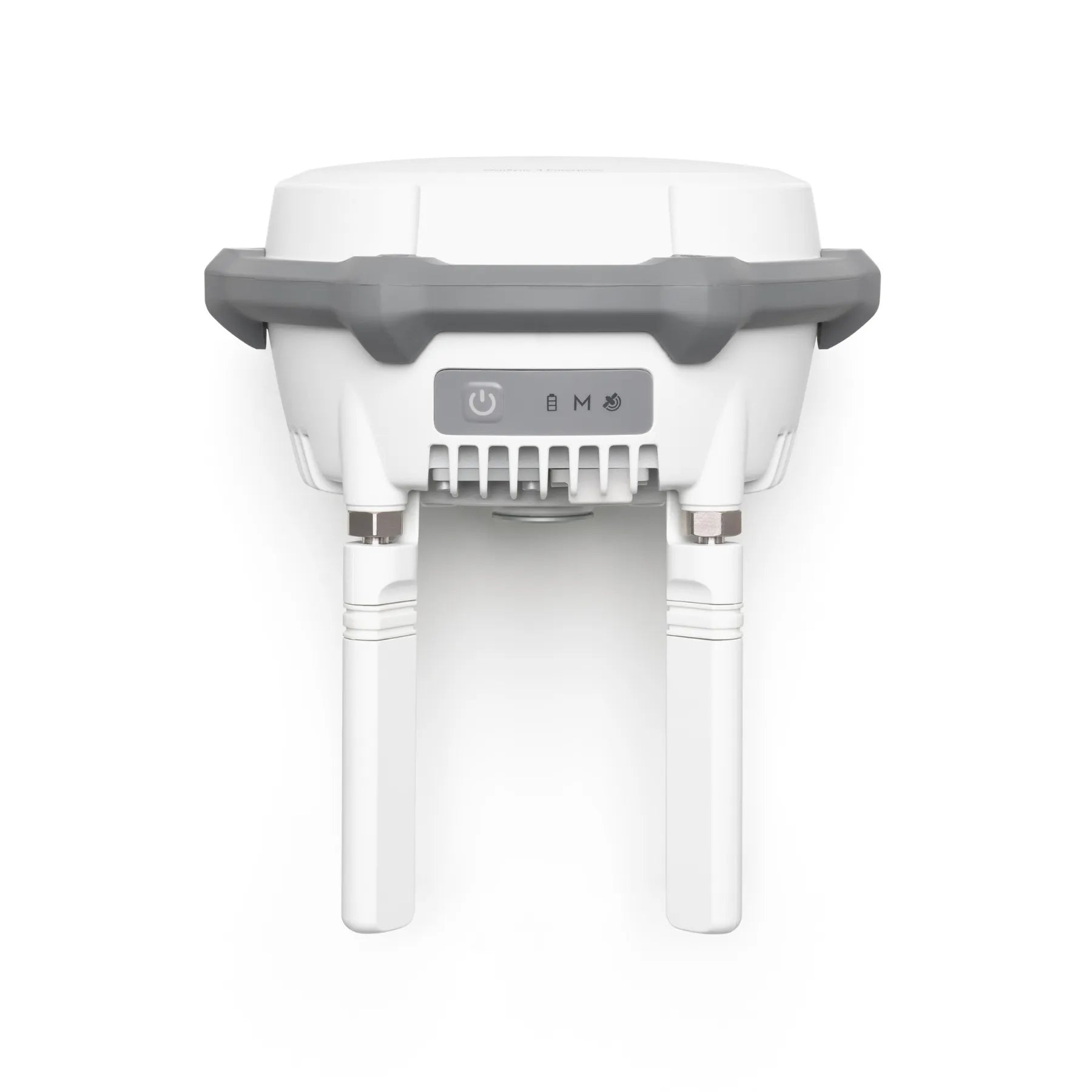
- Multi-constellation GNSS: Tracks GPS, BDS, Galileo, GLONASS, and QZSS signals.
- Survey pole and tripod: Enables stable, repeatable ground station deployment.
- Centimeter-level accuracy: Supports RTK positioning with published performance specifications.
- Network RTK calibration: Enables high-precision positioning for mapping workflows.
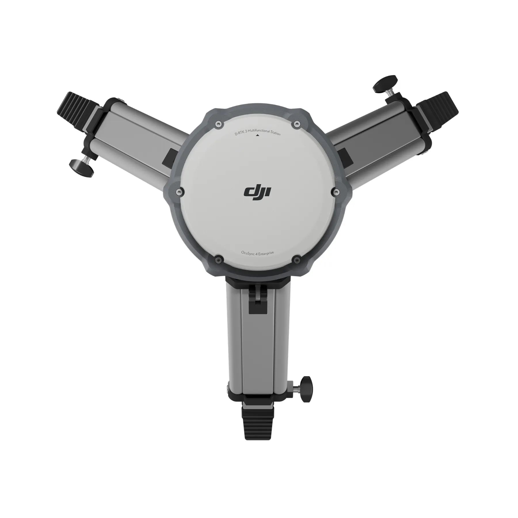
- O4 Enterprise relay support: Improves communication reliability in obstructed environments.
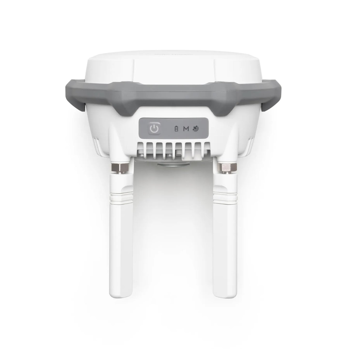
- Integrated battery power: Supports standalone field operation without external power.
- Bundle-ready deployment: Includes mounting hardware for immediate field use.
Accurate positioning with predictable performance characteristics
DJI D-RTK 3 provides clearly defined accuracy specifications across its supported operating modes, allowing teams to plan missions with confidence.
In base station and relay station modes, uncalibrated single point accuracy is specified at 1.5 m horizontal and 3.0 m vertical RMS. Network RTK calibration improves accuracy to 1.0 cm horizontal plus 1 ppm and 3.0 cm vertical plus 1 ppm.
In rover station mode, fixed RTK survey accuracy reaches 0.8 cm horizontal plus 1 ppm and 1.5 cm vertical plus 1 ppm, with initialization reliability exceeding 99.9 percent.
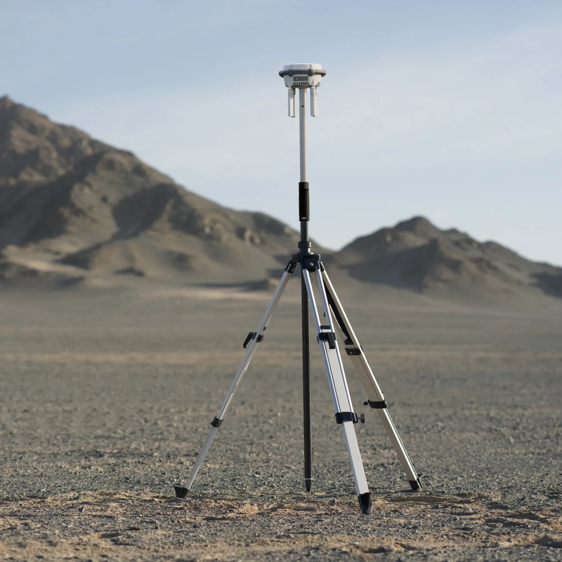
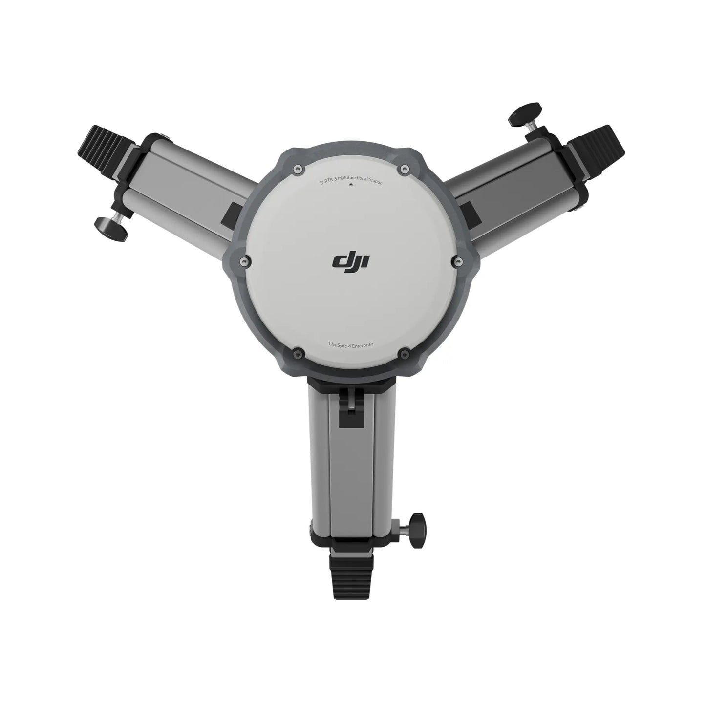
Field-ready design for rapid deployment and repeatable setups
The included survey pole and tripod kit allows the D-RTK 3 station to be deployed quickly and consistently across job sites.
This configuration supports stable antenna placement, improves signal reception, and simplifies repeatable setup procedures for surveying and mapping operations.
Combined with the station’s internal battery and IP67-rated enclosure, the bundle supports extended outdoor use without complex infrastructure requirements.
This makes it suitable for mobile teams working across multiple sites or operating in environments where permanent installations are impractical.
Compatible aircraft and modes
- Key Compatible Drones (Base Station Mode)
- DJI Matrice 4 Series (Including M4E, M4T, M4D, M4TD)
- DJI Matrice 400 RTK
- DJI Matrice 350 RTK
- DJI Matrice 300 RTK
- DJI Matrice 30 Series (M30/M30T)
- DJI Matrice 3D/3TD
- DJI Mavic 3 Enterprise Series (M3E, M3T, M3M)
- DJI Inspire 3 (Professional Filmmaking)
- DJI FlyCart 30
- DJI Matrice 4 Series (Including M4E, M4T, M4D, M4TD)
- Compatible Agricultural Drones
- DJI Agras T60
- DJI Agras T50 / T25
- DJI Agras T40 / T20P
- DJI Agras T60
- Relay Station Mode: Specifically supports the Matrice 4E, Matrice 4T, and FlyCart 100 to extend range.
Professional applications supported by the bundle
- RTK base station deployment: Deliver precise positioning corrections for enterprise UAV missions.
- Rover field surveying: Collect centimeter-level ground points using mobile devices.
- Relay station operations: Extend communication links in obstructed environments.
- Infrastructure inspection: Support accurate positioning around buildings and facilities.
- Mapping and surveying: Enable high-accuracy geospatial data collection workflows.
- Dock site assessment: Improve connectivity planning for fixed UAV infrastructure.
- Multi-aircraft fleet operations: Standardize positioning across mixed DJI platforms.
- Rugged field operations: Maintain accuracy under variable environmental conditions.
For professionals who depend on accurate geospatial data, the DJI D-RTK 3 Multifunctional Station bundle offers a practical and scalable RTK solution.
Its combination of precise GNSS positioning, flexible operating modes, and portable deployment hardware makes it a valuable tool for surveying, mapping, and infrastructure projects.
