


WISPR 24MP Mapper Payload
WISPR 24MP Mapper Payload
SKU:S-WSP-MAP-24MP-SS


- Description
- Specifications
- In the Box
- FAQ
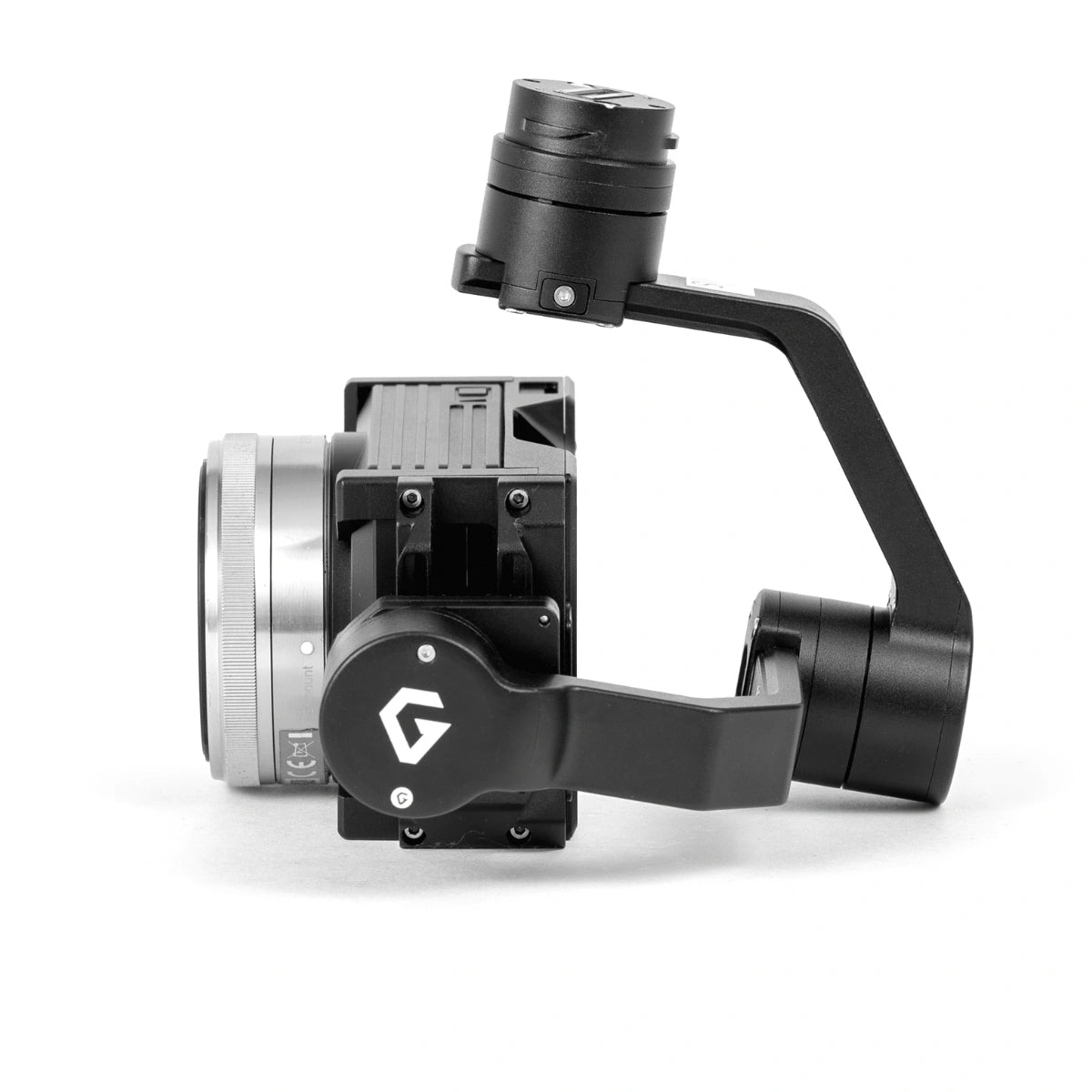
WISPR 24MP Mapper: 24-Megapixel Aerial Imaging Payload for Precision Mapping Missions
The WISPR 24MP Mapper is a professional-grade gimbal-mounted camera payload engineered for drone-based mapping, surveying, and aerial data collection. Built around a 24-megapixel Sony Exmor APS-C CMOS sensor paired with a Sony E Mount 16mm lens, it delivers high-resolution imagery at 6000 x 4000 pixels with an 83-degree field of view — the combination operators need when ground resolution and coverage area both matter. Designed for integration with the WISPR SkyScout 2 Series, it mounts via a twist-lock quick-attach gimbal ring for fast, reliable payload swaps in the field.
Image quality and data integrity are built into every capture. The 24MP Mapper shoots in JPEG, HEIF, or RAW formats and supports a mechanical shutter speed range of 1/4000 to 30 seconds, with exposure compensation of +/- 5.0EV and ISO sensitivity up to 25600 — expandable to 51200 with MFNR. Every image is automatically geotagged with latitude, longitude, altitude, gimbal orientation, and GPS timestamp via EXIF, with a GPSlog.txt backup that also records horizontal and vertical accuracy. Video captures up to 1080P at 60fps with frame-accurate geotag data written to a subtitle file at one data point per second.
WISPR 24MP Mapper Core Features and Advantages
- Sony Exmor APS-C CMOS: 1.11-inch sensor captures sharp, detail-rich aerial imagery.
- 24-megapixel resolution: 6000 x 4000 output supports high-accuracy mapping deliverables.
- 83-degree FOV: Sony E Mount 16mm lens maximizes ground coverage per pass.
- 3-axis stabilized gimbal: ±0.02° vibration tolerance maintains image clarity during flight.
- Mechanical shutter: 1/4000 to 30-second range handles varied lighting conditions precisely.
- EXIF geotagging: latitude, longitude, altitude, and gimbal data embedded in every image.
- GPSlog.txt backup: horizontal and vertical accuracy logged separately for post-processing integrity.
- Video geotagging: subtitle file records positional data at one data point per second.
- RAW format support: uncompressed image capture preserves full data for photogrammetry workflows.
- Quick-attach mount: twist-lock gimbal ring enables fast, secure payload changes between missions.
The WISPR 24MP Mapper solves a core problem in professional aerial data collection: getting consistent, geospatially accurate imagery from a platform that deploys quickly and integrates cleanly with existing ground control workflows. Its operating temperature range of 32°F to 122°F (0°C to 50°C) and 3-axis gimbal with controlled pan rotation of ±320° mean it stays operationally useful across varied field conditions, not just ideal ones.
DSLRPros has the product knowledge and UAV lifecycle support to help you configure the WISPR 24MP Mapper for your specific mapping or survey workflow. Whether you are building out a new SkyScout 2 Series payload kit or expanding an existing fleet, our team is equipped to get you mission-ready. Order the WISPR 24MP Mapper at DSLRPros today.
