


DSLRPros Vantage Robotics Trace US-Made Drone Public Safety Bundle
DSLRPros Vantage Robotics Trace US-Made Drone Public Safety Bundle
SKU:B-NB-PB-S-VAN-TRACE-PS-BUN


- Description
- Specifications
- In the Box
- FAQ
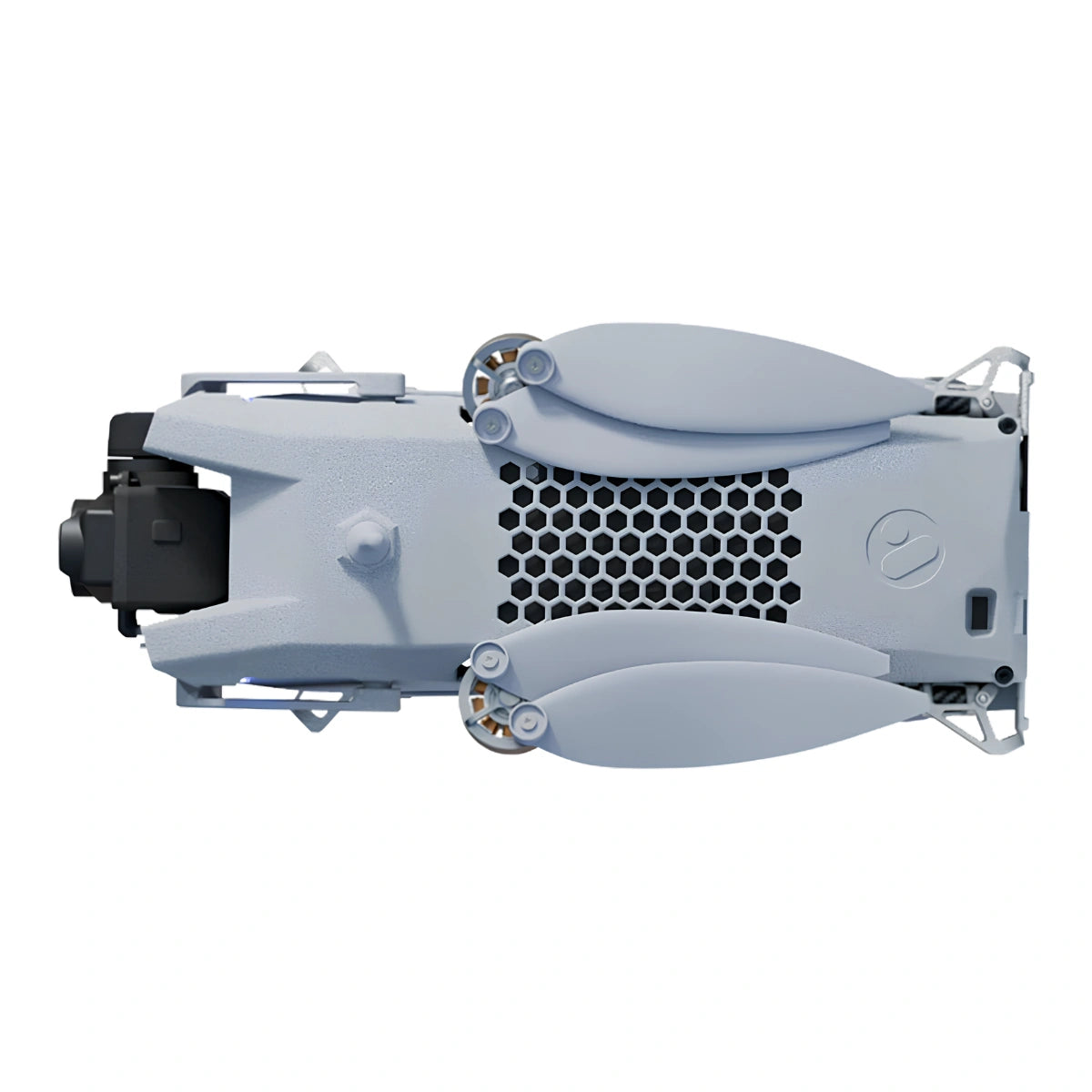
DSLRPros Vantage Robotics Trace UAV Public Safety Bundle: Hand-Launched Nano UAV With 640p Encrypted Thermal Surveillance
Public safety agencies have long faced a straightforward problem with aerial ISR: the platforms capable enough to do the job are too large, too expensive, and too slow to deploy in time-critical situations. The DSLRPros Vantage Robotics Trace UAV Public Safety Bundle solves that problem at 153 grams.
This American-made nano UAV delivers a 2-axis stabilized 48MP electro-optical and 640×480 infrared imaging system, AES-256 encrypted communications, and 360° obstacle avoidance in an airframe that hand-launches in under 30 seconds and fits in a cargo pocket. DoD Blue UAS Cleared and NDAA compliant, Trace is procurement-ready for law enforcement, fire, and emergency response agencies at every level of government.
Key Features and Benefits
- 48MP EO camera: autofocus f/1.8 lens supports 25× digital zoom for target identification.
- 640p thermal sensor: 640×480 uncooled VOx IR with 48° field of view for surveillance.
- Operational endurance: up to 36 minutes flight time on included Endurance Batteries.
- Encrypted range: 6 km LOS with AES-256 encryption and automatic channel hopping.
- Obstacle avoidance: 360° laser sensing supports indoor and confined-space flight operations.
- GPS-denied control: visual inertial odometry with scene illumination maintains indoor stability.
- Acoustic stealth: platform is unseen and inaudible at 30 feet against terrain or sky.
- Rapid deployment: foldable airframe hand-launches from IP67 field case in 30 seconds.
- Wind tolerance: stable and controlled in sustained field winds up to 25 knots.
- Compliance: Blue UAS Cleared, NDAA compliant, AES-256 encrypted with secure boot.
The Public Safety Bundle is a complete operational system. The Trace aircraft pairs with the Wisp w/640p IR gimbal and the Vision2 ground control station — a 7-inch, 2,500 nit sunlight-readable display purpose-built for field operators — along with two Endurance Batteries, chargers, propeller guards, spare rotors, an IP67 field case, and a transport case.
With up to 36 minutes of operational flight time and a 6 km line-of-sight encrypted range, the bundle gives a single officer persistent aerial awareness over a wide operational area without ground support, a vehicle mount, or a second crew member.
Wide-Area Thermal Coverage in a 153-Gram Deployable Airframe
The Trace is not a scaled-down consumer platform — it is a ground-up ISR airframe engineered to meet the sensor, security, and survivability requirements of government and law enforcement operations.
The Wisp w/640p IR gimbal's 640×480 thermal sensor delivers four times the pixel density of the standard IR configuration across a 48° field of view, giving operators a wider thermal scene and finer subject detail without repositioning. AES-256 encryption covers every data path—communications, video stream, and stored files—and the no-remote-data-connect architecture ensures mission data never leaves the operator's network.
At 153 grams, Trace falls below the FAA's intrinsically safe weight threshold, which expands the operational envelope for agencies deploying in populated or sensitive environments.
Compatibility and System Integration
- Vision2 GCS: purpose-built controller with 7 in display, 4-hour battery, NDAA and TAA compliant.
- Wisp w/640p IR gimbal: 2-axis stabilized, 640×480 IR with 48° field of view standard.
- ATAK: native compatibility feeds live video and position data into tactical operating pictures.
- Kutta KTAC and S20 TE: supported C2 alternatives for agencies with existing Kutta deployments.
- Tomahawk Mimic and Grip GCS: additional compatible ground control options for operator preference.
- QGC, WMI, and RAC2: compatible mission planning and flight management software platforms.
- MAVLink and RAS-A: open protocol compliance for interoperability in mixed-fleet environments.
Applications and Use Cases
- Law enforcement overwatch: sustained aerial awareness supports patrol, pursuit, and scene management.
- Search and rescue: 640p thermal and EO sensors locate subjects across darkness and dense terrain.
- Pre-entry reconnaissance: covert acoustic profile enables undetected structure and perimeter assessment.
- Indoor and structure ops: 360° avoidance and GPS-denied stability support safe interior navigation.
- Incident command: live feeds integrate with ATAK for real-time situational awareness at command level.
- Evidence documentation: 48MP stills and 4K MPEG-4 video provide forensic-grade aerial records.
- Perimeter containment: perch-and-stare capability sustains observation posts without continuous flight.
For public safety agencies that need aerial ISR capability now — not after a lengthy procurement cycle, not after crew training, and not after sourcing a support vehicle — the Vantage Robotics Trace Public Safety Bundle delivers a complete, compliant, and immediately deployable system with 640p thermal resolution and 36 minutes of operational endurance. It is the platform that goes where larger drones cannot, operates where GPS is unavailable, and returns data that holds up in any operational debrief.
DSLRPros has supported professional UAV operators across public safety, defense, and critical infrastructure for decades, and the Vantage Robotics Trace represents the kind of purpose-built American capability that belongs in that lineup.
Order the Trace Public Safety Bundle through DSLRPros and receive the complete system with the product expertise, configuration support, and service infrastructure that field operators depend on—contact DSLRPros today to get your unit ordered and in the field.
