Cadastral surveying has been instrumental in shaping societies by clearly demarcating land parcel boundaries, helping everyone know who owns what, and how much it's worth.
This practice, rooted in land law, focuses on land tenure, ownership, and rights, playing a crucial role in land administration and management. It’s a key part of setting the relationship between land rights and their holders, showing them what they can do with it, and any rules they need to follow, often referred to as the three Rs: relationships, rights, and restrictions.
Back in the day, surveyors would be out there with their gear—things like total stations, electronic distance meters, and GPS receivers—to establish baselines and measure everything up.
The resulting maps were used for legal, real estate, taxation, and land management purposes, ensuring clarity in ownership and aiding in dispute resolution, property valuation, and sustainable property use.
Cadastral surveying has come a long way – with historical roots in Ancient Egypt, where it all began because people needed a solid system to manage and own land.
Those early techniques were just the start, and over the centuries, we've gotten better and better at this, thanks to cool tech like theodolites, GPS, and, more recently, drones.
Let’s start at the beginning, then look at how drones are reshaping this industry.


What is Cadastral Surveying?
This is a specialized discipline within the broader field of surveying, focusing primarily on marking and defining real property boundaries. It involves the precise measurement and mapping of property lines and the documentation of its details, including dimensions, areas, and who has the rights to what.
It's not just about land; this can be for any spot that's marked out by natural or artificial boundaries, whether it's on solid ground or over water. The primary goal is to create an official and legal record of land ownership, serving as a foundation for everything from taxation to decisions about how to use the land.
Cadastral surveyors are the pros who make this happen. They're out there on the ground, physically making sure property boundaries are exactly where they should be. They start by digging into all the legal documents, official plans, and maps prepared by attorneys, engineers, and previous surveys. The initial stage of the survey, often referred to as a resurvey, requires a thorough investigation of deed descriptions, adjoining property records, and relevant municipality or county records. Then, they head out to the field, looking for physical markers, signs or monuments that show where property corners are. After that, they document every little detail about the property’s features and limits.
Of course, that’s A LOT of work.
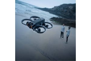
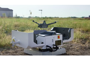
Integrating drone technology into cadastral surveying marked a significant evolution in the field. These nifty flying machines, decked out with advanced sensors and imaging technologies, bring a whole new level of speed, accuracy, and safety to the table. These unmanned aerial vehicles (UAVs) can quickly cover large areas, capturing heaps of high-resolution data that's even more detailed and precise than what we used to get with older methods. The UAVs are capable of generating detailed 3D maps and models of the land which are essential for accurate cadastral documentation – working with software like DJI Terra. They also minimize the risks and physical challenges associated with traditional surveying methods, especially in inaccessible or hazardous terrains.
Hot tip for 2024: Use DJI Terra with the newly introduced intelligent 3D model editing software, DJI Modify.
Using drones for this line of work is a smarter, cost-effective, and eco-friendly way to handle projects. Their ability to capture real-time data and provide aerial perspectives opens up new possibilities for managing and planning how we use land. And with drone tech constantly getting better, we can expect cadastral surveying to become even more efficient and crucial for managing land sustainably and smartly.
Drone Technology in Cadastral Surveying
Drone Type
Land survey drones can be broadly categorized into two:
· Quadcopters, known for their ability to hover around and maneuver into tight spots, perfect for when you need a really close look at a certain area.
· Fixed-wing drones, handy for large-scale surveys due to their longer flight times and ability to cover more ground quickly.
The choice teams make depends on project requirements, such size of the area to be surveyed, level of detail needed, as well as the desired flexibility with the UAV. Then this is further refined with aspects uch as the drone’s flight range, battery capacity, to safety features.
Sensors Used
The sensor technology of the drone often plays a more critical role than the drone's build. While there are different sensor technologies, LiDAR (Light Detection and Ranging) and photogrammetric cameras are the most common. LiDAR sensors create a 3D point cloud representing the terrain, while photogrammetric cameras use a series of photographs to generate a 3D image of the area.
Case Study: Orselina, Switzerland
The local authorities in Orselina, Switzerland aimed to update the cadastral records to reflect the current state of land cover, including green areas, open spaces, and building measurements. They brought in Studio Calastri, a Ticino-based surveying company, to do a digital cadastral survey.
The team used a Matrice 300 RTK drone equipped with a Zenmuse P1 camera to capture a staggering 6,500 images across a 3.5 square kilometer area. The RTK (Real-Time Kinematic) technology enabled precise geolocation of the data.
Orselina's got some tricky terrain, sitting on a steep slope and all, but the team managed to capture all the data they needed by conducting multiple flights and adjusting the flight patterns to follow the lay of the land.
The images and geolocation data were then processed using PIX4Dmatic and PIX4Dsurvey software, leading to the creation of a highly detailed and accurate 3D model of the area. This digital survey provided the Orselina municipality with updated and reliable cadastral records, illustrating just how powerful drone tech can be in making cadastral surveys more efficient and precise.
Performance-wise, the M300 has been eclipsed by the new flagship from DJI – the Matrice 350 RTK – which even made it to the top of 2024’s rankings of the Best GIS Mapping Drones. It is compatible with Zenmuse P1 and L2 payloads for photogrammetry and LiDAR tasks respectively, as well as the broader Zenmuse H20 series.
6 Benefits of Using Drones in Cadastral Surveying
1. Increased Efficiency: Drones can cover large areas quickly and easily, cutting down the time spent on survey tasks. They provide real-time monitoring and data accuracy, minimizing errors and the need for do-overs.
2. Cost-Effective Data Collection: The UAVs slash dependency on expensive equipment and manual labor, leading to substantial cost savings. It sure beats hauling around theodolites and GPS receivers, setting them up at multiple stops.
3. Accuracy, Precision & Quick Data Processing: With drones, surveyors can create detailed 3D models and maps of the target area. This can then be processed with different kinds of mapping software, depending on the required results. Real-time analysis and data visualization capabilities enable improved decision-making by providing up-to-date and reliable information.
4. Improved Safety Measures: No need to send surveyors into risky spots anymore. Drones can fly over and around high buildings or steep cliffs, keeping everyone safe and sound.
5. Versatile Terrain Coverage: Whether it's rocky hills or dense forests, drones handle it all. Modern units are coming with obstacle avoidance as a standard feature and can navigate challenging landscapes, making sure no spot is left uncharted.
6. Remote Access and Monitoring: This provides immediate access to data and enabling quick decision-making, enhancing project supervision. With integrated cloud features the relevant stakeholders can be part of the process through its entirety.
Challenges Cadastral Surveyors Face When Using UAVs
· Regulation: The aviation industry is subject to some of the strictest rules out there, and surveyors must obtain necessary permits and licenses before operating their drones – such as the March 16, 2024 deadline compliance with the Federal Aviation Administration (FAA)'s Remote ID Rule.
Another is the Part 107 rules, where commercial drone operators must maintain a visual line-of-sight (VLOS) with their drones while conducting flight activities, essentially prohibiting operations beyond visual line of sight (BVLOS) as a standard practice. However, you can conduct such flights if you succeed in securing a Part 107 BVLOS Waiver after a stringent evaluation process. Non-compliance with relevant regulations can lead to legal and financial penalties.
· Weather Dependency: Conditions like heavy rain or strong winds can significantly affect drone flights. The last thing you want is to pump loads of capital into getting a drone only to watch it get damaged in a storm or carried off beyond your range of control by a random gust of wind. This is why you should look into aspects such as the wind resistance and IP rating of the drones.
· Equipment Maintenance: Like any other gadget, you will need to invest in routine maintenance, to ensure the proper functioning of the drone. This adds to your operational costs. The care package and warranty you get when purchasing your unit will play a critical role here.
· Technical Expertise: Surveyors must be adept at operating commercial drones and interpreting the data they produce. The skills needed here are different from those of capturing snappy shots and videos at weddings or tour sites. Programs like DSLRPros Advanced UAS Operator Training Course have been developed to educate surveyors on piloting and maintaining drone systems, to smoothly incorporate them into their operations.
Participants gain hands-on experience in creating detailed 2D maps, 3D orthomosaic maps, point clouds, and 360° panoramic images using cutting-edge thermal, LiDAR, and visual sensors, with centimeter-level accuracy. Additionally, the curriculum includes comprehensive training on imaging processing software, empowering surveyors to efficiently generate, scrutinize, and interpret aerial survey data.
· Limited Flight Time: The flight time of drones is constrained by battery limitations and power constraints, which can be challenging when conducting large-scale surveys or covering vast areas. Long-range drones are a natural fit for survey tasks, enabling you to cover more ground with every flight cycle.
Safety Concerns: While drones are safer for surveyors, they still need to be flown responsibly to avoid any bumps or crashes with other objects or, worse, people. The U.S. FAA has published rules for drone Operations Over People (OOP) as well as Moving Vehicles (OOMV).
What's Next on the Horizon
Looking ahead, the future of surveying rests on the continuous advancement of drone technology. Enhanced sensors, improved flight autonomy, and the integration of artificial intelligence are expected to refine surveying capabilities further. These upgrades are set to push the boundaries of what's possible, making surveying more precise, efficient, and versatile than ever. And as always, we will be here to keep you up to speed on the developments as they come.


