


Multispectral and NDVI Drone Payloads: Calibrated Imaging for Precision Agriculture, Environmental Monitoring, and Vegetation Research
Multispectral drone payloads are purpose-built scientific instruments — not cameras in the conventional sense. Where a standard camera records how a scene looks to the human eye, a multispectral sensor measures how surfaces reflect specific, precisely defined wavelengths of light across both the visible spectrum and the near-infrared range that plants, soils, and water bodies interact with in ways visible light cannot reveal. The data they produce is quantitative — calibrated reflectance values per pixel per band — not qualitative images. What operators do with that data is calculate vegetation indices, identify spectral signatures of specific plant conditions, and build maps that make visible the invisible: where a field is stressed before symptoms are visible to the eye, where irrigation is insufficient, where a disease is spreading, where a soil type changes.
DSLRPros carries multispectral payloads and related integration hardware for DJI Matrice platforms, Inspired Flight platforms, and the ACSL SOTEN aircraft, alongside the DJI Mavic 3 Multispectral as a fully integrated multispectral aircraft. Calibration accessories including the MicaSense Calibrated Reflectance Panel 2 are stocked to support radiometrically accurate data collection across all payloads. Contact DSLRPros to confirm payload compatibility with your specific aircraft before purchase.
What Multispectral Sensors Actually Measure: The Five Standard Bands
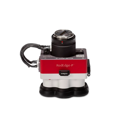
Most professional multispectral payloads — including the MicaSense RedEdge-P, MicaSense Altum-PT, and Sentera 6X family — capture five narrow spectral bands simultaneously. Each band corresponds to a specific region of the electromagnetic spectrum where particular plant and soil characteristics produce distinctive reflectance responses. Understanding what each band measures is essential for interpreting vegetation index maps and selecting the right sensor for a specific analytical workflow.
Vegetation Indices: What NDVI, NDRE, and GNDVI Actually Calculate
Vegetation indices are mathematical transformations of multispectral band data into single-value outputs that quantify specific plant or soil conditions. They are not images — they are calculated maps where each pixel represents a computed value derived from the ratio or difference between two or more spectral bands. The three most operationally relevant indices for drone-based precision agriculture are NDVI, NDRE, and GNDVI.
NDVI (Normalized Difference Vegetation Index) is calculated as (NIR − Red) / (NIR + Red) and outputs values from −1 to +1. High positive values (typically 0.6–0.9) indicate dense, actively photosynthesizing vegetation. Values below 0.2 indicate bare soil, water, or dead plant material. NDVI is the most widely used index for general crop health mapping, early stress detection, and yield estimation. Its limitation is saturation at high biomass levels — in dense canopies, the ratio stops changing meaningfully even as crop condition deteriorates, which is why NDRE was developed.
NDRE (Normalized Difference Red Edge) is calculated as (NIR − Red Edge) / (NIR + Red Edge). Because the Red Edge band sits at the inflection point of the plant reflectance curve — where small changes in chlorophyll produce large changes in reflectance — NDRE is substantially more sensitive than NDVI to chlorophyll concentration changes, particularly at the moderate-to-high biomass levels that characterize most commercial crops at peak growing season. NDRE does not saturate as early as NDVI and is better suited to nitrogen status mapping, late-season stress identification, and monitoring programs that need to detect within-field variability that NDVI cannot resolve.
GNDVI (Green Normalized Difference Vegetation Index) is calculated as (NIR − Green) / (NIR + Green). The Green band is more sensitive to chlorophyll concentration at high-biomass conditions than the Red band, making GNDVI complementary to NDVI for tracking photosynthetic activity in dense canopies. It is frequently used alongside NDVI in programs monitoring large-scale vegetation change over time.
Radiometric Calibration: Why It Is Not Optional
Raw multispectral imagery is not usable for quantitative vegetation index calculation without radiometric calibration. The reflectance values recorded by a multispectral sensor at any given moment are influenced by ambient illumination — sun angle, atmospheric conditions, cloud cover, and even the time of day — not just the surface being imaged. Two flights over the same field on different days, or even at different times on the same day, will produce different raw values for the same vegetation even if nothing has changed at the field level. Comparing uncalibrated data across flights produces meaningless results.
Radiometric calibration converts raw sensor output into surface reflectance: the proportion of incoming light that the surface actually reflects, independent of illumination conditions. This makes data from different flights, different dates, and different sensors directly comparable, which is the foundation of any change detection or temporal monitoring program. Two calibration methods work together in most professional workflows.
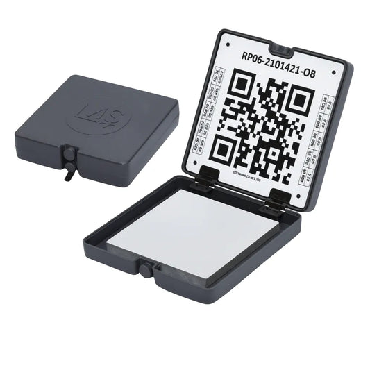
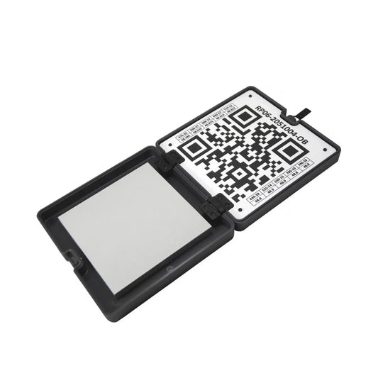
The Calibrated Reflectance Panel is a white-reference target with a precisely known, factory-measured reflectance value for each spectral band. Photographs of the panel are taken before and after each flight; these images anchor the calibration, allowing processing software to compute the relationship between the panel's known reflectance and what the sensor recorded under that flight's specific illumination conditions, then apply that correction to every image in the dataset. The MicaSense Calibrated Reflectance Panel 2 is stocked at DSLRPros and is compatible with all current MicaSense sensors.
The Downwelling Light Sensor (DLS 2) is a skyward-facing irradiance sensor mounted on the aircraft that measures ambient illumination continuously during flight. It corrects for illumination changes that occur mid-flight (a cloud passing overhead, a change in sun angle during a long mission) that the panel capture at takeoff and landing cannot account for. For missions longer than 10–15 minutes or conducted under variable cloud conditions, a DLS 2 is necessary to maintain data consistency across the full dataset.
Payload and Aircraft Options at DSLRPros
The multispectral collection at DSLRPros spans dedicated payload sensors for payload-capable enterprise aircraft, a fully integrated multispectral aircraft, a proprietary system for the ACSL SOTEN, and the calibration accessories required for all of them. The comparison table below maps each option by sensor configuration, aircraft compatibility, and primary use case.
| Option | Sensor Type Configuration | Bands Spectral Coverage | Additional Sensors Beyond Multispectral | Compatible Platform Aircraft | Primary Use Best For |
|---|---|---|---|---|---|
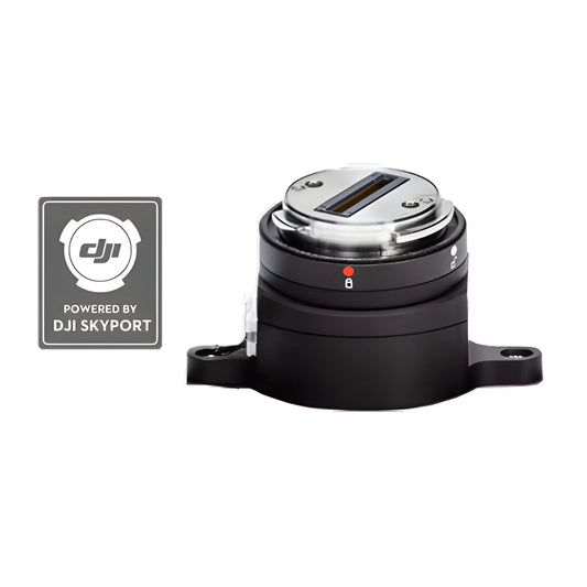
| MicaSense RedEdge-P | 5-band multispectral + panchromatic; 1.6 MP per MS band; 5.1 MP panchromatic; global shutter; up to 3 fps | Blue 475 nm, Green 560 nm, Red 668 nm, Red Edge 717 nm, NIR 842 nm | Panchromatic for pan-sharpening to 2 cm/pixel at 60 m; RGB color output | DJI M300 RTK, M350 RTK, M400 (Skyport V2); DJI enterprise aircraft via Quick Mount | Standard 5-band precision agriculture; NDVI, NDRE, GNDVI; plant counting |
| MicaSense RedEdge-P Blue Kit | Same as RedEdge-P with blue-shifted band configuration for 10-band dual-sensor system | Coastal Blue + extended blue-range bands (pairs with RedEdge-P Red for 10-band) | Same panchromatic as standard RedEdge-P | Same as RedEdge-P (Skyport V2 / Quick Mount) | Aquatic analysis, water body mapping, satellite cross-calibration programs requiring coastal blue band |
| RedEdge-P Dual Upgrade Kit | Second sensor + mounting hardware to expand existing RedEdge-P to 10-band dual-camera system | 10 bands total when paired with a RedEdge-P Red (5 standard + 5 Blue Kit bands) | Not applicable (hardware expansion kit, not a standalone sensor) | Same as RedEdge-P; for existing RedEdge-P owners only | Landsat 8 / Sentinel-2 cross-calibration; expanded spectral coverage for research programs |
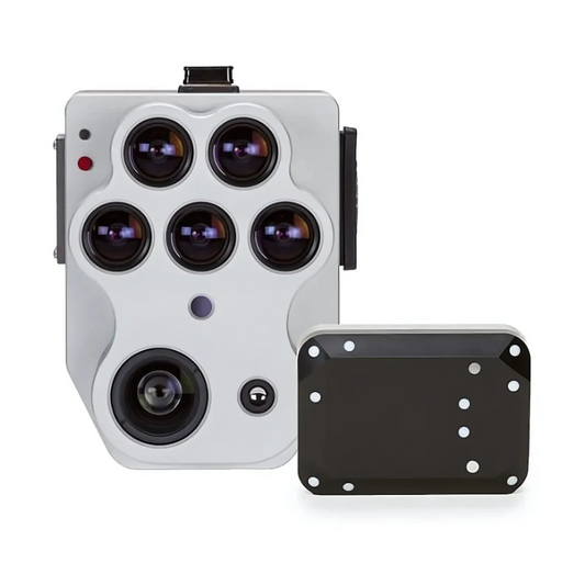
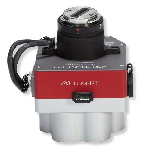
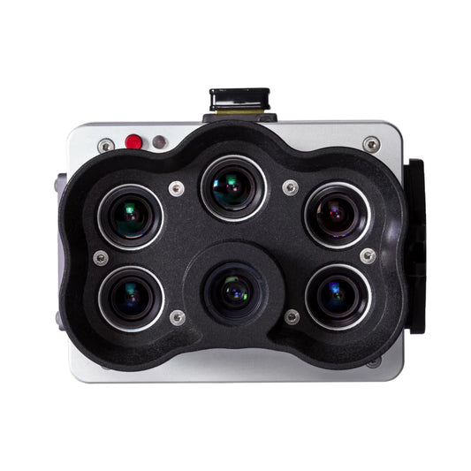
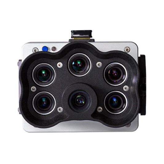
| MicaSense Altum-PT | 5-band multispectral + panchromatic + thermal; 3.2 MP per MS band; 12 MP panchromatic; 320×256 FLIR Boson thermal; global shutter; up to 2 fps | Same 5 standard bands as RedEdge-P plus radiometric thermal (7.5–13.5 µm LWIR) | 320×256 FLIR Boson radiometric thermal; 12 MP panchromatic RGB; pan-sharpened to 1.25 cm at 60 m | DJI M300 RTK, M350 RTK, M400 (Skyport V2 kit); Inspired Flight IF800/IF1200 (integration kit) | Combined thermal and multispectral in one pass; canopy temperature + NDVI; irrigation and water stress |
| IF MicaSense Altum-PT Bundle | Altum-PT sensor + IF800/IF1200 integration hardware as a ready-to-mount bundle | Same 5-band + thermal as Altum-PT standalone | Same as Altum-PT standalone | Inspired Flight IF800; Inspired Flight IF1200 (NDAA/Blue UAS) | NDAA-compliant combined thermal-multispectral workflow; ag programs restricted from DJI aircraft |
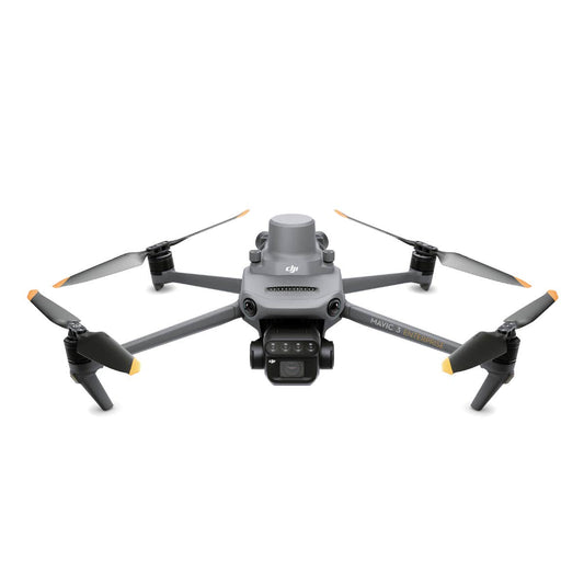
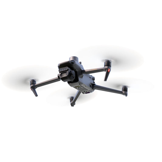
| DJI Mavic 3 Multispectral | Integrated aircraft, not a payload. 5-band multispectral + RGB + DLS; fixed, non-removable sensor array; M3M-specific | Green 560 nm, Red 650 nm, Red Edge 730 nm, Red Edge 740 nm, NIR 840 nm | 20 MP 4/3-inch RGB camera (separate); integrated DLS for in-flight illumination correction | Self-contained aircraft, not a payload for other platforms | Lower-cost entry point for 5-band drone multispectral; smaller-acreage ag operations; compact deployment |
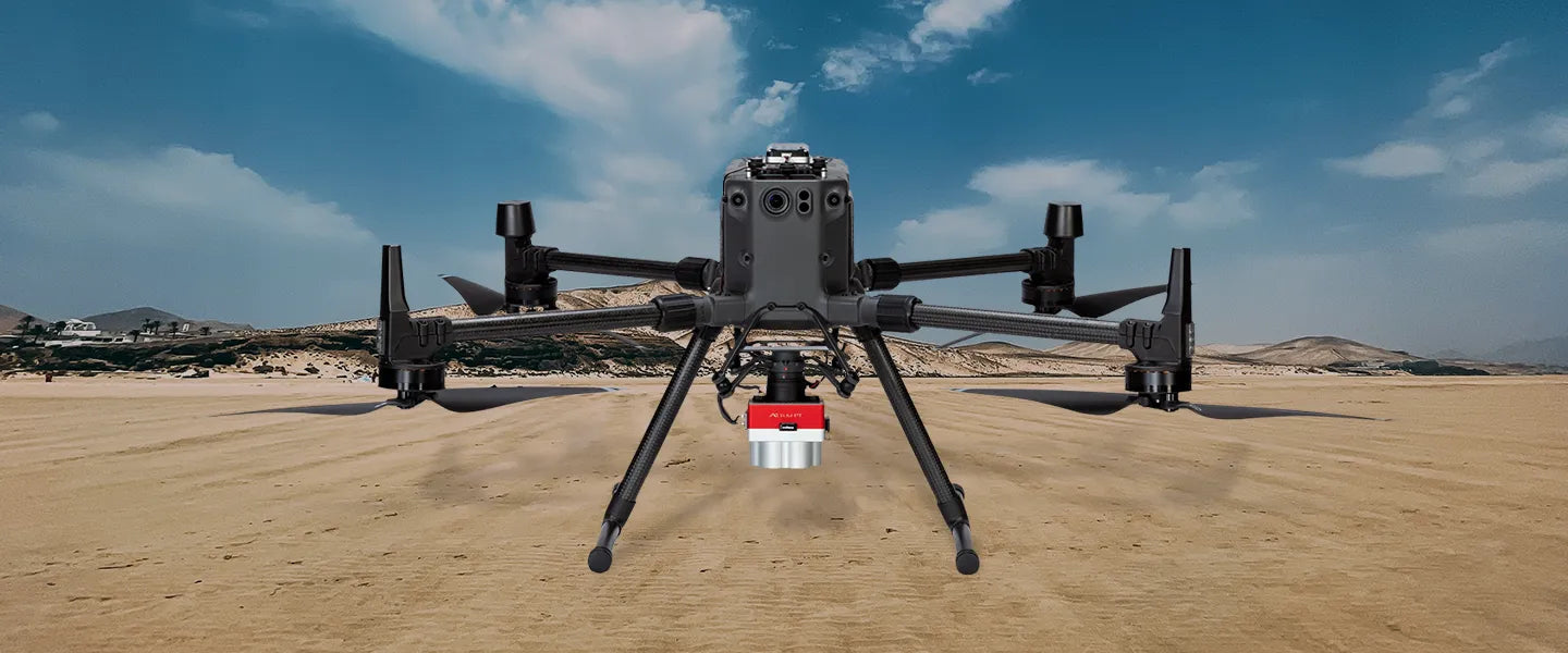
| ACSL SOTEN Multispectral (CX-GB300) | Multispectral imaging system in ACSL proprietary hot-swap format; 20 MP sensor; triple bandpass filter; solar sensor; TIFF 16-bit output | Triple bandpass filter (specific bands per ACSL specification); solar reference sensor | 20 MP CMOS; 16-bit TIFF RAW output; solar irradiance sensor for in-flight correction | ACSL SOTEN aircraft only; no other platform compatible | NDAA-compliant multispectral on SOTEN platform; government and defense-adjacent ag programs |
| MicaSense SkyPort Kit (RedEdge-P) | Integration hardware only: Skyport V2 mount, power, and data cable for RedEdge-P on M300/M350 | Not applicable (hardware integration kit, no sensor) | Not applicable | DJI M300 RTK; DJI M350 RTK | Operators who own RedEdge-P and need DJI Skyport V2 integration hardware separately |
| MicaSense SkyPort Kit (Altum-PT) | Integration hardware only: Skyport V2 mount, power, and data cable for Altum-PT on M300/M350 | Not applicable (hardware integration kit, no sensor) | Not applicable | DJI M300 RTK; DJI M350 RTK | Operators who own Altum-PT and need DJI Skyport V2 integration hardware separately |
| MicaSense CRP 2 | Calibrated white-reference reflectance panel for pre- and post-flight radiometric calibration | Covers all MicaSense sensor spectral bands | Not applicable (calibration accessory) | Compatible with all current MicaSense sensors | Required for quantitative NDVI/NDRE data; must be used before and after every multispectral flight |
Scroll horizontally to view all product details. DJI Mavic 3 Multispectral is an integrated aircraft, not a payload; it cannot mount to other platforms.
Choosing Between the RedEdge-P and Altum-PT
The two MicaSense payload families serve the same five-band spectral mission but differ in sensor resolution, capture speed, thermal capability, and total system weight. The core decision comes down to whether thermal data is required, and whether higher multispectral resolution or faster area coverage is the priority.
The RedEdge-P captures at up to 3 frames per second, weighs approximately 300 g as a single sensor with DLS 2, and produces 1.6 MP per multispectral band and 5.1 MP panchromatic. Its lower weight preserves more flight endurance on weight-sensitive platforms, and its faster capture rate allows higher flight speeds for the same ground sample distance — covering more area per battery. The full dual-sensor RedEdge-P kit (two sensors for 10-band coverage, DLS 2, mounting, and cabling) weighs approximately 745 g. The RedEdge-P is the correct choice for programs where thermal data is not a requirement and maximum area efficiency per flight is the priority.
The Altum-PT captures at up to 2 frames per second, weighs 577 g as a single unit including DLS 2, and produces 3.2 MP per multispectral band and 12 MP panchromatic — twice the multispectral resolution of the RedEdge-P per band. It adds a 320 x 256 FLIR Boson radiometric thermal sensor, enabling simultaneous thermal and multispectral capture in a single flight at 33.5 cm/pixel thermal GSD from 120 m. The Altum-PT is the correct choice for programs combining crop canopy temperature measurement with vegetation index mapping — irrigation stress programs, evapotranspiration modeling, and ag research trials that need both spectral and thermal data from the same flight, correctly aligned.
The DJI Mavic 3 Multispectral as an Entry Point
The DJI Mavic 3 Multispectral is not a payload. It is a complete integrated aircraft with a non-removable five-band multispectral array alongside a 20 MP 4/3-inch RGB camera and an integrated DLS. It is the lowest-cost way to enter drone multispectral imaging and requires no payload integration, no Skyport V2 hardware, and no separate mounting configuration; the aircraft arrives ready to fly multispectral missions from the first charge.
Its five spectral bands are Green 560 nm, Red 650 nm, Red Edge 730 nm, Red Edge 740 nm, and NIR 840 nm, a slightly different band configuration from the MicaSense standard that uses two Red Edge bands rather than separate Red and Red Edge. This configuration was designed for DJI's own Terra processing workflow and for programs where dual Red Edge sensitivity is the priority. Processing is supported in PIX4Dfields, Agisoft Metashape, and other compatible platforms. The M3M is suitable for smaller-acreage operations, programs with limited payload integration resources, and operators who need to demonstrate multispectral ROI before committing to a higher-tier sensor system. It is not upgradeable to a different sensor; the camera system is fixed to the aircraft.
Processing Multispectral Data: Software Workflows
Multispectral data requires specialized processing software that handles radiometric calibration, band alignment, orthorectification, and vegetation index calculation. The most widely used platforms for drone multispectral workflows are PIX4Dfields (fast field-optimized processing for NDVI, NDRE, and zone management outputs), PIX4Dmapper (full photogrammetric processing for survey-grade geospatial outputs from the same imagery), and Agisoft Metashape (general-purpose photogrammetry with multispectral support). MicaSense sensors also output data compatible with QGIS, ArcGIS, and research platforms using the open 12-bit TIFF format. All data is hardware-agnostic — it is not locked to any proprietary processing pipeline.
PIX4Dfields and PIX4Dmapper are available at DSLRPros in the PIX4D software collection. For programs that need both fast field-level crop health outputs (PIX4Dfields) and survey-grade geospatial products from the same imagery (PIX4Dmapper), both products can be purchased and used on the same dataset.
Applications Beyond Agriculture
Multispectral imaging is most commonly associated with precision agriculture, but the underlying physics of measuring how specific wavelengths of light interact with surfaces makes it applicable to any program where spectral reflectance is analytically meaningful.
- Environmental monitoring: vegetation community mapping, invasive species detection, habitat condition assessment, and wetland vegetation discrimination all use multispectral reflectance to classify plant types that appear visually similar but reflect differently in NIR and Red Edge
- Forestry inventory: canopy health mapping across forest stands, early disease and pest detection in tree canopy, species discrimination between conifers and deciduous trees by differential NIR reflectance
- Research and agronomy trials: field trials comparing variety performance, fungicide efficacy, or nutrient application treatments require the radiometric consistency and temporal comparability that calibrated multispectral sensors provide and standard cameras cannot
- Restoration monitoring: tracking vegetation establishment on restored sites, comparing treated and untreated areas, and documenting canopy recovery over multi-year timescales against baseline spectral measurements
- Satellite validation: drone multispectral data aligns with Sentinel-2 and Landsat 8 band sets, enabling aircraft-to-satellite cross-calibration for programs that use both data sources for large-area monitoring
- Golf course and turf management: NDVI and NDRE mapping identifies drought stress, disease, and compaction zones across turf areas without requiring soil sampling or destructive testing
Frequently Asked Questions
What is the difference between NDVI and multispectral imaging?
NDVI is a specific vegetation index — a calculated value derived from multispectral data. Multispectral imaging is the broader capability that enables NDVI and many other indices. A multispectral camera captures reflected light across several specific wavelength bands simultaneously; NDVI is computed from just two of those bands (NIR and Red). The same multispectral dataset used to calculate NDVI can also calculate NDRE, GNDVI, SAVI, EVI, and dozens of other indices depending on the analytical need. Calling a multispectral sensor an "NDVI camera" is accurate in the sense that it can produce NDVI, but it significantly understates what the sensor can do.
How many spectral bands do I actually need?
For most professional agricultural and environmental applications, five bands (Blue, Green, Red, Red Edge, and NIR) provide the spectral range necessary for NDVI, NDRE, GNDVI, and most other operationally used vegetation indices. The Red Edge band is the most diagnostically sensitive to early plant stress and nitrogen status and is absent from most consumer-grade RGB cameras, which is why professional multispectral sensors are necessary for analytical workflows that need early-warning stress detection. Programs requiring satellite cross-calibration or aquatic band analysis may benefit from the 10-band dual-sensor configuration that adds coastal blue and green-shifted bands to the standard five.
Do I need a calibration panel?
Yes, without exception. A calibrated reflectance panel converts raw sensor output into true surface reflectance by providing a known reference value at each spectral band under the specific illumination conditions of that flight. Without panel calibration, the data cannot be compared meaningfully across flights, dates, or sensors, which eliminates most of the analytical value of multispectral imaging. The MicaSense Calibrated Reflectance Panel 2 is designed for use with all current MicaSense sensors and should be imaged before takeoff and after landing on every mission. A Downwelling Light Sensor (DLS 2) supplements the panel by correcting for illumination changes that occur during the flight itself.
What is the difference between the MicaSense RedEdge-P and the Altum-PT?
Both capture the same five standard multispectral bands plus a panchromatic channel, and both are NDAA-compliant sensors designed and manufactured in the United States. The RedEdge-P captures at up to 3 fps with 1.6 MP per multispectral band and 5.1 MP panchromatic, weighs 300 g as a single sensor, and does not include a thermal sensor. The Altum-PT captures at up to 2 fps with 3.2 MP per multispectral band and 12 MP panchromatic, weighs 577 g, and adds a 320 x 256 FLIR Boson radiometric thermal sensor for simultaneous thermal and spectral collection. Choose the RedEdge-P for programs where thermal is not needed and area coverage efficiency is the priority; choose the Altum-PT for programs where canopy temperature measurement must be co-located with multispectral data in the same flight.
Is the DJI Mavic 3 Multispectral compatible with MicaSense processing software?
The DJI Mavic 3 Multispectral outputs data in a format compatible with major processing platforms including PIX4Dfields, PIX4Dmapper, and Agisoft Metashape, the same platforms used for MicaSense data. However, the M3M uses a slightly different five-band configuration (dual Red Edge rather than separate Red and Red Edge) and its integrated DLS handles illumination correction differently from the MicaSense DLS 2. It does not output data directly into MicaSense's Atlas platform. For programs that need to compare M3M and MicaSense datasets across time, confirm that the processing workflow correctly handles the different band configurations and calibration approaches of each sensor.
Can I use a multispectral payload on the DJI Matrice 4 Series?
No. The DJI Matrice 4E, 4T, 4D, and 4TD all have fixed, integrated camera systems and no external payload port. They cannot accept MicaSense, Sentera, or any other multispectral payload. The platforms in the DSLRPros lineup that accept multispectral payloads via Skyport V2 are the DJI Matrice 300 RTK and Matrice 350 RTK; the Matrice 400 accepts payloads via E-Port V2 (confirm Skyport-to-E-Port V2 adapter compatibility with DSLRPros for MicaSense sensors). The Inspired Flight IF800 and IF1200 accept the Altum-PT and Sentera 6X Thermal Pro via their dedicated integration kits. The ACSL SOTEN accepts only ACSL-branded multispectral payloads via its proprietary interface.
How is multispectral data processed after a flight?
The standard workflow is: capture calibration panel images before and after the flight, fly the mission with GPS logging active, offload imagery from CFexpress or SD storage, import into processing software (PIX4Dfields for fast field-level outputs, PIX4Dmapper for survey-grade outputs, Agisoft Metashape for research workflows), process with radiometric calibration using the panel images and DLS 2 irradiance log, generate orthorectified reflectance maps for each band, calculate vegetation indices from the reflectance maps, and export outputs for analysis or prescription map generation. Processing time varies significantly by dataset size and computer hardware — PIX4Dfields is optimized for fast field-level processing, PIX4Dmapper for accuracy-critical outputs at full resolution.
Shop Multispectral and NDVI Drone Payloads at DSLRPros
Multispectral drone payloads produce data that is only as reliable as the calibration workflow, the processing pipeline, and the fit between the sensor and the aircraft platform. DSLRPros provides pre-sale compatibility confirmation for every multispectral payload order, matching sensor, integration hardware, aircraft, and processing software before anything ships. Our team has configured multispectral programs across precision agriculture, environmental monitoring, research, and NDAA-compliant government deployments, and can advise on sensor selection, calibration workflow, and software pairing for your specific program.
DSLRPros is an authorized dealer for MicaSense, DJI, and ACSL, carrying the full multispectral payload lineup alongside calibration accessories and compatible processing software. Contact us to discuss your program requirements, confirm platform compatibility, or request a quote on a complete multispectral system.
