


DJI Mavic 3 Multispectral
DJI Mavic 3 Multispectral
SKU:S-DJI-M3M

- Description
- Specifications
- In the Box
- FAQ
DJI Mavic 3 Multispectral: Dual RGB and Multispectral Imaging for High-Precision Aerial Surveying
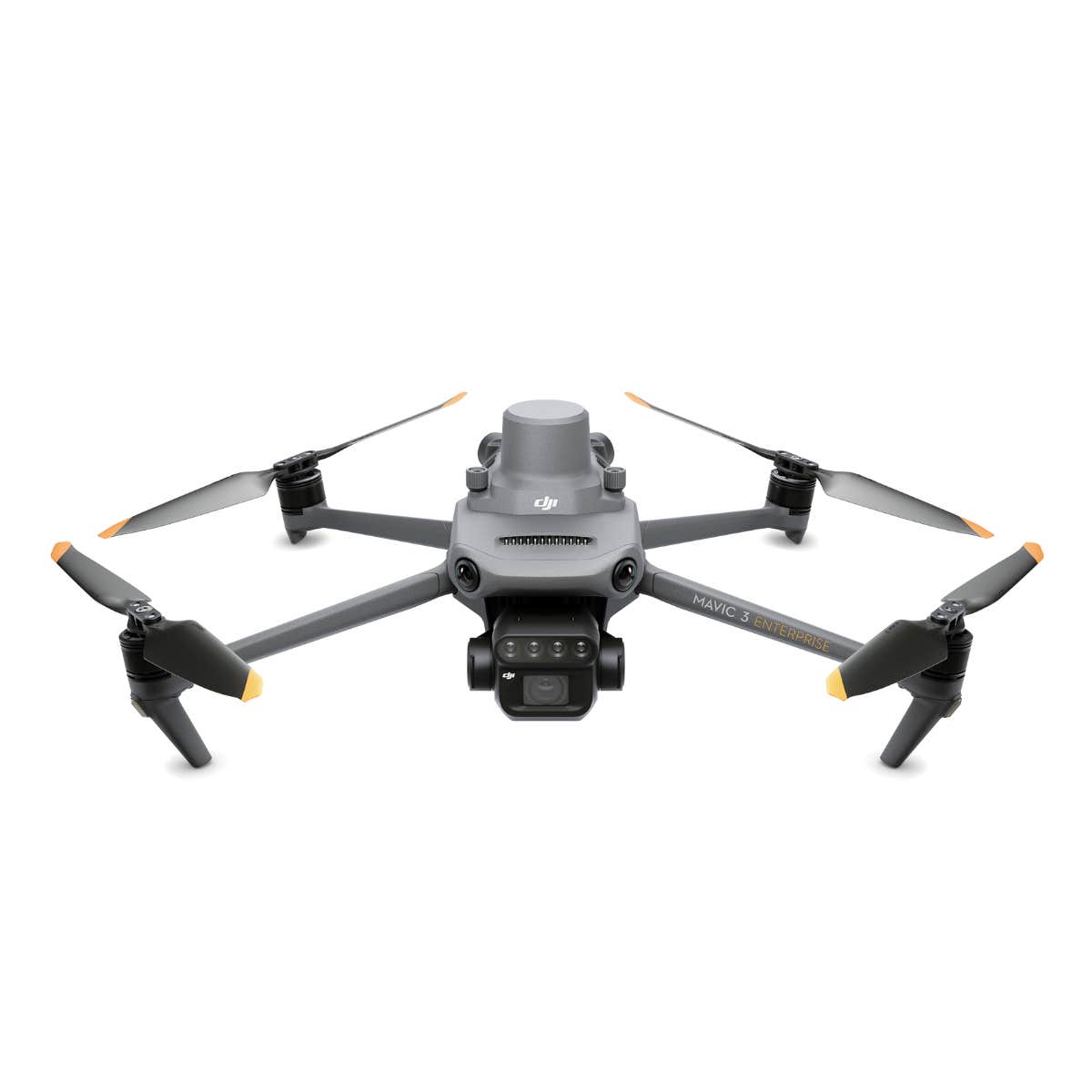
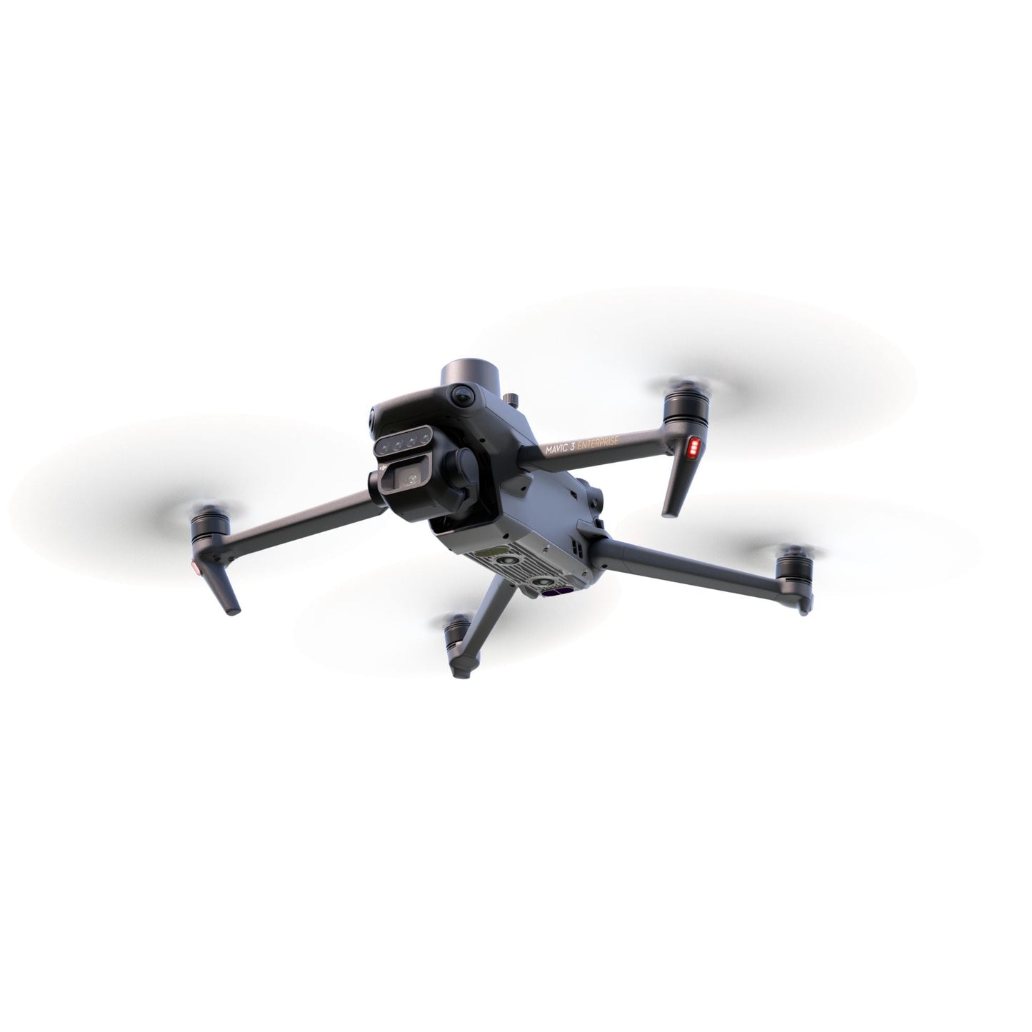
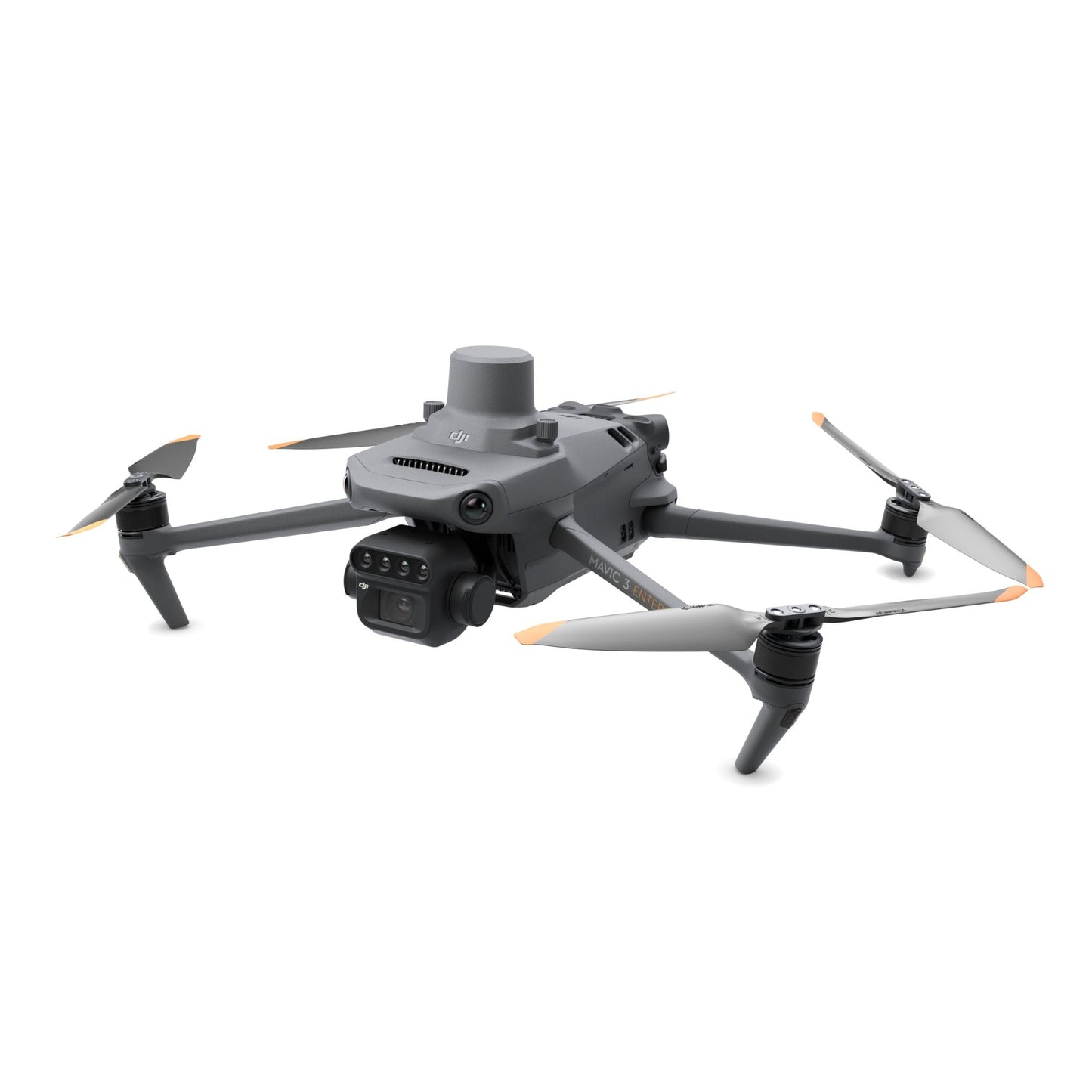
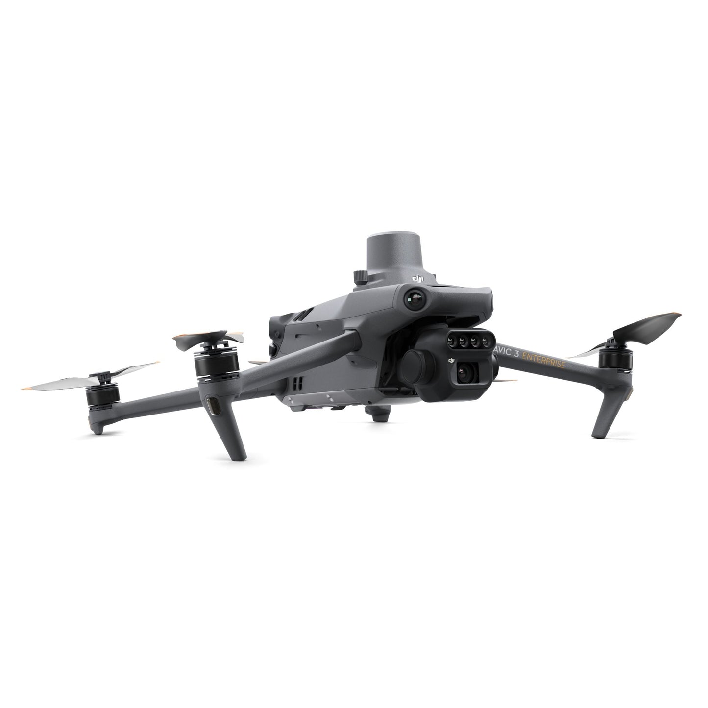
The DJI Mavic 3 Multispectral is a compact, enterprise-grade UAV built for professionals who need more than a standard RGB camera can deliver.
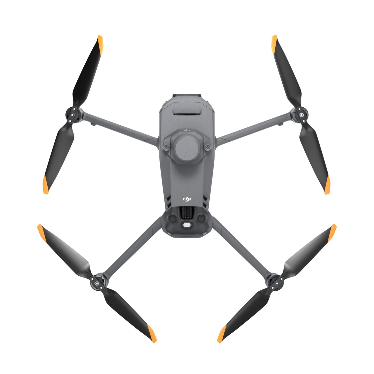
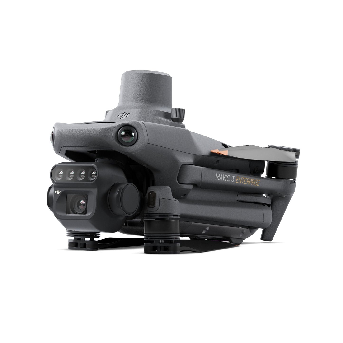
Weighing just 951 grams with its RTK module installed, it combines a 20MP 4/3 CMOS RGB camera with four 5MP multispectral cameras—capturing green, red, red edge, and near-infrared wavelengths simultaneously—in a foldable airframe that deploys from a carrying case and fits in an ordinary field bag.
For agronomists, surveyors, and natural resource managers who need accurate, repeatable aerial data, the Mavic 3M delivers the imaging capability and positioning precision to make every flight count.
Key Features and Benefits
- 20MP RGB camera: 4/3 CMOS sensor with mechanical shutter prevents motion blur at speed.
- Four 5MP multispectral cameras: capture G, R, RE, and NIR wavelengths in a single pass.
- RTK module: centimeter-level positioning with microsecond camera-to-controller synchronization.
- Sunlight sensor: records solar irradiance per image for accurate NDVI and data consistency.
- 43-minute flight time: extended endurance supports up to 200 hectares per flight mission.
- 15 km transmission: O3 Enterprise system delivers 1080p/30fps live view at range.
- Omnidirectional obstacle avoidance: APAS 5.0 protects the aircraft in all directions.
- Terrain follow: real-time vision-based or DSM-based altitude adjustment over sloped terrain.
- Compact and portable: 951 g foldable airframe fits in a standard field bag for easy transport.
- GNSS redundancy: GPS, Galileo, BeiDou, and GLONASS for reliable autonomous positioning.

The RTK module is pre-mounted on the aircraft and synchronizes with the flight controller and camera at the microsecond level, enabling centimeter-level positioning accuracy without ground control points.
A built-in sunlight sensor captures solar irradiance and embeds it directly in each image file, compensating for variable light conditions during 2D reconstruction and improving NDVI consistency across flights. With up to 43 minutes of flight time and coverage of up to 200 hectares per flight, the Mavic 3M reduces the number of flights, batteries, and field hours required to complete a survey without sacrificing data quality.
Precision Agriculture Data That Drives Field Decisions
The Mavic 3M is built around a fundamental requirement of precision agriculture: the data collected in the field must be accurate enough to act on. The 4/3 CMOS RGB camera's mechanical shutter eliminates rolling shutter distortion at mapping speeds, while the four multispectral cameras capture vegetation index data across four critical bands in a single pass—no second flight required.
The pre-mounted RTK module and microsecond-level synchronization between the flight controller, cameras, and positioning system ensure that every image is tagged with centimeter-accurate geospatial coordinates, eliminating the need for ground control points in most mapping scenarios.
Combined with the built-in sunlight sensor's per-image irradiance data, the Mavic 3M produces multispectral datasets that hold up under rigorous agronomic analysis.
Compatibility and System Integration
- DJI RC Pro Enterprise: 5.5 in, 1,000 nit sunlight-readable display with 3-hour battery life.
- D-RTK 2 High Precision GNSS Mobile Station: expands RTK accuracy for large-area operations.
- Network RTK: custom NTRIP server integration via Wi-Fi on the RC Pro Enterprise controller.
- DJI Terra: compatible software for 2D/3D mapping, reconstruction, and Smart Oblique workflows.
- DJI SmartFarm Platform: compatible with NDVI, GNDVI, and NDRE vegetation index generation.
- DJI Agras series: multispectral data feeds prescription maps for variable-rate spray missions.
- DJI Cloud API and MSDK5: open integration for third-party platforms and custom application development.
Applications and Use Cases
- Crop health monitoring: multispectral indices identify stress, disease, and growth variability.
- High-precision aerial surveying: centimeter RTK accuracy supports mapping without ground control points.
- Orchard mapping: terrain-follow capability supports sloped landscapes and tree identification workflows.
- Variable-rate application: prescription maps generated from NDVI data guide agricultural drone spraying.
- Natural resource surveys: NIR and red edge bands support forest distribution and vegetation coverage analysis.
- Water enrichment monitoring: multispectral imaging detects aquatic vegetation and surface water conditions.
- Urban green area surveys: captures vegetation index data for municipal environmental management programs.

The DJI Mavic 3 Multispectral gives field operators and data managers a platform that closes the gap between aerial collection and agronomic action. Its combination of dual imaging, centimeter-accurate positioning, and a 43-minute flight endurance produces datasets that support decisions at the field level—from prescription spraying to natural resource assessment—without requiring a larger, more expensive aircraft.
DSLRPros has supported professional UAV operators across agriculture, surveying, and environmental monitoring for decades, and the DJI Mavic 3 Multispectral represents the kind of purpose-built enterprise capability that belongs in that lineup.
When you order through DSLRPros, you get the complete system with the product knowledge and support infrastructure to put it to work on day one.
Contact DSLRPros today to configure your Mavic 3M package or discuss fleet procurement.
