


DSLRPros Inspired Flight IF1200 Mapping Package
DSLRPros Inspired Flight IF1200 Mapping Package
SKU:B-NB-IF1200-MAP


- Description
- Specifications
- In the Box
- FAQ
DSLRPros Inspired Flight IF1200 Mapping Package
The DSLRPros Inspired Flight IF1200 Mapping Package is a professional, NDAA-compliant aerial mapping solution designed for surveyors, engineers, and government teams who require accuracy, endurance, and regulatory confidence.
Key Mapping Capabilities at a Glance
- Heavy-lift hexacopter platform optimized for mapping and survey payloads
- Up to 43 minutes of flight time for extended mapping sorties
- SAFE drone system for redundancy during critical survey missions
- NDAA and Blue UAS-compliant for government and enterprise deployment
- Sentera 65R 65MP global-shutter camera for survey-grade imagery
- GS-ONE Ground Control Station for mission planning and in-field control
- High wind resistance for consistent data capture in challenging conditions
- Designed and supported in the USA
Built around the powerful Inspired Flight IF1200A hexacopter and paired with the Sentera 65R high-resolution mapping camera and GS-ONE Ground Control Station, this package is purpose-built for large-area photogrammetry, topographic mapping, and geospatial data capture.
From pre-flight planning to data acquisition, the IF1200 Mapping Package delivers stable flight performance, precise sensor integration, and efficient workflows for demanding mapping missions in complex environments.
Inspired Flight IF1200: A Stable Foundation for Mapping
At the core of this package is the Inspired Flight IF1200A, a mission-ready hexacopter engineered for industrial and government operations. Its rigid airframe, advanced flight control system, and high payload capacity make it exceptionally well suited for photogrammetry and geospatial data collection.
With up to 43 minutes of flight time using 16000mAh batteries, mapping teams can cover larger areas per sortie, reducing the number of takeoffs, landings, and battery swaps required per project. The IF1200A’s wind resistance of up to 23 knots ensures stable flight and consistent overlap, even in less-than-ideal weather conditions.
The SAFE drone system adds an extra layer of confidence for survey crews operating over remote or sensitive areas. In the event of a motor failure, the aircraft transitions into a safe manual mode and alerts the pilot, helping protect valuable payloads and collected data.
Mapping-Focused Flight Performance
- Dual GPS and FPV camera for precise positioning and situational awareness
- Multiple flight modes including Auto, Loiter, Position Hold, and RTL
- High payload capacity supports professional mapping sensors
- Stable hexacopter design minimizes vibration for cleaner imagery
GS-ONE Ground Control Station: Command and Control for Mapping Missions
The included GS-ONE Ground Control Station serves as the operational hub for IF1200 mapping missions. Designed for professional field use, GS-ONE enables pilots and survey teams to plan, execute, and monitor flights with confidence. Survey teams benefit from:
- Centralized control for flight operations and mission monitoring
- Clear visibility into aircraft status during long mapping flights
- Designed for professional and government UAS workflows
- Supports safe and efficient execution of automated survey missions
During mapping operations, GS-ONE provides real-time telemetry, aircraft health monitoring, and clear situational awareness, allowing crews to focus on data quality and mission efficiency. Its intuitive interface supports structured workflows for repeatable survey missions and consistent results.
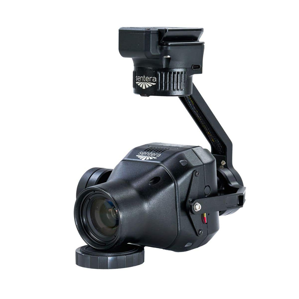
Inspired Flight Sentera 65R: High-Resolution Mapping at Scale
The Inspired Flight Sentera 65R camera features:
- 65MP global-shutter sensor for distortion-free imagery
- High pixel density reduces required flight lines
- Fast 3 fps capture rate shortens mission duration
- Integrated IMU and PPS synchronization for accurate geo-tagging
- Lightweight design preserves IF1200 flight endurance
transforms the IF1200 into a high-performance aerial mapping system. Featuring a 65-megapixel global-shutter sensor with a native resolution of 9344 × 7000 pixels, the 65R captures more ground per image while maintaining survey-grade accuracy.
Its global shutter eliminates motion blur and distortion, making it ideal for high-speed, large-area mapping missions. With a ground sampling distance as fine as 0.45 cm per pixel at 38 meters, the 65R delivers dense datasets suitable for orthomosaics, DSMs, and analytical mapping outputs.
When integrated with the IF1200 platform, the Sentera 65R enables survey teams to fly fewer missions, collect cleaner datasets, and accelerate project delivery timelines without compromising accuracy.
IF1200 + Sentera 65R Mapping and Survey Applications
- Large-area photogrammetry and orthomosaic generation
- Topographic mapping and surface modeling
- Construction and infrastructure progress monitoring
- Land development and site planning
- Environmental and resource monitoring
- Transportation, utility, and corridor mapping
- Government and defense geospatial operations
A Complete, Enterprise-Ready Mapping Solution
The DSLRPros Inspired Flight IF1200 Mapping Package brings together a proven heavy-lift aircraft, a high-resolution global-shutter mapping sensor, and a professional ground control system into one cohesive solution. Designed for accuracy, reliability, and compliance, it is ideal for organizations that demand dependable aerial data collection at scale.
Backed by DSLRPros’ expertise in enterprise drone systems, this package includes access to professional consultation, training, and ongoing support. You are ensured your IF1200 mapping platform is optimized and mission-ready from day one.
For teams seeking a secure, high-endurance, and survey-grade drone mapping solution, the Inspired Flight IF1200 Mapping Package delivers performance you can trust in the field.
