


Drone Trends

DJI Zenmuse L3 Sets a New Standard for Survey-Grade LiDAR Mapping
Introducing the New Standard in Aerial LiDAR DJI has officially launched the Zenmuse L3, a long-range LiDAR and RGB payload that raises the bar for aerial mapping and surveying professionals. Engineered for precision and speed, the Zenmuse L3 combines 1535 nm laser technology, dual 100-megapixel RGB cameras, and an enhanced high-frequency IMU to produce centimeter-level accuracy across complex environments. What...

Aerial Precision: How Drones Are Transforming Surveying and Inspection Workflows
For decades, engineers relied on tripods, scaffolds, and manned aircraft to gather field data. The process was slow, costly, and risky, especially near power lines or unstable terrain. Aerial mapping drones have changed that. Modern UAV platforms equipped with RTK/PPK positioning, LiDAR, and thermal payloads now deliver centimeter-level accuracy and real-time insights. What once took survey crews days can now...
Drone Mapping Software Comparison Guide
Choosing the right drone software is one of the biggest decisions professionals face today. The right platform can mean the difference between centimeter-level accuracy and costly rework, or between audit-ready logs and hours of manual cleanup. With so many tools competing for attention—cloud platforms, desktop photogrammetry engines, open-source projects—professionals need clarity. This 2025 guide delivers that clarity. We break down...
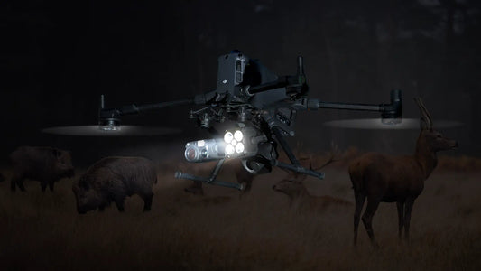
DSLRPros Drone Bundles for Deer and Hog Hunting: Mission-Ready Kits for Every...
Wild hogs aren’t just a nuisance. They can devastate entire fields in a single season. One study found feral pigs caused up to 9.2% damage in monitored cornfields, equal to 3,416 kg of lost grain per hectare. Meanwhile, deer hunters know the frustration of long, exhausting searches for downed game. Across the U.S., hunters and land managers face the same...
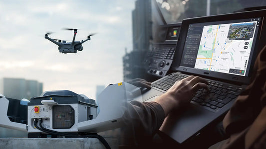
Drone Infrastructure Inspection for Bridges, Roads and Buildings
Critical infrastructure keeps society running: bridges, highways, high-rise buildings, power lines, and pipelines. All of these structures need routine inspection to ensure safety and prevent catastrophic failures. Traditional methods rely on scaffolding, cranes, or manual climbing—techniques that are slow, dangerous, and expensive. Enter drones. Drone infrastructure inspection uses UAVs equipped with high-resolution cameras, LiDAR sensors, and thermal imaging to inspect...
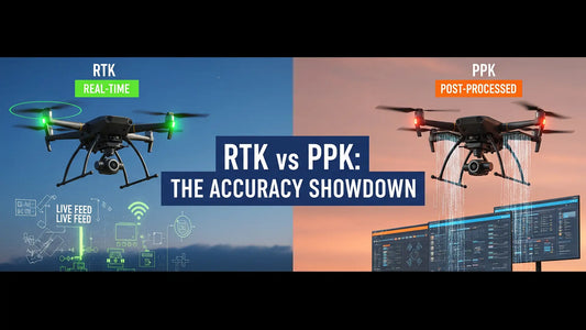
PPK vs RTK in Drone Mapping Explained
When drone operators talk about accuracy, they’re not debating meters—they’re debating centimeters. Standard GPS signals from satellites can drift off target by several feet, which is unacceptable for high-stakes missions like surveying, mapping, or public safety. That’s where advanced GNSS correction methods—PPK (Post-Processed Kinematic) and RTK (Real-Time Kinematic)—come in. For professionals comparing PPK vs RTK drones, the conversation often boils down...
