


GreenValley LiGrip O2 Lite (with GNSS Module & Antenna) + BP Module
GreenValley LiGrip O2 Lite (with GNSS Module & Antenna) + BP Module
SKU:S-GVI-LIGRIP-02


- Description
- Specifications
- In the Box
- FAQ
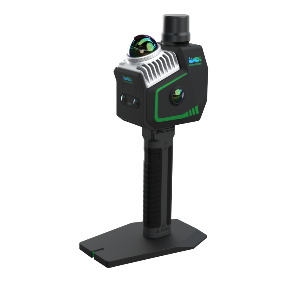
GreenValley LiGrip O2 Lite: High-Precision, Handheld 3D Mapping with Full GNSS Integration
The GreenValley LiGrip O2 Lite is a handheld SLAM LiDAR system designed for rapid, high-precision 3D data collection across complex environments. Built with integrated RTK positioning and multi-sensor fusion, it captures georeferenced point cloud data in real time, even in areas where GNSS signals are limited or inconsistent.
This configuration includes a GNSS module with antenna and a perpetual LiDAR360MLS BP software license, enabling complete field-to-office workflows.
Designed for surveyors, engineers, and mapping professionals, the system supports handheld, pole-mounted, and wearable configurations. It is used for topographic surveys, construction documentation, and asset mapping where speed and accuracy must coexist in real-world field conditions.
At a Glance
- Multi-Mode SLAM Compatibility: Supports RTK-SLAM, PPK-SLAM, and MLF-SLAM for varied terrain
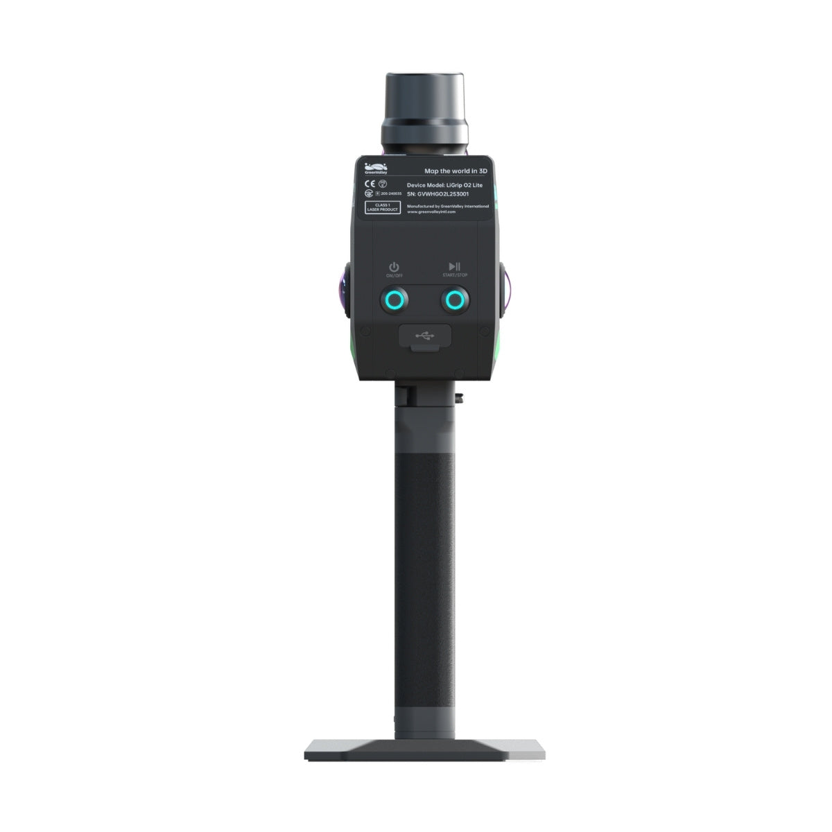
- All-in-One Design: Integrates LiDAR, camera, and power for seamless operation
- GNSS Module with Antenna: Enables accurate geolocation for mapping with absolute coordinates
- Real-Time Point Cloud Generation: Colorized LAZ output supports immediate data validation
- Lightweight Construction: Reduces operator fatigue for large-scale mapping
- Turnkey Software Ecosystem: LiDAR360 & LiDAR360MLS streamline processing and analysis
- Flexible Accessory Support: Customize setup with telescopic pole and frontpack options
- Robust in Low-Feature Environments: Reliable in tunnels, mines, and open water areas
With support for RTK-SLAM, PPK-SLAM, and advanced MLF-SLAM, it excels in mapping environments where GPS is unreliable or unavailable.
When used with LiDAR360 and LiDAR360MLS software, this package forms a powerful end-to-end solution for geospatial professionals working in complex indoor and outdoor spaces.
Highly Integrated and Adaptable for Field Efficiency
The LiGrip O2 Lite simplifies data collection with its all-in-one design and optional RTK module, telescopic pole, and LiGrip frontpack.
Whether walking through urban corridors or surveying tight interiors, the unit remains balanced and ergonomic for prolonged use.
MLF-SLAM enhances its performance in featureless environments such as riverbanks and tunnels, ensuring you capture precise, colorized point cloud data-no matter the terrain.
Scalable Solutions for Technical Demands
Equipped with flexible accessories and scalable software integration, the LiGrip O2 Lite is ideal for organizations that require dependable field-to-office workflows. Real-time LAZ point cloud generation with true color visualization allows for immediate validation.
Teams can rapidly deploy the LiGrip O2 Lite across surveying, AEC, mining, and asset inspection projects.
Applications and Use Cases
- Floor Plan Mapping: Capture detailed indoor layouts quickly and accurately
- Mine and Tunnel Surveying: Navigate confined spaces with centimeter-level accuracy
- Stockpile Volume Measurement: Efficiently monitor material movement and bulk inventories
- Facade and Structural Capture: Generate high-fidelity models of building exteriors
- River and Coastal Mapping: Overcome GNSS dropout using SLAM-enhanced positioning
- Infrastructure Inspections: Scan bridges, rail corridors, and roadways with minimal setup
As an authorized distributor and training provider, DSLRPros delivers customized deployment strategies and in-field support for your surveying operations.
Our team helps maximize the value of the LiGrip O2 Lite with hands-on consulting, ongoing service, and integration with your drone or mobile mapping systems.
Order or contact us today to elevate your geospatial capabilities with the LiGrip O2 Lite.
