


DJI Mavic 3 Enterprise Series: Parts, Accessories, and Current-Generation Upgrade Options at DSLRPros
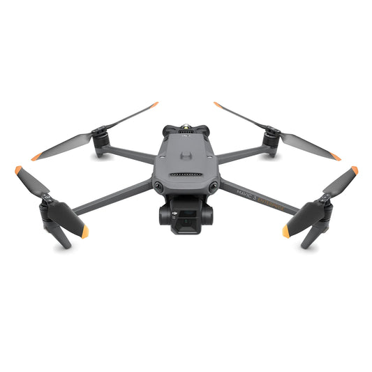
The DJI Mavic 3 Enterprise Series launched in late 2022 and established itself as the benchmark for compact enterprise drones—a 915–920 g folding platform that put mechanical shutter mapping and 640x512 radiometric thermal imaging into a backpack-sized airframe for the first time at this price point.
As of January 2025, DJI replaced the Mavic 3 Enterprise lineup with the Matrice 4 Series, which carries the same compact form factor with significant hardware upgrades: built-in RTK (no module required), a 1,800 m laser rangefinder, O4 Enterprise transmission at 25 km FCC versus O3 Enterprise at 15 km, Smart 3D Capture on the mapping variant, and a 640x512 thermal sensor with 1,280x1,024 super-resolution mode on the thermal variant. The Matrice 4 Series is the correct platform for any new deployment that would previously have used the M3E, M3T, or M3TA.
DSLRPros carries remaining stock of the DJI Mavic 3 Enterprise aircraft and a full selection of M3E-compatible accessories—RTK module, battery kit, propellers, speaker, RC Pro Enterprise controller, power adapter, and WB37 charging hub — for operators maintaining existing M3E fleets. D-RTK 3 positioning hardware, stocked in this collection, is also compatible with the current Matrice 4 Series for operators upgrading their base station infrastructure while retaining an M3E aircraft.
Mavic 3 Enterprise vs. Matrice 4E and 4T: Legacy vs. Current Generation
The table below maps the Mavic 3 Enterprise (M3E) against its direct Matrice 4 Series successors across every key decision variable. The M3T thermal variant maps to the M4T; the M3TA maps to the M4T as well, as DJI consolidated the two thermal tiers into a single higher-resolution model in the Matrice 4 generation.
| Specification | Legacy — Mapping Mavic 3 Enterprise (M3E) Discontinued | Current — Mapping Matrice 4E Current | Legacy — Thermal Mavic 3T / M3TA Discontinued | Current — Thermal Matrice 4T Current |
|---|---|---|---|---|
| Status | Discontinued — remaining stock only | Current generation | Discontinued — not stocked at DSLRPros | Current generation |
| Takeoff weight | 915 g (M3E) | 1,219 g | 920 g | 1,219 g |
| Max flight time | 45 min | 49 min | 45 min | 49 min |
| Max speed | 21 m/s (Sport); 15 m/s (Normal) | 21 m/s (Normal) | 21 m/s (Sport); 15 m/s (Normal) | 21 m/s (Normal) |
| Wide camera | 4/3-inch CMOS, 20 MP, mechanical shutter, f/2.8–f/11 | 4/3-inch CMOS, 20 MP, mechanical shutter, f/2.8–f/11 | 1/2-inch CMOS, 48 MP, electronic shutter only | 1/1.3-inch CMOS, 48 MP, f/1.7, electronic shutter |
| Medium tele camera | None | 1/1.3-inch CMOS, 48 MP, 70 mm EFL, f/2.8 | None | 1/1.3-inch CMOS, 48 MP, 70 mm EFL, f/2.8 |
| Telephoto camera | 12 MP, 162 mm EFL, 56x hybrid zoom | 48 MP, 168 mm EFL, 56x hybrid zoom | 12 MP, 162 mm EFL, 56x hybrid zoom | 48 MP, 168 mm EFL, 112x hybrid zoom |
| Thermal camera | None | None | 640×512, 12 µm (M3T) / 8 µm (M3TA), 30 Hz | 640×512, 12 µm, 30 Hz; 1,280×1,024 super-res mode |
| Laser rangefinder | None | 1,800 m (standard on all M4E) | None | 1,800 m (standard on all M4T) |
| Integrated RTK | Optional module, sold separately ($1,028) | Standard — built in, no module required | Optional module, sold separately | Standard — built in, no module required |
| RTK accuracy | 1 cm + 1 ppm H (with module) | 1 cm + 1 ppm H (standard) | 1 cm + 1 ppm H (with module) | 1 cm + 1 ppm H (standard) |
| Transmission | O3 Enterprise; 15 km FCC | O4 Enterprise; 25 km FCC | O3 Enterprise; 15 km FCC | O4 Enterprise; 25 km FCC |
| Smart 3D Capture | No | Yes | No | No |
| Obstacle sensing | Omnidirectional binocular vision (APAS 5.0) | Omnidirectional binocular vision + 3D infrared (downward) | Omnidirectional binocular vision (APAS 5.0) | Omnidirectional binocular vision + 3D infrared (downward) |
| IP rating | Not rated | Not rated | Not rated | Not rated |
| Controller | DJI RC Pro Enterprise (5.5-inch, 1,000 nits) | DJI RC Plus 2 Enterprise (7.02-inch, 1,400 nits) | DJI RC Pro Enterprise (5.5-inch, 1,000 nits) | DJI RC Plus 2 Enterprise (7.02-inch, 1,400 nits) |
| Battery | 5,000 mAh; not interchangeable with M4 Series | 99.5 Wh, 6,741 mAh; 200-cycle rated | 5,000 mAh; not interchangeable with M4 Series | 99.5 Wh, 6,741 mAh; 200-cycle rated |
| Price band | ~$4,599 (remaining M3E stock) | Check Matrice 4 Series page for current pricing | Not stocked — discontinued | Check Matrice 4 Series page for current pricing |
Scroll horizontally to view all columns. M3T and M3TA are not stocked at DSLRPros. M3E remaining stock available at $4,599 while supply lasts.
Products Available in This Collection
DSLRPros carries the following Mavic 3 Enterprise hardware for operators maintaining existing M3E fleets. The M3T and M3TA aircraft are not stocked.
- DJI Mavic 3 Enterprise (aircraft): the M3E mapping aircraft with 20 MP 4/3-inch mechanical shutter wide camera and 56x hybrid zoom tele camera; remaining stock at $4,599
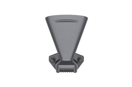
- DJI Mavic 3 Enterprise RTK Module: optional centimeter-level RTK add-on for the M3E; adds GLONASS to the GPS/Galileo/BeiDou constellation; note that the Matrice 4E includes RTK as standard without this module
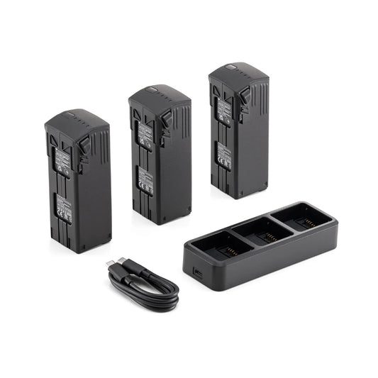
- DJI Mavic 3 Enterprise Battery Kit: replacement and spare batteries for M3E/M3T/M3TA fleet maintenance
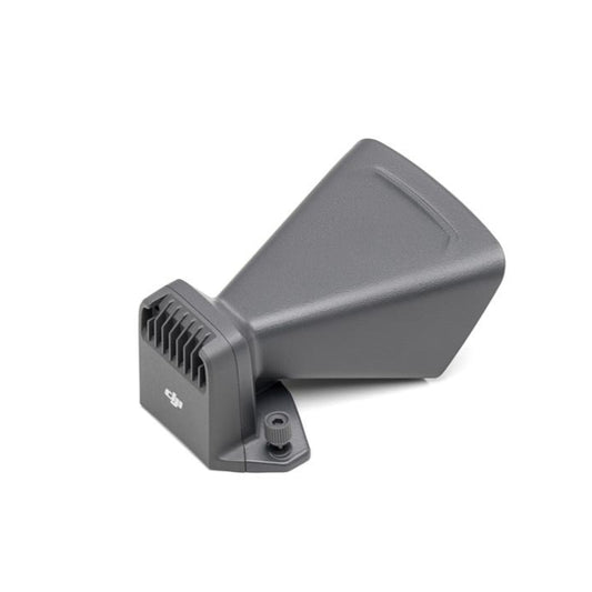
- DJI Mavic 3 Enterprise Speaker: 110 dB broadcast payload compatible with the M3E accessory port
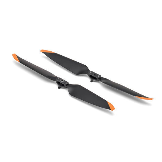
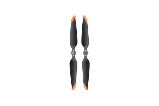
- DJI Mavic 3 Enterprise Propellers: replacement propellers for M3E/M3T/M3TA; on sale
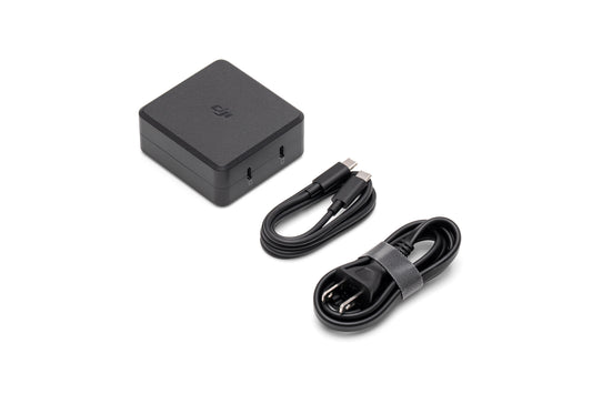
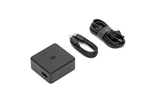
- DJI Mavic 3 Enterprise USB-C Power Adapter (100W): field charging adapter for M3E battery kit
- DJI RC Pro Enterprise for Mavic 3 Series / Matrice 3D Series: 5.5-inch 1,000-nit controller compatible with M3E, M3T, M3TA, and Matrice 3D Series; on sale
- DJI WB37 Battery Charging Hub (USB-C): multi-battery hub for RC Pro Enterprise and compatible devices
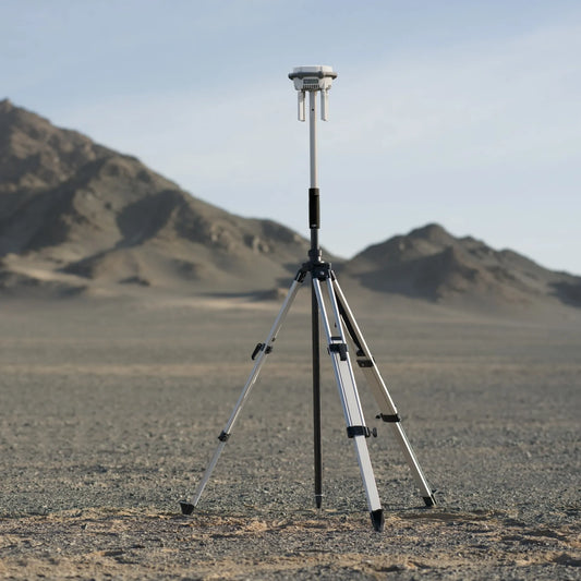
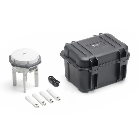
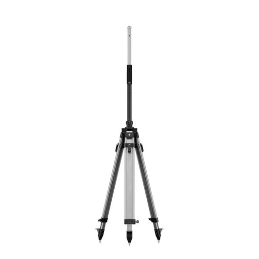
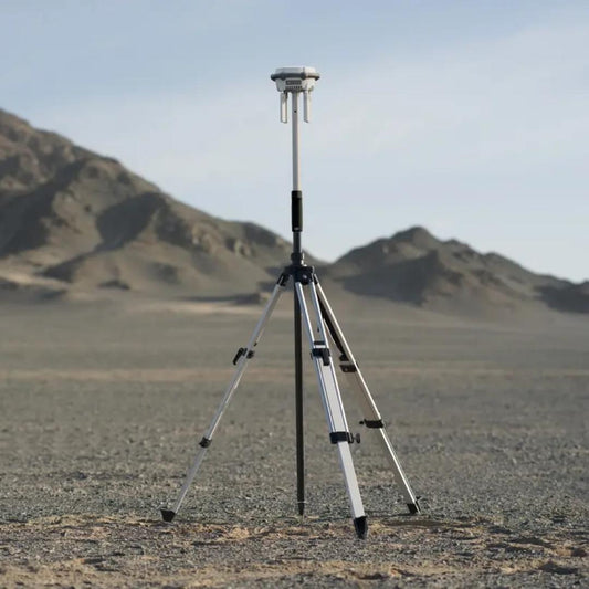
- DJI D-RTK 3 Multifunctional Station + Survey Pole and Tripod Kit: current-generation RTK base station — compatible with both the M3E (via RTK module) and the Matrice 4 Series; a future-proof purchase for operators upgrading their positioning infrastructure
- DJI D-RTK 3 Multifunctional Station (Base Only): RTK base station for operators who already have compatible field hardware; on sale
- DJI D-RTK 3 Survey Pole and Tripod Kit: field deployment hardware for the D-RTK 3 station; on sale
Should You Buy the Mavic 3 Enterprise or Upgrade to the Matrice 4 Series?
- For new programs: the Matrice 4 Series is the correct choice — built-in RTK, a laser rangefinder, longer transmission range, a faster controller, and higher thermal resolution on the 4T are all included as standard without add-on purchases; the M3E's RTK module costs an additional $1,028 on top of the aircraft price, which narrows the price gap significantly
- For existing M3E fleet operators: replacement parts, batteries, propellers, speaker, and the RC Pro Enterprise controller are all still available at DSLRPros; D-RTK 3 base station hardware is also stocked and compatible with both generations
- For operators currently using M3T or M3TA: the direct replacement is the Matrice 4T — it delivers the same compact thermal capability with 1,280x1,024 super-resolution mode, three cameras (versus two on the M3T/M3TA), NIR auxiliary light, and a 1,800 m laser rangefinder; the M3T and M3TA are not stocked at DSLRPros
- For budget-sensitive deployments: the remaining M3E stock at $4,599 represents a lower entry cost than the Matrice 4E, but factor in the RTK module ($1,028) if centimeter-level positioning is required — at that point the total cost approaches the Matrice 4E, which includes RTK as standard
- Batteries and accessories are not cross-compatible: M3E/M3T/M3TA batteries, chargers, and the RC Pro Enterprise controller do not work with the Matrice 4 Series; operators upgrading will need to budget for new controller and battery hardware
What the Mavic 3 Enterprise (M3E) Delivers for Existing Fleet Operators
- 20 MP 4/3-inch mechanical shutter wide camera: eliminates rolling shutter distortion during forward flight mapping; JPEG and RAW output at 0.7 s minimum interval
- 56x hybrid zoom tele camera: 12 MP, 162 mm equivalent focal length for close-up inspection and site documentation at standoff distance
- 45-minute flight time: covers up to 2 km² per flight in Area Route mode at standard mapping altitude
- O3 Enterprise transmission: 15 km FCC range, 1080p/30fps live view, 4-antenna system
- APAS 5.0 omnidirectional obstacle avoidance: forward, backward, lateral, and upward detection; automatic bypass routing in Normal mode
- Modular accessory port: compatible with the Mavic 3 Enterprise Speaker for public safety broadcast operations
- Optional RTK module: centimeter-level horizontal and vertical positioning when the module is attached; adds GLONASS to the GNSS constellation
- DJI Pilot 2 and DJI FlightHub 2: same software stack as the current Matrice 4 Series; mission libraries and flight logs remain compatible
Frequently Asked Questions
Is the DJI Mavic 3 Enterprise still available?
The M3E aircraft is available as remaining stock at DSLRPros at $4,599. The Mavic 3 Thermal (M3T) and Mavic 3 Thermal Advanced (M3TA) are discontinued and not stocked. DJI replaced the full Mavic 3 Enterprise Series with the Matrice 4 Series in January 2025. Once remaining M3E stock sells through, DSLRPros will not receive additional aircraft units. Accessories and replacement parts for existing M3E fleets remain stocked.
What replaced the Mavic 3 Enterprise Series?
The DJI Matrice 4 Series is the direct successor. The Matrice 4E replaces the M3E for mapping and photogrammetry operations — it adds a third medium tele camera, built-in RTK as standard, a 1,800 m laser rangefinder, and O4 Enterprise transmission at 25 km FCC. The Matrice 4T replaces the M3T and M3TA for thermal operations — it retains the 640x512 thermal sensor but adds a super-resolution mode outputting 1,280x1,024, a NIR auxiliary light effective to 100 m, a 112x hybrid zoom telephoto, and the same built-in RTK and laser rangefinder as the 4E. Both models use the larger DJI RC Plus 2 Enterprise controller with a 7.02-inch 1,400-nit display versus the RC Pro Enterprise's 5.5-inch 1,000-nit screen.
Are Mavic 3 Enterprise batteries and accessories compatible with the Matrice 4 Series?
No. The M3E/M3T/M3TA use a 5,000 mAh battery that is not interchangeable with the Matrice 4 Series 6,741 mAh battery. The RC Pro Enterprise controller is not compatible with the Matrice 4 Series — the 4 Series uses the RC Plus 2 Enterprise. Propellers are also not interchangeable. The DJI D-RTK 3 Multifunctional Station is compatible with both generations — it is a future-proof purchase for operators who may upgrade their aircraft while retaining their base station hardware.
Is the Mavic 3 Enterprise RTK module still worth buying?
Only if you plan to continue operating the M3E aircraft specifically. The RTK module at $1,028 is not compatible with the Matrice 4 Series — the 4E and 4T include RTK as a built-in standard feature. If you are evaluating the M3E plus RTK module versus the Matrice 4E, compare the total system cost carefully — the price difference narrows significantly once the module is factored in, and the 4E includes additional capabilities (laser rangefinder, medium tele camera, O4 Enterprise transmission) that the M3E with module does not provide.
Is the DJI RC Pro Enterprise controller still useful after upgrading to the Matrice 4 Series?
The RC Pro Enterprise is compatible with the Mavic 3 Enterprise, M3T, M3TA, and Matrice 3D Series (M3D, M3TD). It is not compatible with the Matrice 4 Series, which uses the RC Plus 2 Enterprise. If you operate a mixed fleet that includes both M3E/Matrice 3D and Matrice 4 Series aircraft, you will need both controllers. The RC Pro Enterprise is currently on sale at DSLRPros for operators maintaining M3E or Matrice 3D fleets.
Shop Mavic 3 Enterprise Parts and Accessories at DSLRPros
The DJI Mavic 3 Enterprise set the standard for compact enterprise mapping and inspection from 2022 through 2024. For operators who built programs around this platform, DSLRPros stocks the replacement parts, batteries, propellers, and accessories needed to keep existing fleets operational. For operators planning new deployments, the Matrice 4 Series is the current generation platform with the full set of upgrades that define where DJI enterprise has moved.
DSLRPros is an authorized DJI Enterprise Gold Partner carrying remaining M3E stock, all available M3E accessories, and the complete Matrice 4 Series lineup. Contact us to discuss upgrade paths, fleet transition planning, or to confirm current stock levels on M3E aircraft and accessories.
DJI Mavic 3 Enterprise Series: The Industry Standard for Portable Aerial Intelligence
Since its introduction, the DJI Mavic 3 Enterprise Series has fundamentally reshaped the commercial drone landscape. It successfully bridged the gap between high-end, heavy-lift platforms and portable consumer drones, establishing itself as the "gold standard" for organizations requiring professional-grade data in a rapid-deployment format. By housing survey-grade mechanical shutters and high-resolution radiometric thermal sensors within a foldable 920-gram airframe, the series continues to be the primary choice for teams in public safety, construction, surveying, and utility inspection worldwide.
This collection brings together the three specialized pillars of the series: the Mavic 3 Enterprise (M3E), the Mavic 3 Thermal (M3T), and the Mavic 3 Thermal Advanced (M3TA). While they share a unified flight architecture and accessory ecosystem, their specific imaging payloads are engineered to meet distinct industrial requirements.
A Proven High-Performance Flight Platform
The enduring success of the Mavic 3 Enterprise series stems from its robust physical and operational capabilities. It remains a benchmark for aircraft efficiency and reliability in the field.
Aerodynamics and Speed
The airframe is designed for maximum operational agility. With a diagonal distance of 380.1 mm, the aircraft provides a stable platform even in turbulent conditions. In Sport Mode, the drones reach a maximum flight speed of 21 m/s (forward), ensuring minimal travel time between the take-off point and the mission area. Even in Normal Mode, a consistent 15 m/s allows for high-speed data collection. The series is also known for its rapid vertical movement, with ascent speeds of up to 8 m/s, allowing pilots to reach operational ceilings almost instantly.
Mission Endurance and Power Management
Operational uptime is a critical metric for any commercial fleet. The Mavic 3 Enterprise series maintains a maximum flight time of 45 minutes (and a hovering time of 38 minutes) when equipped with the standard 5000 mAh Intelligent Flight Battery. This endurance allows a single pilot to map up to 2 square kilometers in a single flight. For operations requiring specific regulatory compliance, such as the EU C1 version, the 4230 mAh battery provides 36 minutes of flight time, ensuring teams can meet legal requirements without a total loss of productivity.
Navigation and Global Positioning
Precision is the hallmark of the Enterprise series. These drones utilize a multi-constellation GNSS system involving GPS, Galileo, and BeiDou. When the optional RTK module is integrated, GLONASS support is added, creating a redundant and highly stable positioning network. This allows the aircraft to maintain a hovering accuracy of ±0.1 m (vertical and horizontal) with the RTK system active, which is essential for repeatable, automated flight paths, and high-accuracy 3D modeling.
Established Safety Systems: Omnidirectional Sensing
To protect the asset and the surrounding infrastructure, the series features a mature Omnidirectional Binocular Vision System.
- 360-Degree Coverage: Lenses on the front, back, left, right, and top provide a comprehensive detection range.
- Forward Detection: Capable of sensing obstacles from 0.5m to 200m away.
- APAS 5.0: This established obstacle-avoidance software automatically calculates bypass routes in real-time, allowing pilots to operate with confidence in cluttered environments like construction sites or forest canopies.
The Mavic 3 Enterprise (M3E): Precision Surveying
The M3E remains the primary choice for surveyors and GIS professionals who need to replace traditional, slower ground-based methods with high-speed aerial data acquisition.
The Mechanical Shutter Advantage
The M3E’s reputation is built on its 20MP 4/3 CMOS Wide Camera. While most portable drones use electronic shutters that cause "rolling shutter distortion" during movement, the M3E features a Mechanical Shutter with a speed of up to 1/2000s. This allows the drone to capture sharp, survey-grade images while flying at full speed, drastically reducing the time required to map large areas without compromising the accuracy of the final orthomosaic.
Advanced Inspection via Zoom
In addition to its mapping sensor, the M3E carries a 12MP Tele Camera. With a 162mm equivalent focal length and 56x Hybrid Zoom, it allows inspectors to identify structural defects or site progress from a safe distance. This dual-sensor approach makes the M3E a versatile tool for both wide-area mapping and close-up asset inspection.
The Mavic 3 Thermal (M3T) and Thermal Advanced (M3TA)
For public safety and utility teams, the M3T and M3TA provide an essential triple-camera payload that integrates visual, zoom, and thermal data into a single, synchronized gimbal.
The Triple-Camera Payload
Both thermal models feature:
- A 48MP Wide Camera: 1/2-inch CMOS sensor, optimized for high-resolution visual situational awareness.
- A 12MP Tele Camera: Featuring 56x Hybrid Zoom for distance identification.
- A 640 x 512 Thermal Imager: An uncooled VOx microbolometer providing a 30Hz frame rate for fluid thermal video.
Distinguishing M3T vs. M3TA
The choice between these two models depends on the specific thermal detail required for the mission:
- Mavic 3 Thermal (M3T): Uses a 12 μm pixel pitch and a wide 61° Field of View. This model is the workhorse for search and rescue (SAR) and firefighting, where a broad view is necessary to locate heat signatures across large fields or burning structures.
- Mavic 3 Thermal Advanced (M3TA): Features a refined 8 μm pixel pitch and a narrower 41.2° Field of View. This higher pixel density provides significantly sharper thermal imagery, making the M3TA the preferred tool for utility inspections—such as detecting failing cells in solar farms or hotspots in high-voltage power lines—where the target is small and distant.
Technical Comparison Table
| Feature | Mavic 3 Enterprise (M3E) | Mavic 3 Thermal (M3T) | Mavic 3 Thermal Advanced (M3TA) |
|---|---|---|---|
| Aircraft Weight | 915 g | 920 g | 920 g |
| Wide Camera Sensor | 4/3 CMOS, 20 MP | 1/2-inch CMOS, 48 MP | 1/2-inch CMOS, 48 MP |
| Shutter Type | Mechanical & Electronic | Electronic | Electronic |
| Thermal Imager | N/A | 640 × 512 @ 30 Hz | 640 × 512 @ 30 Hz |
| Thermal Pixel Pitch | N/A | 12 μm | 8 μm |
| Thermal Lens FOV | N/A | 61° (40mm equiv.) | 41.2° (60mm equiv.) |
| Max Flight Time | 45 Minutes | 45 Minutes | 45 Minutes |
| Max Hybrid Zoom | 56x | 56x | 56x |
| Transmission Range | 15 km (FCC) | 15 km (FCC) | 15 km (FCC) |
Mature Control and Transmission Systems
The reliability of the Mavic 3 Enterprise Series is supported by the DJI O3 Enterprise Transmission system and the DJI RC Pro Enterprise controller.
Stable Long-Range Link
The O3 Enterprise system uses a 4-antenna configuration (2T4R) to deliver a stable 1080p/30fps live feed. In FCC regions, it supports a maximum transmission range of 15 km, while maintaining strong performance in high-interference urban environments (1.5–3 km). This ensures the pilot always has a clear view of the mission, even when flying in RF-heavy industrial zones.
The DJI RC Pro Enterprise
This high-performance remote controller is standard for the series. It features a 5.5-inch 1,000-nit high-brightness screen, which remains visible in direct sunlight—a critical requirement for outdoor field operations. With 64GB of internal storage and a Mini-HDMI port for external monitoring, it serves as a robust command center for every flight.
A Cross-Compatible Accessory Ecosystem
One of the greatest strengths of the series is the modularity of its accessories, which are interchangeable across the M3E, M3T, and M3M models.
- RTK Module: Enables centimeter-level positioning accuracy, recording precise metadata for every image to streamline post-processing in GIS software.
- Modular Loudspeaker: A 110 dB (at 1m) speaker that allows ground teams to communicate with people in the field or play pre-recorded safety loops.
- Efficiency in Charging: The 100W Charging Hub allows for the sequential charging of three batteries, meaning a set can be fully recharged in approximately 70 minutes when using the 100W USB-C adapter.
Established Use Cases
Construction, Mining, and Surveying
The M3E remains the primary tool for stockpile volume calculations and 3D terrain modeling. Its mechanical shutter ensures that data captured at speed remains accurate, allowing construction firms to track progress without disrupting work on the ground.
Public Safety and Firefighting
Fire departments and search and rescue teams rely on the M3T for its ability to see through smoke and darkness. The dual-view capability allows pilots to compare visual and thermal feeds side-by-side, which is crucial for identifying victims or hotspots during active emergencies.
Utility and Infrastructure Inspection
The M3TA is the specialist for solar farms and power grids. Its high-resolution 8 μm sensor can pinpoint a single overheating component from a distance, allowing utility companies to perform preventative maintenance and avoid catastrophic equipment failure.
The DJI Mavic 3 Enterprise Series has earned its place as the backbone of professional drone fleets. By integrating high-end sensors into a portable, foldable airframe, it provides the reliability and precision that commercial operations demand. Whether the mission is mapping a city, inspecting a power grid, or conducting a search and rescue operation, the M3E, M3T, and M3TA continue to deliver the actionable data necessary to get the job done efficiently and safely.
Expert Support and Procurement at DSLRPros
Choosing the right platform for your fleet is a significant investment in your operational efficiency. At DSLRPros, we provide more than just hardware; we offer the technical expertise and support necessary to integrate the Mavic 3 Enterprise Series into your existing workflow. Our team of specialists is ready to help you compare the nuanced differences between the M3T and M3TA or assist in configuring the perfect RTK mapping bundle for your surveying needs. Elevate your aerial capabilities with a partner that understands the demands of professional missions. Explore our full range of DJI Mavic 3 Enterprise solutions and accessories at DSLRPros today to find the ideal fit for your organization.
