
Autel Alpha (With L35T Gimbal Camera)
Vendor Part Number
S-AR-ALPHA-L35T
OR


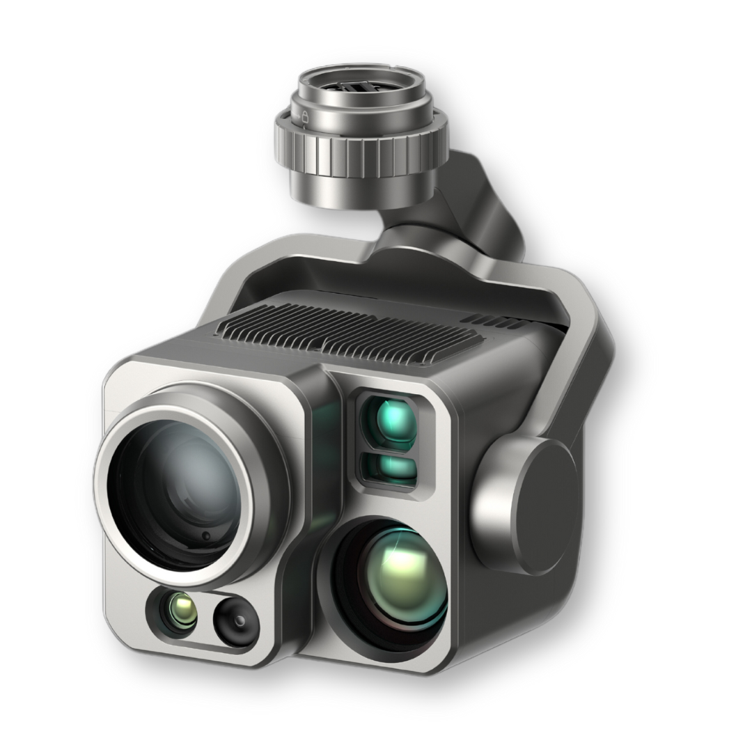
Autel Alpha with L35T Gimbal
The Autel Alpha is a highly anticipated enterprise UAV from Autel Robotics. Gaining notable attention at technology exhibitions and the June 2023 Energy Drone and Robotics Summit, this UAV is designed to meet the advanced needs of professional sectors.

With the recent FCC approval, the Autel Alpha is set to conquer the U.S. market, offering a blend of advanced features and robust performance.
Key Features
- Range and Endurance: Boasting a 20 km transmission range and a maximum flight time of 40 minutes (38 minutes hovering), the drone ensures strong connectivity and efficient power management. It's weather-resistant with an IP55 rating and weighs 6100g.
- Camera and Imaging Suite:
- Wide Camera: Features a 1/2" CMOS sensor with 48MP, a 24 mm equivalent lens, and an f/2.8 aperture. It supports ISO up to 6400 for photos and 64000 for videos, capturing in JPG, DNG, MP4, and MOV formats.
- Zoom Camera: Equipped with a 1/1.8" CMOS sensor, 1-35X optical zoom, and up to 560X digital zoom. The camera has a variable aperture lens and supports a wide ISO range for photos and videos.
- Thermal Cameras: Two thermal cameras (Wide and Tele) use Uncooled VOx Microbolometers, covering a temperature range from -20℃ to +550℃, ideal for industrial inspections and search and rescue operations.
- Obstacle Avoidance & Speed: The drone features 360-degree obstacle avoidance and operates on 2.4/5.2/5.8 GHz frequency bands. It has a maximum horizontal speed of 24m/s and resists wind up to 15m/s.
- Operating Temperature and Satellite Navigation: Functions in temperatures from -20℃ to +50℃ and uses GPS, GLONASS, BeiDou, and Galileo for precise location tracking.
- Safety Features: Includes anti-interference capabilities, AES-256 encryption, and multiple payload compatibilities, ensuring safe and reliable operations.
Additional Components
- Alpha Loudspeaker and Spotlight Combo:
- Spotlight: 60W power, adjustable brightness, and a 14° lighting angle, illuminating areas up to 1063m² at 150m distance.
- Loudspeaker: 10W output, broadcasting over ≥300m, ideal for search and rescue or crowd control.
Applications
- Agriculture: Useful for crop health monitoring, soil moisture detection, and livestock management.
- Construction: Provides accurate 2D and 3D models for planning and monitoring, with capabilities for structural inspections and site management.
- Security: Ideal for perimeter security and search and rescue missions, with long-range cameras and autonomous flight capabilities.
Note: You can purchase the Autel Alpha for your organization from DSLRPros starting February 2024.
Autel Alpha coming soon
| Autel Alpha Specification | |
|---|---|
| Aircraft | |
| Weight (Battery and gimbal included) | 6100g |
| Max. Payload | 3000g |
| Dimensions | 1185*942*262mm (unfolded, incl. propellers) |
| 788*551*255mm (unfolded, excl. propellers) | |
| 453*262*245mm (folded, excl. propellers) | |
| Diagonal Wheelbase | 810mm |
| Max Flight Time (windless) | 40mins |
| Max Hovering Time (windless) | 38mins |
| Max Horizontal Speed (windless near sea level) | 24m/s |
| Max Wind Resistance | 15m/s |
| Hovering Accuracy | Vertically: ±0.1 m (when vision systems working normally); ±0.3 m (when GNSS working normally); |
| Horizontally: ±0.15 m (when vision systems working normally); ±0.3 m (when GNSS working normally) |
|
| IP Rating | IP55 |
| Operating Temperature | -20℃ to +50℃ |
| GNSS | GPS+GLONASS+BeiDou+Galileo |
| DG-L35T | |
| Autel Alpha Wide Camera | |
| Sensor | 1/2 CMOS, Effective pixels: 48M |
| Lens | DFOV: 84° Equivalent Focal Length: 24 mm Aperture: f/2.8 Focusing Distance: 1m ~ ∞ |
| ISO Range | Photo: ISO100~ISO6400 Video: ISO100~ISO64000 (Night scene mode: up to ISO256000) |
| Autel Alpha Zoom Camera | |
| Sensor | 1/1.8" CMOS |
| Lens | FOV: 66.7-34.6° Focal Length: 34.7~838mm Aperture: f/1.61~f/5.19 |
| Zoom Range | Optical Zoom: 1~35 times Digital Zoom: 35~560 times |
| ISO Range | Photo: ISO100~ISO6400 Video: ISO100~ISO64000 (Night scene mode: up to ISO320000) |
| Photo | Format: 8bit JPG,12bit DNG Resolution: 3840*2160 |
| Video | Format: MP4/MOV Max Resolution: 3840*2160 P30 |
| Autel Alpha Thermal Camera (Wide) | |
| Sensor | Uncooled VOx Microbolometer |
| Lens | FOV:42° Focal length: 13mm Aperture: f/1.2 |
| Resolution | 640*512 P25 |
| Temperature Measurement Range | -20℃ to +150℃,0℃ to +550℃ |
| Temperature Measurement Accuracy | 3℃ or ±3% of reading (using the larger value) @ ambient temperature range from -4℉ to 140℉ (-20℃ to 60℃) |
| Autel Alpha Thermal Camera (Tele) | |
| Sensor | Uncooled VOx Microbolometer |
| Lens | FOV:12.3° Focal length: 45mm Aperture: f/1.2 |
| Zoom Range | Wide Digital Zoom: 1~3.5 times Tele Digital Zoom: 3.5~56 times |
| Resolution | 640*512 P25 |
| Temperature Measurement Range | -20℃ to +150℃,0℃ to +550℃ |
| Temperature Measurement Accuracy | 3℃ or ±3% of reading (using the larger value) @ ambient temperature range from -4℉ to 140℉ (-20℃ to 60℃) |
| Autel Alpha Laser Rangefinder | |
| Measuring Range | 10-2000m |
| Measurement Accuracy | ± (1m + D×0.15%) *D is the distance to a vertical surface |
- L35T Camera Payload
- Spare Propellers
- V3 Smart Controller
- Battery Charger
- Battery (x 2)
- Cables & Adapters
- Lanyard & Screwdriver
- Cleaning Kit
- Manuals
Related Products
Check items to add to the cart or
Top customer reviews
No reviews
Write Your Own Review