


Sony ILX-LR1 61 MP Camera with Sigma 24 mm f/3.5 Mapping Lens for Astro Max
Sony ILX-LR1 61 MP Camera with Sigma 24 mm f/3.5 Mapping Lens for Astro Max
SKU:S-FF-SONY-ILX-LR1


- Description
- Specifications
- In the Box
- FAQ
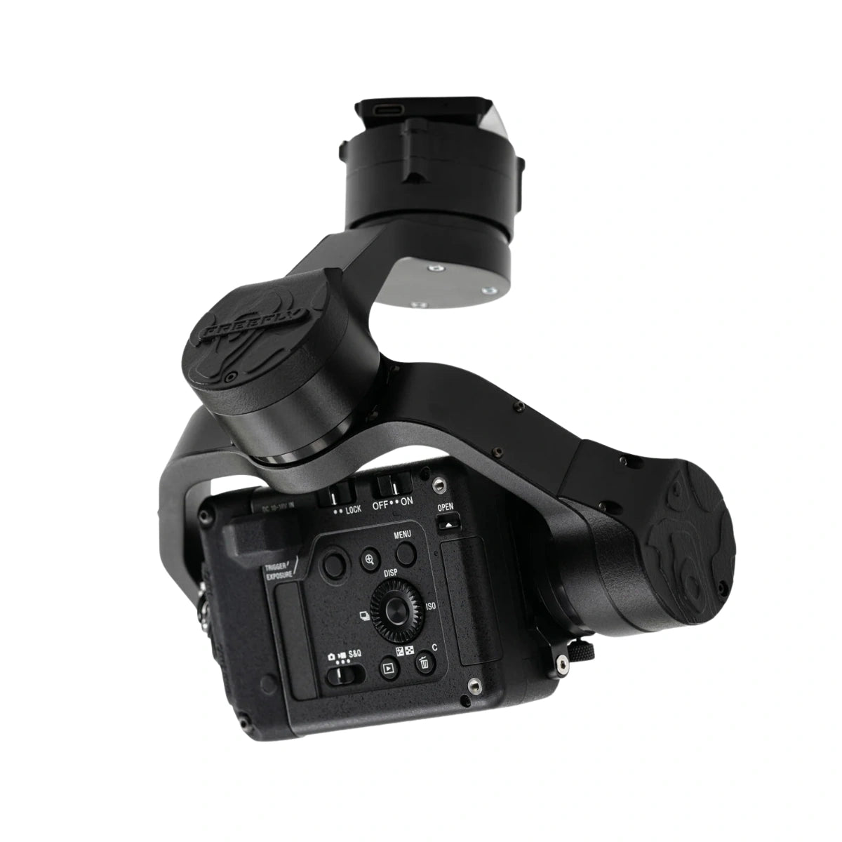
Sony ILX-LR1 61 MP Camera with Sigma 24 mm f/3.5 Mapping Lens: Precision mapping payload for Freefly Astro series
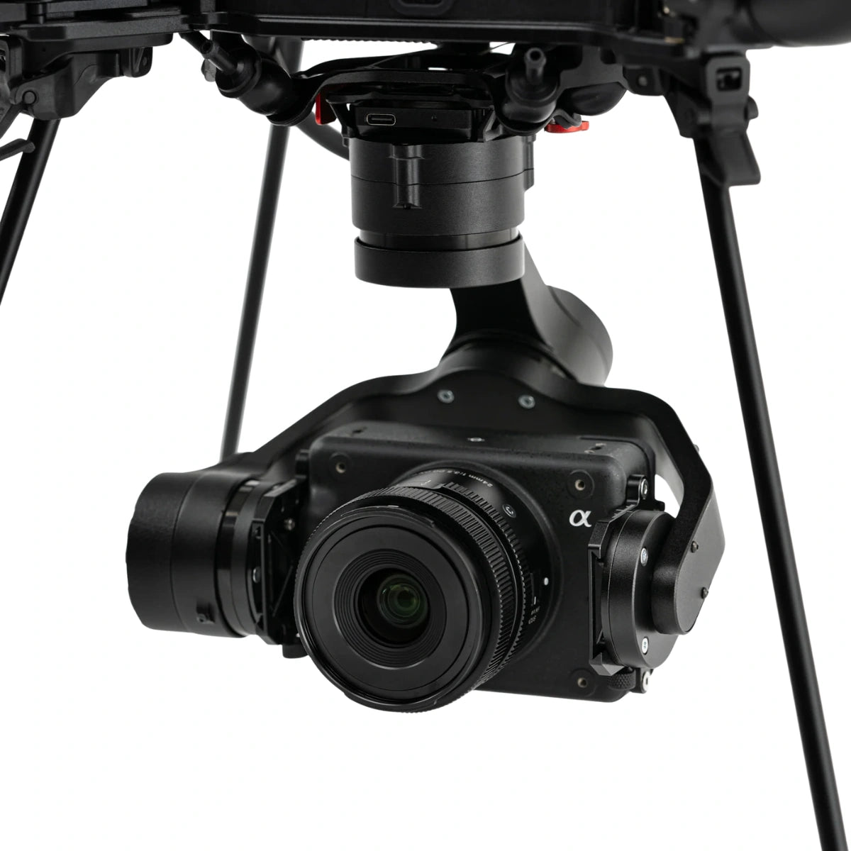
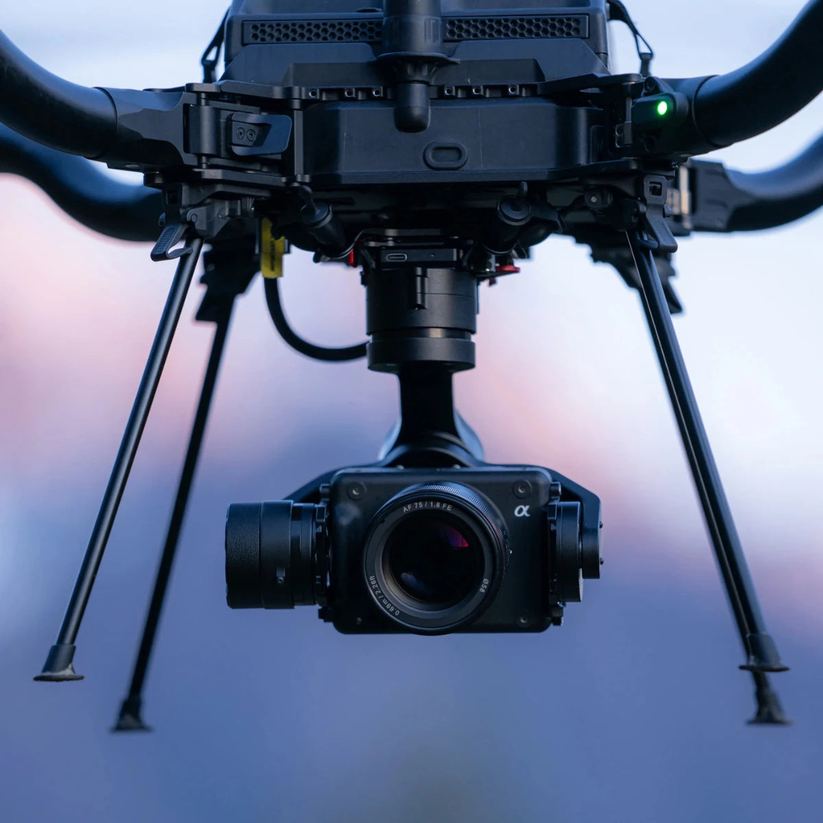
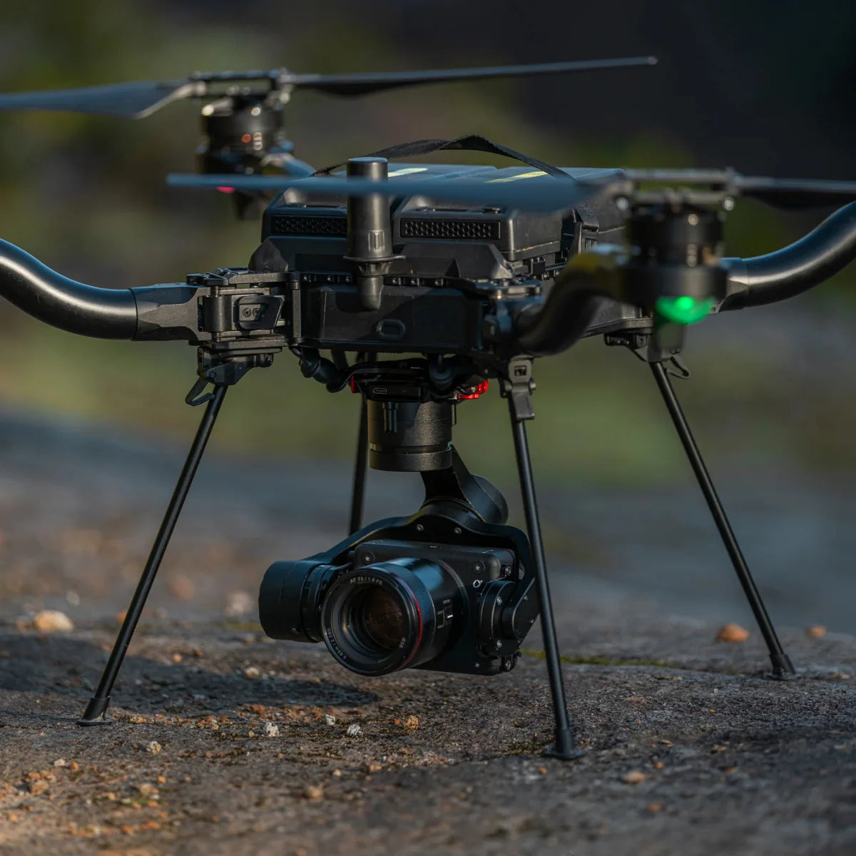
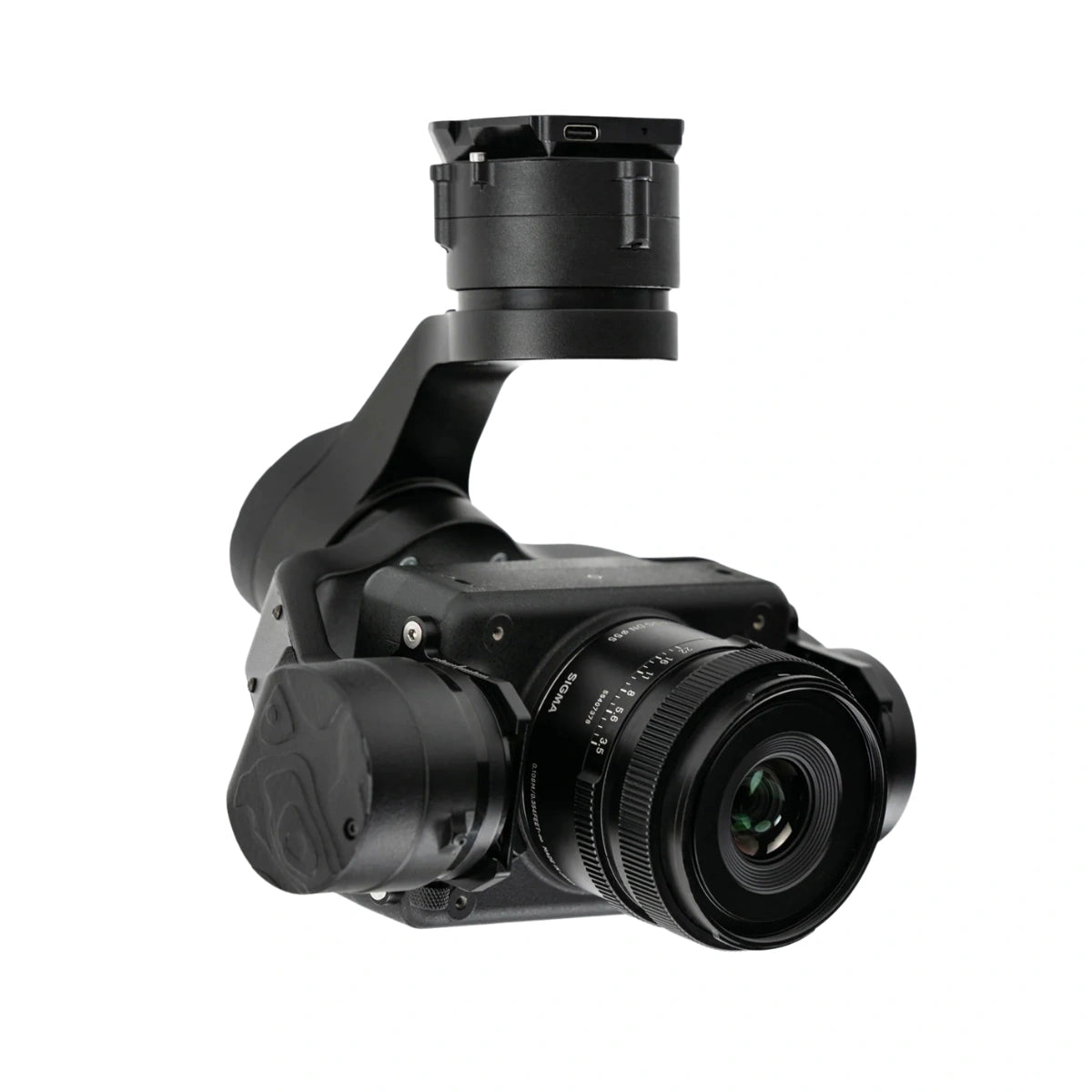
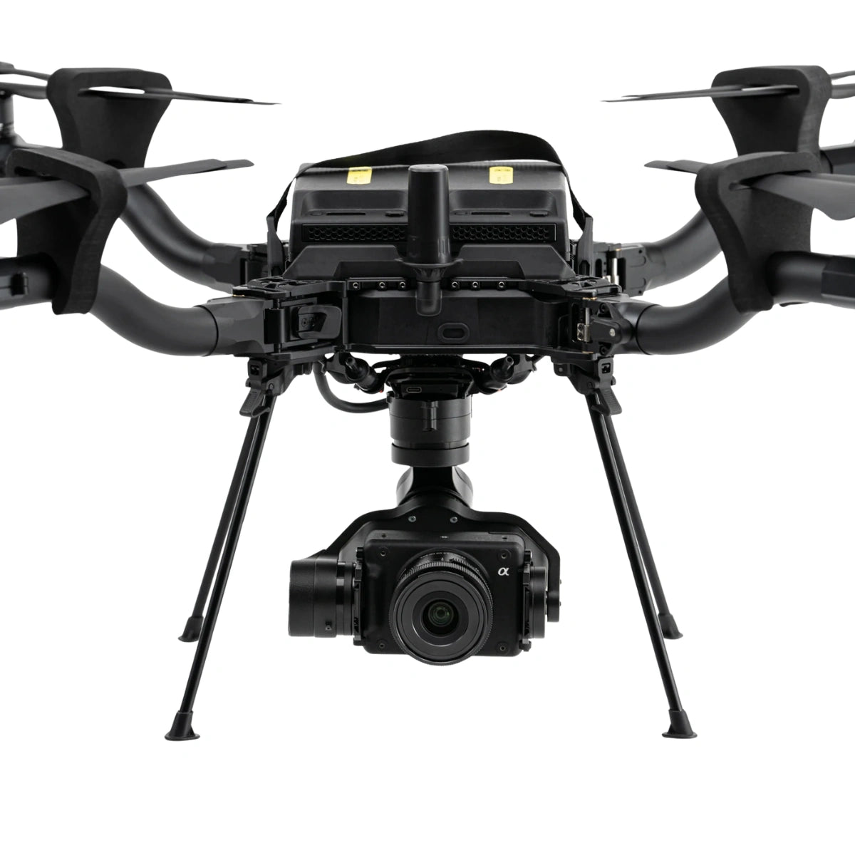
The Sony ILX-LR1 Mapping Payload is an enterprise-grade aerial imaging system designed for precision mapping and inspection missions. Integrated with a 61 MP full-frame sensor and a lightweight Sigma 24 mm f/3.5 lens, this payload captures ultra-high-resolution imagery optimized for photogrammetry and data modeling. Designed and assembled in the USA with NDAA-compliant components, it integrates seamlessly with the Freefly Astro and Astro Max through the Smart Dovetail interface for rapid deployment.
Professional imaging for aerial survey and inspection
The ILX-LR1's 35.7 × 23.9 mm full-frame Exmor R sensor produces 9,504 × 6,336 pixel images with superior dynamic range and minimal distortion-ideal for creating accurate orthomosaics and 3D models. With a total system weight of 970 grams (including gimbal and lens), the payload maintains long flight endurance on Astro platforms, typically 28-34 minutes. The Sigma 24 mm f/3.5 lens ensures uniform edge-to-edge sharpness, making it well-suited for mapping and infrastructure surveys.
Optimized integration with Freefly Astro ecosystem
The LR1 Payload connects directly to the Astro series using the Smart Dovetail mount for power, command, and data link integration. Operators can trigger captures from the Pilot Pro controller and monitor telemetry in real time. The kit ships in a compact hard case with foam cutouts for additional lenses and accessories, providing a ready-to-deploy mapping solution for industrial and environmental applications.
Key Features and Benefits
- 61 MP full-frame sensor: Captures detailed imagery for mapping and modeling
- Sigma 24 mm f/3.5 lens: Delivers consistent, distortion-free sharpness across frame
- 970 g total payload weight: Maintains optimal Astro flight performance
- Smart Dovetail mount: Enables plug-and-play payload integration
- Designed and assembled in the USA: NDAA-compliant construction
- 9,504 × 6,336 resolution: Provides ultra-high clarity for orthophotos
- Compatible with Astro and Astro Max drones: Seamless system integration
- Compact protective case: Holds payload and extra lenses securely
- Supported by Freefly software tools: Simplifies workflow and data capture
Applications and Use Cases
- Aerial mapping and surveying: Capture geospatial imagery with centimeter-level accuracy
- Infrastructure inspection: Detect surface anomalies in bridges and structures
- Construction monitoring: Document site progress and measure volumes precisely
- Environmental research: Record ecosystem changes with detailed imagery
- Urban planning: Generate 3D models and orthomosaics for city development
- Power and pipeline inspection: Support visual and thermal data collection
- Public safety operations: Rapid terrain and disaster area mapping
- Agricultural assessment: Support plant health analysis with high-resolution data
The Sony ILX-LR1 Mapping Payload combines precision, integration, and reliability for professional aerial mapping workflows. Designed for the Astro series, it offers consistent performance and secure data capture for enterprise operations.
DSLRPros provides authentic Freefly payloads, expert setup, and after-sales support for mapping professionals. Purchase today to equip your Astro platform with a fully integrated, 61 MP survey-grade camera system.
