


DSLRPros Inspired Flight IF800 Agricultural Monitoring Package
DSLRPros Inspired Flight IF800 Agricultural Monitoring Package
SKU:B-NB-IF800-AG


- Description
- Specifications
- In the Box
- FAQ
DSLRPros Inspired Flight IF800 Agricultural Monitoring Package
The DSLRPros Inspired Flight IF800 Agricultural Monitoring Package is a secure, enterprise-grade aerial data collection solution built for precision agriculture, crop health analysis, and research-driven farm management.
Standout Features at a Glance
- Blue UAS & NDAA-compliant drone platform: Approved for secure, enterprise, and federally funded operations
- Up to 40-minute flight time: Covers large fields efficiently with fewer battery swaps
- MicaSense Altum-PT payload: Integrated multispectral, panchromatic, and thermal sensing in one flight
- Blue Herelink Ground Control Station: Encrypted long-range control, telemetry, and real-time video
- High payload capacity: Optimized to carry advanced agricultural sensors reliably
- Made & supported in the USA: Backed by Inspired Flight engineering and DSLRPros integration support
Centered around the Blue UAS–approved Inspired Flight IF800 quadcopter and paired with the Blue Herelink Ground Control Station and MicaSense Altum-PT multispectral and thermal sensor, this package delivers high-quality, repeatable insights across large agricultural operations.
Designed for professionals who require data integrity, long endurance, and flexible payload integration, the IF800 platform enables growers, agronomists, and researchers to capture multispectral, panchromatic, and thermal datasets in a single flight—supporting smarter decisions from planting through harvest.
Inspired Flight IF800: Built for Agricultural Data Collection
The Inspired Flight IF800 is a lightweight yet rugged quadcopter engineered for long-duration missions and modular payload integration. Its carbon-fiber folding airframe balances portability with stiffness, making it easy to deploy across farms, research plots, and remote agricultural sites.
With up to 40 minutes of flight time under typical payloads, the IF800 allows operators to map hundreds of acres per mission while maintaining consistent altitude and overlap—critical for high-quality agricultural analytics.
- Stable flight performance: Ensures consistent image capture for accurate vegetation indices
- Secure communications: Offline mission planning and encrypted data links protect sensitive farm data
- Flexible payload support: Optimized for multispectral, thermal, and research-grade sensors
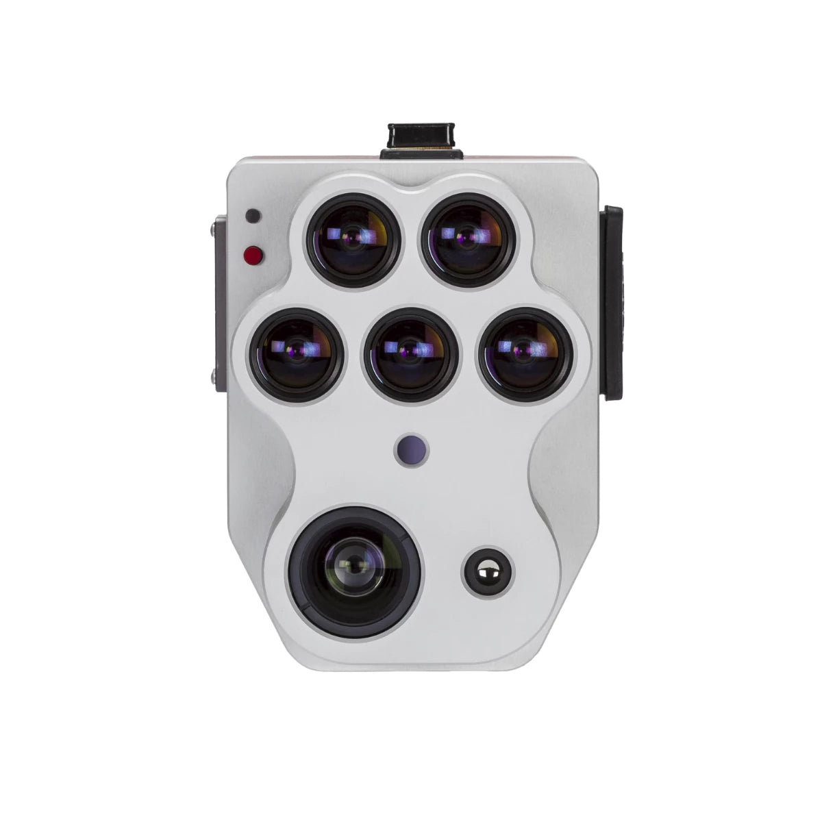
MicaSense Altum-PT on the IF800: One Flight, Multiple Insights
When paired with the IF800, the MicaSense Altum-PT transforms the platform into a powerful agricultural analytics tool. Altum-PT combines five multispectral bands, a high-resolution panchromatic imager, and a radiometrically calibrated thermal sensor into a single synchronized payload.
This means growers and agronomists can capture crop vigor, canopy temperature, and fine spatial detail simultaneously—eliminating the need for multiple flights or separate sensors.
- Multispectral imaging: Supports NDVI, NDRE, and other vegetation indices for crop health analysis
- Thermal data: Reveals irrigation performance, water stress, and soil moisture variability
- Pan-sharpened detail: Enables leaf-level inspection and early stress detection
- Pixel-aligned outputs: All data layers captured at the same moment for accurate analysis
Agricultural Applications & Use Cases
The IF800 Agricultural Monitoring Package is purpose-built for precision agriculture workflows that demand accuracy, repeatability, and scale.
- Crop health monitoring: Detect early signs of stress, disease, and nutrient deficiency before visible symptoms appear.
- Irrigation optimization: Use thermal and multispectral data to identify over- or under-watered zones and improve water efficiency.
- Soil & field variability analysis: Understand spatial variability across large fields to support variable-rate applications.
- Yield estimation & phenotyping: Track crop development stages and assess productivity across growing seasons.
- Agricultural research & trials: Capture consistent, repeatable datasets for field trials, seed development, and environmental studies.
Why Choose the IF800 Agricultural Monitoring Package
This package combines a secure, Blue UAS-approved drone with one of the most advanced agricultural sensors available today. The result is a field-ready system that supports high-confidence decisions, scalable operations, and long-term data programs.
| Requirement | How This Package Delivers |
|---|---|
| Enterprise-Grade Security | NDAA-compliant IF800 with encrypted Herelink communications |
| Advanced Crop Insights | Altum-PT delivers multispectral + thermal data in one mission |
| Large-Area Coverage | Up to 40-minute flight time for fewer flights and higher efficiency |
| Repeatable Results | Radiometrically calibrated sensors for time-series analysis |
| Professional Support | Integrated, tested, and supported by DSLRPros UAS specialists |
When sourced from DSLRPros, the Inspired Flight IF800 Agricultural Monitoring Package includes expert integration, workflow guidance, and long-term support to help you get the most value from your aerial data.
Request a quote today to build a turn-key agricultural monitoring solution tailored to your crops, acreage, and operational goals.
