


DJI Zenmuse L2 LiDAR Camera
DJI Zenmuse L2 LiDAR Camera
SKU:S-DJI-ZL2


- Description
- Specifications
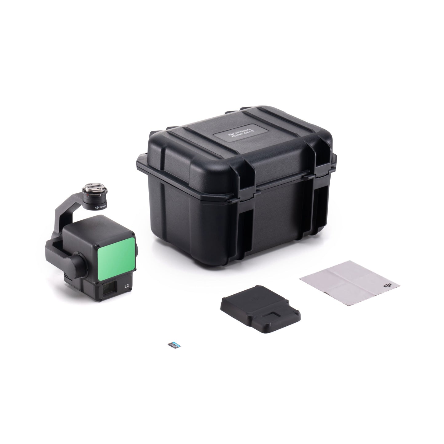
- In the Box
- FAQ
DJI Zenmuse L2: High-precision LiDAR and RGB mapping system for enterprise drones
The DJI Zenmuse L2 delivers survey-grade LiDAR and RGB data collection in a single 3-axis gimbal payload.
Combining a frame-based LiDAR module, a 4/3-inch 20 MP CMOS RGB camera, and a high-accuracy IMU, it captures dense point clouds and detailed imagery for mapping, inspection, and geospatial analysis.
Compact, efficient, and IP54-rated, the L2 is built for professionals who need accurate aerial data with minimal setup time.
System highlights
- Integrated LiDAR, 4/3″ RGB camera, and high-accuracy IMU in one payload.
- Captures 240,000 points per second with 4 cm vertical accuracy.
- Smaller 1.6 × 4.7 in laser spot for denser point cloud mapping.
- Detection range up to 450 m; supports five returns per pulse.
- Covers 2.5 km² per flight at 120 m altitude.
- 20 MP RGB camera adds true color to LiDAR data.
- Instant start-up with no warm-up required.
- IP54 rating and 905 g lightweight construction for field use.
- Compatible with DJI Pilot 2 and DJI Terra software.
High-accuracy data collection made simple
Capturing 240,000 points per second, the L2 achieves vertical accuracy of 4 cm and horizontal accuracy of 5 cm at 150 m altitude. A reduced laser spot size (1.6 × 4.7 in) improves penetration through vegetation and enhances detail in dense terrain.
With a detection range of up to 450 m and support for five returns, the L2 covers up to 2.5 km² in a single flight. No warm-up is required, ensuring faster deployment and operational efficiency.
Professional imaging and workflow integration
The integrated 20 MP RGB mapping camera captures true-color imagery and applies it directly to LiDAR point clouds. Its fast 0.7-second photo interval and 3.3 µm pixel size deliver crisp detail even in low light.
Used with DJI Pilot 2 and DJI Terra, the L2 provides real-time point-cloud visualization, automated task quality reports, and one-click post-processing for 3D modeling and DEM generation. DJI Care Enterprise is not included with this product.
Platform and workflow integration
- Compatible with DJI Matrice 300, DJI Matrice 350 and Matrice 400 RTK aircraft.
- Mounts via DJI SkyPort V2 or E-Port interfaces.
- Integrates with DJI Pilot 2 for mission planning and live point-cloud view.
- Seamless DJI Terra workflow for DEM creation and accuracy checks.
- Supports waypoint, area, and linear flight route types.
- Real-time coloring modes include reflectivity, height, and distance.
Professional applications
- Land surveying and mapping with high point density and precision.
- Forestry management and vegetation penetration studies.
- Electrical and power line inspection with multi-return LiDAR.
- Construction progress tracking and as-built modelling.
- Mining and stockpile volumetrics for resource management.
- Environmental and infrastructure monitoring.
Zenmuse L2 vs Zenmuse L3: LiDAR Payload Comparison
This table compares DJI’s Zenmuse L2 and Zenmuse L3 across core LiDAR, mapping-camera, environmental, and workflow specifications that typically drive enterprise purchase decisions—range and point density, accuracy expectations, aircraft compatibility, power draw, storage media, and downstream software.
| Specification | Zenmuse L2 | Zenmuse L3 |
|---|---|---|
| Positioning / aircraft support | Supports Matrice 400, Matrice 350 RTK, and Matrice 300 RTK (requires DJI RC Plus). | Supports DJI Matrice 400 (requires Zenmuse L3 single gimbal connector). |
| Ingress protection | IP54 | IP54 |
| Operating / storage temperature | Operating: −20 °C to 50 °C (−4 °F to 122 °F) Storage: −20 °C to 60 °C (−4 °F to 140 °F) |
Operating: −20 °C to 50 °C (−4 °F to 122 °F) Storage: −40 °C to 70 °C (−40 °F to 158 °F) |
| Dimensions / weight | 155 × 128 × 176 mm (L × W × H) 905 g ±5 g |
192 × 162 × 202 mm (L × W × H) 1.60 kg (without single gimbal connector) (+145 g connector) |
| Power draw | 28 W (typical), 58 W (max) | 64 W (typical), 100 W (max) |
| Detection range (headline) | 450 m @ 50% reflectivity, 0 klx 250 m @ 10% reflectivity, 100 klx Maximum detection range: 500 m |
700 m @ 10% reflectivity, 350 kHz 950 m @ 10% reflectivity, 100 kHz 2,000 m @ 80% reflectivity, 100 kHz Default maximum detection range: 900 m; extended range available via DJI support or authorized dealers |
| Wire detection (powerline focus) | Not specified | 21.6 mm steel-core aluminum stranded wire: 300 m @ 100 klx, 350 kHz 18.4 mm black PVC-insulated wire: 100 m @ 100 klx, 350 kHz |
| Point cloud rate / returns | Point cloud rate: • Single return: up to 240,000 pts/s • Multiple returns: up to 1,200,000 pts/s Maximum supported returns: 5 |
Number of returns: • 4, 8, 16 (100 kHz, 350 kHz) • 4, 8 (1,000 kHz) • 4 (2,000 kHz) |
| System accuracy (point cloud) | At 150 m: Horizontal: 5 cm Vertical: 4 cm |
RMSE accuracy: At 120 m: Vertical 3 cm, Horizontal 4 cm At 300 m: Vertical 5 cm, Horizontal 7.5 cm |
| Ranging accuracy | RMS (1σ): 2 cm @ 150 m | Absolute accuracy: ±10 mm Repeatability: <5 mm (1σ) |
| Laser wavelength | 905 nm | 1535 nm |
| Scanning modes & FOV | Modes: repetitive, non-repetitive FOV: • Repetitive: H 70°, V 3° • Non-repetitive: H 70°, V 75° |
Modes: Linear, Star-shaped, Non-repetitive FOV: • Linear: H 80°, V 3° • Star-shaped: H 80°, V 80° • Non-repetitive: H 80°, V 80° |
| Minimum detection distance | 3 m | 10 m (minimum effective distance) |
| Real-time point cloud coloring | Reflectivity, Height, Distance, RGB | Not specified in published L3 specifications |
| RGB mapping camera (sensor) | 4/3 CMOS, 20 MP effective | 4/3 CMOS (see resolution modes below) |
| RGB mapping camera (still photo) | 5280 × 3956 (4:3) 20 MP single shot |
100 MP: 12,288 × 8,192 25 MP: 6,144 × 4,096 Minimum interval: JPEG 0.5 s (25 MP), 1 s (100 MP); RAW / JPEG+RAW 1.2 s |
| RGB mapping camera (lens) | 24 mm equivalent FOV: 84° Aperture: f/2.8–f/11 |
28 mm equivalent FOV: 73.3° (diagonal), 62° (horizontal), 41.2° (vertical) Aperture: f/2.0–f/11 |
| Mechanical shutter durability | 200,000 actuations | 500,000 actuations |
| Video | H.264 / H.265 4K (3840 × 2160) @ 30 fps FHD (1920 × 1080) @ 30 fps |
MP4 (HEVC / H.265) 4K (3840 × 2160) @ 30 fps FHD (1920 × 1080) @ 30 fps |
| POS / IMU update rate | IMU update rate: 200 Hz | POS update rate: 200 Hz GNSS update rate: 5 Hz |
| RTK positioning accuracy (FIX) | Horizontal: 1 cm + 1 ppm Vertical: 1.5 cm + 1 ppm |
Horizontal: 1.0 cm + 1 ppm Vertical: 1.5 cm + 1 ppm |
| Storage media | microSD (UHS-I U3 / V30, ≥50 MB/s write), up to 256 GB | CFexpress Type B (≥1,500 MB/s sequential write) Standard card reader throughput: >900 MB/s |
| Software ecosystem | Data processing: DJI Terra Export formats: PNTS, LAS, PLY, PCD, S3MB |
Data collection: DJI Pilot 2 Processing: DJI Terra Data application: DJI Modify Cloud: DJI FlightHub 2 Export: PNTS, LAS, LAZ, PLY, PCD, S3MB Import (Modify): LAS |
| What buyers usually care about | Practical LiDAR + RGB mapping in a lighter payload, multi-aircraft compatibility, and a straightforward microSD-based field workflow. | Long-range capture, utility inspection and wire detection, 100 MP stills, and CFexpress throughput for high-volume enterprise projects. |
Built for professional operations
The Zenmuse L2 combines accuracy, range, and ease of use in a rugged design. With its precise IMU, advanced LiDAR module, and RGB integration, it delivers unmatched data quality for complex field missions.
Operators can preview, merge, and validate point-cloud models directly in the field, reducing rework and downtime. Reliable and efficient, the L2 transforms DJI Matrice series drones into full-scale mapping systems.
Available now from DSLRPros. Purchase today to equip your fleet with enterprise-grade aerial mapping precision.
