


DJI D-RTK 3 Multifunctional Station (Base Only)
DJI D-RTK 3 Multifunctional Station (Base Only)
SKU:S-DJI-DRTK3


- Description
- Specifications
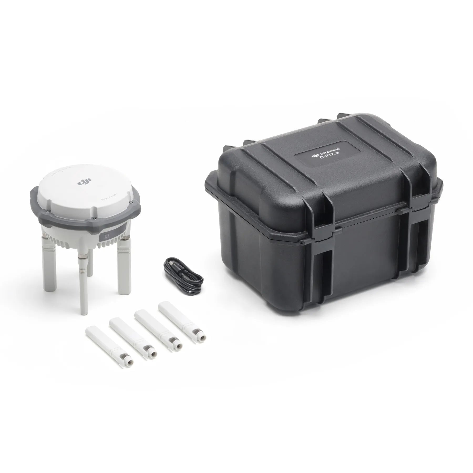
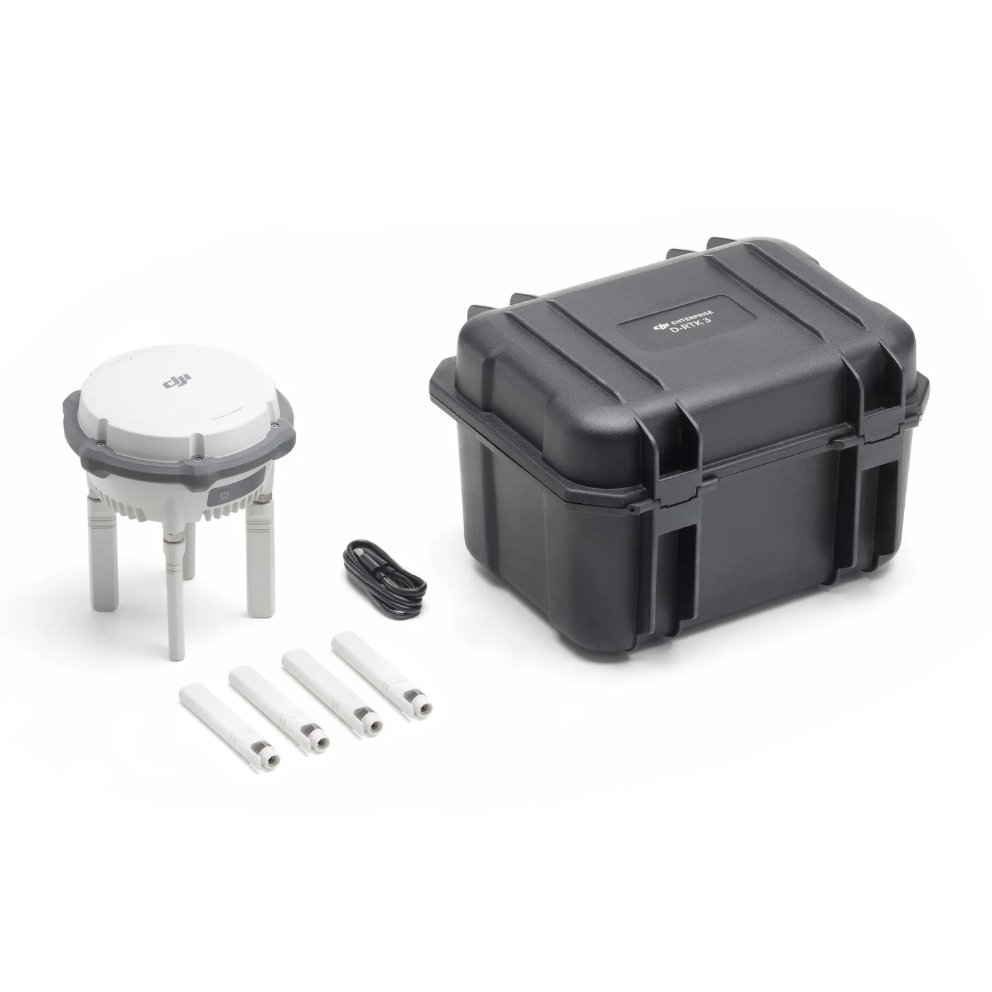
- In the Box
- FAQ
DJI D-RTK 3 Multifunctional Station: Multi-mode GNSS reference station for enterprise RTK and relay operations
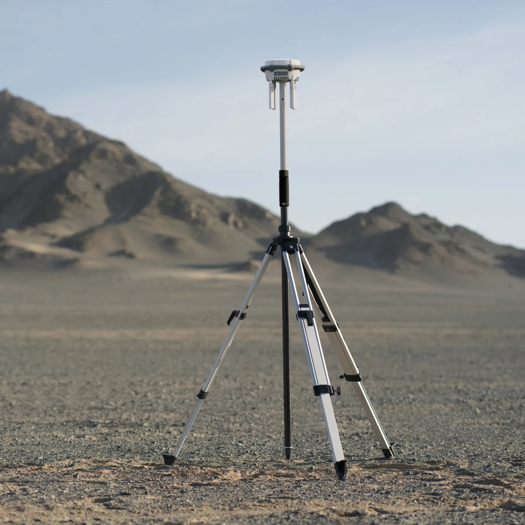
The DJI D-RTK 3 Multifunctional Station is a professional-grade GNSS reference system designed to support enterprise UAV positioning, relay communications, and rover-based surveying workflows. It operates in base station, relay station, and rover station modes, allowing teams to adapt deployment based on mission requirements and site conditions.
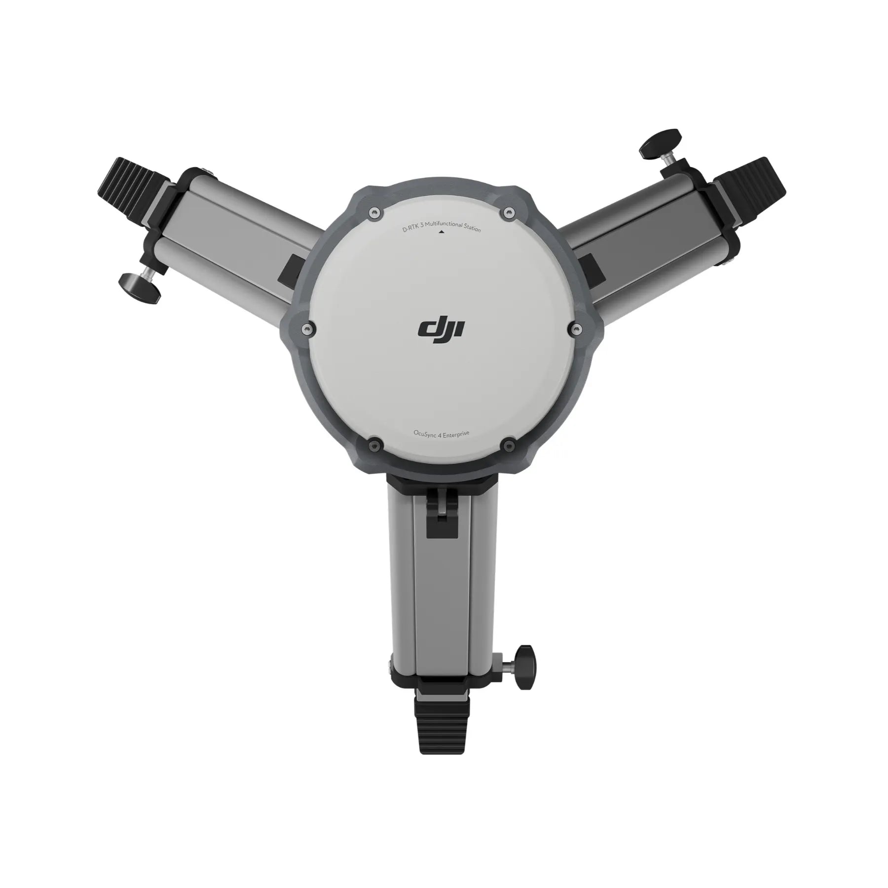
With multi-constellation GNSS tracking, published centimeter-level RTK accuracy specifications, and O4 Enterprise relay capability, D-RTK 3 supports precise positioning and extended connectivity. Its IP67-rated enclosure, internal battery, and defined operating limits make it suitable for repeatable field deployment across demanding environments.
Key features of the DJI D-RTK 3 Multifunctional Station
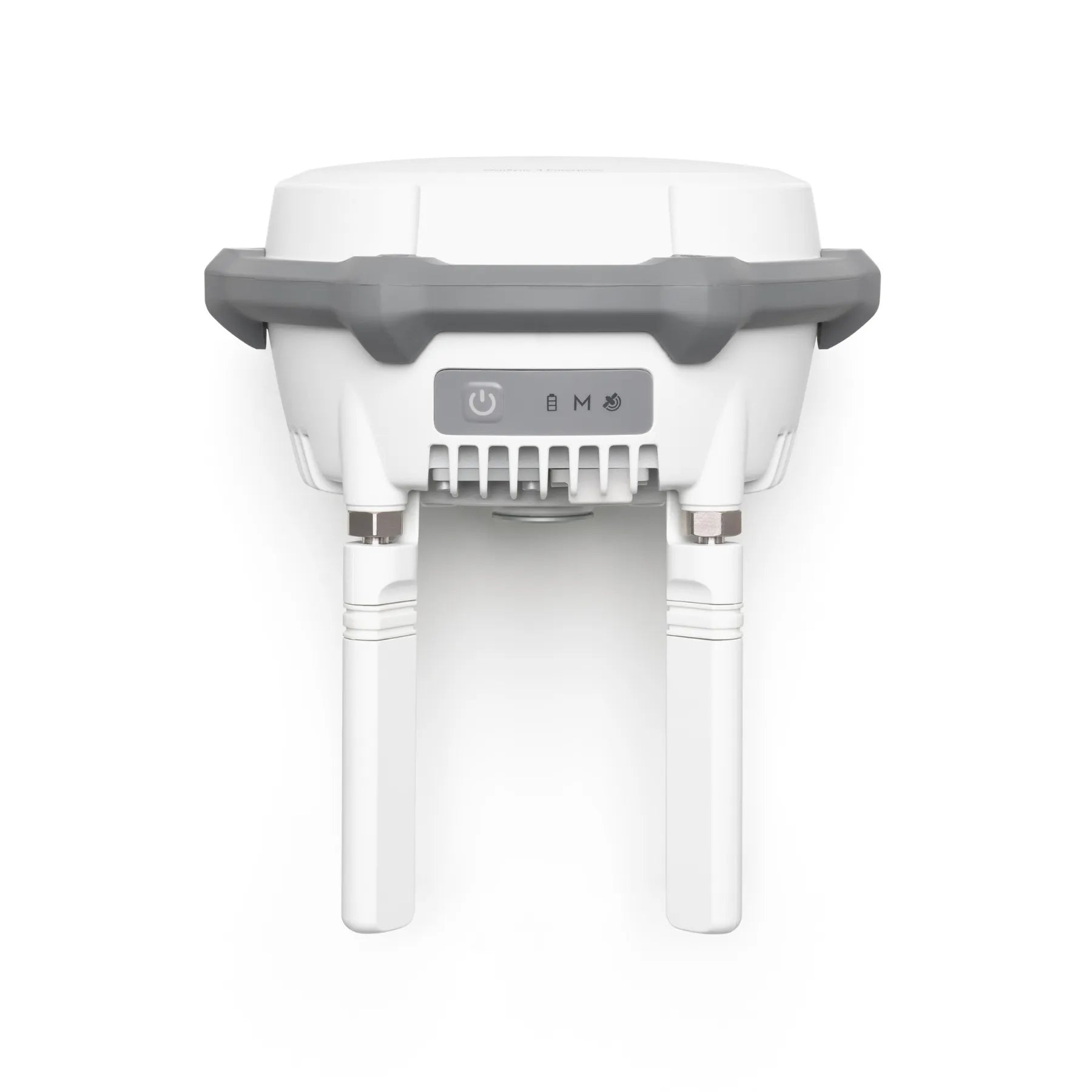
- Multi-band GNSS receiver: Tracks GPS, BDS, Galileo, GLONASS, QZSS constellations.
- Base station operation: Provides RTK corrections for supported DJI aircraft fleets.
- Rover station mode: Supports survey workflows using Bluetooth-connected mobile devices.
- Network RTK calibration: Achieves centimeter-level positioning with published accuracy models.
- Fixed RTK survey accuracy: 0.8 cm horizontal plus 1 ppm specification.
- Tilt survey support: Measures points up to 60° with defined accuracy behavior.
- Satellite-based differential positioning: Supports PPP with stated convergence performance.
- RTCM compatibility: Supports RTCM v3.0–v3.3 and MSM4–MSM7 protocols.
Survey-grade accuracy with clearly defined performance envelopes
DJI publishes explicit accuracy specifications for D-RTK 3 across its supported operating modes, allowing teams to plan missions with predictable results. In base and relay station roles, uncalibrated single point accuracy is specified at 1.5 m horizontal and 3.0 m vertical RMS. Network RTK calibration improves this to 1.0 cm horizontal plus 1 ppm and 3.0 cm vertical plus 1 ppm. In rover station mode, fixed RTK survey accuracy is specified at 0.8 cm horizontal plus 1 ppm and 1.5 cm vertical plus 1 ppm, with initialization reliability exceeding 99.9 percent.
O4 Enterprise relay operation and real-world range planning
D-RTK 3 integrates O4 Enterprise transmission to support relay station deployment in environments where direct aircraft-to-controller links are obstructed. DJI publishes region-specific maximum transmission distances under unobstructed conditions, as well as reference ranges for environments with varying interference and obstruction levels. When deployed in elevated, interference-free locations, relay station mode can improve link performance by up to five times in severely obstructed terrain. These specifications allow operators to plan relay placement using realistic expectations rather than idealized laboratory conditions.
Supported aircraft and devices by operating mode
- Key Compatible Drones (Base Station Mode)
- DJI Matrice 4 Series (Including M4E, M4T, M4D, M4TD)
- DJI Matrice 400 RTK
- DJI Matrice 350 RTK
- DJI Matrice 300 RTK
- DJI Matrice 30 Series (M30/M30T)
- DJI Matrice 3D/3TD
- DJI Mavic 3 Enterprise Series (M3E, M3T, M3M)
- DJI Inspire 3 (Professional Filmmaking)
- DJI FlyCart 30
- DJI Matrice 4 Series (Including M4E, M4T, M4D, M4TD)
- Compatible Agricultural Drones
- DJI Agras T60
- DJI Agras T50 / T25
- DJI Agras T40 / T20P
- DJI Agras T60
- Relay Station Mode: Specifically supports the Matrice 4E, Matrice 4T, and FlyCart 100 to extend range.
Professional applications supported by the system
- RTK base station deployment: Deliver repeatable positioning corrections for enterprise UAV operations.
- Relay station placement: Extend communication links in obstructed inspection or mapping environments.
- Rover field surveying: Collect centimeter-level ground points using Bluetooth-connected mobile devices.
- Network RTK calibration: Establish accurate reference coordinates for precision mapping workflows.
- Tilt survey measurement: Capture survey points at angles up to sixty degrees.
- Dock site assessment: Improve connectivity planning for fixed or semi-fixed UAV infrastructure.
- Multi-aircraft fleet support: Standardize positioning across mixed DJI enterprise platforms.
- Rugged field operations: Maintain positioning performance under variable environmental conditions.
Built for enterprise deployment and operational reliability
The DJI D-RTK 3 Multifunctional Station is engineered for organizations that require consistent positioning performance across sites and missions. Multi-constellation GNSS tracking improves satellite availability, while defined accuracy models support quality assurance workflows. The IP67-rated enclosure, internal battery, and wide operating temperature range support dependable field use. Together, these characteristics make D-RTK 3 suitable for long-term enterprise programs where predictable performance, repeatable deployment, and interoperability across DJI platforms are critical.
The DJI D-RTK 3 Multifunctional Station provides a flexible RTK and relay solution for teams managing complex enterprise UAV operations.
Available now from DSLRPros. Purchase today to equip your team with DJI’s latest enterprise positioning infrastructure.
