


Autel EVO Max 4T XE (Nest Model)
Autel EVO Max 4T XE (Nest Model)
SKU:S-AR-MAX4T-XE-NEST


- Description
- Specifications
- In the Box
- FAQ
Autel EVO Max 4T XE (Nest Model): autonomous multi-sensor performance for mission-critical operations
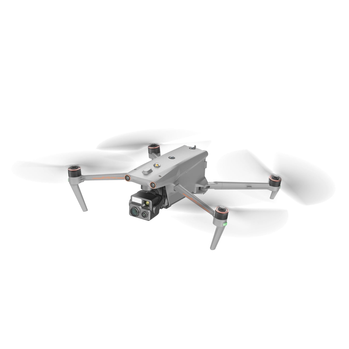
The Autel EVO Max 4T XE (Nest Model) is engineered for advanced mission workflows that require multi-sensor intelligence, autonomous flight support, and dependable performance in challenging environments. Its FusionLight 4T XE gimbal integrates 8K zoom imaging, wide-angle low-light capture, radiometric thermal sensing, and precision laser ranging for complete scene coverage.
With autonomous 3D pathfinding, SLAM-based indoor navigation, enhanced anti-interference design, and A-Mesh multi-aircraft networking, the EVO Max 4T XE delivers the capability needed for public safety, inspection, and emergency teams navigating complex or GPS-restricted environments.
Mission-grade multi-sensor capabilities
- Zoom sensor captures 8K imagery with 10× optical magnification range
- Wide-angle camera records 50 MP detail with enhanced low-light clarity
- Thermal core outputs 640 × 512 footage with strong digital zoom capability
- Laser rangefinder measures coordinates accurately from 16.4 ft to 0.75 miles
- FusionLight system provides multi-channel projection for combined sensor views
- 720° perception detects obstacles as small as 0.5 inches reliably
- SLAM navigation stabilizes flight indoors or in dense structural layouts
- Anti-interference design counters RFI, EMI, and GPS spoofing events
- SkyLink 3.0 streams 1080p60 video at long transmission distances
- Hot-swappable batteries maintain uptime during extended operational cycles
Multi-sensor imaging clarity for high-demand operations
The FusionLight 4T XE payload provides a flexible combination of cameras and ranging tools for detailed situational awareness. The zoom camera delivers up to 8K resolution with 10× optical magnification and 160× hybrid reach for long-range target identification.
A wide-angle 50 MP camera captures expansive 8K or 4K views with low-light enhancement from Moonlight Algorithm 2.0. A 640 × 512 thermal core identifies heat sources with 16× digital zoom, while the integrated rangefinder collects accurate coordinates up to 0.75 miles. This comprehensive suite ensures accurate data capture across search, inspection, and tactical scenarios.
Autonomous navigation and environmental adaptability
Autel Autonomy uses real-time data to map terrain, plan intelligent routes, and avoid obstacles automatically. Dual-vision sensors combined with millimeter-wave radar provide 720° obstacle perception, detecting objects as small as 0.5 inches. Anti-jam architecture counters RFI, EMI, and GPS spoofing, while SLAM navigation maintains stable flight in tunnels, buildings, forests, and urban canyons.
SkyLink 3.0 delivers encrypted 1080p60 video up to 12.4 miles, and A-Mesh networking extends control beyond line of sight using other airborne nodes as relays. With up to 42 minutes of flight time and hot-swappable power, the EVO Max 4T XE stays field-ready for demanding missions.
Platform and operational integration
- Fully compatible with Autel SkyLink 3.0 transmission system
- Supports A-Mesh 1.0 multi-aircraft relay networking
- Works with Smart Controller V3 for bright real-time monitoring
- Integrates with Autel Enterprise app for advanced mission planning
- Supports Autel Mobile SDK for customized workflow development
- Payload SDK enables integration of specialized third-party equipment
- GNSS-denied operation supported through SLAM and radar-based sensing
Field-ready deployment scenarios
- Search and rescue missions: locate heat signatures across rugged terrain
- Utility inspection tasks: examine towers, pipelines, and electrical assets
- Public safety overwatch: track subjects and vehicles from long range
- Disaster response flights: survey damaged structures with multi-sensor detail
- Law enforcement operations: support tactical movement with precise tracking
- Land and corridor surveying: capture high-resolution mapping data efficiently
- Mining volumetric checks: gather measurements across wide industrial areas
- Construction documentation: record site progress and perimeter conditions
- Environmental monitoring: observe wildlife or terrain without disturbance
- Infrastructure evaluation: assess bridges, rooftops, and inaccessible surfaces
Built for operational endurance
The EVO Max 4T XE is designed for unpredictable weather and complex environments, with IP43 sealing, 27 mph wind resistance, and operation from –3 °F to 122 °F. Its autonomous pathfinding, robust anti-jam architecture, and all-sensor visibility suite ensure stability and accuracy through dense forests, urban structures, and interference-heavy zones. With fast 15-second takeoff and reliable return-to-home behavior, it supports consistent mission output for enterprise teams.
The EVO Max 4T XE delivers exceptional imaging capability, autonomous navigation, and resilient communication, supporting long-term reliability for teams requiring precision and multi-sensor flexibility. It integrates smoothly into data-driven workflows for diverse enterprise operations.
At DSLRPros, we provide expert guidance, tailored deployment support, and professional after-purchase assistance. Order the EVO Max 4T XE (Nest Model) today to enhance your operational readiness with proven multi-sensor capability.
