In the last 10 years, the threat of wildfires has increased for towns and communities, small and large. The layman might not be familiar with the term Wildland Urban Interface (WUI), which is defined as the area where human development and undeveloped wildland meet. But for people who live in the WUI, they are all too familiar with how prone to wildfire their area of residence can be. Residents go through Defensible Space Inspections to increase the survivability of the home, as well as to keep firefighters as safe as possible when engaged in structural protection of the house.
An increasingly important tool in both the inspection and protection of property from fire has become the drone. Drones, when applied effectively and with proper coordination, can be used to aid in both wildfire preparation and during firefighting operations.

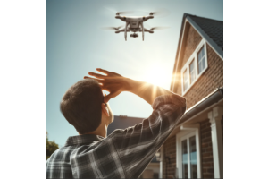
Drones can provide a unique perspective to homeowners and inspectors alike. The bird’s eye view can provide important information about areas of concern on a specific property or hazards that might affect a group of houses. Implementing drone use for these inspections could speed up inspection times, allowing agencies to reach more residents in a shorter period of time while also providing the possibility for multiple inspections over the course of the year to track progress.

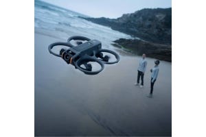
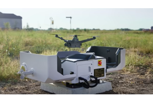
Drones can also be used to help fight wildfires. Many companies, such as Autel and DJI, offer drone packages specifically built for first responder agencies. These packages come with everything needed to fly and care for the drone, all in a rugged protective case.
The use of drones in the fire service is relatively new; and while it will likely become an integral part of wildland firefighting in the future, there are some issues that need to be addressed first.
Airspace is extremely important when dealing with wildfires, especially at the fire front. Multiple types of aircraft fly in specifically designed patterns to avoid collisions; all while coordinating water and fire retardant drops to slow the spread of fast moving flames and extinguish hot spots. Putting drones onto fire engines and allowing firefighters to use them may seem like a good idea at first; but with how low to the ground the air tankers fly to make their drops, the risk of collision with a drone could quickly result in a disaster. Alternatively, it could severely slow down fire suppression by grounding the planes.

There are a couple of ways to tackle this issue. The first is coordinating a strict flight plan with the Incident Commander, ensuring drone operations would not interfere with manned aircraft operations. The second option is to create a dedicated drone strike team for use on the fire. There are already different types of strike teams based on engine and personnel capabilities; and implementing a drone strike team with specifically trained personnel could prove extremely effective when coordinating fire attack and mop up.

Derrick Ward, a 30 year firefighter for one of the largest departments in the world and Director of Public Safety for Enterprise UAS notes that “In some cases, roots may smolder for several days beneath the ground surface. If hotspot locations are provided to fire crews in a timely manner, they can be extinguished to prevent further spreading. It is also critical to clear a burned area before civilians are allowed to return into evacuation zones.”
Derrick also explains that he has “had the opportunity to see firsthand how drones with thermal imaging cameras give firefighters a birdseye view of the terrain and help them determine where a fire will spread. We can make swift decisions about where fire crews should go, and which residents need to be evacuated. This technology also makes it easier to locate and analyze fire risk areas.”
Sensors such as the Zenmuse H20T from DJI can aid in the search for hot spots at specific temperature ranges and pilots can pinpoint their location and notify ground crews.

Handheld thermal sensors or TICs have been used by firefighters on the ground for years. They aid in finding the seat of the fire, trapped occupants and hotspots during mop up. Because of their ability to spot temperature differences and see through smoke, they have become an invaluable tool to firefighters. Thermal sensor equipped drones can help give firefighters some of the same information from a birds eye view; both drawing structure fires, and wildland/forest fires. Because of their ability to see through smoke and the birds eye view, implementing the use of drones on wildland fires will give Incident Commanders valuable information about the head and flanks of the fire, crew locations and wet line integrity.
Firefighting Drones in Use
In Colorado, drones are already helping to assist in fighting fires. The Bureau of Land Management has begun flying a drone that drops balls of fiery chemicals, designed to ignite on the ground. Fire teams control how much of the area burns, and are able to make a burnout line around the uncontrolled fire to contain it.
How Drones Can Be Used to Mitigate Fire Risk
With greater remote sensing capabilities from drones, utility companies can better monitor their equipment and detect irregularities faster. In California, such companies have started testing drones to spot potential equipment issues. Mike Glass, director of data and analytics in PG&E’s IT organization stated “We firmly believe that over time, the entire industry—worldwide, globally—will eventually leverage some sort of remote technology to inspect electrical equipment.” The use of more remote sensing technology to inspect electrical equipment comes after the 2018 Camp Fire was started by a faulty transmission component that could have been detected by a drone.
Our Recommended Public Safety Drone Package

As previously mentioned, there are public safety drone packages available that are purpose built for first responder agencies. The drones are equipped with thermal sensors, which have a variety of applications in a wildfire setting. During the evacuation phase of a fire, drones equipped with thermal sensors could be used to make sure that everyone has evacuated an area and that there are no people or pets being left behind.
If the drone does locate a person or animal that needs assistance being evacuated, features like DJI’s PinPoint and SmartTrack can be used to give ground crews the exact location of the subject, and also follow it as it moves.
The thermal cameras are also extremely useful during the mop up stage of a fire, when it is extremely important for ground crews to locate and extinguish hot spots along the fireline; insuring that further spread of the fire is prevented. It can be difficult to find these areas; especially since they don’t always smoke, and can lay dormant for hours until a gust of wind picks up smoldering embers and starts a fire in a new location. Sensors such as the Zenmuse H20T from DJI can search for hot spots at specific temperature ranges; and pilots can pinpoint their location and notify ground crews.
Because the pace of technological advancements in the drone industry has been so rapid over the last five years, drones are now more capable than ever, boasting impressive durability. The main focus in the next five years should be finding the most effective way of implementing this technology in keeping both ground and aerial crews safe while preventing the spread of wildfires that are encroaching on civilization. A large portion of this goal should be focused on training firefighters to incorporate drones into their everyday arsenal of tools to be used and trained on; so that they can be used quickly and effectively when put into action.
To find out more about acquiring drone firefighting solutions or training, contact one of our knowledgeable DSLRPros specialists at 877.299.1075 or 213.262.9436.

