


DJI Zenmuse L3 with DSLRPros Care Plus
DJI Zenmuse L3 with DSLRPros Care Plus
SKU:B-DJI-ZL3-DCP


- Description
- Specifications
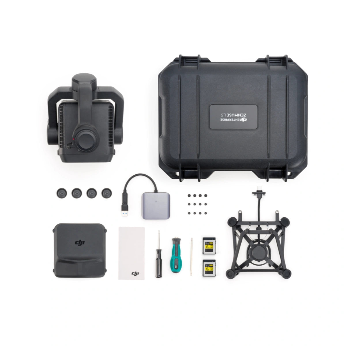
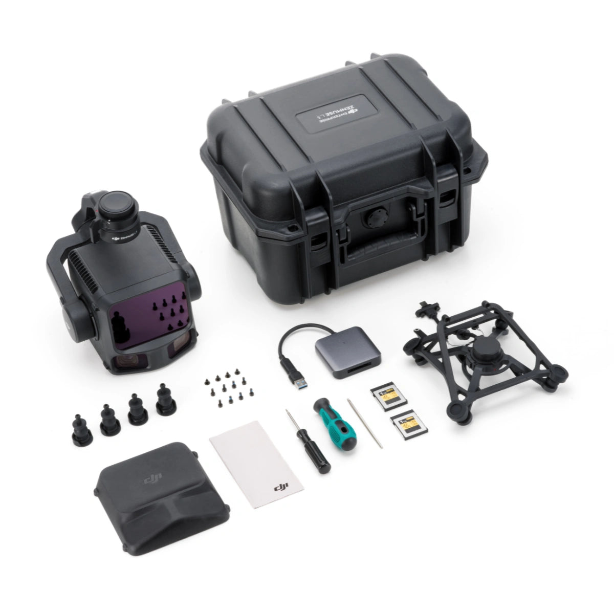
- In the Box
- FAQ
DJI Zenmuse L3 with DSLRPros Care Plus: advanced LiDAR mapping and high-resolution RGB imaging
The DJI Zenmuse L3 is a long-range LiDAR and dual 100 MP RGB mapping payload built for teams that require precise 3D data across varied terrain. Designed for the Matrice 400 Series, it integrates a 1535 nm LiDAR module, high-resolution imaging, and a tightly synchronized POS system to deliver accurate, high-density point clouds and detailed RGB coverage.
This package includes the complete hardware kit plus DSLRPros Care Plus, adding 13-month accidental-damage coverage for dependable, risk-managed enterprise deployment across diverse field environments.
Technical capabilities and operational strengths
- Long-range LiDAR detects up to 950 meters for reliable terrain scanning.
- Dual 100 MP cameras deliver detailed mapping with broad image coverage.
- Mechanical shutter minimizes distortion during high-precision mapping flights.
- Integrated POS system supports centimeter-level accuracy with RTK correction.
- Wide 107-degree horizontal FOV reduces required flight passes significantly.
- Multiple LiDAR scan modes optimize data density for varying terrain conditions.
- IP54-rated construction withstands dust and light rain for field reliability.
- CFexpress Type B media supports stable logging of large LiDAR datasets.
- Rapid capture intervals improve productivity on extensive mapping operations.
- Full DJI software ecosystem streamlines planning, capture, and processing tasks.
High-performance LiDAR and imaging optimized for efficient field acquisition
The L3’s LiDAR enables detection up to 950 m at 10 percent reflectivity and up to 2000 m at higher reflectance, supporting reliable scanning over large survey areas. Its dual 100 MP 4/3 CMOS mapping cameras widen the horizontal field of view to 107 degrees, reducing the number of required flight lines.
Mechanical and electronic shutters enable clean, distortion-controlled imagery, while CFexpress Type B storage provides rapid data handling. With scanning modes including linear, star-shaped, and non-repetitive patterns, and pulse rates ranging from 240–480 kHz depending on DJI’s mode specifications, the L3 meets the demands of intensive geospatial workflows.
Precision, environmental resilience, and structured operational protection
The payload’s integrated POS system supports centimeter-level accuracy when paired with RTK correction, enabling survey-grade deliverables with consistent alignment. IP54 ingress protection and a –20 °C to 50 °C operating range support reliable operation year-round.
DSLRPros Care Plus enhances operational continuity by covering accidental damage from collisions, drops, water exposure, interference, and internal failures for 13 months, including one eligible replacement. This protection limits downtime and supports professional deployment schedules requiring consistent readiness.
System compatibility and data workflow integration
- Operates with the Matrice 400 Series using the included single-port gimbal mount.
- RTK and PPK workflows supported through DAT, RINEX, RTCM, and OEM formats.
- DJI Pilot 2 enables flight management and real-time capture oversight.
- DJI Terra processes LiDAR and RGB data for reconstruction and modeling.
- DJI Modify refines models through point cloud cleanup and adjustments.
- DJI FlightHub 2 provides cloud-based operational coordination across fleets.
- CFexpress Type B storage integrates into high-throughput data pipelines.
- Standard GIS and engineering software compatible with exported deliverables.
Professional applications across multiple industries
- Topographic surveying: accurate terrain models generated from dense point clouds.
- Infrastructure inspection: structural details captured for roads, bridges, and utilities.
- Construction monitoring: high-resolution mapping for progress and quality tracking.
- Forestry mapping: canopy and ground structure documented through LiDAR penetration.
- Mining and aggregates: volume analysis and slope monitoring for operational planning.
- Government planning: geospatial documentation for land management initiatives.
- Emergency response: rapid 3D modeling of incident locations for situational awareness.
- Corridor mapping: efficient surveying of powerlines, railways, and pipelines.
- Environmental assessment: terrain and surface models for hydrology and restoration.
- Asset documentation: detailed geometry records for maintenance and compliance needs.
Designed for enterprise-grade reliability and operation
The Zenmuse L3 is engineered for demanding field conditions, balancing environmental durability with precise sensor alignment and high data throughput. By combining LiDAR, dual-camera imaging, and positional accuracy tools in one stabilized payload, it simplifies mission planning and reduces equipment complexity.
DSLRPros Care Plus adds structured operational protection, ensuring teams can maintain continuity and respond effectively to field challenges throughout the coverage period.
The Zenmuse L3 with DSLRPros Care Plus delivers accurate LiDAR mapping, wide-area RGB capture, and essential deployment protection for organizations requiring dependable geospatial data. DSLRPros provides expert support and guidance for enterprise operations.
Available now from DSLRPros. Purchase today to equip your team with proven aerial performance.
