


DJI Matrice 400
DJI Matrice 400
SKU:S-DJI-M400


- Description
- Specifications
- In the Box
- FAQ
DJI Matrice 400: Enterprise Flagship Drone Platform With 59-Minute Flight Time and Power-Line-Level Obstacle Sensing
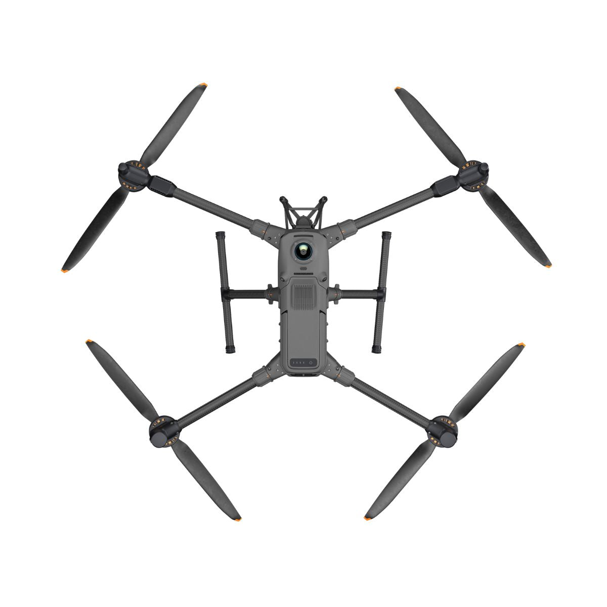
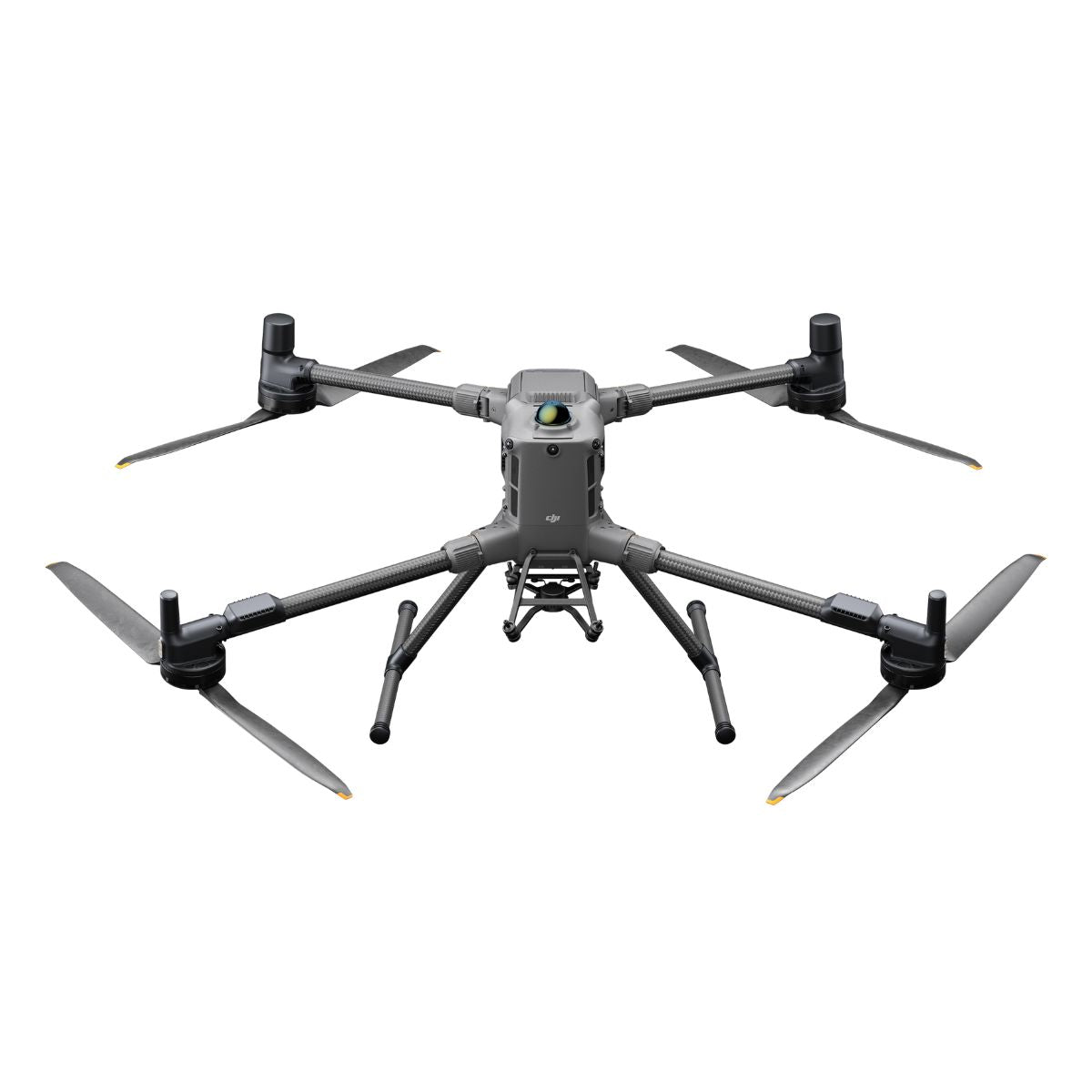
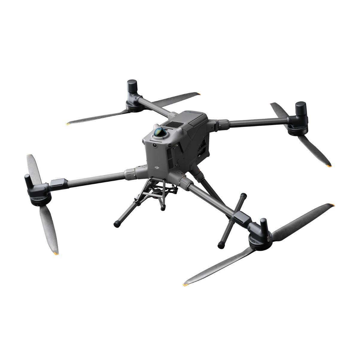
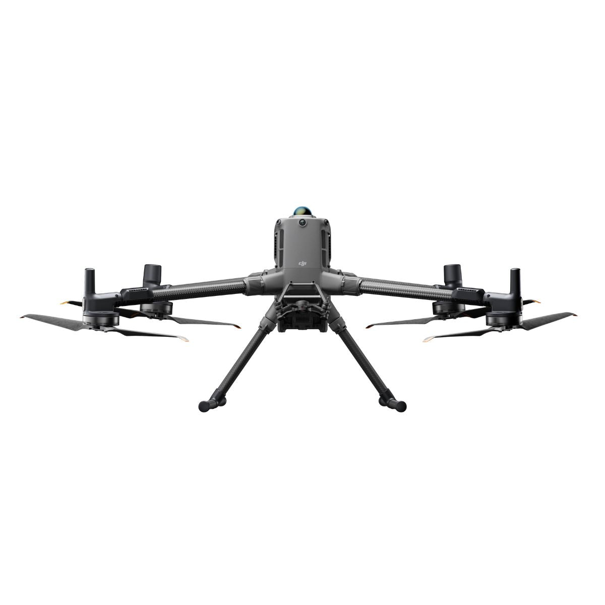
The DJI Matrice 400 is DJI's most capable enterprise drone platform to date — a purpose-built heavy-lift aircraft engineered for the most demanding professional applications.
With a 6 kg payload capacity, 59-minute forward flight time, and an obstacle sensing system that fuses rotating LiDAR, six-direction mmWave radar, and full-color fisheye vision sensors, the M400 operates at a level of mission capability and environmental awareness that previous platforms in its class could not reach.
Released in June 2025, it represents a significant leap over its predecessor—nearly 50% longer effective flight time, double the transmission range, and a sensing suite capable of detecting overhead power lines at speeds up to 25 m/s.
Key Features and Benefits
- 59-minute flight time: forward flight endurance measured with H30T payload at sea level.
- 6 kg payload capacity: supports up to seven simultaneous payloads via four E-Port V2 ports.
- Rotating LiDAR: 360° horizontal, 58° vertical FOV with 520,000 points/second point frequency.
- mmWave radar: six-direction sensing detects power lines up to 50 m in all-weather conditions.
- 40 km transmission: O4 Enterprise Enhanced system delivers 3-channel 1080p live view at range.
- Airborne relay: built-in module allows one M400 to relay signal for a second M400.
- IP55 protection: operational in rain, dust, and temperatures from -20°C to 50°C.
- 7,000 m ceiling: max takeoff altitude supports high-elevation and mountainous terrain operations.
- ADS-B In: standard dual-antenna airborne receiver with detection range up to 20 km.
- RTK positioning: 1 cm + 1 ppm horizontal accuracy with microsecond-level synchronization.
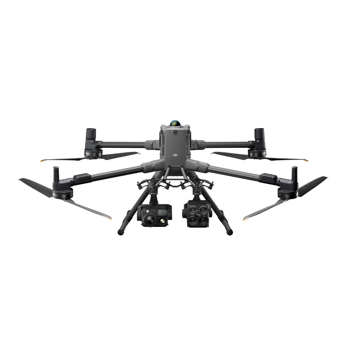
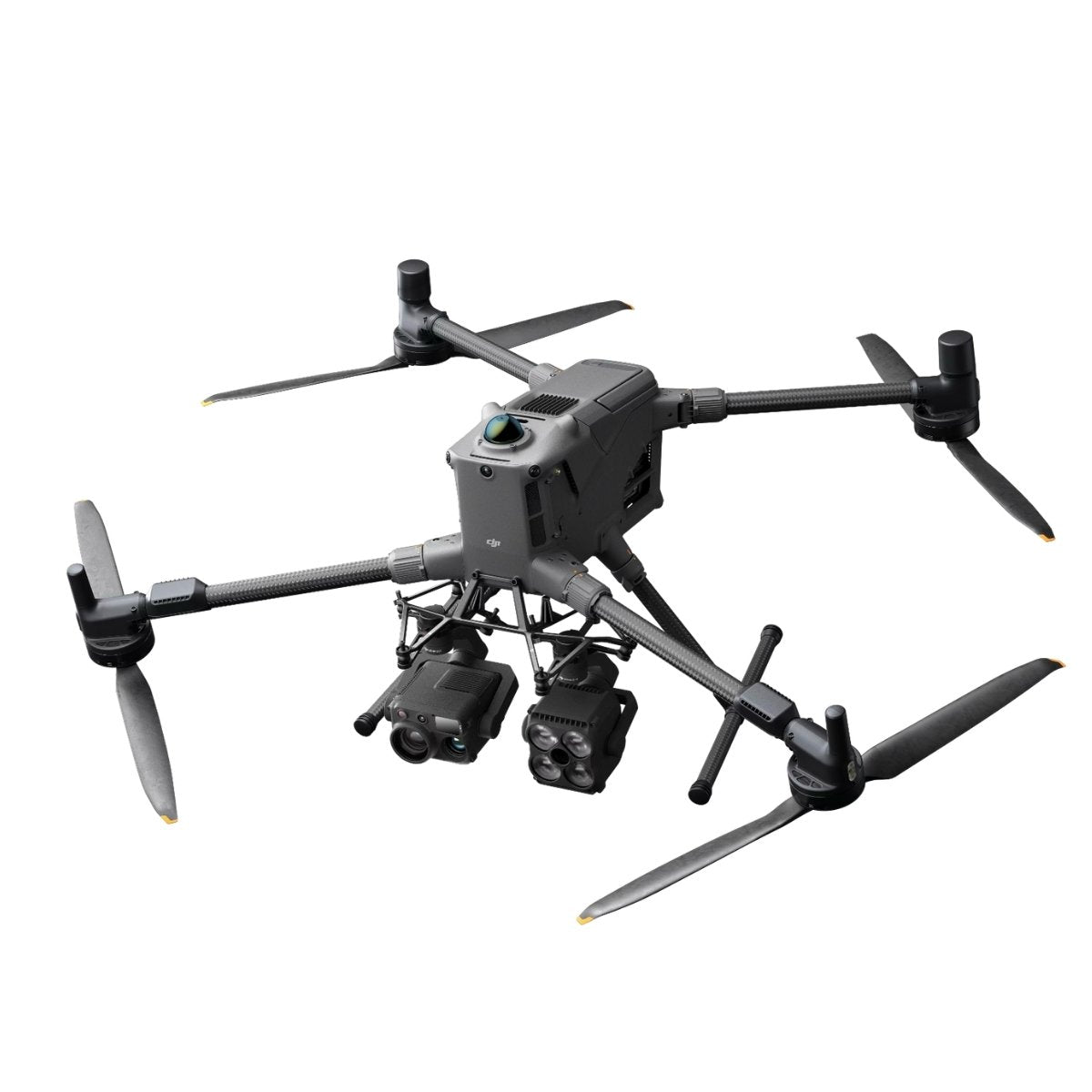
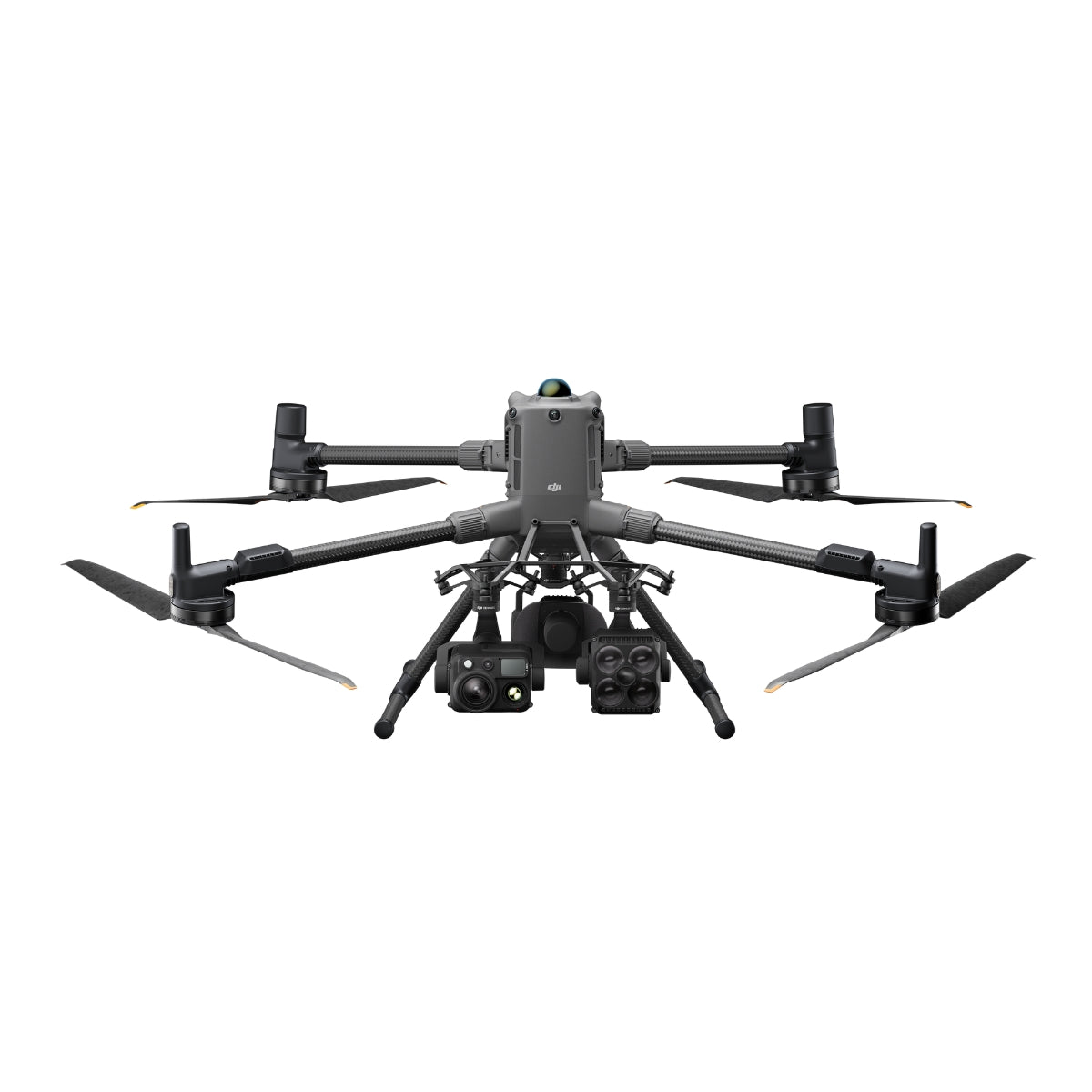
The M400's versatility is built into its architecture. Four external E-Port V2 ports allow up to seven payloads to be mounted simultaneously, supporting flexible single or dual downward gimbal configurations alongside topside accessories.
The DJI O4 Enterprise Enhanced Video Transmission system delivers 3-channel 1080p/30fps live view at up to 40 km (FCC) — double the range of the O3 system — and the built-in airborne relay module allows one M400 to extend signal coverage for a second M400 operating in obstructed terrain.
Compatible with Zenmuse H30, H30T, L2, L3, and P1 payloads, and supported by DJI Pilot 2, FlightHub 2, and full SDK access, the M400 is the platform that professional operators deploy when the mission cannot afford a compromise. Batteries and battery station are sold separately.
Sensing That Holds Up at Mission Speed
The M400's obstacle sensing system is built around a requirement that most enterprise drones cannot meet: detecting overhead power lines while flying at operational speed. The horizontal rotating LiDAR covers a full 360° field of view with 58° vertical coverage, generating 520,000 points per second to produce high-precision 3D environmental maps in real time—including in total darkness.
The six-direction mmWave radar adds all-weather penetration capability, detecting 12 mm distribution lines at 36 m and 21.6 mm main lines at 50 m through rain, fog, and snow. Four full-color low-light fisheye vision sensors complete the picture with rich color, shape, and texture data for comprehensive flight assist displays.
Together, this sensing fusion enables power line obstacle avoidance at speeds up to 25 m/s — a capability level that previously required much larger, more complex aircraft. Note that mmWave radar availability may vary by country or region.

Compatibility and System Integration
- Zenmuse H30 and H30T: all-weather multi-sensor payload with wide-angle, zoom, thermal, laser rangefinder, and NIR auxiliary light.
- Zenmuse L2: LiDAR payload with frame-based LiDAR, high-accuracy IMU, and 4/3 CMOS RGB mapping camera.
- Zenmuse L3: compatible LiDAR payload for geospatial data collection missions.
- Zenmuse P1: full-frame photogrammetry payload with interchangeable fixed-focus lenses on 3-axis gimbal.
- D-RTK 3 Multifunctional Station and D-RTK 2 Mobile Station: RTK correction sources for centimeter-level positioning.
- DJI Cellular Dongle 2: dual-dongle support for automatic carrier network switching in remote or interference-prone areas.
- DJI FlightHub 2: remote fleet management, mission control, and payload operation from a centralized platform.

Applications and Use Cases
- Power line inspection: rotating LiDAR and mmWave radar detect lines and structures at operational speed.
- Emergency response and search and rescue: 59-minute endurance and thermal imaging support extended aerial operations.
- Large-scale mapping and surveying: Zenmuse P1 and L2 payloads deliver photogrammetry and LiDAR data at scale.
- Firefighting and disaster response: IP55 protection and -20°C to 50°C operating range sustain operations in harsh conditions.
- Maritime and offshore inspection: ship-based takeoff from static vessels and landing on moving vessels at up to 10 knots.
- Engineering and construction monitoring: dual gimbal configuration and multi-payload support enable comprehensive site documentation.
- Long-range corridor inspection: 40 km O4 transmission and airborne relay expand operational range across obstructed terrain.
The DJI Matrice 400 exists because professional operators in power inspection, emergency response, and large-scale surveying need a platform that does not require them to choose between endurance, payload capability, sensing accuracy, and transmission range. At 59 minutes of flight time, 6 kg of payload capacity, and a sensing system capable of detecting power lines at 25 m/s, the M400 delivers all four — in a single deployable aircraft.
DSLRPros has supported enterprise UAV operators across inspection, public safety, and geospatial workflows for decades, and the DJI Matrice 400 is the platform that serious operations have been waiting for.
When you configure your M400 through DSLRPros, you get the product expertise and lifecycle support to match the right payload combination to your specific mission requirements.
Contact DSLRPros today to discuss configuration, payload selection, or fleet procurement.
