


Why Use a LiDAR Camera for Drone Work
LiDAR—Light Detection and Ranging—uses laser pulses to measure distances with precision. When mounted on UAVs, LiDAR sensors offer an efficient and safe way to capture detailed elevation and topography data from above. Drone LiDAR cameras support professionals in construction, energy, forestry, and public safety.
Benefits of Drone-Mounted LiDAR
-
Survey wide areas fast
Map large zones in one flight—ideal for corridor or terrain scanning. -
Centimeter-level precision
Capture accurate point clouds with real-world use cases in mind. -
Works in complex terrain
Penetrates tree canopy and adapts to urban clutter. -
Reduces cost and labor
Fewer field crews, fewer delays, and more usable data.
Commercial Drone LiDAR Systems We Carry
Our collection includes LiDAR systems built for airborne UAV, handheld, and compact field applications. Each is compatible with high-end enterprise drones or workflows.
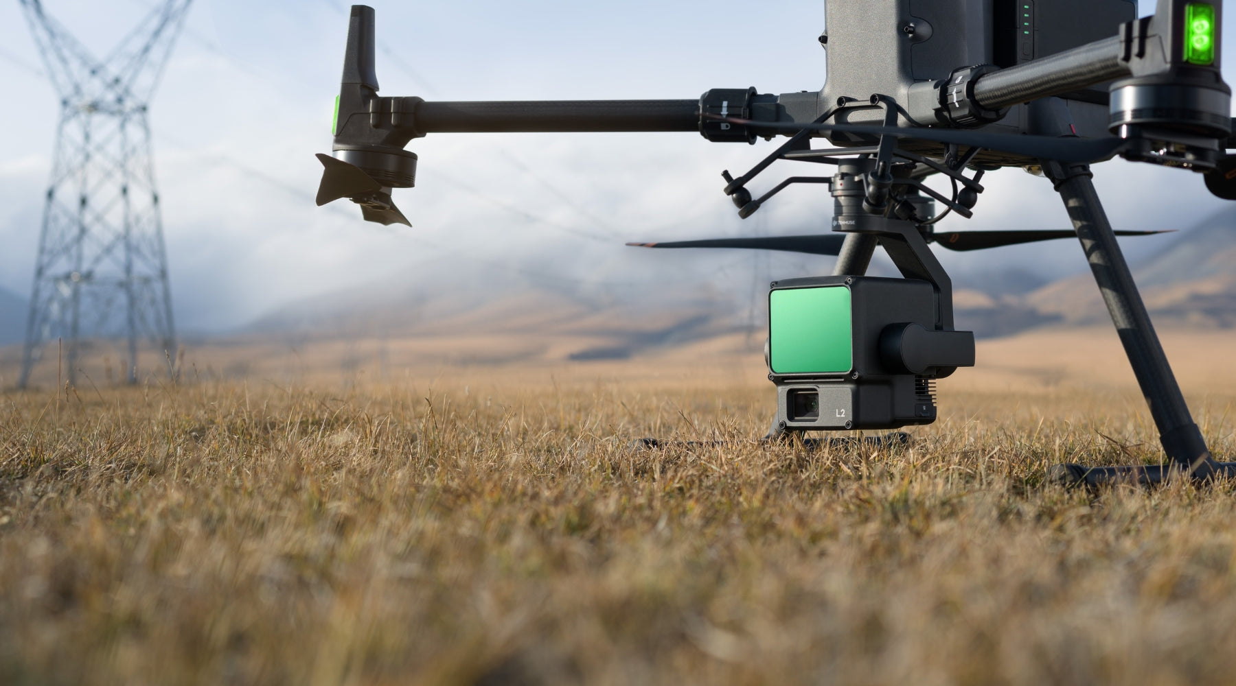
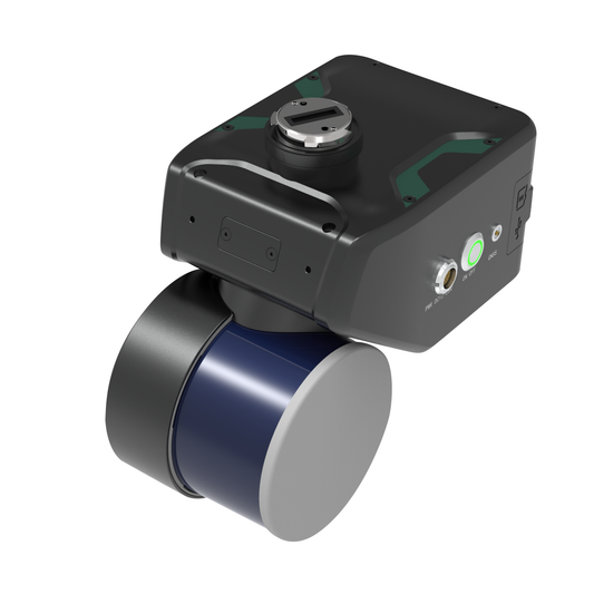
DJI Zenmuse L2: A drone-mounted LiDAR camera that integrates with DJI Matrice 300/350 RTK. Delivers up to 450m detection range, 5 returns per pulse, and real-time RGB fusion.
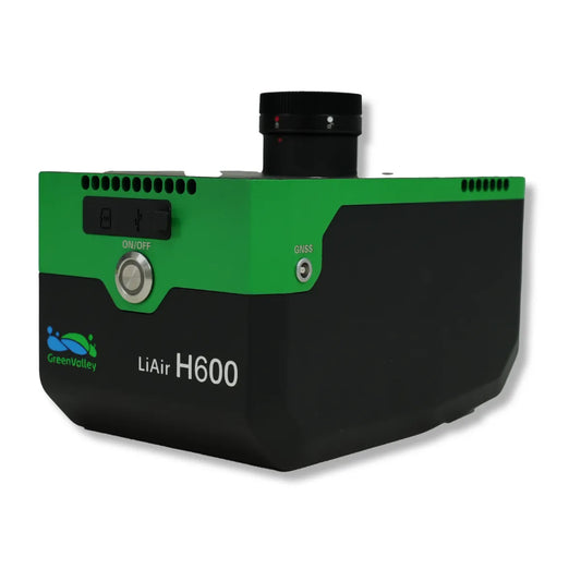
GreenValley LiAir H800 UAV LiDAR System: A heavy-lift airborne LiDAR solution for demanding corridor mapping and wide-area scanning. Features high-density point cloud capture and advanced GNSS/INS integration.
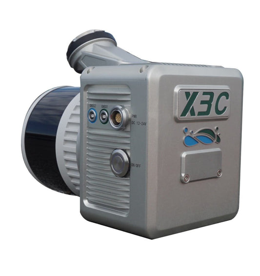
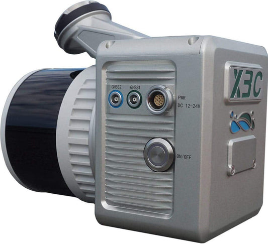
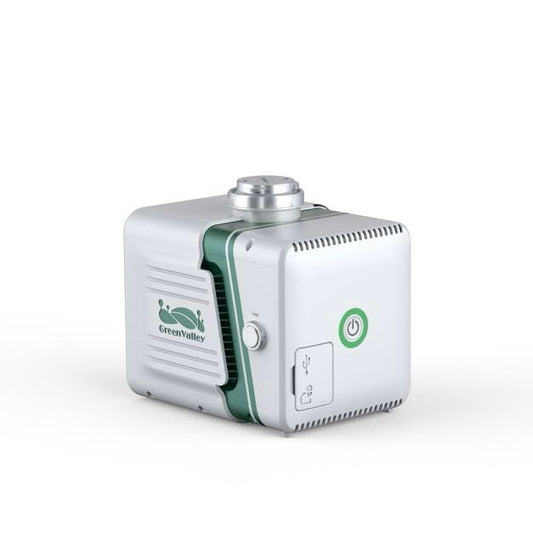
GreenValley LiAir X3C-H Compact UAV LiDAR System: A lightweight LiDAR payload ideal for smaller UAVs and tighter airframes. Delivers solid mapping performance without adding excessive weight.
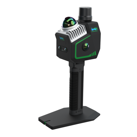
GreenValley LiAirX3-H Airborne Laser Scanning: A high-performance airborne LiDAR sensor with integrated color camera. Well-suited for 3D city modeling, forestry, and mine surveying.
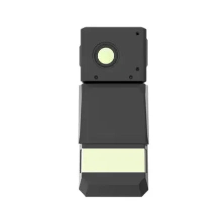
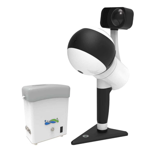
GreenValley LiGrip H300 Handheld Laser Scanning: A portable LiDAR unit for ground-level capture. Use it to supplement aerial scans in tight or indoor environments. Delivers real-time SLAM mapping.
What These Systems Solve
- Slow, outdated field workflows
- Poor performance in low-light or vegetated areas
- Manual data stitching and post-processing hassles
- Inconsistent accuracy from photogrammetry alone
With drone-mounted and handheld LiDAR options, our lineup addresses all the above—whether you're scanning dense forests, construction sites, or inaccessible structures.
Use Cases for UAV LiDAR Sensor Payloads
Drone LiDAR systems support:
- Construction & Infrastructure: LiDAR supports precise site planning, elevation mapping, and tracking progress to reduce errors and costs.
- Environmental & Forestry: Enables monitoring of forest health, water flow, and canopy metrics for conservation efforts.
- Disaster Management: Rapidly maps affected zones, delivering vital data for rescue and recovery operations.
- Urban Planning: Provides accurate 3D city models to guide land use, infrastructure, and environmental planning.
- Agriculture & Land Use: Enhances crop monitoring, irrigation planning, and erosion control for better productivity.
Specs Comparison Table
| Product | Platform | Max Range | Returns | Camera | Use Case |
|---|---|---|---|---|---|
| DJI Zenmuse L2 | DJI M300/M350 RTK | 450m | 5 | 4/3 CMOS | General UAV LiDAR mapping |
| LiAir H800 | Heavy-lift UAVs | 800m+ | 5+ | Optional | Long-range corridor scanning |
| LiAir X3C-H | Compact UAVs | 300m | 3–5 | Optional | Lightweight drone integration |
| LiAirX3-H | Midsize UAVs | 500m | 5 | Integrated RGB | Urban, forestry, mining |
| LiGrip H300 | Handheld | 100m | SLAM | N/A | Interior/ground scan supplement |
Shop Drone LiDAR Surveying Solutions
Browse our collection of drone LiDAR cameras and UAV LiDAR sensor payloads for professional mapping and inspection. Need LiDAR camera accessories for drones? We’ve got compatible mounts, cables, and support gear.
Build a LiDAR-equipped UAV system with the tools that meet real field demands.
Frequently Asked Questions
What is a drone LiDAR camera used for?
Captures 3D terrain data for construction, forestry, urban planning, and emergency response. Faster and more detailed than ground-based survey tools.
How accurate is UAV LiDAR?
Systems like the Zenmuse L2 and LiAir H800 provide centimeter-level accuracy, verified through GNSS and onboard IMUs.
Are all drone LiDAR cameras compatible with DJI drones?
The Zenmuse L2 is built for DJI platforms. GreenValley systems offer broader integration but may require custom mounts.
How is LiDAR better than photogrammetry?
LiDAR works in vegetation and low-light. It’s more accurate for elevation modeling and complex topography.
What is the cost range of these systems?
Drone LiDAR setups typically range from $13,000 to over $40,000 depending on range, accuracy, and platform compatibility.
Not sure which LiDAR system fits your field conditions? Talk to the experts at DSLRPros. We'll get you the right tool for the job.

