Skip to product information
1 of 1

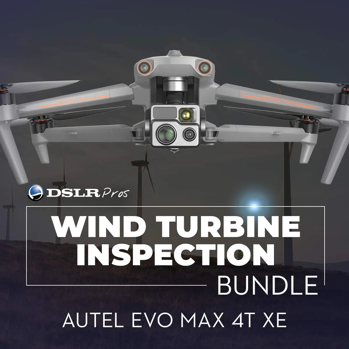
DSLRPros Wind Turbine Inspection Bundle

DSLRPros Wind Turbine Inspection Bundle

Regular price $5,699.00
Regular price Sale price $5,699.00
Sale Sold out
Shipping calculated at checkout.

SKU:B-NB-WTI

  • Multi-sensor imaging supports detailed wind turbine inspections
  • Thermal camera enables 640 × 512 radiometric infrared analysis
  • Telephoto camera supports up to 10× optical and 160× hybrid zoom
  • Up to 42 minutes flight time supports multi-turbine inspections
  • SLAM-based navigation supports stable flight near tall structures
  • 720° obstacle avoidance enhances safety during close-proximity flights
  • IP43-rated airframe supports outdoor turbine inspection environments
  • Bundle can be customized for specific wind inspection needs

1 total reviews

View full details
  • Description
  • Specifications
  • In the Box
  • FAQ

Wind turbine inspection drone bundle with EVO Max 4T XE: precision aerial assessment for vertical assets

The DSLRPros Wind Turbine Inspection Bundle featuring the EVO Max 4T XE is a professional aerial inspection solution designed for assessing wind turbine blades, towers, and nacelles. Built around the EVO Max 4T XE aircraft, this bundle is supplied as a new, inspection-ready configuration for energy operators, service providers, and maintenance teams responsible for large-scale wind assets.

The system combines high-resolution visual imaging, radiometric thermal analysis, autonomous navigation, and extended flight endurance to support safe, repeatable turbine inspection workflows.

System highlights for wind turbine inspection operations

  • Multi-sensor imaging system combines 48 MP visual and thermal cameras.
  • Thermal camera supports 640 × 512 radiometric infrared inspections.
  • Telephoto camera provides up to 10× optical and 160× hybrid zoom.
  • Maximum flight time up to 42 minutes supports extended inspection missions.
  • SLAM-based navigation supports stable flight near tall vertical structures.
  • 720° omnidirectional obstacle avoidance enhances close-proximity flight safety.
  • IP43-rated airframe supports operation in outdoor inspection environments.
  • Long-range transmission supports inspection across large wind farm sites.

Multi-sensor imaging optimized for turbine blade and nacelle inspection

The EVO Max 4T XE integrates a multi-sensor imaging system combining a 48 MP wide camera, a 48 MP telephoto camera, and a radiometric thermal camera into a single stabilized payload. The thermal camera supports 640 × 512 infrared resolution with radiometric data capture, enabling detection of temperature anomalies associated with electrical components, bearing issues, or blade defects.

The telephoto camera provides up to 10× optical zoom and up to 160× hybrid zoom, allowing inspectors to capture detailed imagery of blades and nacelles while maintaining safe stand-off distances.

Autonomous navigation and endurance for complex vertical structures

Wind turbine inspections demand precise positioning around tall, narrow structures. The EVO Max 4T XE uses SLAM-based visual navigation to maintain stable flight in environments where GNSS accuracy may be reduced near towers and blades.

The aircraft features 720° omnidirectional obstacle avoidance to support safe flight close to turbine structures. With a maximum flight time of up to 42 minutes, the platform enables efficient inspection of multiple turbines per sortie while minimizing battery changes and downtime.

Platform compatibility and operational integration

  • Includes EVO Max 4T XE aircraft with integrated imaging payload.
  • Uses Autel intelligent flight batteries for extended inspection operations.
  • Supports Autel enterprise flight control and mission planning software.
  • Captures radiometric thermal and high-resolution visual inspection data.
  • Integrates into professional wind asset inspection reporting workflows.

Wind energy inspection and maintenance applications

  • Wind turbine blade inspection to identify cracks, erosion, or surface damage.
  • Nacelle inspection for thermal anomalies and mechanical irregularities.
  • Tower inspection for structural defects and corrosion assessment.
  • Preventive maintenance planning using aerial inspection datasets.
  • Post-installation inspection of newly commissioned turbines.
  • Safety inspections without rope access or turbine shutdowns.
  • Rapid assessment following extreme weather events.
  • Documentation for compliance and long-term asset monitoring.

Designed for enterprise inspection reliability

This bundle is engineered for energy professionals who require dependable aerial diagnostics and consistent data quality around complex vertical assets. The combination of radiometric thermal imaging, high-resolution zoom, and autonomous navigation supports efficient turbine inspection workflows while reducing risk to personnel.

The bundle can be further customized based on customer requirements, allowing teams to tailor batteries, accessories, and support services to specific inspection programs.

The DSLRPros Wind Turbine Inspection Bundle with EVO Max 4T XE delivers a practical, inspection-focused aerial solution for wind energy operations. Backed by DSLRPros integration expertise and post-sale support, it enables teams to deploy with confidence and scale turbine inspection programs efficiently.

Available now from DSLRPros. Purchase today to improve the safety and efficiency of your wind turbine inspections.

Aircraft

  • Weight (battery & propellers included): 1640 g (3.62 lbs, ABX40 smart battery, Fusion 4T gimbal, and propellers included)
  • Maximum take-off mass: 1999 g (4.41 lbs)
  • Maximum take-off mass (for C2 certification in EU): 1890 g (4.17 lbs)
  • Dimensions:

    562 × 651 × 147 mm (unfolded, incl. propellers)
    318 × 400 × 147 mm (unfolded, excl. propellers)
    257 × 145 × 131 mm (folded, excl. propellers)

  • Diagonal wheelbase: 466 mm (1.53 ft)
  • Propeller dimension: 11 inches
  • Propeller weight: 10.5 g
  • Maximum propeller rotational speed: 8000 RPM
  • Maximum ascent speed:

    Slow: 3 m/s
    Smooth: 5 m/s
    Standard: 6 m/s
    Ludicrous: 8 m/s

  • Maximum descent speed:

    Slow: 3 m/s
    Smooth: 5 m/s
    Standard: 6 m/s
    Ludicrous: 6 m/s

  • Maximum horizontal flight speed (windless near sea level):

    Slow: 3 m/s
    Smooth: 10 m/s
    Standard: 15 m/s (forward & backward), 10 m/s (sidewards)
    Ludicrous: 23 m/s (forward), 18 m/s (backward), 20 m/s (sidewards)

  • Maximum service ceiling above sea level:

    4000 m (13,123 ft) using ABX40 smart battery
    3000 m (9,843 ft) using ABX41 smart battery

  • Maximum flight altitude: 800 m (2625 ft) (altitude limit in app)
  • Maximum flight time (windless): 42 minutes
  • Maximum hovering time (windless): 38 minutes
  • Maximum wind resistance: 12 m/s (27 mph)
  • IP rating: IP43 (custom service)
  • Maximum tilt angle:

    Slow: 10°
    Smooth: 30°
    Standard: 30°
    Ludicrous: 36°

  • Maximum angular velocity:

    Pitch axis: 300°/s
    Heading axis: 120°/s

  • Operating temperature: -20°C to 50°C (-4°F to 122°F)
  • Internal storage: 128 GB (64 GB available, varies with firmware versions)
  • Wi-Fi operating frequency:

    2.4G: 2.400–2.476 GHz, 2.400–2.4835 GHz
    5.2G: 5.15-5.25 GHz (only FCC, CE, and UKCA regions), 5.17-5.25 GHz (only Germany)
    5.8G: 5.725-5.829 GHz, 5.725-5.850 GHz

    Note: Some frequencies are only applicable in certain regions or only for indoor use. Refer to local laws and regulations.
  • GNSS: GPS, Galileo, BeiDou, GLONASS
  • Wi-Fi effective isotropic radiated power (EIRP):

    2.4G: ≤30 dBm (FCC), ≤20 dBm (CE/SRRC/UKCA), ≤12.14 dBm (MIC)
    5.2G: ≤30 dBm (FCC), ≤23 dBm (CE/UKCA)
    5.8G: ≤30 dBm (FCC/SRRC), ≤14 dBm (CE/UKCA)

  • Hovering accuracy:

    Vertically: ±0.1 m (vision systems working normally), ±0.5 m (GNSS working normally)
    Horizontally: ±0.3 m (vision systems working normally), ±0.5 m (GNSS working normally)

  • Wi-Fi protocol: 802.11a/b/g/n/ac/ax (supports 2x2 MIMO Wi-Fi)

Gimbal

  • Mechanical range:

    Fusion 4T XE Gimbal: Pitch: -135° to 45°, Yaw: -45° to 45°, Roll: -45° to 45°
    Fusion 4T Gimbal: Pitch: -135° to 45°, Yaw: -45° to 45°, Roll: -45° to 45°
    Fusion 4N Gimbal: Pitch: -135° to 45°, Yaw: -50° to 50°, Roll: -45° to 45°

  • Controllable range: Pitch: -90° to 30°
  • Stabilization system: 3-axis mechanical gimbal (pitch, yaw, roll)
  • Max control speed (pitch): 100º/s
  • Angular vibration range: < 0.005°

EVO Max 4T XE Zoom Camera

  • Sensor: 1/2" CMOS, 48M effective pixels
  • Lens: Focal length: 11.8-43.3 mm, 35 mm equivalent: 64-234 mm, Aperture: f/2.8-f/4.8, Focusing distance: 5 m ~ ∞
  • ISO range:

    Normal mode: Auto: ISO 100 ~ ISO 6400, Manual: Photo: ISO 100 ~ ISO 6400

  • Shutter speed: 1/8 s ~ 1/10000 s
  • Digital zoom: 2.7-10x continuous optical zoom, 160x hybrid zoom
  • Max photo resolution: JPG: 4000 × 3000, 8192 × 6144, DNG: 4000 × 3000
  • Max video resolution: 4000 × 3000 30P

EVO Max 4T XE Infrared Thermal Imaging Camera

  • Image sensor: Uncooled VOx Microbolometer
  • Lens: FOV: 61°, Focal length: 9.1 mm, Aperture: f/1.0, Focusing distance: 2.2 m ~ ∞
  • Radiometric measurement accuracy: ±2°C or ±2% of reading (using the larger value) @ ambient temperature range -20°C to 60°C (-4°F to 140°F)
  • Video resolution: 640 × 512 30P
  • Photo size: 640 × 512
  • Pixel pitch: 12 µm
  • Radiometric measurement methods: Center measurement, spot measurement, rectangular measurement
  • Temperature measurement range: -20°C to 150°C (-4°F to 302°F), 0°C to 550°C (32°F to 1022°F)
  • Temperature alert: High and low-temperature alarm thresholds, reporting coordinates and temperature values
  • Palette: White Hot, Black Hot, Ironbow, Rainbow

Laser Rangefinder

  • Wavelength: 905 nm
  • Measurement accuracy: ±(1 m + D×0.15%) where D is the distance to a vertical reflecting plane
  • Measuring range: 5 - 1200 m

Wide Angle Camera

  • Image sensor: 1/1.28" CMOS, 50M effective pixels
  • Lens: DFOV: 85°, Focal length: 4.5 mm (equivalent: 23 mm), Aperture: f/1.9, AF motor: 8-line SMA, PDAF focusing, Focusing distance: 1 m ~ ∞
  • ISO range:

    Auto: Photo: ISO 100 ~ ISO 6400, Video: ISO 100 ~ ISO 64000, Night mode: up to ISO 64000
    Manual: Photo: ISO 100 ~ ISO 12800, Video: ISO 100 ~ ISO 64000

  • Shutter speed: Photo: 0.5 s ~ 1/8000 s, Video: 1/30 s ~ 1/8000 s
  • Video resolution: 4000 × 3000 30P
  • Video format: MP4
  • Max bit rate: 70 Mbps
  • Photo size: 4000 × 3000 (default), 8000 × 6000
  • Photo format: JPG

Image Transmission

  • Operating frequency:

    900M: 902-928 MHz*
    2.4G: 2.400–2.476 GHz**, 2.400–2.4835 GHz
    5.2G: 5.15-5.25 GHz***, 5.17-5.25 GHz****
    5.8G: 5.725-5.829 GHz**, 5.725-5.850 GHz

    *Only applicable to FCC and ISED regions. **Only applicable to SRRC regions. ***Only applicable to FCC, CE, and UKCA regions. ****Only applies to Germany.
  • Max transmission distance (without interference and blocking):

    FCC: 15 km
    CE: 8 km

  • Independent networking: Autel Smart Controller V3
  • Effective isotropic radiated power (EIRP):

    900M: ≤30 dBm (FCC/ISED)
    2.4G: ≤30 dBm (FCC/ISED), ≤20 dBm (CE/SRRC/UKCA)
    5.8G: ≤30 dBm (FCC/ISED/SRRC), ≤14 dBm (CE/UKCA)

Millimeter-Wave Radar Sensing System

  • Operating frequency:

    60G: 60 - 64 GHz
    24G: 24.0 - 24.25 GHz

  • Effective isotropic radiated power (EIRP):

    60G: ≤20 dBm (CE/UKCA/FCC)
    24G: ≤20 mW (SRRC)

  • Sensing range:

    60G millimeter-wave radar:

    Upward: 0.3 - 20 m
    Downward: 0.15 - 80 m
    Forward & backward: 0.3 - 50 m


    24G millimeter-wave radar:

    Downward: 0.8 - 12 m


  • FOV: Horizontal (6 dB): ±60°/±22° (60 GHz/24 GHz), Vertical (6 dB): ±30°/±20° (60 GHz/24 GHz)
  • Operating environment:

    60 GHz millimeter-wave radar sensing system: Supports all-weather obstacle avoidance for glass, water, wires, buildings, and trees in 4 directions. The obstacle avoidance distance varies with the obstacle's ability to reflect electromagnetic waves and its surface size.
    24 GHz millimeter-wave radar sensing system: Supports downward sensing, and its sensing range varies depending on the ground material. For example, the sensing range on cement is 12 m, while grass with a thickness of more than 3 cm reduces the range to less than 6 m.

Aircraft version limitations*

  • To comply with (national) regional regulations, certain aircraft versions use a 24 GHz millimeter-wave radar in the downward direction and 60 GHz radars in the forward, backward, and upward directions.
  • In the 24 GHz aircraft version, the 60 GHz radars in the forward, backward, and upward directions are disabled in the flight software at the factory. Only the 24 GHz radar in the downward direction is enabled to assist in landing.
  • The 24 GHz aircraft version only supports visual obstacle avoidance under good lighting conditions and does not support millimeter-wave radar obstacle avoidance at night.

Visual obstacle avoidance sensing system

  • Sensing range:

    Forward: 19.7 - 1220.5 in (0.5 - 31 m)
    Backward: 19.7 - 984.3 in (0.5 - 25 m)
    Sideward: 19.7 - 1023.6 in (0.5 - 26 m)
    Upward: 0.66 - 85.3 ft (0.2 - 26 m)
    Downward: 0.98 - 75.5 ft (0.3 - 23 m)

  • FOV:

    Forward/backward sensor: 60° (horizontal), 80° (vertical)
    Upward/downward sensor: 180° (sideward), 120° (forward & backward)

  • Operating environment:

    Forward, backward, sideward, and upward: Surface with rich texture, under sufficient lighting (>15 lux, normal indoor fluorescent lighting environment)
    Downward: Diffuse surface with a reflectivity >20% (walls, trees, humans, etc.), under sufficient lighting (>15 lux, normal indoor fluorescent lighting environment)

Radar and visual obstacle avoidance sensing systems

  • Sensing range:

    Forward & backward: 0.3 - 50 m
    Sidewards: 0.5 - 26 m
    Upward: 0.2 - 26 m
    Downward: 0.15 - 80 m (60 GHz millimeter-wave radar)

  • FOV:

    Forward & backward: 120° (horizontal), 80° (vertical)
    Upward: 180° (sideward), 120° (forward & backward)
    Downward: 180° (sideward), 120° (forward & backward)

  • Operating environment:

    Forward, backward, upward, and downward: Supports all-weather obstacle avoidance for various conditions, including water, forests, buildings, and high voltage lines. At least one of the two conditions should be met: sufficient lighting or the obstacle has a strong reflection ability to electromagnetic waves.
    Sidewards: Surface with rich texture, under sufficient lighting (>15 lux, normal indoor fluorescent lighting environment).

Autel smart controller V3

  • Display:

    Dimensions: 7.9 inches
    Maximum brightness: 2000 nits
    Resolution: 2048 × 1536
    Refresh rate: 60 Hz

  • Battery:

    Battery type: Li-Po 3S
    Rated capacity: 5800 mAh
    Voltage: 11.55 V
    Battery energy: 67 Wh
    Charging time: 120 minutes

  • Operating time: 2.5 hours (max brightness), 4.0 hours (50% brightness)
  • Maximum transmission distance (without interference and blocking):

    FCC: 15 km (9.3 miles)
    CE/SRRC: 8 km (4.9 miles)

  • IP rating: IP43
  • Internal storage: 128 GB
  • GNSS: GPS, GLONASS, Galileo, BeiDou
  • Operating temperature: -4°F to 104°F (-20°C to 40°C)
  • Wi-Fi protocol: 802.11a/b/g/n/ac (supports 2x2 MIMO Wi-Fi)
  • Wi-Fi operating frequency:

    2.4G: 2.400–2.476 GHz, 2.400–2.4835 GHz
    5.8G: 5.725-5.829 GHz, 5.725-5.850 GHz

    * Only applies to SRRC regionsNote: Some frequencies are only applicable in certain regions or only for indoor use. Refer to local laws and regulations.
  • Wi-Fi effective isotropic radiated power (EIRP):

    2.4G: ≤30 dBm (FCC/ISED); ≤20 dBm (CE/SRRC/UKCA)
    5.8G: ≤30 dBm (FCC/ISED/SRRC); ≤14 dBm (CE/UKCA)

Smart battery

  • Battery dimension: 158.4 × 74.3 × 50.7 mm
  • Operating temperature: -4°F to 113°F (-20°C to 50°C)
  • Rated capacity:

    ABX40: 8070 mAh
    ABX41: 9248 mAh

  • Voltage:

    ABX40: 14.88 V
    ABX41: 14.76 V

  • Battery type: LiPo 4S
  • Battery energy:

    ABX40: 120 Wh
    ABX41: 136.5 Wh

  • Weight:

    ABX40: 1.15 lbs (520 g)
    ABX41: 1.17 lbs (533 g)

  • Battery charge temperature: 41°F to 113°F (5°C to 45°C)

    When the battery temperature is below +5°C, the battery stops charging and activates self-heating.
    When the battery temperature is above +45°C, the battery stops charging.

  • Hot swappable: Supported

  • 1x Autel EVO Max 4 Aircraft
  • 1x Autel EVO Max 4T XE Camera/Gimbal
  • 1x Autel EVO Max 4 Series Intelligent Flight Battery
  • 1x Autel EVO Max 4 Series Gimbal Cover
  • 1x Autel EVO Max 4 Series Battery Charger & Power Cable
  • 3x Autel EVO Max 4 Series Propellers (Pair) x3 (3-CW/3-CCW)
  • 1x Autel Smart Controller V3
  • 1x Autel Smart Controller Lanyard
  • 1x Autel Smart Controller Cover
  • 1x Autel Smart Controller Joysticks (Spare Pair) x1
  • 1x Autel RC Charger
  • 1x Autel RC Charging Cable
  • 1x Autel EVO Max 4 Series Rugged Case
  • 1x 64GB MicroSD Card
  • 1x Screwdriver
  • 1x Data Cable
  • 1x Manual
  • 1x Quick Start Guide
  • 1x Packing List
  • 1x Limited 1-Year Manufacturer Warranty
What drone is included in the Wind Turbine Inspection Bundle?

The bundle includes the EVO Max 4T XE enterprise inspection drone.

Does the EVO Max 4T XE support thermal inspections of turbines?

Yes. The thermal camera captures radiometric infrared data at 640 × 512 resolution.

How does the drone handle inspections near tall turbine structures?

SLAM-based navigation and omnidirectional obstacle avoidance support stable close-proximity flight.

What is the maximum flight time of the EVO Max 4T XE?

The aircraft supports up to 42 minutes of maximum flight time.

Is this bundle suitable for large wind farms?

Yes. The imaging system and endurance are designed for multi-turbine and wind farm inspections.