
S-MICA-REMX
MicaSense RedEdge-MX Multispectral Kit
Estimated delivery
Delivers in 1–5 business days after dispatch
Product Summary
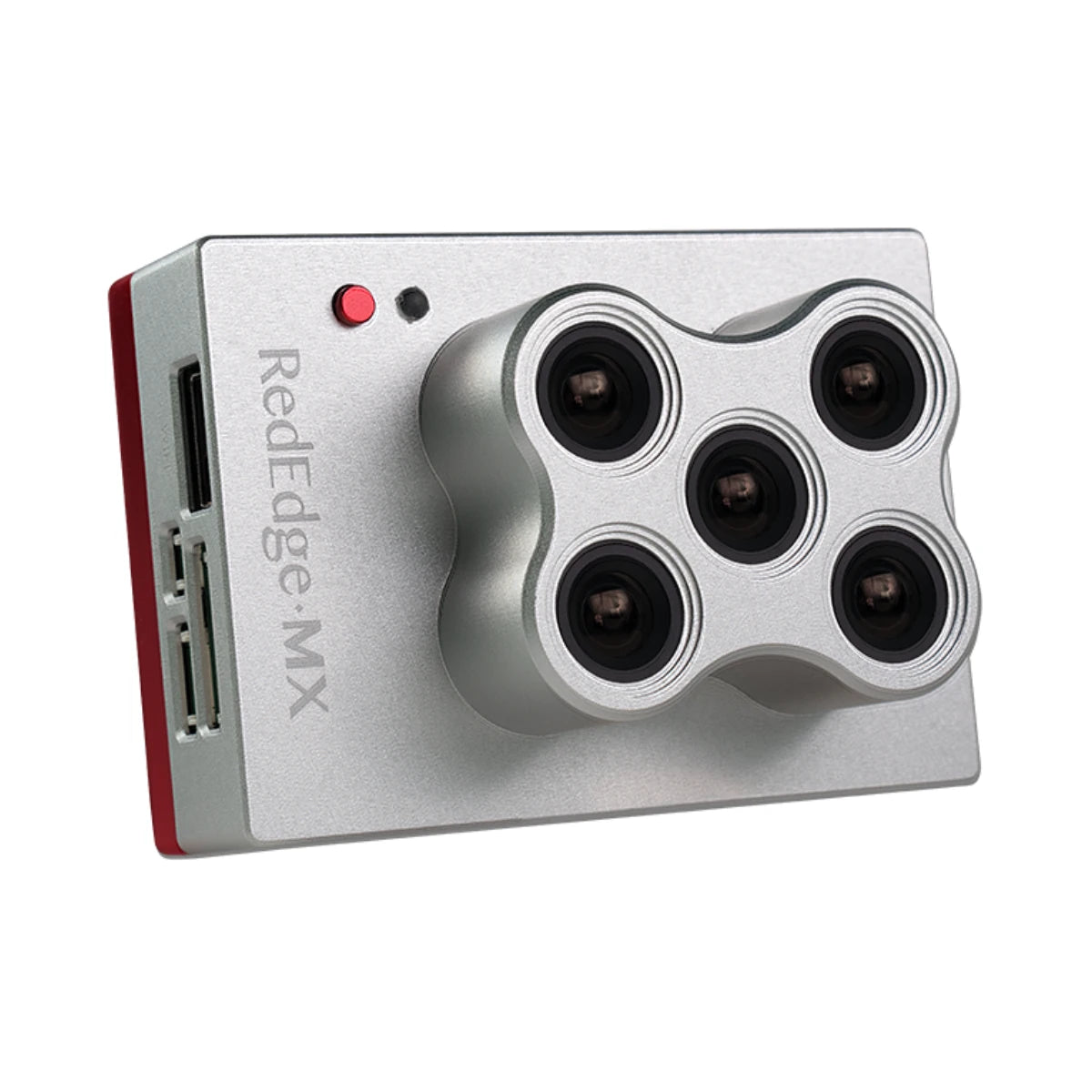
The DSLRPros MicaSense RedEdge-MX Multispectral Kit is a five-band sensor package for crop health mapping. It records blue, green, red, red edge, and near-infrared imagery at 1280×960 pixels per imager, with a ground sampling distance of 3.14 in (8 cm) from 400 ft (120 m). The kit includes the sensor, a DLS 2 light sensor with embedded GPS, a CRP2 calibrated reflectance panel, a CFexpress card with reader, a USB Wi-Fi dongle, integration cables, mounting hardware, a lens cover, a hard carrying case, and a start guide. The DJI SkyPort kit for Matrice 300 and 350 is sold separately.
Vendor: MicaSense
MPN: 805-00041
Fulfilled by: DSLRPros
Couldn't load pickup availability
Pickup available at EUAS
Usually ready in 24 hoursAll about the
MicaSense RedEdge-MX Multispectral Kit
Product Details & Specifications
Description
MicaSense RedEdge-MX Multispectral Kit: Five-Band Crop Health Mapping
The MicaSense RedEdge-MX Multispectral Kit captures five spectral bands in a single flight, giving growers, agronomists, and researchers a consistent way to measure crop health from the air. Separate blue, green, red, red edge, and near-infrared imagers each record 1280×960 pixels, and the data feeds orthomosaics, vegetation indices such as NDVI and NDRE, and reflectance maps. From 400 ft (120 m), ground sampling distance is 3.14 in (8 cm) per pixel per band. Global shutter imagers limit distortion from aircraft movement, and mapping a field in one flight keeps every band tied to the same conditions and flight line.
The kit pairs the sensor with a DLS 2 light sensor, which measures ambient light and sun angle for each band, and a CRP2 calibrated reflectance panel for reference captures before and after each flight. A CFexpress card with card reader, USB Wi-Fi dongle, integration cables, and mounting hardware are included. Captures are saved as TIFF files that work with Pix4D and Agisoft, and the DJI SkyPort kit for Matrice 300 and 350 aircraft is sold separately. Setup runs through a web-based configuration page over Wi-Fi, and the lens cover and hard case protect the sensor in transit.
Key Features and Benefits
- Five bands: Blue, green, red, red edge, and near-infrared per flight
- Sharp maps: 3.14 in (8 cm) GSD at 400 ft altitude
- Global shutter: Imagers limit distortion from aircraft movement during capture
- Light correction: DLS 2 measures ambient light and sun angle
- Reference panel: CRP2 supports calibration before and after each flight
- Imager resolution: Each of five imagers records 1280×960 pixels per capture
- Capture rate: About one capture per second across all bands
- Vegetation indices: Outputs support NDVI, NDRE, orthomosaics, and reflectance maps
- Light payload: Weighs 8.18 oz (231.9 g) with DLS 2
- Wi-Fi setup: Web-based configuration page through included USB Wi-Fi dongle
Calibrated Data You Can Compare
Calibration is what separates a useful map from a pretty one. The DLS 2 records light conditions on every frame, and the CRP2 panel gives each flight a known reflectance target, so imagery from different days and fields can be compared on equal terms. Global shutter imagers work without a gimbal, which keeps the payload simple and light on the airframe. The kit arrives complete in one case, so a crew can move it between supported aircraft and keep the same sensor and routine across seasons, spreading the cost of the system over every repeat survey.
Compatibility and System Integration
- 1 RedEdge-MX sensor with 5 imagers and global shutter (included)
- 1 DLS 2 incident light sensor with embedded GPS (included)
- 1 CRP2 calibrated reflectance panel for pre-flight and post-flight captures (included)
- 1 CFexpress card with reader and 1 USB Wi-Fi dongle (included)
- 1 set integration cables, 1 set mounting hardware, 1 lens cover (included)
- 1 hard carrying case for transport and 1 start guide (included)
- DJI SkyPort kit for Matrice 300 and 350 (sold separately)
- Pix4D or Agisoft photogrammetry software for orthomosaic and index processing (sold separately)
Applications and Use Cases
- Crop scouting: flags plant stress at zone level across large fields
- Phenotyping: compares plant response across plots using calibrated reflectance data
- Input planning: guides fertilizer and irrigation decisions with NDRE maps
- Crop health diagnosis: detects disease, pest pressure, and nutrient deficiency patterns
- Trend analysis: tracks seasonal change with repeat flights over same fields
- Land restoration: monitors revegetation progress with repeatable multispectral survey data
Multispectral surveys earn their value through repeatability: the same bands, the same calibration routine, and the same outputs on every flight. This kit packages those pieces together, so the first mission follows the same routine as the fiftieth.
Crews that need calibrated multispectral data without sourcing parts piecemeal can get the full kit from DSLRPros, with the SkyPort kit and processing software available separately for their aircraft. Order the MicaSense RedEdge-MX Multispectral Kit from DSLRPros today.
Key Features
Specifications
What's in the Box?
Frequently Asked Questions
More questions? Speak with an Expert.
What is included in the RedEdge-MX Multispectral Kit?
Which DJI aircraft can carry the RedEdge-MX?
What does the DLS 2 do?
How is the CRP2 reflectance panel used?
What ground sampling distance does the RedEdge-MX deliver?
What software works with RedEdge-MX images?
DSLRPros Verified Reviews
Verified DSLRPros Reviews & Ratings
Inquire about the MicaSense RedEdge-MX Multispectral Kit
Our experts are here to help answer any questions you might have.
Thanks -- we got it.
Thanks! A drone specialist will be in touch within one business day.