
B-NB-M3MAG
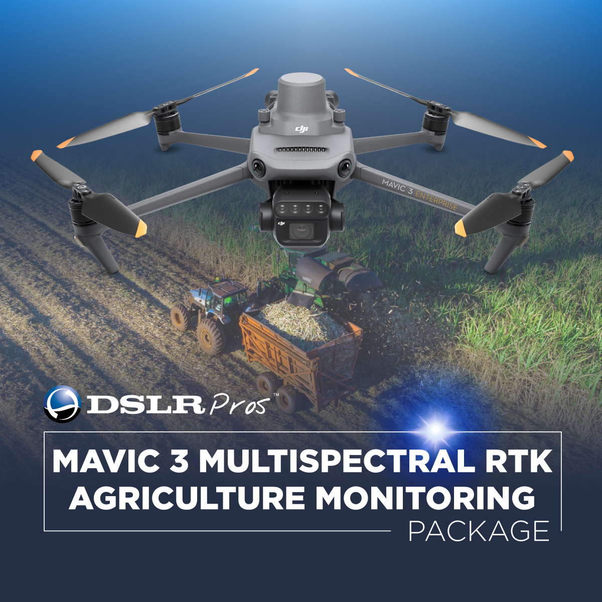
DSLRPros DJI Mavic 3 Multispectral RTK Agriculture Monitoring Package
Product Summary
This agriculture-focused bundle pairs the DJI Mavic 3 Multispectral—a 20 MP RGB camera plus four-band (Green, Red, Red Edge, NIR) multispectral array with an integrated sunlight sensor—with the DJI D-RTK 2 Mobile Station and a three-battery flight kit for centimeter-level, radiometrically consistent field surveys. Five-directional obstacle sensing, O3 Enterprise transmission, and TimeSync data alignment support safe, repeatable crop health assessments across large or multi-parcel farms. A compact foldable airframe and included Go Professional Cases bag round out the kit for rapid deployment between field locations.
Key Features
In the Box
Vendor: DJI
MPN: CP.EN.00000444.SB2
Fulfilled by: DSLRPros
Couldn't load pickup availability
Pickup available at EUAS
Usually ready in 24 hoursAll about the
DSLRPros DJI Mavic 3 Multispectral RTK Agriculture Monitoring Package
Product Details & Specifications
Description
DJI Mavic 3 Multispectral RTK Agriculture Monitoring Package: precision crop intelligence for professional field management
The DJI Mavic 3 Multispectral RTK Agriculture Monitoring Package delivers high-quality aerial data for agronomists, growers, and agricultural service providers who require reliable multispectral insights and precise geolocation accuracy.
The DJI Mavic 3 Multispectral combines a 20 MP RGB camera, four-band multispectral array, and an integrated sunlight sensor for radiometric consistency.
Paired with the DJI D-RTK 2 Mobile Station and a three-battery flight kit, this solution supports large-scale field surveys, crop health assessments, and multispectral monitoring with consistent centimeter-level precision.
Core system capabilities and strengths
- Multispectral camera captures Green, Red, Red Edge, and NIR vegetation data reliably.
- 20 MP RGB camera with mechanical shutter delivers distortion-free mapping imagery.
- Integrated RTK system provides centimeter-level accuracy for agricultural workflows.
- D-RTK 2 Mobile Station supplies stable GNSS corrections for field-wide consistency.
- Three-battery kit supports long-duration, multi-field agricultural survey missions.
- Sunlight sensor ensures radiometric accuracy across varying light conditions.
- O3 Enterprise transmission maintains reliable communication over large fields.
- Five-directional obstacle sensing improves safety around orchards and treelines.
- TimeSync system aligns flight and sensor metadata for precise dataset accuracy.
- Compact foldable airframe supports rapid deployment across multiple field locations.
Multispectral imaging and precise crop analysis for modern agriculture
The DJI Mavic 3 Multispectral includes a four-band multispectral camera system (Green, Red, Red Edge, NIR) designed to capture vegetation signatures that support plant health evaluation and field variability analysis. Its 20 MP RGB camera with mechanical shutter delivers distortion-free imagery suitable for mapping, stand counts, and crop documentation.
The integrated sunlight sensor maintains radiometric accuracy across varying light conditions, and the O3 Enterprise transmission system provides stable connectivity for extended field passes. With up to 43 minutes of flight time per battery, teams can efficiently cover large agricultural areas.
Integrated RTK workflows and field-ready operational strength
Built-in RTK capability and full compatibility with the DJI D-RTK 2 Mobile Station allow operators to achieve centimeter-level positioning for accurate mapping, plant index generation, and long-term crop performance monitoring. The D-RTK 2 Mobile Station supports multi-constellation GNSS correction, providing stable baselines for reliable ground control.
The Mavic 3 Enterprise Battery Kit extends mission availability across large farms, orchards, and multi-parcel operations. The included Go Professional Cases bag offer durable protection for transport and storage when working in rugged agricultural environments.
Why this package is ideal for agricultural monitoring and multispectral mapping
This package is specifically optimized for agricultural monitoring by pairing the DJI Mavic 3 Multispectral’s four-band multispectral imaging system with a reliable RTK reference station. The D-RTK 2 Mobile Station ensures centimeter-level positional accuracy, enabling precise plant index mapping, vigor assessment, and temporal comparisons across large fields.
The RGB mechanical-shutter camera captures distortion-free imagery for survey and documentation purposes, while the extended battery kit supports long-duration field operations.
System compatibility and workflow integration
- Supports NTRIP networks and custom correction services when necessary.
- Integrates with DJI Pilot 2 for automated mapping and agriculture missions.
- Compatible with DJI Terra (sold separately) for photogrammetry and multispectral processing.
Agriculture-focused applications and operational scenarios
- Crop health mapping: captures multispectral signatures to assess canopy vigor accurately.
- Variable-rate prescriptions: generates detailed index maps for targeted nutrient application.
- Stand count analysis: records high-resolution data to evaluate plant emergence quality.
- Orchard monitoring: captures spectral differences for pest stress and irrigation needs.
- Crop growth tracking: produces consistent datasets for multi-stage field comparison.
- Field scouting support: identifies stress patterns and anomaly zones for verification.
- Soil condition mapping: assists pre-season evaluation through vegetative index analysis.
- Irrigation planning: highlights canopy variability linked to moisture distribution issues.
- Yield estimation modeling: collects spectral data correlated with crop productivity levels.
- Pre-harvest assessments: documents field conditions to guide harvest and logistics planning.
Designed for enterprise integration
This package is engineered for agricultural teams that require dependable accuracy, consistent radiometric performance, and streamlined mobile deployment. The combination of the Mavic 3 Multispectral, D-RTK 2 Mobile Station, and enhanced battery capacity ensures reliable operation across large farms and complex crop zones.
Rugged transport bags protect essential field hardware and support frequent site transitions. Together, these tools form a complete multispectral monitoring ecosystem built for professional agricultural operations.
This agriculture monitoring package provides long-term reliability for farmers, agronomists, and service providers needing precise crop intelligence across varied field environments. Its integrated multispectral imaging, RTK precision, and extended flight capabilities enable informed decision-making and comprehensive field analysis.
DSLRPros supports this system with expert consultation, operational guidance, and dedicated service resources, ensuring successful integration into your agricultural monitoring workflows. Available now from DSLRPros.
Purchase today to equip your team with high-accuracy agricultural intelligence capabilities.
Key Features
Specifications
What's in the Box?
DSLRPRosCare Extended Warranty
DSLRPROS DJI Care is our exclusive extended warranty program, designed to give you peace of mind and extra protection for your drone investment.
- Coverage Length: 13 months from the date your product ships
- What’s Covered: Accidental damage from pilot error, collisions, drops, water exposure, signal interference, and internal malfunctions
- What’s Not Covered: Intentional misuse, modifications, loss or theft, cosmetic wear, consumables (like propellers or batteries), or operation outside manufacturer guidelines
- Replacements: One replacement during the coverage term. Replacement may be new or refurbished. If unavailable, we’ll provide a product of similar capability.
- How to File a Claim: Notify support@dslrpros.com within 7 days of an incident. Ship the product using the label we provide.
- Eligibility: Policy must be purchased before your product ships from DSLRPROS. Coverage applies only to the original purchaser.
Simple, clear protection—so you can focus on flying, not worrying.
Frequently Asked Questions
More questions? Speak with an Expert.
How does the DJI Mavic 3 Multispectral RTK Agriculture Monitoring Package improve crop analysis?
What crops can I use the Mavic 3 Multispectral RTK package for?
Do I need ground control points for accurate maps?
What software can I use to process the data?
What role does the D-RTK 2 High Precision GNSS Mobile Station play in agricultural missions?
How long can the DJI Mavic 3 Multispectral RTK Agriculture Monitoring Package operate during field surveys?
Can the package support variable-rate application planning?
DSLRPros Verified Reviews
Verified DSLRPros Reviews & Ratings
Inquire about the DSLRPros DJI Mavic 3 Multispectral RTK Agriculture Monitoring Package
Our experts are here to help answer any questions you might have.
Thanks -- we got it.
Thanks! A drone specialist will be in touch within one business day.