






DJI Matrice 4E Universal Edition (Used)
DJI Matrice 4E Universal Edition (Used)
SKU:S-DJI-M4E-USD

- Description
- Specifications
- In the Box
- FAQ
DJI Matrice 4E Universal Edition (Used): Flagship Mapping Performance at a Lower Entry Cost
The DJI Matrice 4E Universal Edition (Used) brings DJI's flagship mapping and surveying platform to your fleet at a lower entry cost, offered here in pre-owned condition that has been inspected and verified to perform like new. This unit pairs a 4/3-inch CMOS wide camera with 48 MP medium tele and telephoto cameras, delivering 5-directional oblique imaging that DJI rates as a 40 percent efficiency gain over single-angle capture.
Built for surveyors, GIS professionals, and construction teams, the M4E combines a 49-minute flight time with 0.5-second interval shooting for fast, high-volume data collection across large sites.
Key Features and Benefits
- Inspected condition: used unit verified to perform like new before sale.
- Extended flight: 49-minute maximum flight time on standard propellers per charge.
- High-res mapping: 20 MP wide camera with mechanical shutter reduces distortion.
- Rapid capture: 0.5-second interval shooting speeds up large-area data collection.
- Oblique imaging: five-directional capture improves mapping efficiency by up to 40 percent.
- Precision correction: Distortion Correction 2.0 keeps residual error under two pixels.
- Centimeter RTK: 1 cm plus 1 ppm horizontal positioning without ground control.
- Onboard planning: Smart 3D Capture builds routes from the RC Plus 2.
- Omnidirectional sensing: obstacle avoidance functions at full 21 m/s flight speed.
- Long-range transmission: O4 Enterprise delivers live 1080p view up to 25 km.
Teams building out a mapping program do not always need a brand-new airframe to get flagship performance, and this used unit is priced to reflect that. Every core capability carries over from new: distortion correction under two pixels, factory-calibrated cameras, centimeter-level RTK positioning, and omnidirectional obstacle avoidance for safer flights near structures and vegetation.
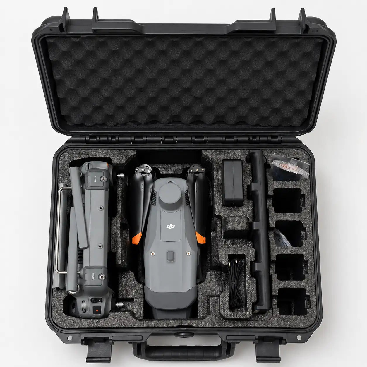
The full standard kit ships alongside the aircraft, including the RC Plus 2 Enterprise controller, battery, 100W charging hub, and storage case, giving your team everything needed to fly on day one. As a used unit, this listing does not include the complimentary 1-year DJI Terra Pro license bundled with new M4E purchases.
Verified Performance in a Compact Drone
A used airframe should not mean compromised data quality, and this unit was verified before listing to confirm every camera, sensor, and flight system performs to factory standard. The 4/3-inch wide camera's mechanical shutter eliminates rolling shutter distortion during forward flight, a detail that matters when reconstructing accurate 3D models from overlapping imagery.
Paired with factory-calibrated optics and DJI Terra compatibility, this platform produces reconstruction-ready datasets with less manual cleanup. Choosing a verified used unit gets your team flagship mapping performance at a lower upfront cost without giving up the accuracy professional deliverables require.
Compatibility and System Integration
- DJI RC Plus 2 Enterprise: standard controller included with this unit (included).
- Matrice 4 Series Battery: one unit included with this used aircraft (included).
- 100W Charging Hub: standard sequential charger included with this used kit (included).
- DJI Terra: compatible reconstruction software for mapping data (sold separately).
- Zenmuse and third-party PSDK payloads: connect via the E-Port interface (sold separately).
- DJI FlightHub 2: supports remote mission and fleet management tools (sold separately).
- DJI Cellular Dongle 2: enables 4G connectivity for the controller (sold separately).
Applications and Use Cases
- Topographic mapping: 0.5-second capture intervals speed up large-area data collection.
- Urban 3D modeling: five-directional imaging captures complete building facades accurately.
- Infrastructure inspection: extended flight time supports bridges, pipelines, and towers.
- Environmental monitoring: efficient coverage supports coastline and forest survey missions.
- Disaster response mapping: rapid deployment generates on-site 3D models for logistics.
- Construction site documentation: precise 3D models support planning and progress tracking.
- GIS data collection: centimeter RTK accuracy supports professional survey deliverables.
The Matrice 4E exists to give mapping and survey teams flagship-grade accuracy without the workflow compromises of consumer-grade equipment, and this verified used unit extends that value to a lower entry point. Inspected condition, factory-level camera calibration, and centimeter RTK positioning mean your deliverables don't have to suffer for choosing pre-owned.
DSLRPros inspects and verifies used enterprise drones before they reach your team, so buying pre-owned doesn't mean buying uncertainty. Our technicians can walk you through this unit's condition and confirm it fits your mapping workflow before you order.
Order the DJI Matrice 4E Universal Edition (Used) today at DSLRPros.


