


Enterprise-Grade RTK Power in a Compact Package
The Autel EVO II Pro 6K RTK Rugged Bundle V3 is purpose-built for professionals who demand precision, flexibility, and reliability. Equipped with an integrated RTK module and a high-resolution 6K 1" CMOS sensor, this compact UAV delivers survey-grade results without the bulk.
Whether you're mapping job sites, inspecting infrastructure, or conducting large-scale surveys, this bundle enables accurate data collection with minimal setup.
NOTE: This is a used unit. The drone and all included components have been inspected and tested to ensure full functionality. While minor signs of previous use may be present, the unit operates smoothly and is good as new in performance.
Key Features of the EVO II Pro 6K RTK V3
Get dependable results from a platform engineered for serious fieldwork:
- 6K Camera with 1" CMOS Sensor: Capture ultra-detailed imagery at up to 5472 x 3648 resolution, ideal for mapping, photogrammetry, and high-fidelity inspections.
- RTK Precision with GNSS Support: Achieve centimeter-level accuracy with support for GPS, GLONASS, Galileo, and BeiDou. Pair with an NTRIP network or Autel's GNSS base station for real-time correction.
- RTK Reprocessing Support: All positioning data is embedded and can be post-processed to meet stringent survey deliverables.
- Robust Flight Performance: Fly up to 36 minutes on a single charge with a max wind resistance of 27 mph (12 m/s), giving you more time in the air per mission.
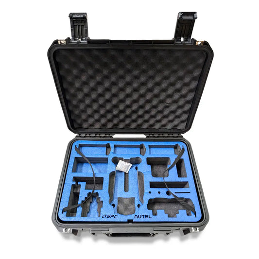
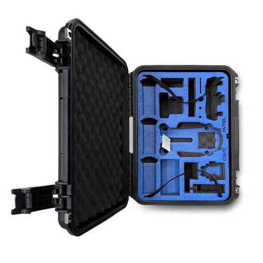
- Rugged, Ready-to-Deploy Package: Includes a hard-shell carrying case, extra battery, and charging hub-ideal for field teams who need grab-and-go reliability.
Real-World Use Cases for the EVO II Pro 6K RTK
The Autel EVO II Pro 6K RTK Rugged Bundle V3 is trusted across industries for its geospatial accuracy and visual clarity:
- Surveying & Mapping: Generate accurate 2D/3D models with RTK-enhanced metadata-perfect for topographic maps, volume calculations, and GIS workflows.
- Construction Inspection: Monitor progress and capture high-resolution orthomosaics to support site documentation and stakeholder reporting.
- Public Infrastructure Monitoring: Inspect bridges, roadways, utility corridors, and rail networks with minimal flight restrictions thanks to compact size and RTK precision.
- Land Development & Urban Planning: Use high-resolution visuals and positional data to plan layouts, verify as-built conditions, and support zoning approvals.
Payload Capabilities
Built for geospatial and visual intelligence, the EVO II Pro 6K RTK V3 delivers:
- 1" CMOS Sensor: Provides wide dynamic range and excellent low-light performance for sharp, usable data in any lighting condition.
- 6K Ultra HD Video & 20MP Stills: High-resolution data capture supports advanced processing pipelines like photogrammetry and asset modeling.
- RTK-Enabled Imaging: Each image is tagged with real-time corrected geolocation, ready for mapping software integration.
- Adjustable Aperture (f/2.8-f/11): Control depth of field and exposure to fine-tune imagery depending on the environment.
Talk to a Drone Expert
Need help choosing between RTK systems or building out your drone program? Call 877-299-1075 or click Request Info/Quote to speak with a DSLRPros specialist today.
Specifications
- Aircraft
- Weight (with propeller and battery): 1250g±0.5g(EVO II Dual 640T RTK V3)1237g±0.5g(EVO II Pro RTK V3)
- Size (L*W*H): 230*130*143mm (folded)457*558*143mm (unfolded)
- Wheelbase: 397 mm
- Maximum Service Ceiling Altitude: 7000 m
- Max ascent speed: 8 m/s (Ludicrous)
- Max descent speed: 4 m/s (Ludicrous)
- Max horizontal flight speed: 20 m/s (Ludicrous)
- Max flight distance (no wind): 21 km
- Max angular velocity: 120°/s
- Max tilt angle: 33° (Ludicrous)
- Max flight time: 36 min
- Max hovering time (no wind): 32 min
- Operating temperature range: -10℃ ~ 40℃
- Maximum resistance to wind: Level 8
- Operating frequency: 902-928MHz (FCC Only)2.400-2.4835GHz5.725-5.850GHz (non-Japan)5.650-5.755GHz (Japan Only)
- Transmission power: 900M FCC/ ISED: ≤31dBm2.4G FCC/ ISED: ≤32dBmSRRC/CE/MIC/RCM: ≤20dBm5.8G (non-Japan) ; 5.7G (Japan) FCC/ISED/SRRC/MIC: ≤33dBmCE/ RCM: ≤14dBm
- Hovering accuracy:When RTK is enabled and working normally: Vertical: ±0.1 m; Horizontal: ±0.1 mVertical: ±0.1 m (when the visual positioning is working normally); ±0.5 m (when GPS works normally)Horizontal: ±0.3 m (when the visual positioning is working normally); ±1.5 m (when GPS works normally)
- Image position compensation: The position of the camera center relative to the phase center of the airborne A-RTK antenna, under the body axis system: (-2.63, 0.31, 83.5) mm, and the photo EXIF coordinates have been compensated. The positive XYZ axis of the body axis system points to the front, right, and bottom of the aircraft respectively.
- Internal storage: 8GB
- SD storage: max. support 256GB (UHS-3 or Class 10)
GNSS
- Single frequency high sensitivity GNSS: GPS+BeiDou+Galileo(Asia)GPS+GLONASS+Galileo(Other areas)
- Multi-frequency multi-system high-precision RTK GNSS: Frequency points used:GPS: L1/L2GLONASS: L1/L2BeiDou: B1/B2Galileo: E1/E5
- First positioning time: <50 s
- Positioning accuracy: vertical 1.5 cm + 1 ppm (RMS); Horizontal 1 cm + 1 ppm (RMS) 1 ppm means that the error increases by 1 mm for every 1 km the aircraft moves
Gimbal
- Gimbal: 3-axis stabilization
- Mechanical range: Tilt: -135° to +45°; Pan: -100° to +100°
- Controllable rotation range: Tilt: -90° to +30°; Pan: -90° to +90°
- Max control speed (Tilt): 300°/s
- Angular Vibration Range: ±0.005°
Remote controller and image transmission
- Operating frequency: 902-928MHz (FCC Only)2.400-2.4835GHz5.725-5.850GHz (non-Japan)5.650-5.755GHz (Japan Only)
- Transmission power: FCC: ≤33dBmCE: ≤20dBm@2.4G,≤14dBm@5.8GSRRC: ≤20dBm@2.4G,≤33dBm@5.8G/5.7G
- Max Transmission Distance (unobstructed, free of interference): FCC: 15km CE: 8km
- Display screen: 2048x1536 60fps
- Battery: 5800mAh
- Operating time: ~3 hours (Max. Brightness)~4.5 hours (50% Brightness)
- Charging time: 120 minutes
- Internal Storage: ROM 128GB
Sensing system
- Sensing system type: Omnidirectional sensing system
- Forward: Accurate measurement range: 0.5-18 m Effective sensing speed: <12m/sViewing angle: Horizontal: 60°, Vertical: 80°
- Backward: Accurate measurement range: 0.5-16 m Effective sensing speed: <12m/sViewing angle: Horizontal: 60°, Vertical: 80°
- Upward: Accurate measurement range: 0.5-10 m Effective sensing speed: <5m/sViewing angle: Horizontal: 65°, Vertical: 50°
- Downward: Accurate measurement range: 0.5-10 m Effective sensing speed: <5m/sViewing angle: horizontal: 100°, vertical: 80°
- Left and right: Accurate measurement range: 0.5-10 m Effective sensing speed: <5m/sViewing angle: horizontal: 65°, vertical: 50°
- Operating Environment: Forward, Backward and Sides: Surface with clear pattern and adequate lighting (lux > 15) Upward: Detects diffuse reflective surfaces (>20%) (walls, trees, people, etc.)Downward: Surface with clear pattern and adequate lighting (lux > 15)Detects diffuse reflective surfaces (>20%) (walls, trees, people, etc.)
EVO II Pro RTK V3 visual camera
- Sensor: 1 inch CMOS; 20M pixels
- Lens: FOV: 82°35 mm format equivalent focal length: 29 mmAperture: f/2.8 - f/11Focus range: 0.5 m to infinity
- ISO range: Video: 100-44000Photos: 100-6400
- Shutter speed: Photo mode: 1/8000 ~ 8sOther: 1/8000 ~ 1/frame rates
- Zoom: 1-16x (up to 3x lossless zoom)
- Photo mode: Single shot/Burst shooting/AEB/Time Lapse/HDR
- Maximum photo size: 5472*3648 (3:2)5472*3076 (16:9)3840*2160 (16:9)
- Image Format: JPG (default) / DNG / JPG+DNG
- Photo mode: 5472x3076P30/P25/P243840x2160P60/P50/P48/P30/P25/P242720x1528P60/P50/P48/P30/P25/P241920x1080P60/P50/P48/P30/P25/P24
- Video format: MP4 / MOV (MPEG-4 AVC/H.264, HEVC/H.265)
- Max bitrate: 120Mbps
- Supported file system: FAT32/exFAT
EVO II Dual 640T RTK thermal camera
- Sensor: Uncooled VOx Microbolometer
- Lens: FOV H33°V26°
- Focal length: 13mm
- Zoom: 1-16x
- Sensor resolution: 640*512
- Pixel size: 12μm
- Wavelength range: 8 - 14μm
- Temperature range: High gain mode: -20° to +150°Low gain mode: 0° to +550°
- Temperature measurement accuracy: ±3℃ or ±3% of reading (whichever is greater) @Environmental temperature-20℃~60℃
- Accurate temperature measurement distance: 2-20 meters
- Video resolution: 640x512@30fps
- Video format: MOV / MP4 (Support H.264/H.265)
- Camera resolution: Infrared mode: 640*512Picture-in-picture mode: 1920*1080, 1280*720
- Photo mode: Single shotBurst shooting: 3/5 frames, 3 is the defaultTime Lapse:JPG: 2s/5s/7s/10s/20s/30s/60s
- Photo format: JPG (with irg file)
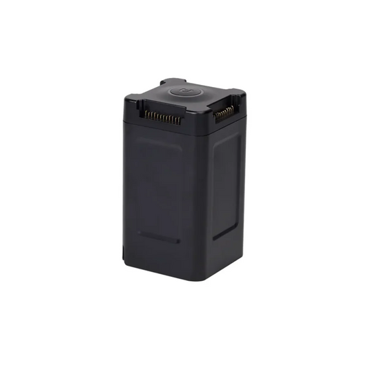
Battery
- Capacity: 7100 mAh
- Voltage: 11.55 V
- Battery type: LiPo 3S
- Energy: 82 Wh
- Weight: 365 g
- Charging temperature range: 5℃ to 45℃
- Storage temperature and humidity: -10~30℃,65±20%RH
- Recommended storage temperature: 22-28℃
- Max charging power: 93W
- Charging time: 90 minutes
Charger
- Input: 100-240 V, 50/60 Hz, 1.5A
- Output: 13.2 V ⎓ 5 A5V⎓3A 9V⎓2A 12V⎓1.5A
-
Voltage: 13.2±0.1V
- Rated power: 66W
Multi-Charger
- Voltage: 13.2 V
- Charging temperature range: 5℃ to 45℃
In The Box
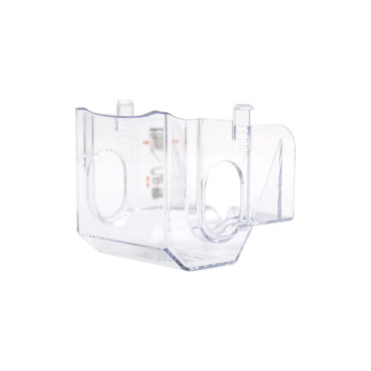
- 1x Aircraft (including battery, propellers, gimbal cover, and 32G SD Card)
- 1x Remote Controller (sticks included)
- 2x Spare batteries
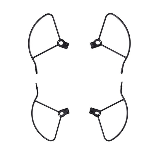
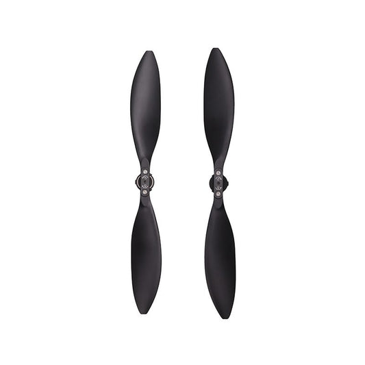
- 2x Spare propellers (pair)
- 1x Battery charger + power cable
- 1X Car charger
- 1x Multi-charger
- 1x RC charger
- 1x RC charging cable
- 1x RC lanyard
- 1x RC protective case
- 1x Spare control stick (pair)
- 1x Extended port cover
- 1x Protector case
- 1x Manual (Packing List, Quick Guide, Disclaimer & Safety Instructions, Battery Safety Instructions, Car Charger Quick Guide, and Multi-Charger Quick Guide)

