
S-AR-E2PRO-6K-RTK-RB-V3
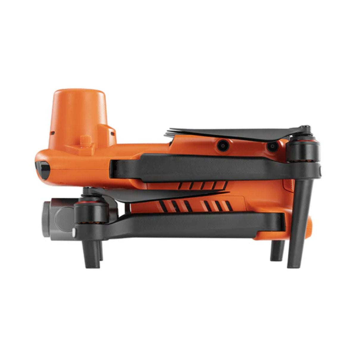
Autel EVO II Pro 6K RTK Rugged Bundle V3
Estimated delivery
Delivers in 1–5 business days after dispatch
Product Summary
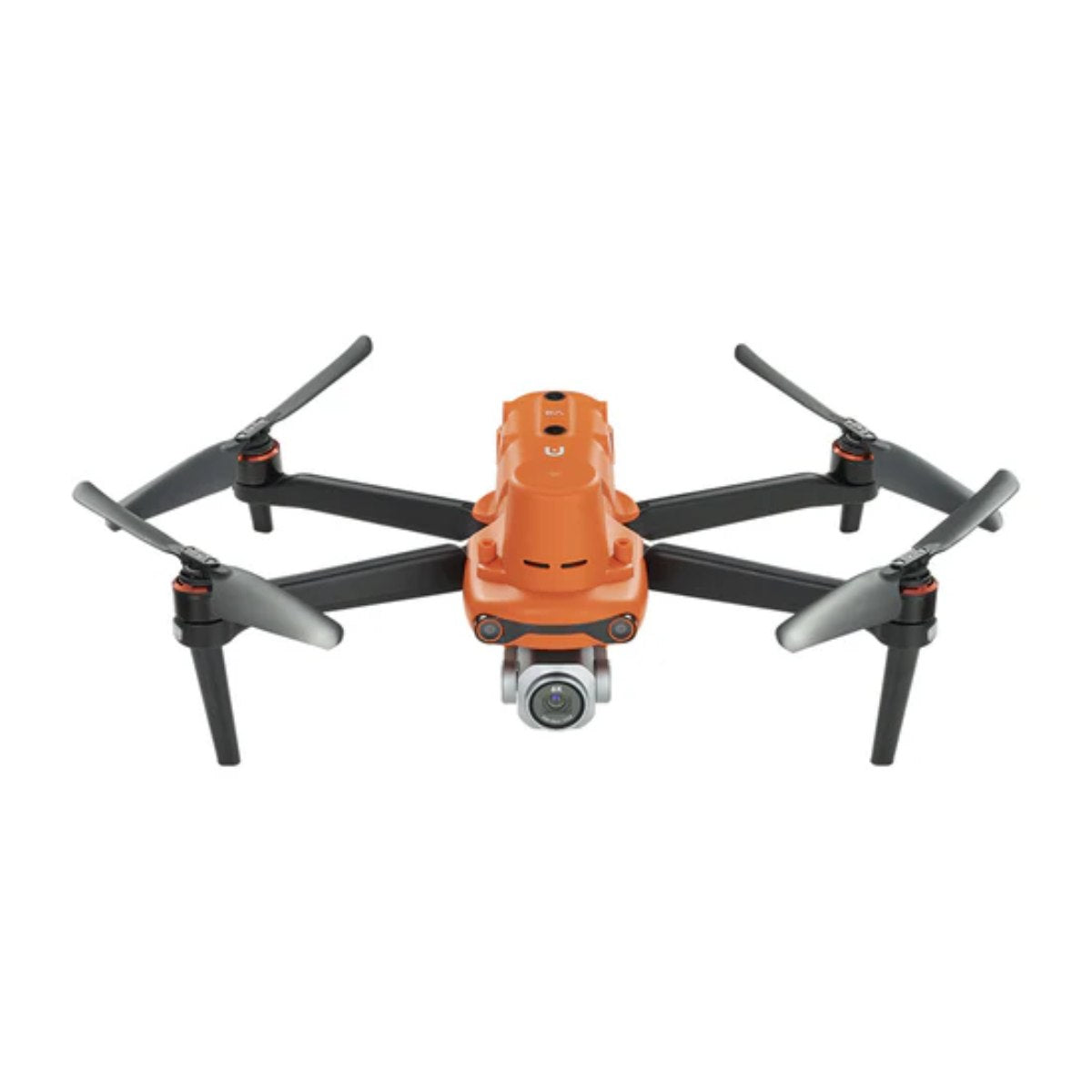
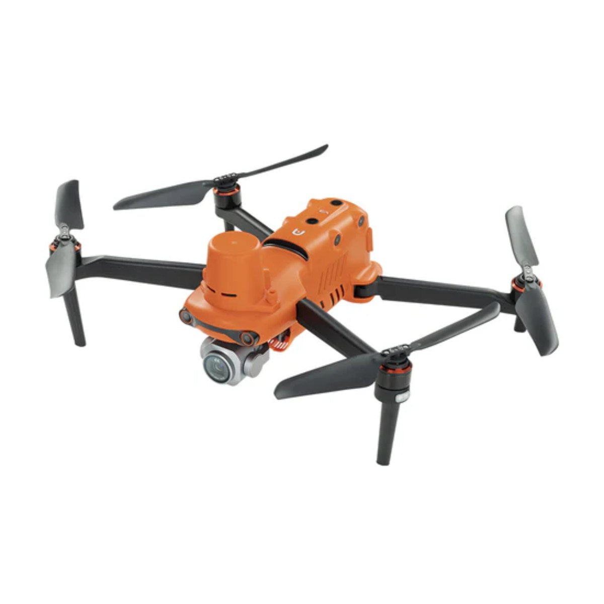
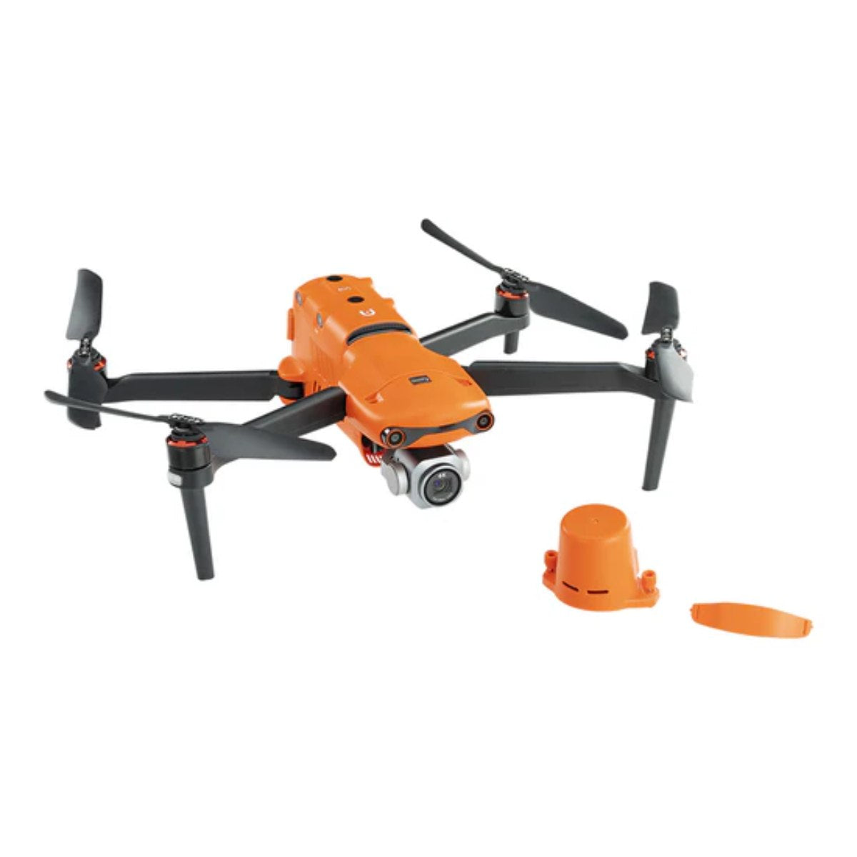
The Autel EVO II Pro 6K RTK Rugged Bundle V3 combines a 20MP 1-inch CMOS camera recording 6K Ultra HD video with an integrated RTK module supporting real-time centimeter-level positioning, PPK workflows, time synchronization, and NTRIP correction, reducing the need for traditional ground control points on many mapping projects. Autel Explorer mapping software supports rectangular and polygon missions with double-grid flight patterns, saved mission settings for repeat inspections, and multi-battery mission continuation, while SkyLink 2.0 transmission reaches up to 9 miles with 360° obstacle avoidance across 19 sensor groups. It's built for surveyors, engineers, utility companies, and inspection teams who need survey-grade geospatial data with greater efficiency.
Key Features
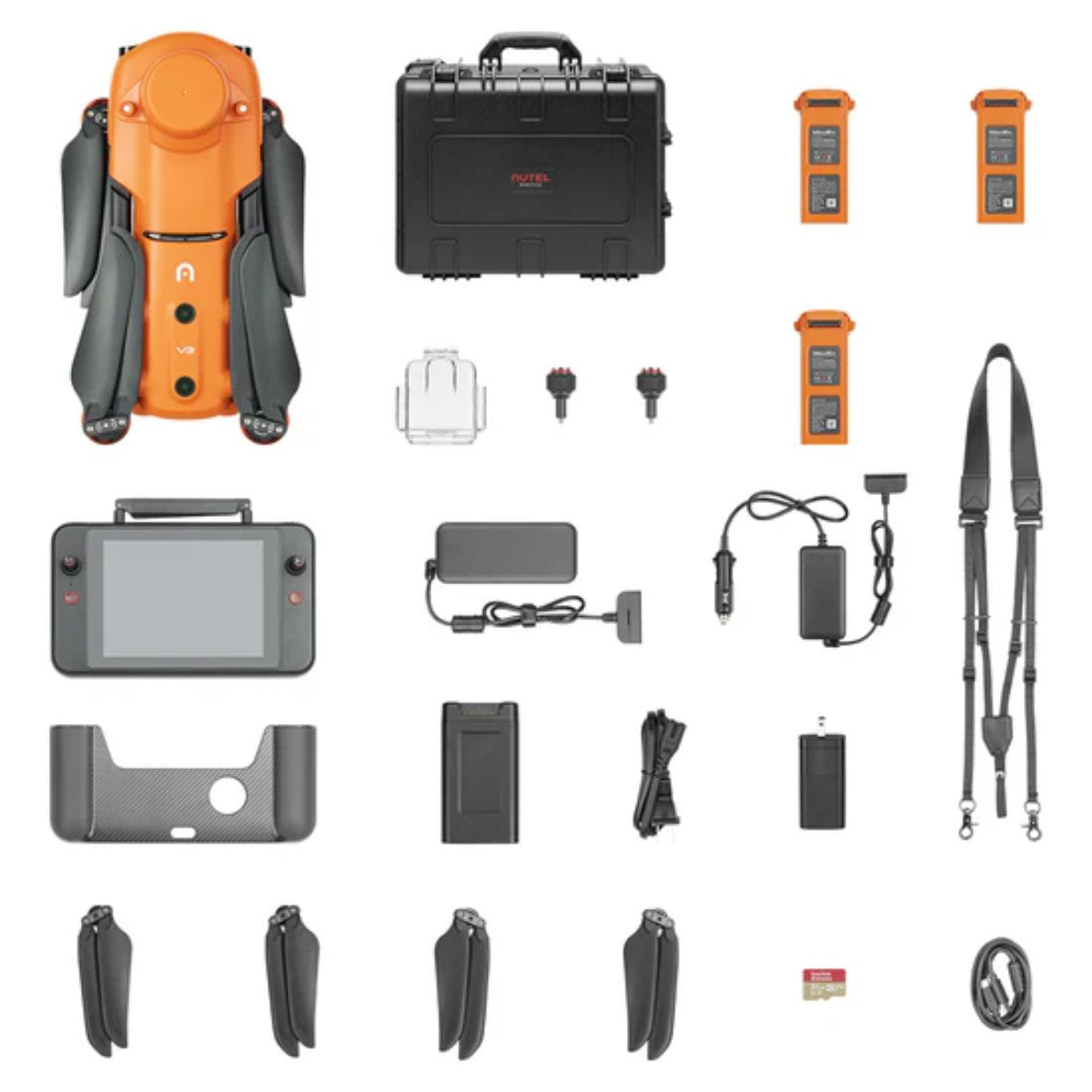
In the Box
Vendor: Autel
MPN: EVO2-PRO-RTK-V3-BUN
Fulfilled by: DSLRPros
Couldn't load pickup availability
Pickup available at EUAS
Usually ready in 24 hoursAll about the
Autel EVO II Pro 6K RTK Rugged Bundle V3
Product Details & Specifications
Description
Enterprise RTK Drone for Accurate Mapping, Surveying, and Geospatial Workflows
The Autel EVO II Pro 6K RTK Rugged Bundle V3 combines professional aerial imaging with centimeter-level positioning to help surveyors, engineers, utility companies, and inspection teams collect reliable geospatial data with greater efficiency.
It features an integrated RTK module, support for PPK, time synchronization, and NTRIP correction services. Altogether, the platform delivers highly accurate positioning while reducing the need for traditional ground control points on many mapping projects.
Feature Overview
- Integrated RTK module with centimeter-level positioning
- Supports RTK, PPK, time synchronization, and NTRIP workflows
- Compatible with third-party RTK base stations
- 20 MP 1-inch CMOS camera with 6K Ultra HD recording
- Adjustable aperture from f/2.8 to f/11
- 10-bit A-Log for greater editing flexibility
- Up to 36 minutes of flight time
- SkyLink 2.0 transmission up to 9 miles
- Maximum speed of 45 mph
- 360° obstacle avoidance with 19 sensor groups
- Autel Explorer mapping software with intelligent mission planning
- Includes Smart Controller V3 and rugged carrying case
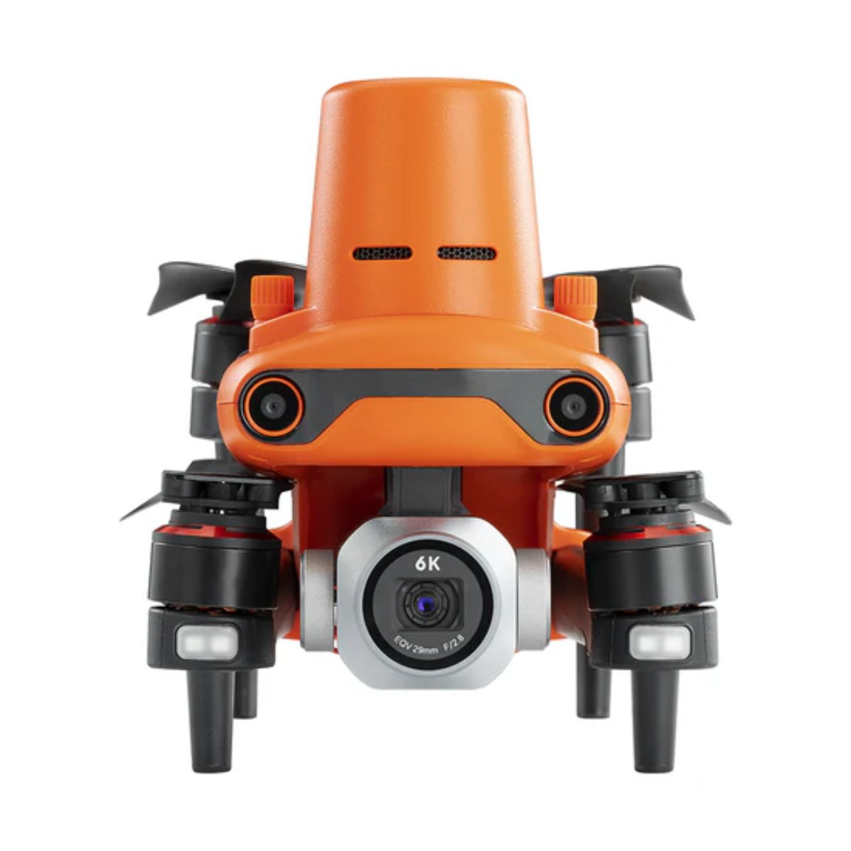
Built around a 20 MP 1-inch CMOS camera, the aircraft records detailed 6K Ultra HD video and high-resolution still images for photogrammetry, infrastructure inspection, and engineering documentation.
Combined with SkyLink 2.0 transmission, Autel Explorer mapping software, intelligent obstacle avoidance, and a rugged field-ready package, the EVO II Pro 6K RTK Rugged Bundle V3 is designed to simplify complex aerial data collection from mission planning through post-processing.
Survey-Grade Accuracy With Integrated RTK
Accurate positioning is essential for producing dependable mapping deliverables. The integrated RTK module provides real-time centimeter-level positioning while supporting Post-Processed Kinematic (PPK) workflows and time synchronization for greater accuracy during aerial surveys.
The aircraft records satellite observations together with flight and camera data, allowing professionals to generate highly accurate orthomosaics, digital surface models, and other geospatial outputs.
Support for NTRIP correction services and third-party RTK base stations gives organizations the flexibility to integrate the drone into existing survey workflows without requiring proprietary infrastructure.
Efficient Mapping From Takeoff to Processing
The Autel Explorer application helps reduce repetitive tasks throughout the mapping process. Operators can create rectangular and polygon mapping missions while supporting double-grid flight patterns for projects requiring additional image overlap.
Mission settings can be saved for repeat inspections, making it easier to revisit infrastructure, construction sites, or utility corridors using the same flight path and camera configuration.
Multi-battery mission support also enables operators to pause and resume larger mapping projects without rebuilding the mission from scratch.
High-Resolution Imaging for Professional Data Collection
The integrated 20 MP 1-inch CMOS sensor captures sharp, detailed imagery suitable for surveying, engineering, and inspection applications. Operators can record 6K Ultra HD video while maintaining greater control over exposure through the adjustable f/2.8–f/11 aperture.
Support for 10-bit A-Log preserves additional image information for color grading and post-processing, while 3× lossless zoom and 16× digital zoom allow detailed inspections of elevated structures, communication towers, and utility assets without flying unnecessarily close.
Designed for Productive Field Operations
Whether working on construction projects or inspecting utility infrastructure, long endurance helps reduce downtime between flights. The EVO II Pro 6K RTK Rugged Bundle V3 provides up to 36 minutes of maximum flight time and reaches speeds of up to 45 mph, allowing operators to cover large project areas efficiently.
The aircraft also offers wind resistance of up to 27 mph, helping maintain stable flight performance in challenging outdoor environments.
SkyLink 2.0 Keeps You Connected
The integrated SkyLink 2.0 transmission system delivers HD video transmission at distances of up to 9 miles under FCC conditions.
Automatic frequency hopping across supported communication bands helps minimize interference while maintaining a stable connection between the aircraft and the Smart Controller V3 during long-range operations.
Fly More Confidently Around Obstacles
Operating around structures often requires additional situational awareness. The EVO II Pro 6K RTK Rugged Bundle V3 incorporates 360° obstacle avoidance using 19 groups of sensors, including visual sensors, ultrasonic sensors, and onboard positioning systems that continuously monitor the surrounding environment.
The aircraft also includes an integrated ADS-B receiver that alerts pilots when nearby manned aircraft are detected, helping improve operational awareness in shared airspace.
Smart Controller V3 for Professional Field Use
Included with the Rugged Bundle is the Autel Smart Controller V3, featuring a 7.9-inch display with 2,000 nits of brightness for excellent visibility in direct sunlight.
The controller runs a customized Android operating system, supports third-party applications, and is protected by an IP43 weather-resistance rating for reliable outdoor operation.
With up to 4.5 hours of operating time, the Smart Controller V3 is built to support extended survey and inspection missions without frequent recharging.
Applications
- Photogrammetry
- Land surveying
- Construction progress monitoring
- Civil engineering
- Topographic mapping
- GIS data collection
- Powerline inspection
- Utility asset inspection
- Telecommunications infrastructure inspection
- Environmental monitoring
- Mining operations
- Public safety planning
Compare EVO II Pro V3 Bundle Options
Each EVO II Pro V3 package shares the same 1-inch 6K camera but is built on a different version of the aircraft, configured for different operational requirements. The comparison table below outlines the differences between the Rugged Bundle, RTK Rugged Bundle, and Enterprise Bundle to help you select the configuration that best supports your workflow.
| Feature | EVO II Pro 6K RTK Rugged Bundle V3 | EVO II Pro 6K Rugged Bundle V3 | EVO II Pro 6K Enterprise Bundle V3 |
|---|---|---|---|
| Aircraft | EVO II Pro RTK V3 | EVO II Pro V3 | EVO II Pro Enterprise V3 |
| Controller | Smart Controller V3 (7.9") | Smart Controller SE (6.4") | Smart Controller V3 (7.9") |
| Max flight time | 36 min | 40 min | 42 min |
| 1" Sony CMOS 20MP camera | ✓ | ✓ | ✓ |
| 6K video | ✓ | ✓ | ✓ |
| Rugged carrying case | ✓ | ✓ | ✓ |
| Three Intelligent Flight Batteries | ✓ | ✓ | ✓ |
| RTK module included | ✓ | ✗ | ✗ |
| PPK support | ✓ | ✗ | ✗ |
| NTRIP support | ✓ | ✗ | ✗ |
| Spotlight included | ✗ | ✗ | ✓ |
| Loudspeaker included | ✗ | ✗ | ✓ |
| Strobe included | ✗ | ✗ | ✓ |
| RTK module compatibility | Built in | Not supported | Optional add-on |
| Primary application | Surveying & mapping | General imaging & inspection | Public safety & enterprise operations |
A Complete Mapping Solution for Professional Teams
The Autel EVO II Pro 6K RTK Rugged Bundle V3 brings together precision positioning, professional imaging, intelligent mission planning, and field-ready hardware in one portable platform.
From topographic surveys and construction documentation to infrastructure inspections and utility mapping, it provides the accuracy, flexibility, and reliability professionals need to complete aerial data collection projects with confidence.
Key Features
Specifications
What's in the Box?
DSLRPRosCare Extended Warranty
DSLRPROS DJI Care is our exclusive extended warranty program, designed to give you peace of mind and extra protection for your drone investment.
- Coverage Length: 13 months from the date your product ships
- What’s Covered: Accidental damage from pilot error, collisions, drops, water exposure, signal interference, and internal malfunctions
- What’s Not Covered: Intentional misuse, modifications, loss or theft, cosmetic wear, consumables (like propellers or batteries), or operation outside manufacturer guidelines
- Replacements: One replacement during the coverage term. Replacement may be new or refurbished. If unavailable, we’ll provide a product of similar capability.
- How to File a Claim: Notify support@dslrpros.com within 7 days of an incident. Ship the product using the label we provide.
- Eligibility: Policy must be purchased before your product ships from DSLRPROS. Coverage applies only to the original purchaser.
Simple, clear protection—so you can focus on flying, not worrying.
Frequently Asked Questions
More questions? Speak with an Expert.
DSLRPros Verified Reviews
Verified DSLRPros Reviews & Ratings
Inquire about the Autel EVO II Pro 6K RTK Rugged Bundle V3
Our experts are here to help answer any questions you might have.
Thanks -- we got it.
Thanks! A drone specialist will be in touch within one business day.