


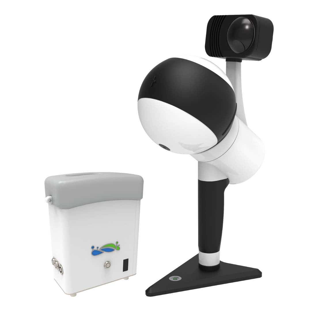
LiGrip H300 Handheld Laser Scanning System
The GreenValley International LiGrip H300 is a powerful handheld laser scanning solution designed for field professionals who need accurate, real-time LiDAR data capture. This mobile, SLAM-based device delivers unmatched precision in a compact form—ideal for geospatial, infrastructure, and forestry applications.
Why Choose the LiGrip H300?
- Built for handheld laser scanning with centimeter-level accuracy (±1 cm)
- Lightweight and portable laser scanning device—perfect for fieldwork
- Delivers real-time handheld LiDAR data capture with absolute coordinates
- Designed for rapid workflows in both indoor and outdoor conditions
See it in action:
Scan Faster with Multiple SLAM Modes
The LiGrip H300 supports a full range of SLAM positioning options to suit any mapping scenario:
- SLAM / PPK‑SLAM / RTK‑SLAM switching for flexibility and precision
- 640,000 points per second scan rate for fast data collection
- 300-meter scan range for large-area coverage
- ±1 cm laser accuracy for reliable, professional-grade results
High-Performance Camera + Imaging Features
- Integrated 6K 1-inch CMOS camera for high-resolution visuals
-
Captures both visual and LiDAR data in real time
Performs exceptionally in low-light and indoor environments
Compatible Platforms & Software Integration
The LiGrip H300 adapts to your workflow:
- Works as a handheld, backpack, vehicle-mounted, or airborne scanner
- Integrates with LiDAR 360 and LiDAR 360MLS for processing, visualization, and analysis
- One solution for survey-grade point clouds, 3D mapping, and inspection tasks
Product Specifications
| Feature | Specification |
|---|---|
| Scanning Modes | SLAM, PPK-SLAM, RTK-SLAM |
| Scan Rate | Up to 640,000 points per second |
| Maximum Range | 300 meters |
| Accuracy | ±1 cm |
| Camera | 1" CMOS sensor, 6K resolution |
| Platform Compatibility | Handheld, backpack, vehicle-mounted, airborne |
| Software Support | LiDAR360, LiDAR360MLS |
Applications: Field-Ready Laser Scanning Equipment
This system is built for professionals who demand speed, reliability, and ease of use across industries:
-
Geospatial surveying and terrain mapping
Forestry canopy analysis and biomass estimation
Mining and infrastructure documentation - Road inspection, bridge modeling, utility corridor scanning
- Indoor mapping and architectural as-builts
What Makes It Field-Ready?
- Compact design for mobile laser scanning for surveying
- Fast deployment—scan large sites without setup delays
-
Supports real-time field data collection and post-processing workflows
Frequently Asked Questions
What is the LiGrip H300 handheld laser scanner used for?
The LiGrip H300 is a rotating handheld LiDAR system designed for high-precision mapping using SLAM, RTK‑SLAM, or PPK‑SLAM. It works in handheld, backpack, vehicle, or drone-mounted setups for applications like forestry, infrastructure inspection, road surveying, and topographic mapping.
What is the scan range and accuracy of the LiGrip H300?
It achieves a maximum range of approximately 300 meters and supports scan rates up to 640,000 points per second with laser accuracy within ± 1 cm.
What mapping methods does the LiGrip H300 support?
LiGrip H300 supports SLAM, PPK-SLAM, and RTK-SLAM. RTK‑SLAM works in GNSS-enabled areas, and PPK-SLAM works offline or in areas without CORS.
How long can the LiGrip H300 scan continuously?
The device supports continuous scanning for up to 55 minutes per charge, depending on mode and power usage.
Can the LiGrip be mounted on a drone?
Yes. It supports multiple mounting options—including handheld, backpack, vehicle, and drone attachments—making it a versatile tool for remote aerial mapping needs.
Order the LiGrip H300 Today
Experience the power of handheld laser scanning in a portable, easy-to-deploy solution. The LiGrip H300 gives surveyors and field engineers the tools to complete complex scanning projects faster and more accurately.
Contact us for custom bundles, integration kits, or project consultation.
- Compatible with LiDAR 360 & LiDAR 360MLS
- Ships with software license and documentation
- Enterprise and government purchasing available

