


DJI D-RTK 3 Multifunctional Station + Survey Pole and Tripod Kit and Care Basic: Precision RTK Support for Enterprise UAVs
For teams that demand centimeter-level positioning accuracy, the DJI D-RTK 3 Multifunctional Station bundle delivers a complete and reliable ground solution. This package combines the D-RTK 3 Station, a dedicated survey pole and tripod kit, and DJI Care Enterprise Basic for comprehensive coverage. Fully compatible with DJI's enterprise platforms-including the Matrice 400, Matrice 350 RTK, Matrice 300 RTK, Matrice 30 Series, Mavic 3 Enterprise Series, and Inspire 3-this system ensures your operations benefit from consistent and dependable RTK corrections in real time.
Built for Field Reliability
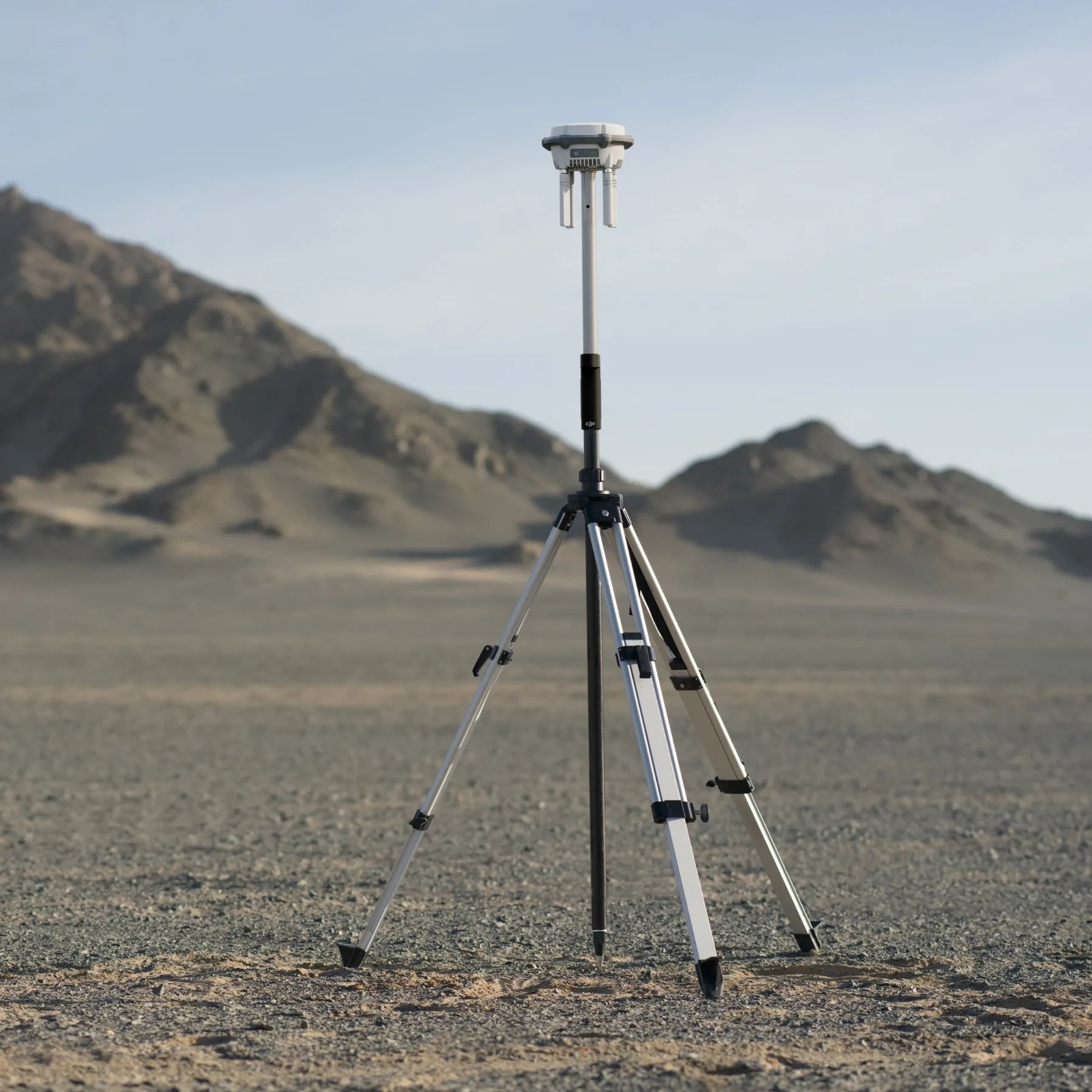
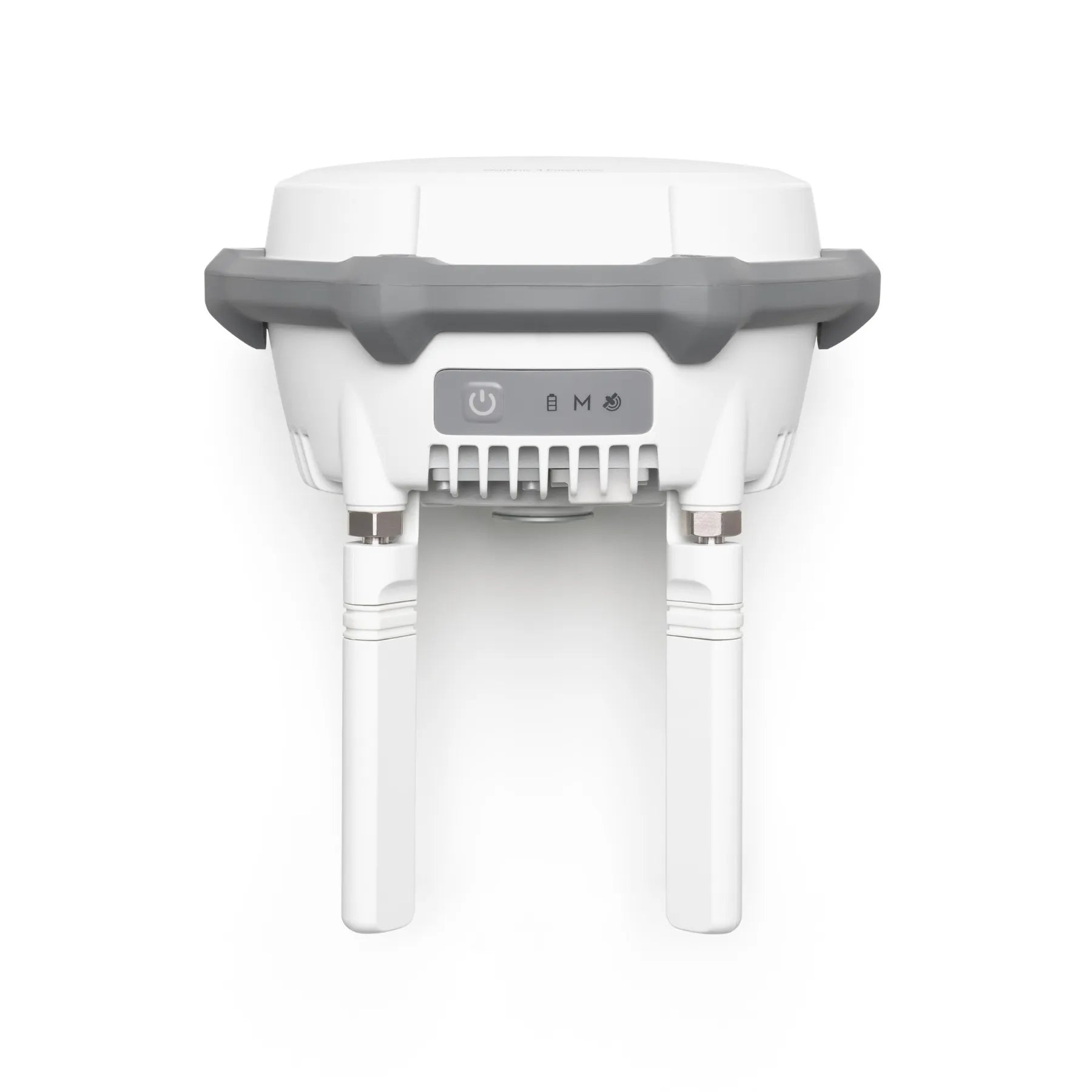
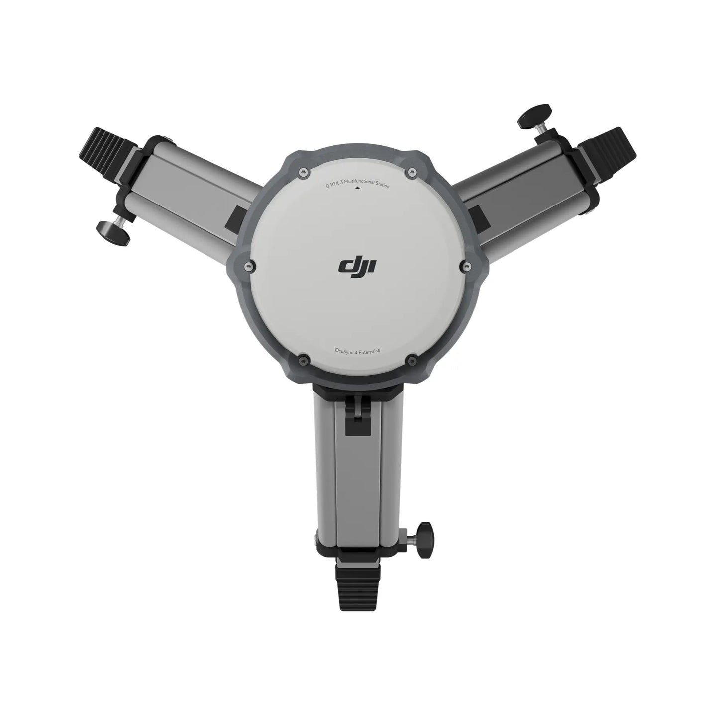
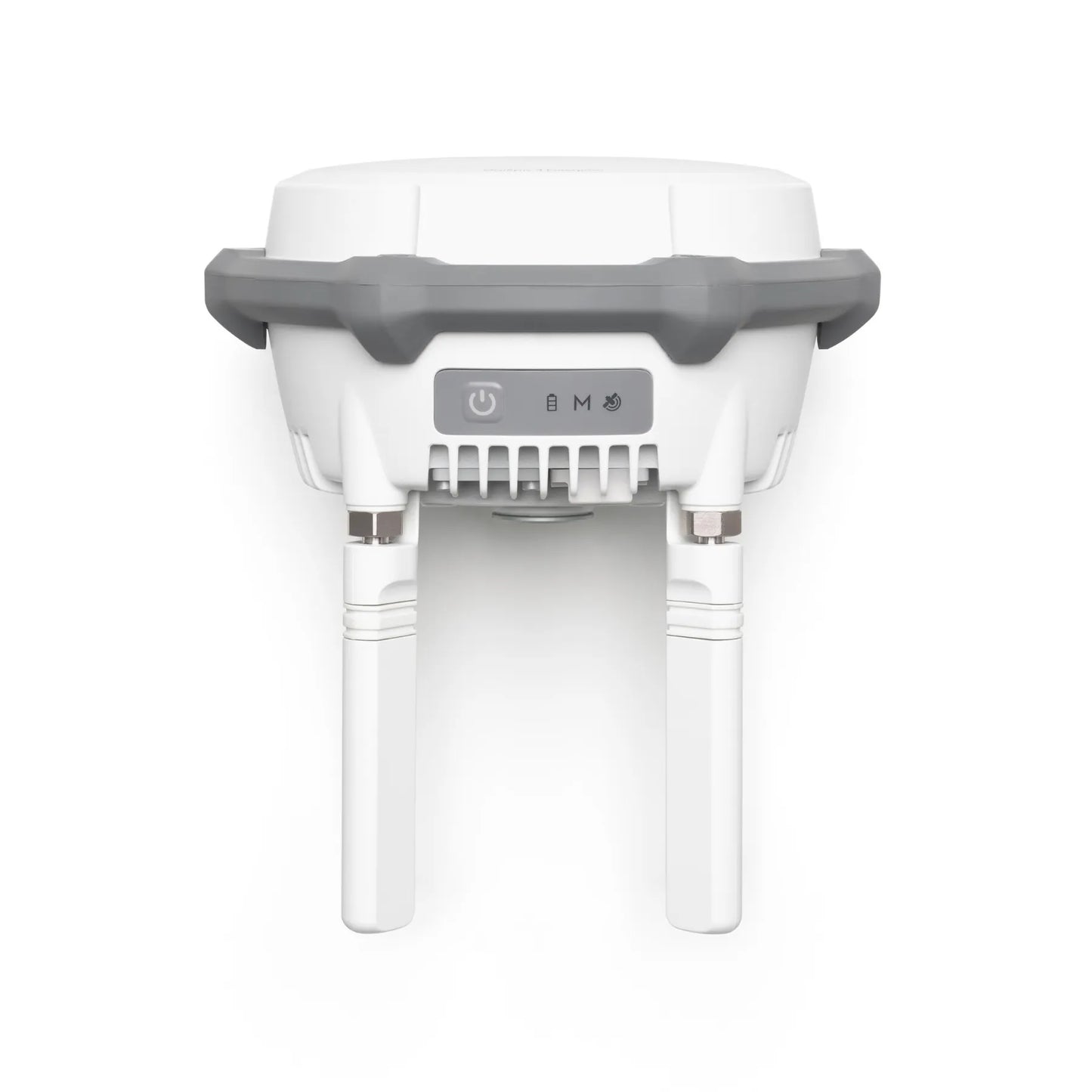
The D-RTK 3 Station supports multi-constellation and multi-frequency GNSS, maintaining accuracy even in dense or obstructed environments. With its tripod and survey pole kit, the system can be deployed quickly and securely for static base use or mobile rover missions. Whether on remote terrain or in built-up areas, this station is engineered for rugged field conditions and long-duration missions.
Confidence with Enterprise Coverage
This bundle includes DJI Care Enterprise Basic, giving your team peace of mind with repair coverage and technical assistance. Whether used for surveying, construction mapping, or disaster response, this package protects your investment and reduces downtime so missions can proceed with minimal disruption.
Key Features and Benefits
- Centimeter-level RTK accuracy: Reliable geolocation for enterprise UAV operations
- Multi-constellation GNSS: Stable positioning even in challenging signal conditions
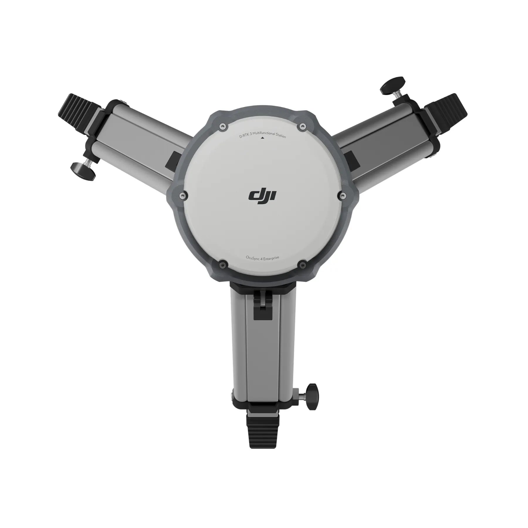
- Tripod and Survey Pole Kit: Secure mounting for flexible static or mobile use
- DJI Care Enterprise Basic: Repair coverage to minimize downtime risks
- Enterprise drone compatibility: Supports Matrice 400, 350, 300, 30 Series, Mavic 3E, Inspire 3
- Rugged, IP65-rated design: Built for demanding outdoor environments
- Extended operational range: Up to 40 km RTK coverage with Matrice 400
- Seamless DJI integration: Optimized with DJI Enterprise apps and DJI Terra
Applications and Use Cases
- Surveying and mapping: Capture precise topographic and geospatial data
- Infrastructure inspection: Support accurate powerline and bridge assessments
- Construction projects: Improve site surveying efficiency and accuracy
- Public safety: Enable dependable positioning for search and rescue operations
- Agriculture: Enhance field mapping and crop analysis
Why Buy from DSLRPros
Since 2012, DSLRPros has equipped professionals with UAV solutions that drive mission success. As an authorized DJI Enterprise distributor, we provide not just hardware but complete lifecycle services, training, and repair programs that keep your operations running. Our UAS specialists deliver field-tested expertise, ensuring that your RTK solutions perform exactly as required. Equip your team today with the DJI D-RTK 3 bundle from DSLRPros for precision you can trust.
Specifications
- GNSS Receiver
-
GNSS Frequency
- GPS: L1C/A, L2C, L5
- BDS: B1I, B2I, B3I, B1C, B2a, B2b
- GALILEO: E1, E5a, E5b, E6
- GLONASS: L1, L2
- QZSS: L1C/A, L2C, L5
- L-Band
-
System Accuracy*
- Base Station Mode (Broadcast Mode) and Relay Station Mode
- Single Point Accuracy (Uncalibrated): Horizontal 1.5 m (RMS), Vertical 3.0 m (RMS)
- Satellite-Based Differential Accuracy: Convergence Time 20 mins, Horizontal 30 cm (RMS), Vertical 40 cm (RMS)
- Network RTK Calibration**: Horizontal 1.0 cm (RMS) + 1 ppm, Vertical 3.0 cm (RMS) + 1 ppm
- Rover Station Mode*
- RTK Accuracy (Fixed Survey): Horizontal 0.8 cm (RMS) + 1 ppm, Vertical 1.5 cm (RMS) + 1 ppm
- RTK Accuracy (Tilt Survey)***: Angle Range 0° to 60°, Horizontal 8 mm + 0.7 mm/° tilt (accuracy <2 cm within 30°)
- Base Station Mode (Broadcast Mode) and Relay Station Mode
-
Satellite-Based Precise Point Positioning*
- Supported Frequencies: BDS B2b, GALILEO E6**, L-BAND**
- Convergence Time: 20 mins
- Accuracy: Horizontal 30 cm (RMS), Vertical 40 cm (RMS)
-
Differential Data Transmission Format
- Records RTCM 3.2 raw observation data in DAT format
- Supports RTCM v3.0, v3.1, v3.2, v3.3, MSM4–MSM7 protocols
- Recommended: receivers supporting four or more GNSS systems
- Initialization Reliability: >99.9%
- Video Transmission
- System: O4 Enterprise
- Operating Frequency
- Relay Station Mode: 2.4 GHz / 5.2 GHz / 5.8 GHz
- Base Station Mode: 2.4 GHz / 5.8 GHz
- Rover Station Mode: BLE 2.4 GHz
- Transmitter Power (EIRP)
- 2.4000–2.4835 GHz: <33 dBm (FCC), <20 dBm (CE/SRRC/MIC)
- 5.150–5.250 GHz: <23 dBm (CE/FCC)
- 5.725–5.850 GHz: <33 dBm (FCC), <30 dBm (SRRC), <14 dBm (CE)
- Bluetooth
- Protocol: Bluetooth 5.1
- Frequency: 2.400–2.4835 GHz
- Power: <10 dBm
-
Max Transmission Distance
- Base Station Mode (aircraft ↔ D-RTK 3): FCC 15 km, SRRC 12 km, CE/JP 8 km
- Rover Station Mode (D-RTK 3 ↔ mobile devices): 30 m
- Relay Station Mode (aircraft ↔ relay): FCC 25 km, SRRC 12 km, CE 10 km
- Relay Station ↔ remote/DJI Dock 3: FCC 1 km, SRRC 1 km, CE 300 m
- With interference: Strong 1.5–5 km, Medium 5–15 km, Micro 15–25 km
- Obstructed: Buildings 0–0.5 km, Trees 0.5–3 km
- Relay Station Range Extension Effect
- Severe obstruction: 3–5x improvement
- Mild obstruction: 1–3x improvement
- Antenna: OcuSync 4 directional antennas ×4, 2T4R (RP-SMA)
- Others
- D-RTK 3 Relay Fixed Deployment: Compatible with DJI Cellular Dongle 2
- Electrical Properties
- Power Consumption
- Relay Station: 14.5 W (36.5 W with heating)
- Base Station: 7 W
- Rover Station: 6.2 W
- Power Output Ports
- Multifunctional Station: USB-C
- Relay Fixed Deployment: USB-C & Ethernet (PoE)
- Supported Adapters
- USB PD 3.0 (9V–15V, e.g., DJI 65W Portable Charger)
- Relay Version: PoE IEEE 802.3bt Type 4/3, 802.3at Type 2
- Battery Operating Time
- Relay Station: 4 hrs
- Base Station: 7 hrs
- Rover Station: 10 hrs
- Battery: LiPo, 6500 mAh, 46.8 Wh
- Physical Characteristics
- Operating Temperature
- Multifunctional Station: -20° to 55° C
- Relay Fixed Deployment: -30° to 55° C
- Altitude: 6000 m
- Protection Rating: IP67
- Drop Resistance: 2 m (with pole)
- Dimensions
- Multifunctional: 163 × 89 mm
- Relay Fixed Deployment: 163 × 344 mm
- Weight
- Multifunctional: 1.26 kg (2.78 lbs)
- Relay Fixed Deployment: 2.24 kg (4.94 lbs)
-
Survey Pole
- Height: 125 cm to 200 cm (without the 5/8" thread)
- Weight: 900 g
-
Tripod
- Height: 92 cm
- Weight: 2800 g
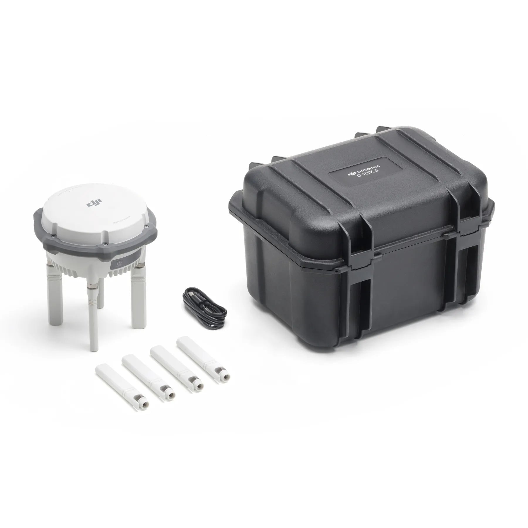
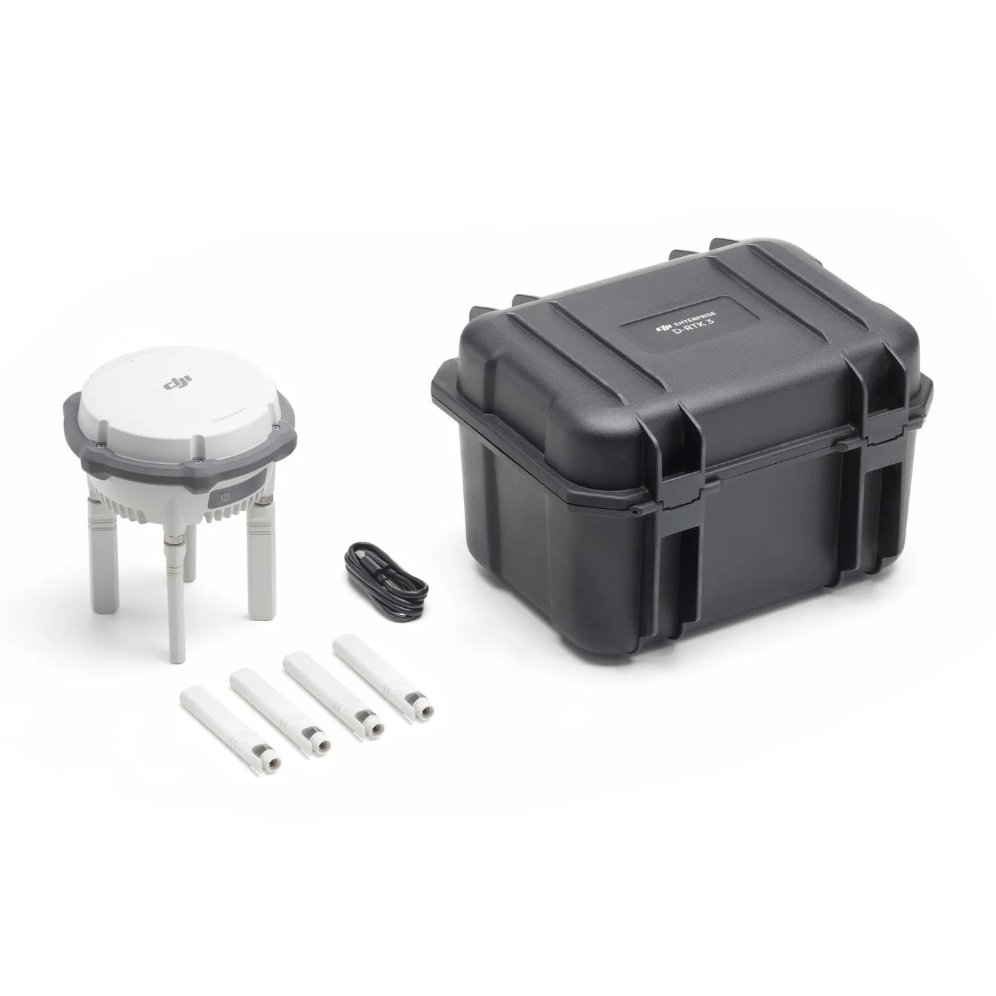
In The Box
- 1x D-RTK 3 Multifunctional Station
- 4x Spare OcuSync Directional Antennas
- 1x USB-A to USB-C Cable
- 1x Battery
- 1x D-RTK 3 Survey Pole and Tripod Kit
- 1x DJI Care Enterprise Basic D-RTK 3

