


Drone Infrastructure Inspection for Bridges, Roads and Buildings
Critical infrastructure keeps society running: bridges, highways, high-rise buildings, power lines, and pipelines. All of these structures need routine inspection to ensure safety and prevent catastrophic failures. Traditional methods rely on scaffolding, cranes, or manual climbing—techniques that are slow, dangerous, and expensive.
Enter drones.
Drone infrastructure inspection uses UAVs equipped with high-resolution cameras, LiDAR sensors, and thermal imaging to inspect assets from the air. The benefits are immediate: safer workflows, faster data capture, and significant cost savings. Industry studies confirm that UAV-based inspections reduce inspection time by up to 70% and lower costs by 40–60% compared to traditional manual inspections.
Why does this matter now?
- Aging infrastructure: According to the American Society of Civil Engineers (ASCE), more than 46,000 U.S. bridges are structurally deficient.
- Rising maintenance demands: Urbanization and extreme weather increase wear on roads and buildings.
- Labor shortages: Qualified structural inspectors are limited; drones help fill the gap.
- Regulatory push: Governments now encourage technology adoption for safer inspection workflows.
Real-world example:
The Minnesota Department of Transportation used drones for bridge inspections and reduced the need for lane closures. Their studies showed 2–3 hours per bridge inspection with UAVs compared to 8+ hours with manual lifts. More importantly, inspectors stayed out of harm’s way, working from safe vantage points while drones captured the necessary visual data.
Drone inspections capture high-resolution visual and thermal data in a fraction of the time of manual inspections, while reducing risk to workers and traffic disruptions.
For engineering firms, DOTs, and inspection contractors, drones aren’t a futuristic concept—they are already being used daily for:
- Bridge and roadway evaluations
- High-rise facade inspections
- Powerline, pipeline, and railway monitoring
This guide will explain how to start or improve your drone inspection program with confidence.
What This Article Covers
This is a complete guide to drone infrastructure inspection for industry professionals. It’s designed for DOTs, engineering contractors, and asset managers who need reliable inspection workflows.
What you’ll learn:
- How drones inspect infrastructure: We’ll break down how UAVs capture data on bridges, roads, and high-rises and what sensors matter most.
- Safety and cost benefits: We’ll quantify the improvements in worker safety, inspection frequency, and total cost of ownership.
- Regulatory and compliance requirements: FAA Part 107 rules, Remote ID, and BVLOS waivers—and how they impact inspection workflows.
- Technology that matters: From RTK/PPK GNSS workflows to LiDAR and AI defect analytics.
- Future trends: Digital twins, autonomous drone docks, and AI-driven inspections.
- Actionable guidance: Buyer recommendations and how to select UAV hardware and sensors.
By the end of this article, you’ll know not just what drones can do, but how to integrate them into your inspection workflows while meeting compliance and ROI goals.

Why Drones Matter for Infrastructure Inspection
Inspections are not optional—they’re mandatory for public safety and asset management. But the way inspections have been done for decades has major flaws: high costs, dangerous work environments, and limited frequency.
Drones fix these problems. UAVs add measurable safety, speed, and savings to infrastructure assessments without cutting corners on data quality.
1. Safety Comes First
Traditional inspection methods put workers at risk:
- Bridge inspectors dangle from under-deck platforms or rappel down support structures.
- High-rise facade teams use scaffolding or lifts, often near traffic.
- Roadway inspections require lane closures, exposing crews to moving vehicles.
According to OSHA, falls remain a top cause of fatalities in construction and inspection jobs. UAVs reduce these risks by keeping personnel safely on the ground.

Case example:
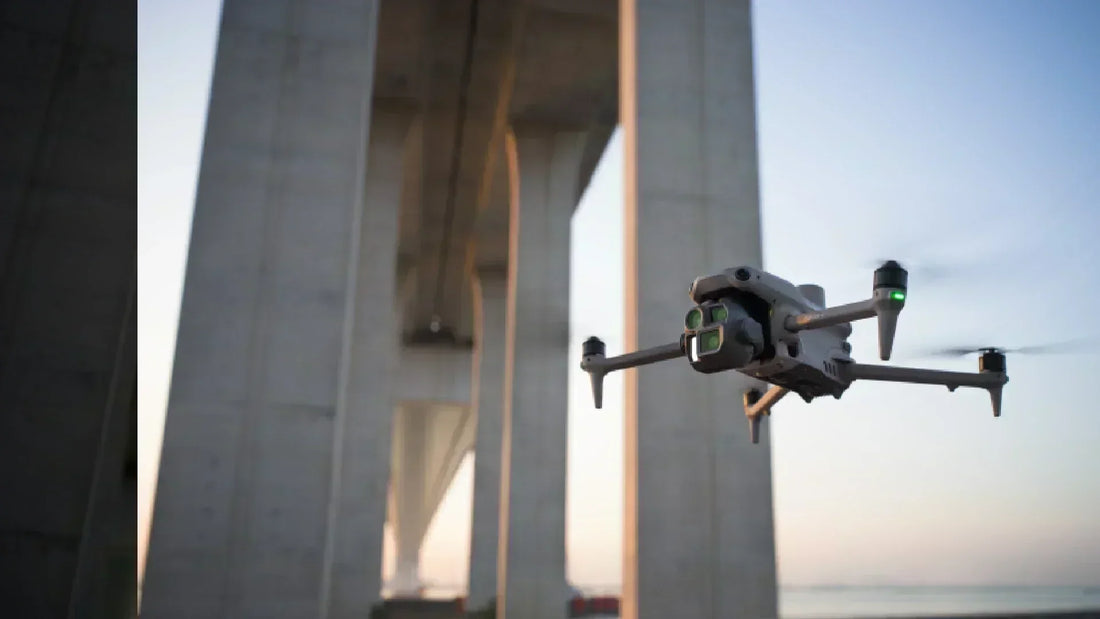
Caltrans is expanding its use of drones for bridge inspections across California, offering a safer, more efficient alternative to traditional access methods. Since late 2019, Caltrans’ bridge inspection crews have operated a specialized drone "air corps"—ranging from compact to larger multi-sensor models—to inspect hard-to-access elements like piers and under-deck sections.
- These drones carry high-definition cameras (with features like upward-facing video, optical zoom, and infrared) and send real-time imagery to ground-based inspection teams.
- The main advantage: drones allow inspectors to stay on stable ground, avoiding traffic hazards, lane closures, and hazardous maneuvering from under-bridge vehicles or boats.
Drone inspections improve worker safety by eliminating the need for scaffolding, rope access, or lane closures. UAVs capture detailed data while crews remain safely on the ground.
2. Faster and More Frequent Inspections
Manual inspections take time—sometimes days per structure. Lane closures and equipment rentals slow everything. UAVs change the math:
- UAVs can inspect 3–4 bridges per day versus one bridge per day with conventional methods.
- High-rise facade scans can be done in hours instead of days, reducing disruption to occupants.
- Rail corridor inspections that take weeks on foot are completed in days with drones.
Example:
Union Pacific deploys drones to inspect bridges, culverts, tunnels, and other elevated infrastructure across its 32,000-mile network—helping teams spot damage faster and minimizing manual access to risky areas.
3. Cost Savings That Add Up
Every hour of inspection costs money: crew wages, lane closures, traffic management, and equipment rental. Drones minimize these expenses.
- A Michigan Department of Transportation analysis (reported through AASHTO and media) found:
- A typical bridge inspection costs about $4,600.
- A drone-assisted inspection costs about $250.
- That’s a savings of roughly $4,350 per inspection.
- PwC research highlights the broader economic potential of drone technology:
- Contributions to UK GDP.
- Productivity gains across industries.
- However, PwC does not provide specific percentage savings for UAV inspection methods.
The savings aren’t just direct; UAVs also enable predictive maintenance. Inspect more often, find issues earlier, and prevent expensive failures.
4. Data Quality and Coverage
Speed and safety mean nothing without accurate data. Drones deliver more detail than human eyes alone:
- High-resolution optical cameras capture hairline cracks and corrosion.
- Thermal cameras detect water intrusion or insulation gaps invisible to the naked eye.
- LiDAR payloads map entire structures in 3D with centimeter-level accuracy.
Advanced UAV workflows integrate RTK/PPK GNSS corrections to geotag every image precisely.
5. Increased Regulatory Compliance
Inspection intervals are dictated by law. FAA Part 107 allows UAV operations under controlled conditions; Remote ID and BVLOS waivers expand what’s possible legally. Agencies and contractors using drones gain:
- Easier documentation to meet DOT and OSHA reporting requirements.
- Permanent digital records for audits and legal defense.
- FAA compliance using updated Remote ID and BVLOS frameworks (Part 108 overview).
Drone inspection data doubles as compliance evidence, offering timestamped, geotagged imagery for legal and regulatory reporting.
Why It Matters Now
Infrastructure failure costs lives and billions of dollars. The I-35W bridge collapse in Minneapolis (2007) killed 13 people and injured 145. Investigations cited missed structural deficiencies. More frequent, safer UAV inspections help prevent tragedies like this.
Want to make inspections safer and more efficient?
Contact DSLRPros to build your UAV inspection program →

How Drone Infrastructure Inspections Work
Knowing drones improve safety and costs is one thing. Understanding how UAV inspections actually happen is what helps teams adopt them effectively. Here’s how modern infrastructure inspections are conducted with drones, from hardware to workflow.
1. UAV Platforms for Infrastructure Work
Not all drones are inspection-ready. Enterprise platforms offer the stability, payload capacity, and GNSS accuracy that critical infrastructure projects demand.
Common UAV types used:
- Multirotors (e.g., DJI Matrice 350 RTK): Stable hover for close-up bridge, facade, and utility inspections.
- Fixed-wing drones (e.g., senseFly eBee): Longer endurance for highway corridors and large area surveys.
- Hybrid VTOL platforms: Combine multirotor hover with fixed-wing range for diverse missions.
Key platform features that matter:
- High wind resistance for bridge/roadway projects.
- RTK/PPK GNSS modules for centimeter-level data.
- Redundant IMU/GNSS for safety compliance.

2. Sensors That Capture Critical Data
UAVs are only as effective as the payload they carry. For infrastructure inspection, multi-sensor payloads provide a complete picture:
- Optical RGB Cameras: 20–45 MP stills for high-resolution imagery of cracks, corrosion, and spalling.
- Thermal Cameras: Detect moisture intrusion, insulation gaps, and overheated electrical components.
- LiDAR Sensors: Generate dense point clouds for bridge decks, towers, or road grade mapping.
- Multispectral Sensors: Useful for vegetation encroachment on rights-of-way and erosion monitoring.
Drone inspections use optical, thermal, and LiDAR sensors to detect cracks, heat anomalies, and structural deformation in bridges, roads, and buildings with centimeter-level accuracy.
3. End-to-End UAV Inspection Workflow
A successful drone infrastructure inspection follows a repeatable, defensible process:
- Mission Planning:
- Define inspection targets and flight routes.
- Check airspace regulations (FAA Part 107, Remote ID compliance).
- Pre-Flight Setup:
- Calibrate GNSS/IMU.
- Confirm sensor payloads and batteries.
- Data Capture:
- Fly pre-programmed routes or manual close-up passes.
- Capture high-res images, thermal scans, or LiDAR swaths.
- GNSS Corrections:
- Use RTK/PPK for geotagging accuracy.
- Data Processing:
- Upload imagery to photogrammetry or inspection software.
- Generate 3D models, orthomosaics, or heat maps.
- Analysis & Reporting:
- Engineers review annotated datasets.
- Findings exported for compliance reports or predictive maintenance plans.
4. Compliance Built Into the Workflow
Drone inspections don’t happen in a vacuum. FAA regulations dictate flight parameters:
- Remote ID: All UAVs must broadcast identification as of 2024.
- BVLOS Operations: Many corridor projects apply for waivers (see Part 108 BVLOS guide).
- Data Retention: Audit-ready geotagged imagery supports legal and insurance requirements.
Why This Section Matters
Professionals need clear, defensible workflows before investing in UAV inspections. By breaking down platforms, sensors, and process steps, readers see how drone inspections fit their operations with minimal guesswork.
Ready to build your inspection workflow?
Talk to DSLRPros for UAV platform and sensor recommendations →
Key Benefits of Drone Infrastructure Inspections
Enterprise buyers don’t need hype. They need proof that drones solve real safety risks, save time, and cut costs. Here’s how UAV inspections deliver measurable value for critical infrastructure projects.
1. Safety Improvements That Protect Lives
Traditional inspections put people in harm’s way:
- Bridge inspectors dangle from harnesses or climb scaffolding.
- Utility crews work near live electrical lines.
- Road inspectors walk active lanes.
With drones:
- UAVs access hard-to-reach areas without putting workers at height.
- Thermal and zoom sensors detect hazards from a safe distance.
- Autonomous routes limit human exposure to traffic and live loads.
Drone inspections improve safety by replacing hazardous climbs and close contact with remote aerial data collection. Workers stay on the ground while UAV sensors capture detailed imagery and thermal data.
2. Efficiency Gains That Speed Projects
Manual inspections are slow. Drones compress timelines:
- Bridges that take two weeks with scaffolding can be inspected in two days with UAVs.
- LiDAR-equipped UAVs map road corridors in hours instead of days with survey crews.
- Automated flight plans allow repeatable inspections on schedules, reducing downtime.
Case example:
A Midwest utility reduced transmission tower inspection time by 55%, freeing crews for repair work instead of manual surveys.
Workflow efficiency pain point solved:
- Less need for lane closures.
- Reduced setup time for scaffolding.
- Digital data archived and reused for trend analysis.
3. Cost Savings That Impact the Bottom Line
Labor and downtime are expensive. UAV inspections offer:
- Lower labor costs: One drone pilot replaces teams of inspectors.
- Reduced equipment rental: No need for lifts, scaffolding, or lane closure permits.
- Preventive maintenance savings: Detecting early issues avoids catastrophic failures.
Stats: FHWA studies show UAV bridge inspections can save 30–50% in total inspection costs.
Drone infrastructure inspections reduce costs by eliminating scaffolding, lane closures, and excessive labor. Many agencies report 30–50% savings compared to traditional methods.
4. Additional Buyer Pain Points Addressed
For infrastructure owners and operators, the benefits extend beyond cost and safety:
- Audit-ready data: UAV inspections produce high-resolution, geotagged imagery that can be archived and reused for compliance reports.
- Fewer site visits: Engineers can analyze data remotely, reducing travel time.
- Integration with asset management systems: UAV outputs link to BIM models or predictive maintenance software.
Drone Inspection Compliance Basics
Infrastructure inspections aren’t just about drones and data—they’re governed by strict FAA rules. Compliance is mandatory, and violations risk fines, waivers being revoked, and even legal consequences. For teams flying near bridges, highways, or utility corridors, the following compliance areas matter most.
FAA Compliance at a Glance
| Compliance Element | What It Requires | Inspection Relevance |
|---|---|---|
| Remote ID | Drone broadcasts ID, location, altitude, and control station data (mandatory as of March 2024). | Verifies legal operation during urban or roadway flights; ensures traceability and public safety. |
| VLOS (Visual Line of Sight) | Pilot or visual observer must maintain unaided visual contact under Part 107. | Restricts range unless waived; impacts tall structure and corridor inspections. |
| BVLOS (Beyond Visual Line of Sight) | Requires FAA waiver or upcoming Part 108 approval; detect-and-avoid and safety mitigations are needed. | Enables long-range inspections of pipelines, railways, and remote infrastructure. |
| Audit-Ready Data | Records and logs that meet regulatory and legal review standards. | Essential for DOT and utility contracts; RTK/PPK supports defensible deliverables. |
1. Remote ID and Why It Matters
Remote ID is the FAA’s system for making drone flights transparent and accountable. It functions like a “digital license plate,” broadcasting essential information about your drone during every mission. For infrastructure inspections near roads, bridges, or urban spaces, this requirement is essential for both compliance and public trust.
- Acts as the FAA’s “digital license plate” for drones.
- Mandatory since March 2024 for most commercial UAVs.
- Broadcast includes: ID, location, altitude, control station, and takeoff point.
- Why it matters for inspections:
- Proves compliance during urban or roadway flights.
- Provides traceable, auditable flight records.
- Reduces risk of FAA violations and safety complaints.
2. Visual Line of Sight (VLOS)
VLOS is the cornerstone of Part 107 operations, requiring pilots to maintain unaided visual contact with their drone. While it ensures safety in most operations, it also limits the scope of inspections when infrastructure stretches beyond the pilot’s view. Knowing the rules helps teams decide when a waiver is worth pursuing.
- Required under Part 107: pilot or visual observer must keep eyes on the drone.
- Unaided visual contact means no binoculars, FPV feed, or other visual tools.
- Why it matters for inspections:
- Restricts inspection range to what the human eye can see.
- Impacts corridor missions (highways, bridges, powerlines).
- Waiver may be needed for tall structures or extended routes.
3. Beyond Visual Line of Sight (BVLOS)
BVLOS operations unlock the ability to inspect pipelines, corridors, and remote infrastructure that extend far beyond visual range. While waivers are currently the only pathway, the FAA is moving toward a permanent BVLOS rule (Part 108). Understanding requirements and planning mitigations early ensures smoother approvals.
- Part 107 limits operations to within VLOS.
- BVLOS requires an FAA waiver until new Part 108 rules are finalized.
-
Operators must build a safety case with:
- Detect-and-avoid measures.
- Remote ID compliance.
- Pilot and crew training.
Why it matters for inspections:
- Essential for pipelines, bridges, and utility corridors.
- Expands coverage without requiring constant repositioning.
4. Audit-Ready Data
Audit-ready deliverables ensure inspection data can withstand legal or regulatory scrutiny. Many DOT and utility contracts require defensible records that prove accuracy and compliance. RTK/PPK corrections and secure archives help teams provide evidence that stands up to audits.
- Regulatory expectation: contracts often require auditable records.
- Why it matters for inspections:
- Surveys must be legally defensible in court or regulatory reviews.
- DOT and utility regulators demand traceable deliverables.
- How drones support compliance:
- RTK/PPK workflows for centimeter-level geotag accuracy.
- Digital archives with time-stamped flight logs.
- Integration with asset management platforms for reporting.
Audit-Ready Checklist
- High-resolution geotagged imagery
- Remote ID and flight logs
- RTK/PPK accuracy reports
- Secure archival in compliance with industry standards
5. Common Compliance Pain Points and Solutions
Even well-prepared inspection teams run into compliance challenges. Remote ID misconfigurations, VLOS limits, or data quality concerns can put projects at risk. Anticipating these pain points—and planning solutions in advance—keeps missions legal, safe, and audit-ready.
Remote ID Issues
- Problem: Drone fails to broadcast Remote ID due to outdated firmware or setup errors.
- Solution: Regularly update UAV firmware, confirm Remote ID status before takeoff, and maintain backup logging tools.
VLOS Limitations
- Problem: Corridor or tall-structure inspections extend beyond the pilot’s line of sight.
- Solution: Apply for BVLOS waivers early, and include FAA-approved detect-and-avoid mitigations in your safety case.
BVLOS Waiver Delays
- Problem: FAA waiver process takes months, slowing project timelines.
- Solution: Build a reusable waiver package with documented safety protocols, training records, and equipment specs to accelerate approvals.
Audit Challenges
- Problem: Flight records or imagery questioned during legal or regulatory audits.
- Solution: Use RTK/PPK corrections, maintain redundant logs, and store records in secure archives with timestamps.
⚠️ Compliance Reminder
Compliance isn’t optional—FAA violations can mean fines, revoked waivers, and stalled projects. Staying audit-ready keeps your inspection program moving forward.
Stay ahead of FAA compliance.
DSLRPros helps inspection teams meet Remote ID rules, prepare BVLOS waiver packages, and deploy drones with RTK/PPK for defensible data.
- Get step-by-step support for waiver applications.
- Configure inspection hardware for Part 107 and future Part 108 standards.
- Build audit-ready workflows with traceable logs and geotag accuracy.
Talk to a DSLRPros expert today to make your inspection program compliant, efficient, and audit-proof.

Future Trends in Drone Infrastructure Inspection
Inspection workflows evolve fast. Here's what mental shift you need to make now:
BVLOS Regulation Is Nearing the Tipping Point (FAA Part 108)
- In August 2025, the FAA released the long-awaited BVLOS NPRM (Notice of Proposed Rulemaking) (Part 108), aimed at removing waiver limitations and offering a scalable compliance path for long-distance UAV operations.
- The rule introduces two FAA pathways:
- Part 108 Permit: For lower-risk, routine operations like surveying and civic use
- Part 108 Certificate: For complex, high-stakes applications such as infrastructure inspection over critical areas
- Industry experts note this shifts accountability from individual pilots to operators—large agencies or teams can obtain permits for wide programs, increasing scale and consistency.
Once finalized—likely by early 2026—this rule will simplify execution of long corridor inspections, enabling routine, compliant drone scans of linear assets like pipelines or rail networks.
FAA Part 108 (BVLOS framework) moves drone inspections from site-by-site waivers to scalable, permit-based operations—unlocking routine long-range inspection programs.
AI, Automation, and Agentic UAVs Are Raising the Bar
- AI-powered analytics transform raw footage into insights. AWS’s AI Workforce system drives defect detection across wind turbines, pipelines, and power infrastructure.
- Market growth: Autonomous drone systems are at the forefront of a projected $54.6B industry by 2025, with the autonomous segment alone reaching ~$25B.
- Autonomous coordination: Swarm intelligence and edge processing are enabling multiple UAVs to operate collaboratively and autonomously.
- Agentic UAVs integrate perception, decision-making, and mission adaptation, offering responsiveness in unpredictable environments. Infrastructure inspection is a prime use case.
Autonomous drones will operate with minimal human oversight—adapting real-time to structural changes or obstacles. Inspection project managers will increasingly rely on AI for rapid defect classification and decision support.
AI-enabled drones perform smarter inspections. They adapt to structural risks, flag failures, and sync with inspection asset systems, reducing human review time.
Autonomous Drone-in-a-Box Systems Are Becoming Standard
- Drone-in-a-box (DIAB) systems combine self-charging docks with pre-programmed missions for on-demand inspection. Pilots monitor from afar, reducing labor overhead.
- Industrial deployments—such as mining sites in Peru and Australia—show high utilization (150–200 flights/month per dock).

Sites like substations, rail yards, and communication towers benefit from scheduled inspections powered by DIAB. No need to dispatch crews—just schedule daily autonomous scans and get immediate data.
AI and Robotics in Confined-Space and Underground Infrastructure
- Sewer inspections are being revolutionized by AI-enabled drones like Flyability Elios 3, paired with inspection software (SewerAI). Operation time shrank, and defect detection soared.
- Agentic systems like AERIAL-CORE demonstrate UAVs inspecting power lines autonomously beyond visual range, integrating aerial manipulators for maintenance tasks.
Even the riskiest environments—confined, leaking, or degrading—are now accessible remotely. Automated drone systems replace confined-space crews entirely.
Global Drone-as-a-Service Models Grow
- Private sector adoption is rising: Nokia and Swisscom rolled out drone networks across Switzerland, delivering inspection and emergency support on demand—without purchasing fleets.
Inspecting agencies can adopt drone workflows instantly through services—benefiting from expert setup and scaling without deployment costs.
What This Means for Your Inspection Strategy
- Plan for BVLOS readiness. Grant remote corridor surveys and rapid response.
- Invest in AI-capable drones and software. Speed and accuracy come through automation.
- Deploy DIAB for high-frequency sites. Think of your infrastructure as being always monitored.
- Adopt AI + robotics in tricky sites. Confined or underground assets can now be monitored painlessly.
- Consider DaaS (Drone-as-a-Service) if managing fleets is out of scope.
Want to pilot autonomous drone inspections with future-ready tech?
Schedule a strategy session with DSLRPros →
Buyer Guidance for Drone Infrastructure Inspection Programs
Implementing drones is not just about buying an aircraft. The right solution aligns with your inspection workflow, regulatory needs, and long-term ROI. Here’s how to approach procurement with clarity.
1. Define Your Mission and Assets
Ask the right questions:
- What assets will you inspect? (Bridges, railways, towers, pipelines)
- Are inspections high frequency (daily, weekly) or periodic?
- Do you need data fast, or can you process post-flight?
These answers determine your hardware class (multi-rotor for confined spaces, fixed-wing for long corridors) and payloads (visual cameras, thermal, LiDAR)
Choosing a drone starts with defining your asset profile and inspection frequency. The wrong platform wastes time and budget.
2. Choose Sensors that Match Inspection Needs
Different sensors unlock different insights:
- High-res RGB cameras: Structural cracks, corrosion, missing bolts.
-
Thermal cameras: Overheating components in substations or railways.
- LiDAR payloads: Vegetation encroachment, elevation models for bridges.
- Multispectral sensors: Less common for infrastructure but useful for railbeds or adjacent land monitoring.
3. Evaluate RTK/PPK and Data Accuracy
Inspection deliverables require defensible data. Most agencies now mandate centimeter-level GNSS accuracy.
- RTK drones: Immediate geotagging, ideal for same-day reporting.
- PPK workflows: Post-processed logs for audit-ready documentation.
- Hybrid: The safest approach (recommended by DSLRPros).
Want a deeper look at how these methods compare? Check out our RTK vs PPK guide, where we break down accuracy, workflows, and when to use each.
4. Consider Compliance Upfront
Compliance isn’t optional:
- Remote ID hardware/software must be integrated.
- BVLOS waivers or upcoming Part 108 pathways may affect your program.
- Night operations and flights over people require proper lighting and parachute systems.
Tip: Choose platforms already compliant or easily upgradable.
5. Assess Software Ecosystem and Data Management
Hardware is half the story. Data must flow into your asset management systems.
- Flight planning software: DJI Pilot 2, DroneDeploy, Skydio Autonomy Enterprise.
- Inspection software: AI-driven defect detection (e.g., AWS, Skydio 3D Scan).
- Data integration: APIs to sync with GIS, CMMS, or BIM systems.
Buyer pain point:
Many agencies underestimate data workflow costs. Managing 4K footage and LiDAR point clouds without a system plan creates bottlenecks.
6. Budget Beyond Hardware
A $20K drone package is meaningless if operating costs cripple you. Budget for:
- Pilot training and recurrent FAA Part 107 certification.
- Insurance and liability coverage.
- Spare batteries, propellers, and payload calibration.
- Data storage and processing software.
ROI example:
Some utility cooperatives have shifted inspection tasks from helicopters to drones, realizing significant cost savings, enhanced data quality, and improved safety. While precise figures like “$150K investment yielding $600K in savings” aren’t publicly documented, industry reports consistently highlight strong operational ROI and safety improvements with drone adoption.
7. Pilot Programs and Scaling Strategy
Start with a pilot project before fleet rollouts:
- Select one or two assets for initial inspection.
- Measure key KPIs: inspection time, data quality, rework rate.
- Refine SOPs and safety protocols.
Scaling comes once ROI and compliance are proven.
8. Should You Buy or Outsource?
Not all agencies need an internal fleet. Drone-as-a-Service (DaaS) is growing, allowing on-demand inspections without asset ownership.
- Best for small municipalities or firms with occasional needs.
- Avoids training, compliance, and fleet management overhead.
Need help selecting the right drone inspection solution?
DSLRPros provides platform demos, hybrid RTK/PPK workflows, and compliance consultation to reduce your risk and speed up deployment.
What is the best drone for infrastructure inspection?
The best drone depends on your assets and workflow. Agencies inspecting bridges and towers often choose RTK-enabled multi-rotors like the DJI M350 with thermal and LiDAR payloads. Long corridor projects may need fixed-wing VTOLs. Compliance-ready platforms with Remote ID and hybrid RTK/PPK provide the most flexibility.
Conclusion and Final Recommendations
Drone technology has transformed infrastructure inspections from a slow, high-risk process into a precise, data-driven operation. Whether you’re overseeing bridges, pipelines, or power grids, UAVs provide the safety, efficiency, and compliance edge modern asset managers demand.
Key Takeaways:
- Accuracy drives results: RTK and PPK workflows deliver centimeter-level mapping critical for structural monitoring and predictive maintenance.
- Safety is non-negotiable: Drones reduce the need for lifts, scaffolding, or lane closures. Workers stay out of harm’s way while data quality improves.
- Compliance matters: FAA Remote ID, BVLOS waivers, and audit-ready logs are now baseline requirements. Investing in compliant workflows avoids costly rework and regulatory penalties.
- Technology is evolving: AI-driven defect detection, digital twins, and automated inspection drones are setting the stage for 2025 and beyond. Teams that plan now will lead tomorrow.
How to Move Forward With Confidence
If you’re evaluating drones for infrastructure inspections, ask these questions:
- What assets are you inspecting, and how often?
- Do you need real-time results (RTK) or validated post-processing (PPK)?
- What regulatory approvals will your program require?
- How will you integrate drone data with your existing asset management systems?
Your answers determine the right drone platform, sensors, and workflow. The smart move is partnering with experts who have done this across industries and regulatory frameworks.
Why Work With DSLRPros
DSLRPros provides turnkey drone inspection packages designed for enterprise-grade operations:
- Hybrid RTK/PPK drones ready for audit-proof data.
- Payloads for thermal, LiDAR, and visual inspections with IP-rated durability.
- Consultation on FAA waivers, BVLOS approvals, and Remote ID compliance.
- Training and ongoing support for long-term success.
Ready to build or scale your drone inspection program?
Talk to a DSLRPros expert today for a custom consultation, workflow design, and compliant UAV packages built for your industry.
Drone inspections improve safety, cut costs, and meet compliance. RTK/PPK drones with the right sensors deliver 1–3 cm accuracy for bridges, pipelines, and other assets. DSLRPros helps agencies and companies deploy turnkey solutions with training and regulatory support.
Frequently Asked Questions on Drone Infrastructure Inspections
What is a drone infrastructure inspection?
A drone infrastructure inspection uses UAVs equipped with cameras, LiDAR, or thermal sensors to collect high-resolution data on assets like bridges, towers, and pipelines. Drones reduce the need for scaffolding, lifts, or helicopters while providing safer, faster, and more accurate visual and geospatial data.
How are drones used for bridge and road inspections?
Drones fly pre-planned routes around bridges and roads to capture detailed images and 3D models. RTK/PPK positioning ensures centimeter-level accuracy for defect mapping. Engineers can detect cracks, corrosion, or alignment issues without closing lanes or risking worker safety.
Drones inspect bridges and roads by capturing high-resolution imagery and geotagged 3D models, enabling faster, safer defect detection without lane closures.
Are drone inspections cost-effective for infrastructure projects?
Yes. Agencies typically report 50–70% cost savings compared to manual or helicopter inspections. Drones lower labor costs, reduce downtime, and minimize the need for traffic control or access equipment. Long-term ROI comes from more frequent, proactive inspections and reduced asset failures.
What regulations apply to drone infrastructure inspections?
Operators must comply with FAA Part 107 rules, Remote ID requirements, and sometimes BVLOS waivers. Night operations or flights over people need proper lighting and parachute systems. Choosing compliant platforms helps agencies avoid penalties and speed waiver approvals.
What is the best drone for infrastructure inspection?
There is no one-size-fits-all answer.
- Bridges and towers: DJI Matrice 350 RTK or Skydio X10 with zoom and thermal payloads.
- Corridor projects (roads, pipelines):
- Fixed-wing VTOLs like WingtraOne or Quantum Systems Trinity with LiDAR.
- Hybrid RTK/PPK platforms are preferred for audit-ready data.
Do drones replace manual inspectors?
No. Drones enhance inspections by capturing data in hard-to-reach or hazardous areas. Engineers and inspectors still interpret the data and make final decisions. Drones complement—not replace—human expertise.
Can drones inspect infrastructure in bad weather?
Most commercial UAVs operate safely in light wind and mild rain. IP-rated platforms like the DJI M300/M350 RTK offer weather resistance. However, heavy rain, strong winds, and low visibility may still require postponing flights.
How accurate is drone data for infrastructure surveys?
With RTK or PPK workflows, accuracy can reach 1–3 cm. This is sufficient for structural monitoring, digital twins, and maintenance planning. For a full breakdown of GNSS workflows, see our PPK vs RTK guide.
Can drones inspect under bridges or confined spaces?
Yes. Skydio, Elios, and similar drones with obstacle avoidance and protective cages are designed for close-quarter inspections. They safely navigate under decks or inside tunnels where GPS may be weak.
Need guidance on building or scaling your drone inspection program? DSLRPros offers compliance-ready UAV packages, RTK/PPK hybrid workflows, and consultation for public agencies and private firms.
Talk to an expert →

