PIX4Dreact

Vendor Part Number
REACT

As low as $450.00

  • 2D fast-mapping for emergency response and public safety
  • Intuitive software for situations that require rapid insights
  • No cloud computing involved
  • Document, annotate, and share maps in minutes
  • Great for quickly informing civilians of status
  • Monthly subscription: $70/month (billed monthly)
  • Yearly subscription: $700/year (billed yearly)
  • Perpetual License: $1999 (one-time) 

Out of stock

OR

Give Us A Call

Kevin Hale - Drone Expert

(213) 262-9436

Pix4Dreact


2D fast-mapping for emergency response and public safety

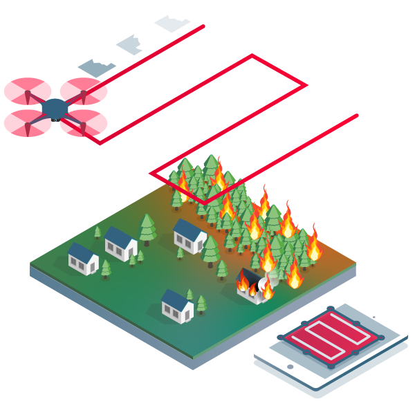
Capture: Fly your Mavic 2 Pro to capture the images you need. Plan an optimized and automated flight with an app like Pix4Dcapture.

Process: Combine large numbers of images in minutes with Pix4Dreact. Create measurable 2D maps either in the field or back at base.

Examine: With Pix4Dreact's simple tools, identify and measure points of interest, mark and evaluate your maps while on the ground to provide powerful data needed to take action.

Share: Export your maps to ensure teams and decision-makers are provided with effective information when it is needed most.

Respond: With up-to-date maps, gain precious time, improve safety, and reduce costs when responding to an evolving situation.

Pix4Dreact creates 2D maps from aerial imagery in minutes. Because when every second counts, up-to-date and reliable information is of utmost importance to teams on the ground.

Simple and intuitive to use, even in complex and stressful situations. Pix4Dreact is developed with public safety and humanitarian aid professionals to meet their unique challenges.

Lightweight enough to work on a mid-range computer in the field. Pix4Dreact doesn’t rely on an internet connection or the cloud for processing.

PIX4Dreact Subscription Options:

  • Monthly subscription: $70/month (billed monthly)
  • Yearly subscription: $700/year (billed yearly)
  • Perpetual License: $1999 (one-time)


MAKE SURE YOUR PLANS ARE BASED ON UP-TO-DATE DATA

This image shows side-by-side comparisons of satellite imagery and an up-to-date map created with Pix4Dreact. If your public safety organization was planning simply based on satellite images, the dirt area behind the building may look like an acceptable staging area. Unfortunately, there has been some construction since the satellite has updated. The up-to-date map from Pix4Dreact ensures when you're planning, you won't have any surprises like a new wall or an additional 2000 square feet of parking lot to deal with on the fly.

The full map of this building and its near surrounding area took a total of 23 minutes to create, from pulling the drone (DJI Mavic Pro) out of the bag to the final map export. All of that while also maintaining complete control of the data, which is not uploaded to or processed in the cloud..


Compare Pix4Dreact & Pix4Dmapper

Orthomosaic output from react and mapper with the exact same data set.

Click and slide the blue slider to compare two images:


Dataset captured with DJI Mavic 2 Enterprise Dual (RGB only) with Smart Controller using DJI Pilot App.

In the comparison above, you can see that Pix4Dmapper stitches the images together much more accurately, giving much straighter edges and lines. Pix4Dreact has some rough edges, but for most first-responder situations is accurate enough for quick action. While mapper's map has incredible detail, it took 5 hours and 52 minutes to process the map and be able to export or interact with the map. In a tight (or simply time-sensitive) situation, the Pix4Dreact map is adequate for action and took a mere 16 minutes to process the data.

Recommended Hardware and Software Requirements


  • CPU: Intel® Coreâ„¢ i3 or AMD Phenom processor (or faster)
  • RAM: 4GB RAM (or more)
  • Hard disk: 4GB HDD free space (more for large datasets)
  • Operating system: Windows 10 (64 Bit)


Inputs

  • .jpg
  • .jpeg
  • .p4r


Outputs

Pix4Dreact can export these outputs which can be used outside the software or shared with external stakeholders:

  • Screenshot (.jpeg): Image of the markers and orthomosaic displayed on the map.
  • Orthomosaic (GeoTIFF): 2D map created by blending multiple orthophotos. The orthomosaic is color balanced and georeferenced. Optionally, the surface model can be generated as GeoTIFF.
  • Markers (GeoJSON): Vector files which include the geometry features Point, Line, Area.
  • PDF Report (.pdf): Low-resolution version of the orthomosaic which contains an overview of the map. Optionally, the surface model and markers can be exported and displayed altogether or individually.
  • Whole map (.p4r): Map files used for importing into Pix4Dreact on another computer. These files include a .p4r file which contains information about the map, a snapshot of the orthomosaic (.png), the orthomosaic (GeoTIFF), the surface model (GeoTIFF) and the markers (GeoJSON).
  • Log files: Text files which show useful information about the processing of the project. They describe the steps and substeps of processing, the actions taken, the warnings and the errors during the processing. Log files are needed if the users experience problems and are in contact with technical support.


  • TUTORIAL VIDEOS


    Download & Install Pix4Dreact


    How to create a Pix4Dreact map


    How to mark & measure in Pix4Dreact


    Export Pix4Dreact outputs


    Pix4D Dashboard & settings


    • 1x Pix4Dreact License (choice of 1-year or perpetual license)

    Top customer reviews

    No reviews

    Write Your Own Review
    You're reviewing:PIX4Dreact
    Your Rating