


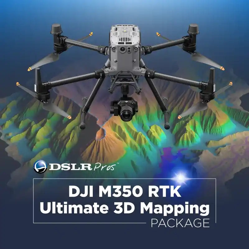
Matrice 350 RTK Ultimate 3D Mapping Package for Professional Precision Surveys
Elevating Mapping Accuracy and Efficiency
The Matrice 350 RTK Ultimate 3D Mapping Package is built for industry professionals who demand centimeter-level accuracy, high efficiency, and reliable data in every mission. This complete professional enterprise drone mapping package combines the DJI Matrice 350 RTK with the Zenmuse P1 photogrammetry camera, intelligent flight batteries, a mobile RTK base, and more—delivering a full-scale aerial mapping system that’s ready for demanding fieldwork.
Whether your projects involve topographic surveys, 3D mesh mapping, orthomosaic creation, or environmental monitoring, this package is designed to streamline workflows, reduce re-flights, and produce precise, dependable results.

Key Benefits of the Matrice 350 RTK Ultimate 3D Mapping Package
Centimeter-Level RTK Accuracy for Professional Mapping
- Real-Time Kinematic (RTK) precision supports cm-level positioning for high-stakes projects such as urban planning, utility mapping, and construction site surveys.
- Reliable geotagging ensures minimal deviation in captured data, reducing costly rework.
- Ideal for critical infrastructure mapping where accuracy is non-negotiable.
High-Resolution Imaging with the Zenmuse P1
- 45MP full-frame sensor captures more detail in fewer passes, saving flight time.
- Global mechanical shutter eliminates motion blur for crisp, distortion-free imagery.
- Large-area coverage in a single mission, ideal for time-sensitive mapping projects.
Streamlined Data Processing with DJI Terra
- Automated flight routes for precision coverage.
- Real-time visualization of captured imagery for on-the-spot decisions.
- Seamless integration with processing platforms like DJI Terra for efficient analysis.
Complete Package Contents for a Turnkey Mapping Solution
- DJI Matrice 350 RTK Enterprise Drone
- Zenmuse P1 Photogrammetry Camera
- Spare TB65 Intelligent Flight Batteries
- BS65 Intelligent Battery Station
- D-RTK 2 Mobile Station
- Charging cables, mounts, and accessories
This RTK drone mapping solution with cm-level accuracy is designed to be field-ready out of the box, supporting professionals in construction, environmental monitoring, disaster response, and industrial inspections.
Versatile Applications Across Industries
Construction and Infrastructure: Conduct detailed 3D site surveys for progress tracking, quality checks, and resource planning.
Environmental and Agricultural Monitoring: Perform precision crop health mapping and monitor environmental changes with multispectral data analysis capabilities.
Disaster and Emergency Management: Map disaster zones from a safe distance, aiding in search and rescue or post-event damage assessment.
Mining and Industrial Operations: Survey large industrial sites while reducing crew exposure to hazardous environments.
Quick Specs
| Feature | Specification |
|---|---|
| Drone Model | DJI Matrice 350 RTK |
| Camera | Zenmuse P1, 45MP full-frame sensor |
| Accuracy | Centimeter-level RTK positioning |
| Batteries | TB65 Intelligent Flight Batteries |
| Base Station | D-RTK 2 Mobile Station |
| Shutter Type | Global Mechanical Shutter |
| Software Integration | DJI Terra and third-party platforms |
Frequently Asked Questions
-
What makes the Matrice 350 RTK Ultimate 3D Mapping Package different from a standard drone?
This package combines the Matrice 350 RTK with a photogrammetry-grade camera, RTK positioning, and professional accessories for centimeter-level mapping accuracy—far beyond what standard drones offer. -
How accurate is the mapping data from this package?
With RTK enabled, it delivers cm-level accuracy, suitable for professional surveying and engineering-grade mapping. -
Is the Matrice 350 RTK Ultimate Package compatible with other DJI payloads?
Yes, the M350 RTK supports multiple DJI Enterprise payloads, including LiDAR, thermal, and multispectral cameras. -
How long can the M350 RTK fly with the Zenmuse P1?
Flight time is approximately 40–50 minutes, depending on environmental conditions and mission settings. -
What industries benefit most from this mapping package?
It’s widely used in construction, mining, agriculture, forestry, urban planning, and disaster response for fast, accurate data collection.
Why Choose DSLRPros for Enterprise Drone Solutions
At DSLRPros, we provide purpose-built UAV systems tailored to professional operations. As an authorized DJI Enterprise dealer, we ensure genuine products, manufacturer-backed warranties, and expert support for setup, compliance, and ongoing operations.
Order the Matrice 350 RTK Ultimate 3D Mapping Package Today
Get a complete mapping package with intelligent batteries, RTK base station, and high-accuracy photogrammetry tools—ready for deployment.
Shop Now or contact our experts for a custom integration plan.
Specifications
Aircraft
- Dimensions (unfolded, without propellers): 810×670×430 mm (L×W×H)
- Dimensions (folded, with propellers): 430×420×430 mm (L×W×H)
- Diagonal Wheelbase: 895 mm
- Weight (with single downward gimbal)
-
Without batteries:
Approx. 3.77 kg -
With two TB65 batteries:
Approx. 6.47 kg
- Single Gimbal Damper’s Max Payload: 960 g
- Max Takeoff Weight: 9.2 kg
- Operating Frequency
2.4000-2.4835 GHz
5.150-5.250 GHz (CE: 5.170-5.250 GHz)
5.725-5.850 GHz
In some countries and regions, the 5.1GHz and 5.8GHz frequency bands are prohibited, or the 5.1GHz frequency band is only allowed for indoor use. Please refer to local laws and regulations for more information.
- Transmitter Power (EIRP)
2.4000-2.4835 GHz:
< 33 dBm (FCC)
< 20 dBm (CE/SRRC/MIC)
5.150-5.250 GHz (CE: 5.170-5.250 GHz):
< 23 dBm (CE)
5.725-5.850 GHz:
< 33 dBm (FCC/SRRC)
< 14 dBm (CE)
- Hovering Accuracy (with moderate or no wind)
Vertical:
±0.1 m (with vision positioning)
±0.5 m (with GNSS positioning)
±0.1 m (with RTK positioning)
Horizontal:
±0.3 m (with vision positioning)
±1.5 m (with GNSS positioning)
±0.1 m (with RTK positioning)
- RTK Positioning Accuracy (RTK FIX)
1 cm + 1 ppm (horizontal)
1.5 cm + 1 ppm (vertical)
- Max Angular Velocity
Pitch: 300°/s
Yaw: 100°/s
- Max Pitch Angle
30°
When in N mode and with the forward vision system enabled: 25°.
- Max Ascent Speed: 6 m/s
- Max Descent Speed (vertical): 5 m/s
- Max Tilted Descent Speed: 7 m/s
- Max Horizontal Speed: 23 m/s
- Max Flight Altitude
5000 m
When using the 2110s propellers and with the takeoff weight ≤ 7.4 kg.
7000 m
When using the 2112 High-Altitude Low-Noise Propellers and with the takeoff weight ≤ 7.2 kg.
- Max Wind Speed Resistance: 12 m/s
- Max Flight Time
55 minutes
Measured with Matrice 350 RTK flying at approximately 8 m/s without payloads in a windless environment until the battery level reached 0%. Data is for reference only. Actual usage time may vary depending on the flight mode, accessories, and environment. Please pay attention to reminders in the app.
- Supported DJI Gimbals: Zenmuse H20, Zenmuse H20T, Zenmuse H20N, Zenmuse P1, and Zenmuse L1
- Supported Gimbal Configurations
Single downward gimbal
Single upward gimbal
Dual downward gimbals
Single downward gimbal + single upward gimbal
Dual downward gimbals + single upward gimbal
- Ingress Protection Rating
IP55
The IP rating is not permanently effective and may decrease due to product wear and tear.
- Global Navigation Satellite System: GPS + GLONASS + BeiDou + Galileo
- Operating Temperature: -20° to 50° C (-4° to 122° F)
Remote Controller
- Screen: 7.02-inch LCD touchscreen; resolution: 1920×1200; max brightness: 1200 nits
- Weight
Approx. 1.25 kg (without WB37 battery)
Approx. 1.42 kg (with WB37 battery)
- Global Navigation Satellite System: GPS + Galileo + BeiDou
- Built-in Battery
Type: Li-ion (6500 mAh@7.2 V)
Charging Type: Use the battery station or USB-C fast charger with a max power of 65 W (max voltage of 20 V).
Charging Time: 2 hours
Chemical System: LiNiCoAlO2
- External Battery (WB37 Intelligent Battery)
Capacity: 4920 mAh
Voltage: 7.6 V
Type: Li-ion
Energy: 37.39 Wh
Chemical System: LiCoO2
- Ingress Protection Rating: IP54
- Operating Time
Built-in Battery: approx. 3.3 hours
Built-in Battery + External Battery: approx. 6 hours
- Operating Temperature: -20° to 50° C (-4° to 122° F)
- Operating Frequency
2.4000-2.4835 GHz
5.725-5.850 GHz
- Transmitter Power (EIRP)
2.4000-2.4835 GHz:
< 33 dBm (FCC)
< 20 dBm (CE/SRRC/MIC)
5.725-5.850 GHz:
< 33 dBm (FCC)
< 14 dBm (CE)
< 23 dBm (SRRC)
- Wi-Fi Protocol: Wi-Fi 6
- Wi-Fi Operating Frequency
2.4000-2.4835 GHz
5.150-5.250 GHz
5.725-5.850 GHz
- Bluetooth Protocol: Bluetooth 5.1
- Bluetooth Operating Frequency: 2.4000-2.4835 GHz
Video Transmission
- Video Transmission System: DJI O3 Enterprise Transmission
- Antenna: 4 video transmission antennas, 2T4R
- Max Transmission Distance (unobstructed, free of interference)
20 km (FCC)
8 km (CE/SRRC/MIC)
- Max Transmission Distance (with interference)
Low Interference and Obstructed by Buildings: approx. 0-0.5 km
Low Interference and Obstructed by Trees: approx. 0.5-3 km
Strong Interference and Unobstructed: urban landscape, approx. 1.5-3 km
Medium Interference and Unobstructed: suburban landscape, approx. 3-9 km
Low Interference and Unobstructed: suburb/seaside, approx. 9-20 km
Measured with FCC compliance in unobstructed environments with typical interference at a flight altitude of approximately 120 m. Data is for reference only. The actual transmission distance may vary depending on the environment’s obstruction and interference conditions. Please pay attention to reminders in the app.
Vision System
- Obstacle Sensing Range
Forward/Backward/Left/Right: 0.7-40 m
Upward/Downward: 0.6-30 m
- FOV
Forward/Backward/Downward: 65° (horizontal), 50° (vertical)
Left/Right/Upward: 75° (horizontal), 60° (vertical)
- Operating Environment: Surfaces with discernible patterns and adequate lighting (lux > 15)
Infrared Sensing System
- Obstacle Sensing Range: 0.1-8 m
- FOV: 30° (±15°)
- Operating Environment: Large, diffuse, and reflective obstacles (reflectivity > 10%)
LED Auxiliary Light
- Effective Illumination Distance: 5 m
- Illumination Type: 60 Hz, solid glow
FPV Camera
- Resolution: 1080p
- FOV: 142°
- Frame Rate: 30fps
Intelligent Flight Battery
- Model: TB65
- Capacity: 5880 mAh
- Voltage: 44.76 V
- Type: Li-ion
- Energy: 263.2 Wh
- Weight: Approx. 1.35 kg
- Operating Temperature: -20° to 50° C (-4° to 122° F)
- Ideal Storage Temperature: 22° to 30° C (71.6° to 86° F)
- Charging Temperature
-20° to 40° C (-4° to 104° F)
When the ambient temperature is below 5° C (41° F), the battery will trigger the auto-heating function. Charging at low temperatures may reduce battery life. It is recommended to charge at 15° to 35° C (59° to 95° F).
- Charging Time
With a 220V power supply, it takes approximately 60 minutes to fully charge two TB65 Intelligent Flight Batteries and approximately 30 minutes to charge them from 20% to 90%.
With a 110V power supply, it takes approximately 70 minutes to fully charge two TB65 Intelligent Flight Batteries and approximately 40 minutes to charge them from 20% to 90%.
Intelligent Battery Station
- Dimensions: 580×358×254 mm (L×W×H)
- Net Weight: Approx. 8.98 kg
- Compatible Stored Items
Eight TB65 Intelligent Flight Batteries
Four WB37 Intelligent Batteries
- Input Voltage
100-120 VAC, 50-60 Hz
220-240 VAC, 50-60 Hz
- Max Input Power: 1070 W
- Output Power
100-120 V: 750 W
220-240 V: 992 W
- Operating Temperature: -20° to 40° C (-4° to 104° F)
Zenmuse P1
General
- Product Name: Zenmuse P1
- Dimensions: 198×166×129 mm
- Weight: Approx. 787 g
- Power: 13 W
- IP Rating: IP4X
- Supported Aircraft: Matrice 300 RTK
- Operating Temperature Range: -20° to 50° C (-4° to 122° F)
- Storage Temperature Range: -20° to 60° C (-4° to 140° F)
- Absolute Accuracy: Horizontal: 3 cm, Vertical: 5 cm *(Using Mapping Mission at a GSD of 3 cm and flight speed of 15 m/s, with an 75% front overlap rate and a 55% side overlap rate.)
Camera
- Sensor: Sensor size (Still): 35.9×24 mm (Full frame) ; Sensor size (Max video recording area): 34×19 mm ; Effective Pixels: 45MP ; Pixel size: 4.4 μm
- Supported Lenses: DJI DL 24mm F2.8 LS ASPH (with lens hood and balancing ring/filter), FOV 84° ; DJI DL 35mm F2.8 LS ASPH (with lens hood and balancing ring/filter), FOV 63.5° ; DJI DL 50mm F2.8 LS ASPH (with lens hood and balancing ring/filter), FOV 46.8°
- Supported SD Cards: SD: UHS-1 rating or above; Max capacity: 128 GB
- Storage Files: Photo / GNSS Raw Observation Data/ Image Log File
- Photo Size: 3:2 (8192×5460)
- Operation Modes: Capture, Record, Playback
- Minimum photo interval: 0.7 s
- Shutter Speed: Mechanical Shutter Speed: 1/2000-1/8 s ; Electronic Shutter Speed: 1/8000-8 s
- Aperture Range: f/2.8-f/16
- ISO Range: Photo: 100-25600 ; Video: 100-3200
Video
- Video Format: MP4
- Video Resolution: 16:9 (3840×2160)
- Frame Rate: 60fps
Gimbal
- Stabilized System: 3-axis (tilt, roll, pan)
- Angular Vibration Range: 0.01°
- Mount: Detachable DJI SKYPORT
- Mechanical Range: Tilt: -125° to +40°; Roll: -55° to +55°; Pan: ±320°
In the Box
NOTE:
Please contact our drone experts at (213) 262-9436 for more details.
- 1x Matrice 350 Aircraft Body
- 1x (Year) DJI Care Enterprise
- 1x DJI Smart Controller Enterprise
- 1x USB Charger
- 1x USB-C Cable
- 8x (Total) TB65 Intelligent Flight Battery
- 4x WB37 Intelligent Battery
- 2x 2110 Propeller (CW)
- 2x 2110 Propeller (CCW)
- 2x Landing Gear
- 1x (Pair) Spare RC Stick Cover
- 2x Spare Propeller Holder
- 4x Spare Gimbal Damper
- 1x USB Cable with Double-A Ports)
- 1x Vision System Calibration Plate
- 1x Carrying Case
- 1x Smart Cotroller Lanyard
- 1x Rubber Port Cover Set
- 1x BS65 Intelligent Battery Station
- 1x BS65 Power Cable
- 1x Zenmuse P1 Full-Frame Aerial Camera
- 1x SD Card (128GB)
- 1x P1 Storage Case
- 1x Camera Body Cap
- 1x Lens Rear Cap
- 1x Lens Cleaning Cloth
- 1x DJI Terra License
- 1x D-RTK 2 Mobile Station (Matrice)
- 1x DJI D-RTK 2 - Base Station Tripod
- 1x GPC Matrice 350 Case
- 1x GoProfessional Cases D-RTK 2 Ground Station Bag
- 1x GoProfessional Cases Tripod Bag for D-RTK 2 Mobile Station
- 1x Drone Landing Pad
- Screws & tools
- Manuals

