


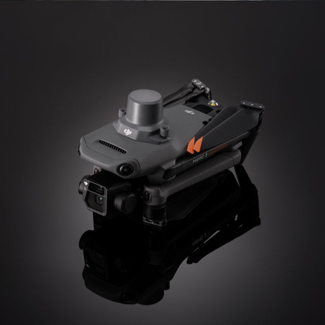
Real-Time Kinematic Upgrade for DJI Mavic 3 Enterprise
The DJI Mavic 3 Enterprise RTK Module is a compact, high-precision positioning upgrade engineered for serious survey and mapping professionals. This real-time kinematic module for Mavic 3 delivers centimeter-level accuracy by leveraging multi-band GNSS and real-time corrections via D-RTK 2 or NTRIP network integration.
Built specifically for the DJI Mavic 3E and 3T, it transforms your drone into a survey-grade platform—reducing reliance on ground control points, accelerating post-processing, and increasing the precision of every data set you collect.
DJI Mavic 3 RTK Module Features That Matter
Unlock the full potential of your DJI Mavic 3 Enterprise drone with features engineered for precision. From centimeter-level positioning to seamless real-time data correction, the RTK Module is built to elevate your accuracy, efficiency, and confidence in every mission.
- Centimeter-Level Positioning Accuracy: Achieve 1 cm + 1 ppm (horizontal) and 1.5 cm + 1 ppm (vertical) precision—ideal for topographic surveys, construction sites, and volume measurements.
- Multi-Constellation GNSS Support: Tracks GPS, BDS, Galileo, GLONASS, and QZSS signals simultaneously for more reliable positioning in challenging environments.
- Real-Time Data Processing: Apply RTK corrections in-flight using the D-RTK 2 High Precision GNSS Mobile Station or a custom Network RTK (NTRIP) configuration.
- Fast, Tool-Free Installation: Weighing just 24g, the RTK module mounts directly to the drone’s PSDK port—no cables, brackets, or custom fittings needed.
- Minimal Power Draw: Designed for efficiency, it integrates seamlessly without sacrificing flight time or aircraft performance.
Precision Mapping Applications
Whether you're working in construction, agriculture, or public infrastructure, the RTK Module delivers the accuracy and reliability needed for high-stakes aerial mapping. These are just a few of the mission-critical use cases where precision positioning makes all the difference.
Surveying and Civil Engineering
Generate high-accuracy maps and 3D models with reduced reliance on GCPs. Eliminate guesswork in job site layouts and grading plans.
Construction and Infrastructure
Track progress, capture as-built documentation, and measure stockpiles using RTK-enhanced orthomosaics and point clouds.
Precision Agriculture
Map large fields with centimeter-level accuracy to plan irrigation, drainage, and planting layouts with data you can act on.
Utilities and Environmental Monitoring
Inspect roads, railways, powerlines, or forests while maintaining exact geotagging for repeatable, accurate site analysis.
Get More from Your Payload
The Mavic 3 Enterprise RTK upgrade is more than a technical add-on—it’s a strategic asset for professionals who depend on data accuracy. By applying real-time kinematic corrections during flight, the RTK Module ensures that every geotag, model, and measurement is grounded in precision from takeoff to post-processing.
Whether you're generating photogrammetry deliverables for clients, monitoring progress on construction sites, or executing government-mandated inspections, this module minimizes error, reduces reliance on ground control points, and shortens project turnaround times. It doesn’t just improve positioning—it transforms the reliability of your entire workflow.
DJI Mavic 3 RTK Module Specifications
-
Positioning Accuracy:
Horizontal: 1 cm + 1 ppm
Vertical: 1.5 cm + 1 ppm
-
Supported GNSS Systems:
GPS (L1C/A, L2C)
BDS (B1I, B2I)
Galileo (E1, E5b)
GLONASS (G1, G2)
QZSS (L1, L2)
-
Dimensions: 50.2×40.2×66.2 mm
-
Weight: 24 g
-
Interface: DJI PSDK (plug-and-play mount)
-
RTK Integration: DJI D-RTK 2 Mobile Station or custom Network RTK (NTRIP)
-
Real-Time Output: Compatible with most GIS and photogrammetry platforms
Why Teams Choose DSLRPros
At DSLRPros, we don’t just supply drone hardware—we help you build high-performance, field-ready systems that deliver consistent results.
-
Mission-Tuned Configurations: From drones to RTK upgrades, every kit is purpose-built
-
Enterprise Certified: DJI-authorized dealer for professional and government-grade gear
-
Industry Expertise: Mapping, construction, energy, and public safety integration
-
Full Lifecycle Support: Guidance, configuration, and support—before and after the sale
Ready to Upgrade Your Mavic 3 with RTK?
Get expert guidance on integrating the DJI Mavic 3 Enterprise RTK Module into your workflow.
Call (213) 262-9436 or click Request Info/Quote to speak with a DSLRPros mapping expert.

