Aerial mapping has come a long way in recent years, both in terms of overall map quality and what’s possible with the images and types of maps produced.
The relative ease and decreased price point of creating these superior maps has also been a game changer in the field of aerial mapping, especially with the advent of drones and rapidly developing sensor and imaging technology.
As a result, aerial mapping is being utilized in a broader range of industries than ever before, changing the way businesses and organizations monitor assets, inspect crops, measure stockpile volume, and even go about rescue efforts.
For these many specialized mapping applications, there are several excellent options available for image processing software that can turn aerial data into valuable maps. The best software for any given situation will of course be dependent on the industry, the type of aerial imagery available for input, and the desired outcome.
A few of the leading programs available in the drone mapping industry are Pix4D, DroneDeploy, and DJI Terra, each having its own advantages and disadvantages depending on a number of factors including price, sensor/image compatibility, and product output.
1. Pix4Dreact and Pix4Dmapper

From the beginning, Pix4D has led the way in innovation and technology development in the drone mapping field. They offer a number of industry-specific software package options, aimed at meeting the unique needs of industries such as agriculture, surveying and construction, emergency response, and more. Two such packages are Pix4Dreact and Pix4Dmapper.
Pix4Dreact
This is the mapping package developed specifically with the needs and unique challenges of first responders in mind. It offers the unparalleled advantage of quick turn-around times, with the ability to turn aerial images into 2D orthomosaic maps in a matter of minutes. And the lightweight software can do all of the image processing on a mid-range computer, without the need for an Internet connection for cloud processing.
Pix4Dreact Applications
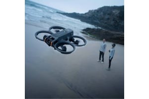
Emergency responders and public safety organizations are often faced with the challenge of being in quickly evolving situations where rapid decision-making and accurate information are essential. Natural disasters such as earthquakes, floods, and fires create a rapidly changing, and often unrecognizable landscape where existing maps of the area may be less than useful. In such cases where up-to-date data can mean the difference between life and death to many individuals, and a timely response is crucial, a map that can be produced, from start to finish, in less than half an hour is a huge asset allowing emergency responders to make informed decisions.
In situations where the terrain may not be impacted, but where rapid response and up-to-date, accurate information is crucial, the fast mapping made possible by Pix4Dreact can also save lives and greatly aid the work of emergency responders. These situations might include search and rescue missions, incidents of human displacement, and tactical planning efforts. Pix4D offers the ability to do all image processing right on a computer, without needing internet access for cloud processing. This means that getting from images to maps can happen faster, and operators can have a finished product in hand without ever needing to leave the field, allowing them to stay connected with developments on the ground.
Pix4Dreact Turnaround Time
One of the biggest advantages of Pix4Dreact is the fast turnaround time. The entire process, from the time of launching a drone, to having a finished map in hand can be accomplished in less than half an hour. Simply set a pre-programmed flight plan through the Pix4Dcapture app and launch the drone flight. Once landed, download images to the desktop, and see the finished map in minutes. The precise time will depend on the image size and number, but take for example a map made from 518 images, that took a mere 16 minutes to process. Finished maps are pdf files small enough to easily share via email with other emergency response personnel on the rescue team.
Pix4Dreact Compatible Aircraft and Sensors
Pix4Dreact software is compatible with a wide range of image sources and UAS aircraft, being limited, however, to primarily RGB imagery.
A few aircrafts that are well suited to providing images for Pix4Dreact processing are: Phantom 4 RTK and Phantom 4 Pro, the Mavic 2 Enterprise Dual (RGB only) and Mavic 2 Advanced, the Matrice 300 series drones, and the Matrice 600. It should be noted that with the Matrice models, the compatibility of the images is dependent on an RGB sensor.
The following sensors from DJI are compatible with Pix4Dreact software: Zenmuse X3, Zenmuse X4S, and Zenmuse X5S. Multispectral and thermal sensors such as the Zenmuse XT are not compatible.
Pix4Dreact software is also a good fit for images from the eBee, again, dependent on the sensor in use. The AeriaX, S.O.D.A., S.O.D.A. Corridor, and S.O.D.A. 3D sensors are all compatible, as are RGB images from the senseFly Duet T. Parrot ANAFI images are also compatible with Pix4Dreact.
Pix4Dreact Price Point
There are several pricing options for access to Pix4Dreact software. Monthly subscriptions start at about $39 per month, or you can purchase a yearly subscription for around $390 per year. A perpetual license is also available, starting at $990.
Pix4Dreact Limitations
Pix4Dreact is a pared down version of Pix4Dmapper, and as such, it does have certain limitations. Intended to create maps as quickly as possible, the finished maps are not the same quality as those produced by more advanced mapping software programs. Maps are 2D only, not intended to provide the survey-grade, volume-measuring capabilities of a 3D map. They offer accurate, reliable, and measurable information on landscapes and terrain, but lack the finesse and ultra-sharp high definition image quality that you would get from a map produced through Pix4Dmapper.
Mapper vs. React
Pix4Dmapper is a much more sophisticated mapping software program than Pix4Dreact. It is capable of producing higher quality, and more versatile maps. For example, Pix4Dmapper has the ability to produce maps from almost any type of sensor, including RGB, thermal or multispectral, whereas Pix4Dreact is optimized for use with RGB cameras.
Pix4Dmapper can generate 3D maps, and is not limited to the 2D maps created through Pix4Dreact. These 3D maps provide the ability to measure not only distances and areas, but also volume, and extract elevation profile data and conduct virtual inspections. Pix4Dmapper offers unparalleled, sub-centimeter accuracy, making it suitable for surveying and construction applications where absolute precision is required.
Pix4Dmapper Price Point
With more advanced capabilities comes a higher price tag, with a monthly subscription to Pix4Dmapper starting at around $292/month (when billed annually). A perpetual license is available for $4,990. It should be noted that the monthly subscription includes the option for cloud processing, visualization and sharing, whereas the perpetual license only offers desktop processing and data access.
Pix4Dmapper Compatible Aircraft and Sensors
Pix4Dmapper offers the added advantage of having an even broader range of compatibility than that of Pix4Dreact. All of the aircraft and sensors that are compatible with Pix4Dreact (listed above) are also compatible with Pix4Dmapper (with the single caveat that images from the Mavic 2 Enterprise Dual, while compatible, are not recommended). Expanding on that list however, thermal and multispectral images can be processed with Pix4Dmapper. For example, images from the Zenmuse XT, MicaSense RedEdge-MX and MicaSense RedEdge-MX Dual, and MicaSense Altum are compatible, in addition to the senseFly S.O.D.A. 3D sensor.
Fixed Wing Drone Mapping
For mapping needs that include coverage of large land areas, one unbeatable option is a fixed-wing drone such as the senseFly eBee X . Unlike with the quadcopter and other multirotor drone designs, the eBee X can cover extensive areas of land, up to 500 ha (1,235 ac), due to its extended flight time capacity of up to 90 minutes.
With flight planning tools for high-precision results, and a compatible sensor for any application, the eBee X is a great fit for a range of industrial uses. Image and map accuracy is ensured through the High-Precision on Demand feature that enables you to achieve absolute accuracy of down to 3 cm (1.2 in), even without ground control points. Image compatibility with Pix4Dmapper and DroneDeploy makes it easy to turn images collected with the eBee X into valuable maps and models.
- Solar inspection
One ideal application for a fixed-wing drone such as the eBee X is inspection of solar arrays, which can often cover large amounts of land. The eBee X can easily cover the entire solar array in a single flight, in a fraction of the time it would take a multirotor to cover the same area. A sensor such as the senseFly Duet T, which includes a dual thermal/visual sensor can easily identify hotspots or areas of concern. - Dirt-moving
For industrial applications that involve significant earth-moving works such as mining, quarries, and construction sites, a record of the changing landscape over time is essential. Repeat flights over the same area are simplified by good flight planning tools, and made more efficient with a drone that can cover the territory quickly. The eBee X fits the bill, and can provide the kind of quality images necessary to create 3D models for volume measurement of stockpiles, etc. - Golf courses
The intensive work of golf course management can easily be enhanced with a drone to quickly cover the entire course to monitor the health of the turf and condition of other features. A multispectral sensor on the eBee X can gather information on the condition of the grass in different areas of the course. The eBee X allows flights to be completed in less time, an important time-saver when flights covering the large area included in a golf course need to be performed routinely.

Another top mapping software choice available is DroneDeploy, which offers user-friendly flight planning, and streamlined data processing that is widely compatible with many different image sources, at an affordable price.
How does it work?
DroneDeploy has several different platforms to address three layers of the aerial map-making process.
- Flight Planning
The first layer is data collection, and the DroneDeploy solution is their Flight App (for Android or iOS), which allows you to plan data collection missions, automate flights, thereby saving time and increasing efficiency. The intelligent flight planning program makes it easy to plan and execute complex flight plans with just a few taps, and automate the entire flight (including take-off and landing) getting you in the air and back again in less time. Your customized flight plan can also be shared with your entire team to improve consistency and reliability of data captured. From the DroneDeploy Flight App, you can easily capture any type of drone media, including photos, videos, and panoramas.Another unique feature of the Flight App is its ability to create real-time Live Maps, allowing you to make assessments based on the data gathered, even while your drone is still in the air, no SD or internet connection required.
- Drone Data Processing
Once you have drone data in hand, whether gathered with the aid of DroneDeploy’s Flight App, or another flight planning program, images can easily be uploaded to the DroneDeploy data processing platform to generate precise 2D maps, 3D models, 360 panoramas, and more. Data upload of up to 10,000 images is fast and simple, and doesn’t require any specialized hardware or software, just upload and go.With DroneDeploy it’s easy to achieve survey-grade results through use of built in support for ground control points and RTK GPS technology. Nearly any type of drone imagery can be processed as well, including thermal and multi-spectral. You can also store your uploaded images with DroneDeploy for easy access to them at a later date.
- Data Analysis
The third layer of drone mapping is the analysis of data and maps, after the processing is accomplished. DroneDeploy offers a solution for this as well, with a place to store and study your data, collaborate with team members, and perform measurements and create reports. Measurement and analysis is simplified through automated insights to do tasks such as detect and count objects or measure stockpile volumes.
Applications
The DroneDeploy mapping software is a good fit for a range of industrial applications, including mining and quarries, construction and surveying, agriculture, utilities and solar array inspections, roofing inspections, oil and gas, and other professional applications.
- Mining and Quarries
The use of aerial mapping has immense potential to increase efficiency and accuracy of stockpile management, inspections, and excavation, at a fraction of the cost of traditional surveying methods. It offers the added advantage of improved personnel safety, and aiding in maintaining site compliance with federal regulations. - Construction and Surveying
DroneDeploy offers the ability to produce accurate, high-resolution drone maps, reports, 3D models, and real-time 2D maps to improve the construction process for any site. Having all your site data stored in one place makes it simple and straightforward to share images and reports for collaborative decision making. Ongoing site monitoring aids in evaluating project health and keeping the timeline on track, while adjusting or correcting any initial plan defects. - Agriculture
The easy to use mobile app makes flying a field simple and straightforward, allowing you to fly 160 acres in less than 15 minutes. Mapping technologies can be utilized to spot crop variability with multispectral imaging, improve crop scouting practices and outcomes, and even assess equipment or drainage issues for off-season planning. - Solar Array & Roofing Inspections
The ability to make maps with thermal data makes DroneDeploy ideal for both solar array and industrial roofing inspections. Thermal image processing can identify problem spots on solar panels, and also potential water damage or insulation weak spots on rooftops. Fast turn-around time for PDF reports, 3D models, and DXF files improve on-site decision making and efficiency. - Oil & Gas
For the oil and gas industry, aerial mapping is perfect for asset inspection and photographic record-keeping, with reduced risk to workers when inspecting hard-to-reach or unsafe locations. The Live Map feature of DroneDeploy also allows for real-time infrastructure or equipment inspections and inventory management. Radiometric thermal visualizations aid in analyzing site health, and maintaining compliance with regulations.
DroneDeploy LiveMap vs Pix4Dreact?
DroneDeploy has a Live Map feature, that can give instant, real-time insights even while the drone is still in flight. Through testing the live map we found that the software will sometimes glitch out and the map would not be completed. Pix4Dreact is a much more robust application. The post-processing on the computer after the flight has been conducted makes the mapping process much more reliable. Having the drone fly, take pictures, and map all in the same flight oftentimes causes the Drone Deploy LiveMap to get overloaded and the live map stops processing. To get a high-quality map from Drone Deploy it requires an internet connection to the cloud for the images on the drone to process. This process has a long turn around time. For Pix4Dreact quick mapping is easy as the images from the drone can be quickly downloaded into the Pix4dreact software and the stitching of the map can begin. This streamlined process produces accurate maps as quickly as possible for emergency situations all without an internet connection.
DroneDeploy Compatibility and Price Point
DroneDeploy software is compatible with almost all of the DJI professional or enterprise level drones, dependent in part on the sensor. This includes the Matrice 600 Pro, Matrice 200 V2, 210 V2 and 210 RTK V2, and the Inspire 1 V2 and Inspire 2. Compatible sensors include the X3, X4S, X5, X5S, XT and XT2. The X5R, the Z3 and Z30 are not compatible, and the X7 is only compatible with DroneDeploy on the Inspire 2 model. Other compatible DJI products include the Phantom 4 Multispectral and Phantom 4 Pro, and all of the Mavic Enterprise and Mavic Pro models (including Mavic Zoom).
Data from the Sensefly Ebee can also be imported to Dronedeploy with sensors including the Aria X, S.O.D.A., S.O.D.A. Corridor, and S.O.D.A. 3D. Other compatible sensors include the MicaSense RedEdge-MX, the MicaSense Altum, and Parrot ANAFI.
Pricing for access to DroneDeploy’s image processing software is available at several different price points, dependent on the size of the operation. For a single user, the Pro package, which includes a more limited functionality, is available for $99/month (when billed annually). The Business package, again for a single user, provides more sophisticated mapping and analysis tools, and is available for $299/month (billed annually). The Enterprise level of access to DroneDeploy offers advanced mapping and analysis tools for multiple users across an organization. Pricing is customized per the organization’s needs.
DJI Terra is the mapping software solution offered by DJI. The all-in-one program includes all the resources you need to plan flight missions, capture image data, process images into maps and models, and analyze data for improved decision making. In flight planning, you can choose from pre-programmed mission types such as Waypoints, Area, Oblique, or Corridor, or customize and save your own mission plans. For data processing, DJI Terra offers the ability to create a variety of 2D and 3D maps and models for analysis.
DJI Terra vs. DroneDeploy vs. Pix4D
DJI Terra is a solid mapping program that offers similar types of outputs to those of DroneDeploy and Pix4Dmapper, including real-time 2D mapping for instant readability of mapping data in remote areas, or in instances where fast decision making is crucial. Other similar products include 2D orthomosaics and multispectral reconstructions, and 3D point-cloud models and reconstructions.
Where DJI Terra falls short of DroneDeploy or Pix4Dmapper is in the overall accuracy and high-quality resolution of the finished maps and models. While use of ground control points can improve the absolute accuracy of maps and models, DJI Terra does not advertise the ability to produce survey-grade results. And while both DroneDeploy and Pix4Dmapper are able to make use of images from a wide variety of sources to produce ultra-high resolution, high-accuracy 3D maps and models, DJI Terra is much more limited in image source compatibility.
While the real-time 2D mapping offered by both DJI Terra and DroneDeploy are potentially useful in emergency or first response situations, they lack the flexibility and shareability of the unique offering of non-cloud based, fast-mapping from Pix4Dreact.
DJI Terra Compatibility & Price Point
Unlike the flexibility in terms of image source available with DroneDeploy and Pix4Dmapper, DJI Terra is very limited in what aircraft and sensors are compatible. DJI Terra compatible aircraft include Phantom 4 models such as the Phantom 4 RTK, the Phantom 4 Multispectral, and the Phantom 4 Pro V2. The only other compatible model is the Matrice 210 RTK V2 when equipped with the Zenmuse X7 sensor.
A subscription to DJI Terra is available at two levels, either the Advanced License or the Pro License. An advanced subscription costs $2000/year, while a Pro subscription will cost $3000/year.
Matrice 210 RTK V2 Ultimate 3D Mapping Package
Designed for the rigors of the worksite, the Matrice 210 RTK V2 is capable of delivering centimeter level accuracy. The Matrice 210 RTK V2 Ultimate 3D Mapping Package from DSLRPros includes the Matrice 210 RTK V2, along with a Zenmuse X7 plus lens, and everything else you need to get started with advanced 3D mapping. The X7 is the only non-Phantom 4 sensor currently compatible with DJI Terra mapping software. The powerful X7 delivers stunning resolution and image quality, but is not compatible with any of the Pix4D mapping packages, and is only compatible with DroneDeploy when used with the Inspire 2.
This 3D mapping package including the Matrice 210 and X7 combination is ideal for construction sites, mining and quarry sites, industrial inspections and more – in fact, anywhere you need the robust design and GPS accuracy of the Matrice 210 RTK, and the precise, high-resolution imaging capabilities of the Zenmuse X7.
Updates: 2021
Here, you’ll find all our updated information specifying what the right softwares for your fleet are.
DJI Matrice 300 RTK: DJI Terra
While Pix4D and DroneDeploy are not compatible with the DJI M300, the Matrice comes with a native mission planner to cover the job. Additionally, when you purchase the L1 or P1 payloads, they come with a demo license to DJI Terra.
SenseFly eBee: Pix4D Mapper
For the Sensefly eBee drones, Pix4D is the perfect software. Part of the reason is because eBee and Pix4D are both owned by a parent company called The Parrot Group. The parent company has worked hard to make a seamless workflow between eBee’s mission planner (eMotion) and Pix4D’s processor.
Autel Evo Line and DJI Mavic 2 Line: Pix4D React
Due to: the rolling shutter found in the 6K camera, the main users for this craft (first responders), the lower accuracy/expectations, and the quick timeline for deliverables, Pix4D React is the best fit for these compact drone lineups.
Phantom 4 RTK and Multispectral: DJI Terra
Like the M300, the Phantom 4 RTK and Multispectral come with a native mission planner; but, Pix4D Mapper or Fields are both usable options if they have a particular feature you need. DJI Terra is also compatible and cheaper than Pix4D.