Aerial map-making capabilities have been a game-changer in many industries, including surveying, construction, mining, and more. Industry leader Pix4D has been instrumental in leading this progress, developing the software and technology necessary to produce the ultra-reliable, detailed maps needed for these types of industries. However, in certain instances, the need for high-resolution, crisp image maps is counterbalanced by the need for quick turnaround and speed, without compromising accuracy and reliability in the finished product.
This is especially the case in crisis situations such as search and rescue missions, natural disasters, or other emergency situations, when every minute, and accurate maps, can mean the difference of life and death to many individuals. With the need for high-speed mapping capability as a goal, Pix4D has developed a mapping program specifically tailored to the needs of first responders facing the demands of crisis situations. This program, Pix4Dreact, can provide accurate, up-to-date, detailed maps of a scene in a matter of minutes, giving first response teams the information they need to make informed decisions, plan rescue missions, and save lives and property.
How it works
One of the time-saving advantages of Pix4Dreact is that it has been designed as a lightweight software program, streamlined enough to be able to run on a mid-range computer. Unlike many other mapping software programs, it does not rely on an internet connection or the cloud for data processing. First responders operating a command station in the field need not worry about leaving the scene to get collected data turned into map form, wasting time and resources. The entire process, from the time of launching a drone to collect aerial images, to having a finished map in hand can be accomplished in less than half an hour.
The Pix4Dreact program is designed for use by first-responders, who may not necessarily be drone or mapping experts, and is simple and intuitive to use. The process starts with a pre-programmed drone flight to capture aerial images. These easy and straightforward flight plans can be created through the Pix4Dcapture app, or another flight planning program.

Once the images are collected, they are downloaded to your computer and processed in a matter of minutes. Although lightweight and streamlined, Pix4D is robust enough to quickly process a large number of image files and use them to produce a detailed, accurate, measurable 2D map.
The finished map is now ready for use, and Pix4Dreact includes tools to make even better use of the information in the map. These tools allow you to easily identify and measure points of interest, make notations for reference by other team members, or connect maps to developments on the ground. Maps are easily shared with team members and other key decision-makers, as they can be exported as lightweight PDF files via email.
Applications
Pix4Dreact was developed in collaboration with emergency responders to optimally meet their mapping needs. 2D fast mapping software offers the speed and accuracy that public safety and humanitarian aid professionals need to efficiently respond to quickly evolving disaster scenes. These situations include natural disasters such as earthquakes, floods and fires where seconds count in efforts to locate victims, dispatch first response teams and plan strategies for rescue efforts. The fast turn-around time from drone flight to finished map means that the data is relevant to the real-life situation, and repeated flights over the same area can be done easily and efficiently to provide up-to-date data on the changing scene, allowing for informed decision making.
Other situations that demand fast mapping are search and rescue efforts, and occurrences of human displacement. In these situations, large areas of territory often need to be covered, and up-to-date, accurate maps are crucial in mission planning and decision making. These missions are often directed from a location in the field where an internet connection and cloud processing are not a possibility, making Pix4Dreact an ideal solution. With the ability to process images into reliable maps right from a computer in a field station, the finished maps are in hand faster, without ever needing to leave the location. In tactical planning missions as well, where accurate, reliable maps are essential, and cloud processing is impossible, Pix4Dreact provides the ability to get reliable maps while in the field.
Limitations
Designed to be a stand-alone 2D fast mapping software program, Pix4Dreact is ideally suited to emergency response applications. It can also be used as a companion to Pix4Dmapper, the industry-leading 2D and 3D photogrammetry processing software. With this in view, it’s worth stating that Pix4Dreact does come with some limitations, primarily in terms of the image quality and resolution of the finished maps. It is not intended to be used for survey-grade reconstruction tasks, as the finished images do not provide the same level of precision and detail that you would get from a program such as Pix4Dmapper. Also, Pix4Dreact does not provide the ability to create 3D orthomosaic maps, being limited to 2D map production. This is the trade-off that comes as part of the lightweight, computer-based processing capability that allows image processing to be done in the field – images are quickly stitched into maps, and although accurate and reliable, they lose some of the high-resolution seen in other more advanced mapping programs. If survey-grade, 3D maps is what you need, Pix4Dreact is not the software program you are looking for. But if speed, reliability and efficiency is your priority, it could be just what you need.
Pix4Dmapper Comparison
Pix4Dmapper is a much more advanced map-making program capable of producing higher quality maps that can do more. For example, Pix4Dmapper works well in its ability to produce maps from any type of sensor, including RGB, thermal or multispectral, whereas Pix4Dreact is optimized for use with RGB cameras. Also, the 3D maps created through Pix4Dmapper software allows you to measure not only distances and areas, but also volume, and extract elevation profile data – capabilities not offered through the 2D maps produced through Pix4Dreact. The level of accuracy is also unbeatable with Pix4Dmapper, providing results that offer sub-centimeter accuracy.

In terms of processing speed however, Pix4Dreact comes out the clear winner, with processing time a matter of minutes, where it can take much longer (depending on image resolution, number of images, etc.) to produce a finished map with Pix4Dmapper. And while Pix4Dreact is meant to run on desktop, and can run well on nearly any computer, Pix4Dmapper is optimized for cloud processing, and desktop processing, while available, has much more demanding minimum operating system requirements.
Cost
Several pricing options are available for access to the Pix4Dreact software, depending on your needs and situation. Monthly subscriptions start at about $33 per month, or you can purchase a yearly subscription for around $390 per year. A perpetual license is also an option, starting at $990.
Package Options
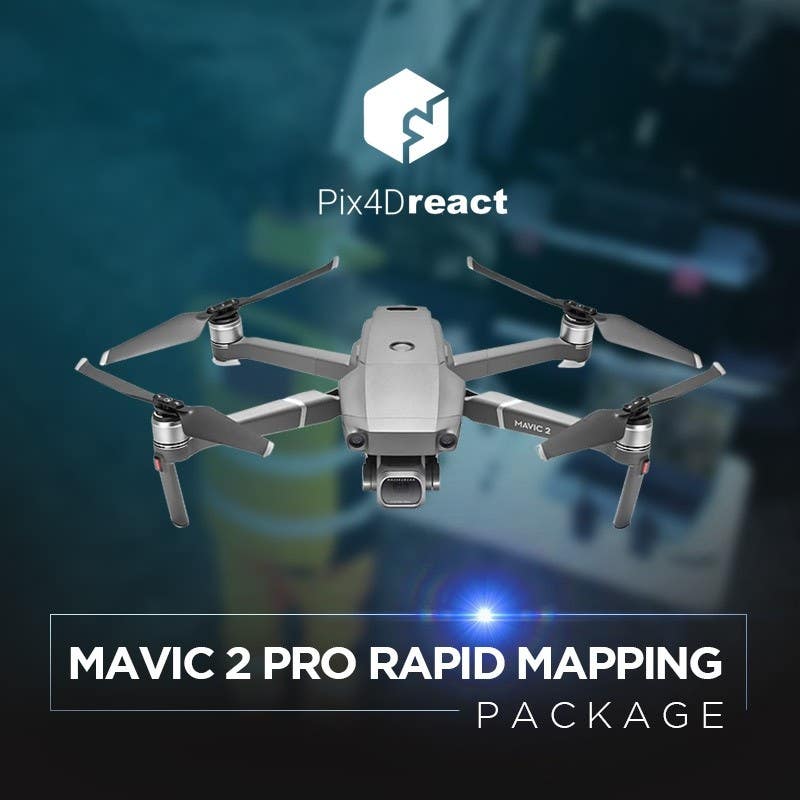
Mavic 2 Pro Pix4Dreact Rapid Mapping Package
The Mavic 2 Pro Pix4Dreact Rapid Mapping Package from DSLRPros provides everything you need to get up and running to complete aerial flights, collect images, and get finished maps in your hands. In addition to a Pix4Dreact license, of which you can choose either a yearly or perpetual license, the package includes a DJI Mavic 2 Pro, a remote controller, 4 intelligent life batteries, a DJI standard charger, a Mavic 2 car charger, a battery charging hub, and a battery to power bank adapter. Also included is the Mavic Series CrystalSky and tablet mount, and a Go Professional Mavic 2 case, along with extra propellers, USB cables, etc. With this package in hand, there is nothing else that you will need to purchase to get flying, and start making maps with Pix4Dreact right from your computer.
Image quality and flight time
The Mavic 2 Pro comes equipped with a Hasselblad camera for superior image quality and better performance even in low-light conditions, ensuring that you get the highest possible resolution and detail out of your 2D maps created through Pix4Dreact. And with 31 minute maximum flight time, you have longer time in the air to get more images, and cover more distance, making the most efficient use of precious time in emergency situations.
Why choose Mavic 2 Pro Rapid Mapping Package
Opting for an all-in-one package provides the convenience of knowing that you have everything you need for successful map-making operations, and the confidence that all the components are compatible. A few of the advantages of the Mavic package include the advanced sensor of the Mavic 2 Pro for high-quality imaging, even in low-light conditions, and automated flight planning capabilities. The CrystalSky Monitor and tablet mount included in the package also offers clear real-time image viewing to drone operators, increasing ability to see the whole scene, even before getting to the map-making stage.
Phantom 4 Pro Pix4Dreact Rapid Mapping Package

Another package option from DSLRPros to get you mapping faster is the Phantom 4 Pro Pix4Dreact Rapid Mapping Package. This package also includes a yearly or perpetual license to Pix4Dreact, but the aircraft provided is the Phantom 4 Pro V2. In addition to all the chargers, cables, propellers, etc. needed to operate the drone, the package also includes 4 intelligent flight batteries with LiPo Safety storage bags, a Phantom Series Tough case with wheels, a 32GB microSDHC card, and a Lume Cube anti-collision strobe light.
Image quality and flight time
The Phantom 4 Pro was designed by DJI as a photography powerhouse, with a 20 MP 1” CMOS Sensor, and a mechanical shutter for clean, crisp imaging. The drone also includes intuitive, smart flight features to aid in easy and rapid image collection. Up to thirty minutes of continuous flight time allows for large area coverage for faster, more efficient data collection to get you a map in hand sooner.
Why choose Phantom 4 Pro Rapid Mapping Package
Just as with the Mavic 2 package, the Phantom 4 Pro mapping package gets you flying successful, efficient mapping missions faster and with fewer hassles than trying to piece together your own bundle. In terms of the hardware, the Phantom 4 drone is fairly comparable with the Mavic 2 in terms of sensor quality, flight times, intelligent flight features, and automated flight planning. One key element of the Phantom 4 Pro mapping package is the Lume Cube anti-collision strobe, for increased drone visibility, improving safety while in flight.