HARDWARE
1. What is the price for an M3M?
The price of the Mavic 3 Multispectral ranges between $4,600 and $5,000, depending on the length of Care coverage you want. The M3M Care Basic starts as low as $4,618 while the Mavic 3 Multispectral Basic Care 2-Year and the Mavic 3 Multispectral Care Plus go for $4,828 and $5,038 respectively.
2. What is the price of the Mavic 3 Enterprise RTK module?
The price of an RTK module varies depending on factors such as the model, features, and brand among others. The price for the Mavic 3 Enterprise RTK module is $709. You can reach out to DSLRPros to get more information regarding the RTK module.
3. Does the RC for the M3M also work with the M300?
The remote controller for the DJI Mavic 3 Multispectral (M3M) drone is not compatible with the DJI Matrice 300 (M300) drone. This is because the two drones also have different features and control systems.
If you’re looking for an M300 remote controller, you can consider the DJI Smart Controller Enterprise. It’s specifically designed for the M300 and is compatible with the drone’s features and transmission protocols.
4. What is the battery life of the DJI M3M remote controller and is it interchangeable?
The remote controller comes with an in-built and rechargeable 5000mAh battery, which provides up to 4.5 hours of flight time on a single charge. However, the battery is not interchangeable, as it’s built-in and integrated into the controller's design. If you need to replace the battery, you should contact DJI support or an authorized DJI service center to have it serviced.
5. Does the DJI Mavic 3 Multispectral Remote Controller have a place for a lanyard?
Yes, the RC comes with an in-built lanyard hook that allows you to attach a lanyard for hands-free operations. You can find the lanyard hook at the bottom of the remote controller. The hook is compatible with most standard lanyards, and you can find compatible lanyards at DSLRPros.
6. Do all Mavic 3 products use the same batteries?
Yes, all DJI Mavic 3 products use the same batteries, but it’s always important to check the battery specifications for each product to ensure compatibility when you’re upgrading your hardware.
FEATURES
1. Does terrain-following on the M3M work lower than 250’ AGL?
Terrain-following is a feature on the DJI Mavic 3 Multispectral drone that uses the drone's downward-facing vision sensors to maintain a consistent altitude above the ground, even in uneven terrains. It helps your drone maintain a consistent altitude above ground level (AGL). By default, the M3M has a flight altitude of 400 feet AGL. However, you can adjust the drone’s flight altitude to below 250 feet AGL in Terrain-Following mode.
But it's important to be aware of local regulations and airspace restrictions.
2. What is the fastest shutter time to capture images?
The fastest shutter time to capture images in drones varies depending on the specific drone and camera model. For example, the DJI Mavic 3 Multispectral has a mechanical shutter with a maximum speed of 1/2000 second and an electronic shutter with a maximum speed of 1/8000 second.
It's important to note that fast shutter speeds may not always be necessary for all types of operations. It's important to consider the specific shooting conditions and subject and adjust the camera settings accordingly.
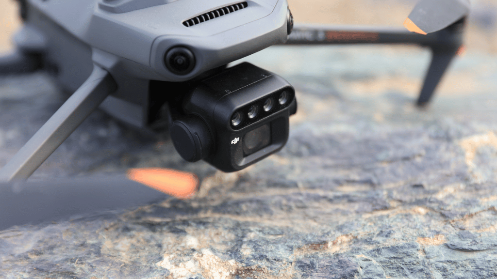
3. Does the M3M have the same GSD and accuracy as the M3E for mapping?
The M3M and the M3E drones have similar camera specifications and features, a 1-inch CMOS sensor, a mechanical shutter, and a 24mm equivalent lens. Both have the ability to capture high-resolution aerial imagery for mapping and surveying applications.
However, they have different applications. The M3M is designed for precision agriculture and remote sensing applications and is optimized for multispectral and thermal data while the M3E is used for commercial and industrial operations such as mapping and surveying.
In a nutshell, the M3M doesn’t have the same ground sample distance (GSD) and accuracy as the M3E because of its calibrations.
4. What is the max speed of the M3M?
The DJI Mavic 3 Multispectral has a maximum speed of 15 m/s in Normal mode and 21 m/s in Sport mode. When flying sideways, the drone has a maximum speed of 20 m/s and 19 m/s when flying backward (both in Sport Mode).
You should note that these are the maximum speeds when there’s no wind. When there’s wind resistance, the maximum speed reduces to 12 m/s.
Additionally, the drone’s maximum ascent speed is 6 m/s in Normal Mode and 8 m/s in Sport Mode, while its maximum descent speed is 6 m/s in both Normal and Sport modes.
5. Is infrared (thermal) useful for picking up invasive species?
Yes. Invasive species may have different biochemical and physiological properties from native species. These can manifest themselves in differences in temperature patterns, which can be detected using thermal imaging.
Thermal imaging can also be useful for identifying areas of high plant stress, which can be indicators of invasive species or other environmental issues. This can help in prioritizing areas for further investigation or treatment.
SOFTWARE
1. What is the cost for DJI Terra and DJI SmartFarm?
You can buy the DJI Terra mapping software for as low as $400 from DSRL Pros. The DJI SmartFarm App is available for download on the Apple and Google play stores.
2. Is DJI Terra cloud-based or does it use local processing?
DJI Terra is a desktop-based software that relies on local processing power to perform data analysis, but also includes optional cloud-based sharing and collaboration features. It offers both online and offline modes, with the latter allowing for paid features to be accessed without a network connection, ensuring that no information is shared externally.
USE CASES
1. What industries other than agriculture benefit from using this kind of multispectral sensor?
The use of multispectral sensors is expanding rapidly in a variety of industries and applications besides agriculture. Their ability to provide detailed, high-resolution data makes them an increasingly valuable tool for a wide range of professionals and organizations. Some of the industries that can benefit from using M3M include construction and infrastructure, mining, public safety, and environmental conservation.
2. What agricultural missions benefit from the use of RTK?
RTK technology can help the agricultural industry to improve accuracy, efficiency, and productivity. Some of the benefits agricultural missions can get from RTK include:
- Improving the accuracy of mapping and data collection for precision agriculture applications.
- Crop scouting to help farmers pinpoint areas of concern
- Drainage management
- Land and boundary management
3. Can you detect bodies of water beneath vegetation using multispectral sensors?
Yes. You can use multispectral sensors to detect water beneath vegetation. Multispectral sensors are designed to capture light across multiple wavelengths, including the visible and near-infrared (NIR) spectrum. Water bodies typically have a different reflectance pattern in the NIR spectrum compared to vegetation. Therefore, by analyzing the multispectral data, it is possible to distinguish water bodies from vegetation and other features on the ground, even if they are obscured by dense vegetation.
But the accuracy of such exercises can be affected by factors such as the depth and turbidity of the water, the density and height of vegetation cover, and the spatial resolution of the sensor.
OTHER
1. Where can I get more training on using the M3M in real-world environments?
DSLRPros regularly publishes informative blogs on drones on our website. You can check out our articles on different types of drones and drone software here. We also offer drone training, including up-to-date courses and flight practices suitable for professional use cases.
Start your drone pilot training today.